https://cameras.alertcalifornia.org/?pos=35.6205_-118.6427_10&id=Axis-Mebane1
2 Likes
Tough area
4 Likes
Vehicle over the side in the canyon. Now on fire.
2 Likes
3 acres below the road and above the road is off to the races.
3 Likes
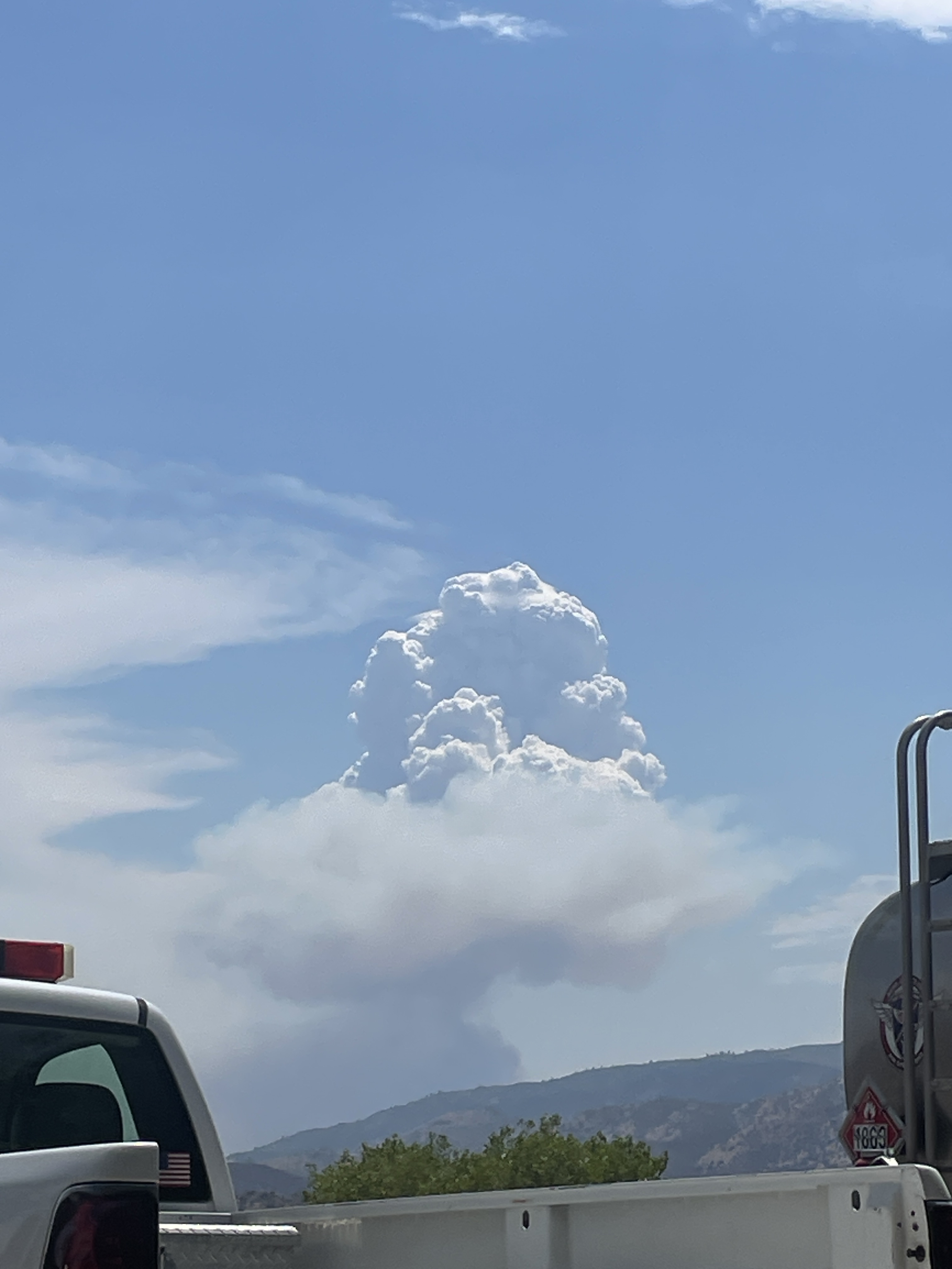
looks like it just found some good fuels, blowing up now.
5 Likes
It’s running up a drainage.
3 Likes
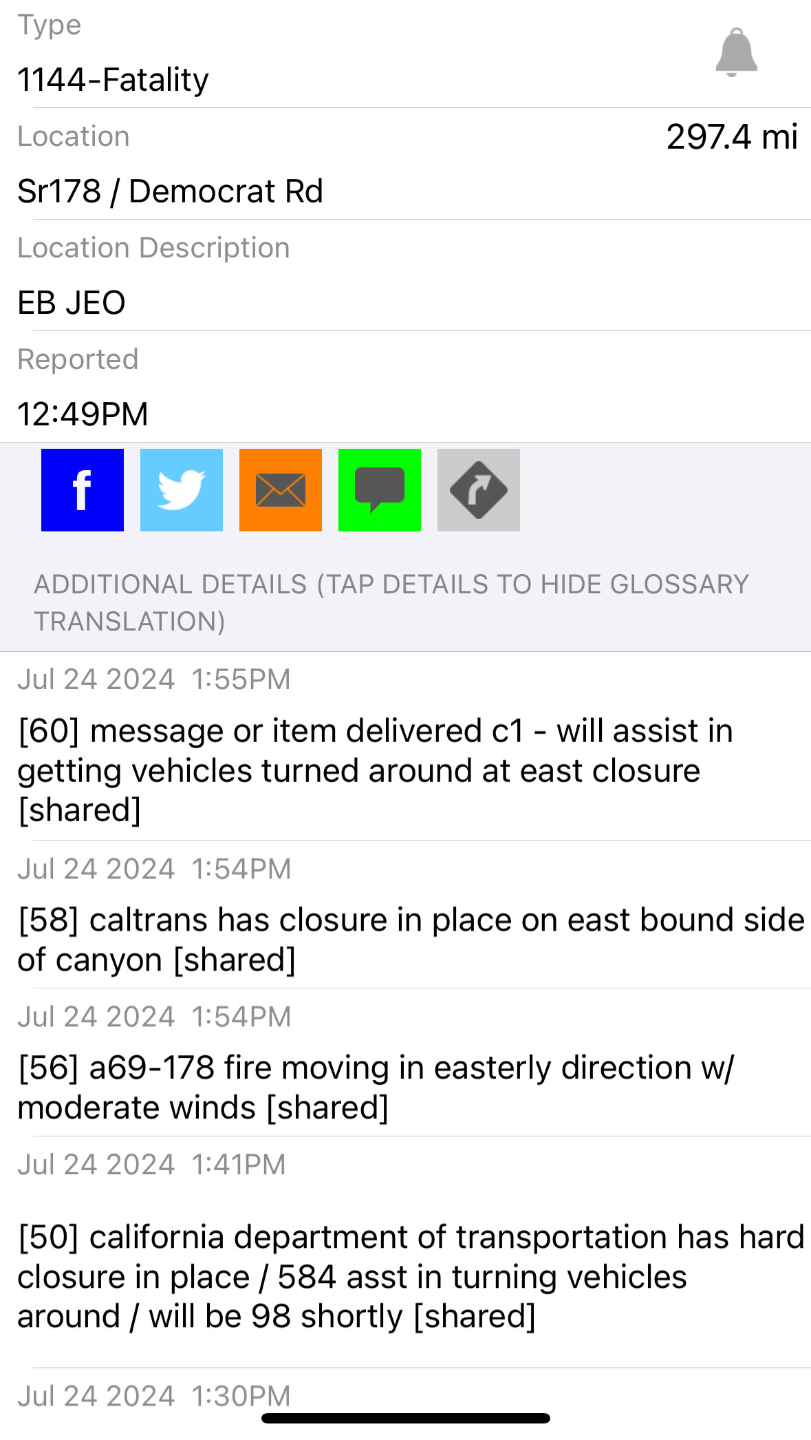
Location is Hwy 178, just east of Democrat.
3 Likes
Scanner link ?
1 Like
According to Intel 24 just now 941 acres
3 Likes
When this thing hits the top, there’s not a lot of fire history. When I was up that way a few weeks ago there’s a heavy fuel loading everywhere. And there is a “subdivision” up there to consisting of about 20 cabins with not a lot of clearance around them.
5 Likes
Well that escalated quick.
9 Likes
Right. Quite the air show too.
AA-410, AA-651, T-74,75,76,78,79,80, T-41
H-408, HT-37S
3 Likes
Video from Intel 24
5 Likes
1700 acres just reported.
5 Likes
The data from the first flight was released quickly and was quite informative. There was also an intel flight later in the afternoon and I’m not sure if another one was done late.
Unfortunately the Data/results from those flights were not released. It’s difficult planning without much information coming out.
3 Likes
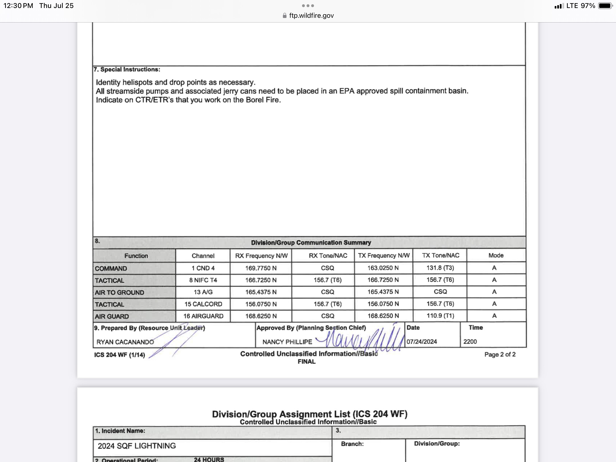
Anybody have a com plan for this today?
2 Likes
I guess no backfires or fire out then. Can’t get those drops of fuel on the ground.
3 Likes