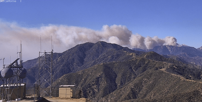
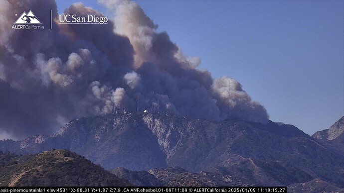
A TAK DP has been posted for the Eaton fire - I listed it as ANF cuz its in the federal folder but I see its also listed as LAC but lets not sweat the details. http://maps.takserver.us
204s look really bare. Divs Mike and Juliet with no resources listed. Mike was hot two nights ago. Wondering if they’re staffing those divisions or having to move strike teams to other divisions or fires. Or just assigning at briefing. Also, as the Feds do, looks like 12 hour op periods.
Typical procedure is they fill in the blanks with whoever is present at morning briefing. When you aren’t sure who is still enroute and their eta
Lots of resources double and even triple shifted per friends down there. Might be resources on those divisions from IA that haven’t been reconciled yet.
And more resources keep rolling in to fill in the gaps.
The fire is almost to mt Wilson.
https://cameras.alertcalifornia.org/?pos=34.2200_-118.0686_13&id=Axis-PineMountainLA1
Watching KTLA5 and the fire has hit the ridge at Mt. Wilson
Tanker 914 just lifted off from San Bernardino base headed west.
I only stopped on CNN cuz News Nation went to a commercial. CNN is reporting that the Eaton fire growth has been stopped per the LA County Fire Chief…I can’t make this fake news up. What a joke!!

Pretty standard for a fire with this complexity with the lack of information. The IMT is still getting caught up.
Live news footage showing structures on top of Mount Wilson involved with fire. I am assuming these are communications buildings
Pulling C19, C22, HT55 off the Palisades to head for Mt Wilson.
Let’s keep it civil everyone. There’s no need to start being abrasive to anyone
Tnrk 914 off SBD headed for mt wilson?
Technically this is the Q n A page, so it’s a little less formal than the Initial Attack/Continuing pages. However, MVU is correct. The bulk of towers along the southwest edge of Wilson are largely TV and radio stations. There is also a significant amount of other comms towers all along the ridge top. Further east are the obervatories. South, on Mt Harvard are more critical comms towers.
The importance of Mt Wilson cannot be over-stated.
Tower cam view shows the fire dying out as it gently backed up to the communication facilities. LIVE | Here's a tower camera view over the Eaton Fire in LA County | LIVE | Here's a tower camera view over the Eaton Fire in LA County | By KCRA 3 | Facebook
The copters made it to the Eaton from Palisades incident but were unable to operate due to the winds.
Every year we see these over grown comms sites. Just crazy to see fuels growing directly through chain link fences etc. So preventable
AA asking for aircraft to come in from the hi desert to support if possible. Looks like resources are posted up in the lot below the Pavilion on Mt Wilson and more are en route from what I see on Tablet Command.
Fire activity picking up downslope as fire gets into the Canyon Oaks and Big Cone Doug Firs.
Edit: AA just reported things are holding below the towers and minimal impact. Also holding on the Mount Lowe road to the west (which is good) in Section 32.
Tanker 55 en route


