
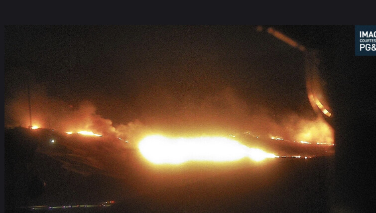
not a good picture with 72hrs of high wind warning left and a wind driven fire in BDU taking off
5 Likes
div A advising fire 1/2 mile from pyramid lake power plant
4 Likes
CAL FIRE IMT 2 being activated
18 Likes
Thank You.
3 Likes
Any word on morning aircraft order?
Lots of LAT’s and VLAT’s (T-137,132,910,911) in the area between SMX, SBD, WJF, PTV, PRB, FAT.
3 Likes
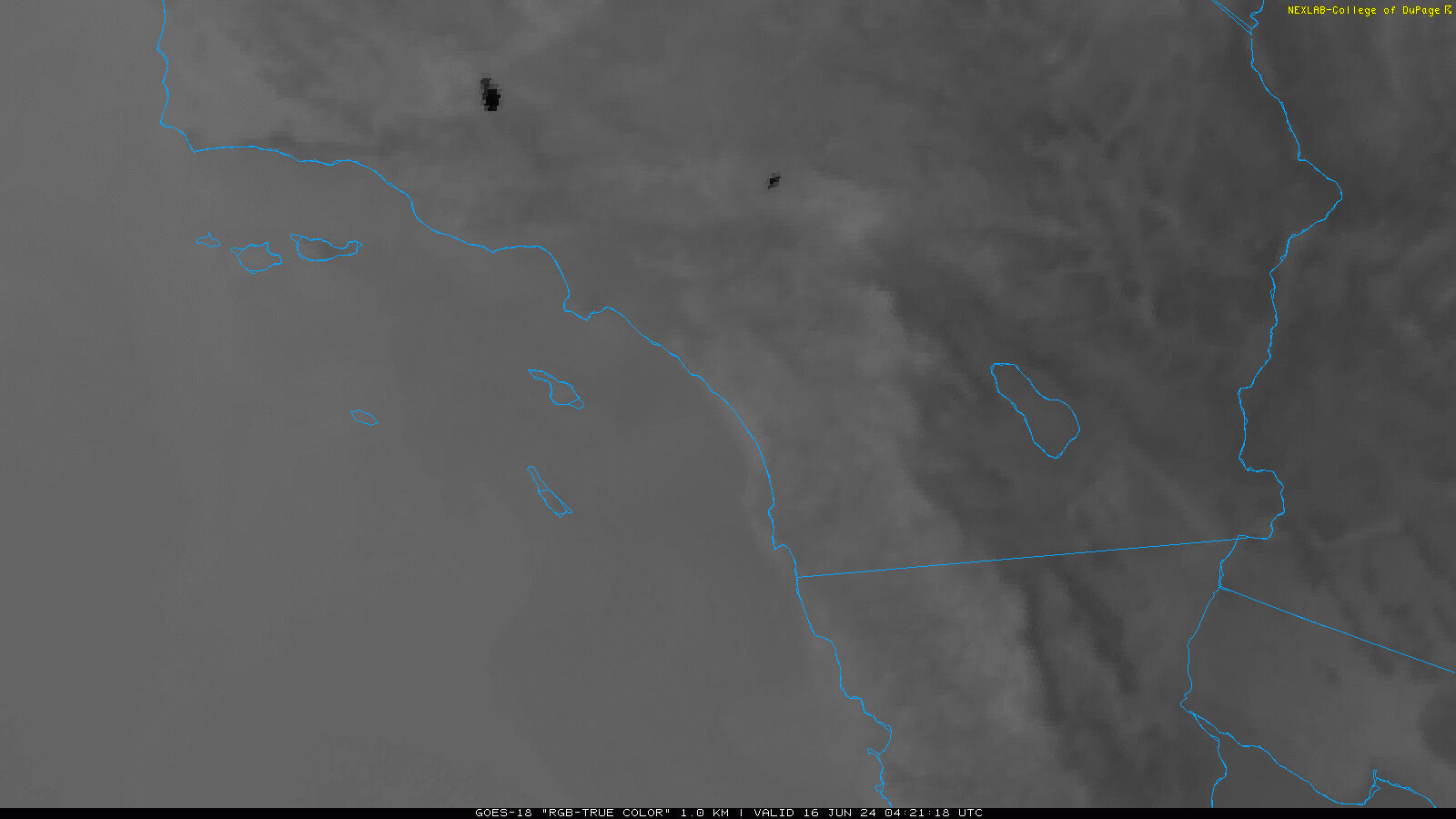
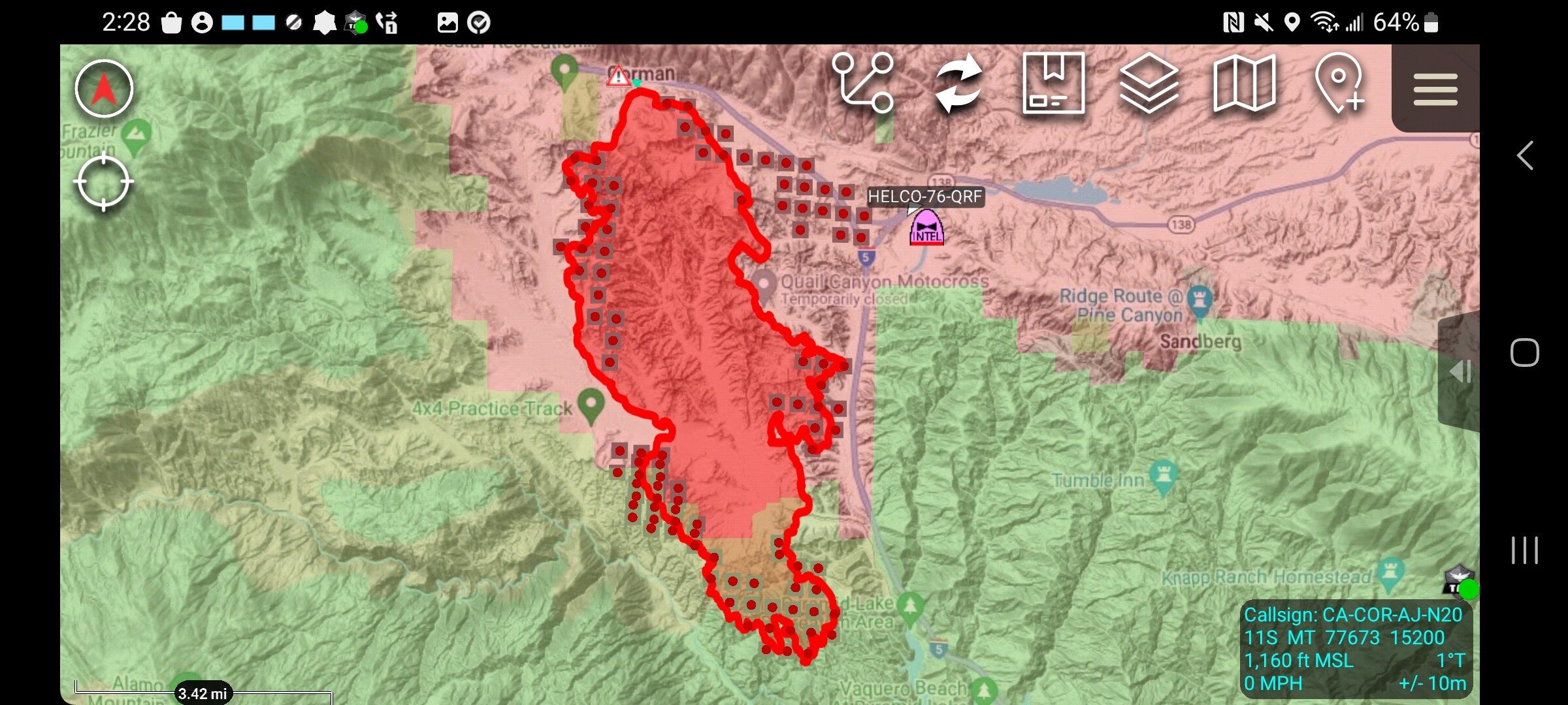
Both the Post and Hesperia fires (left and right respectively) continuing to exhibit relatively strong after-dark heat signatures via GOES.
8 Likes
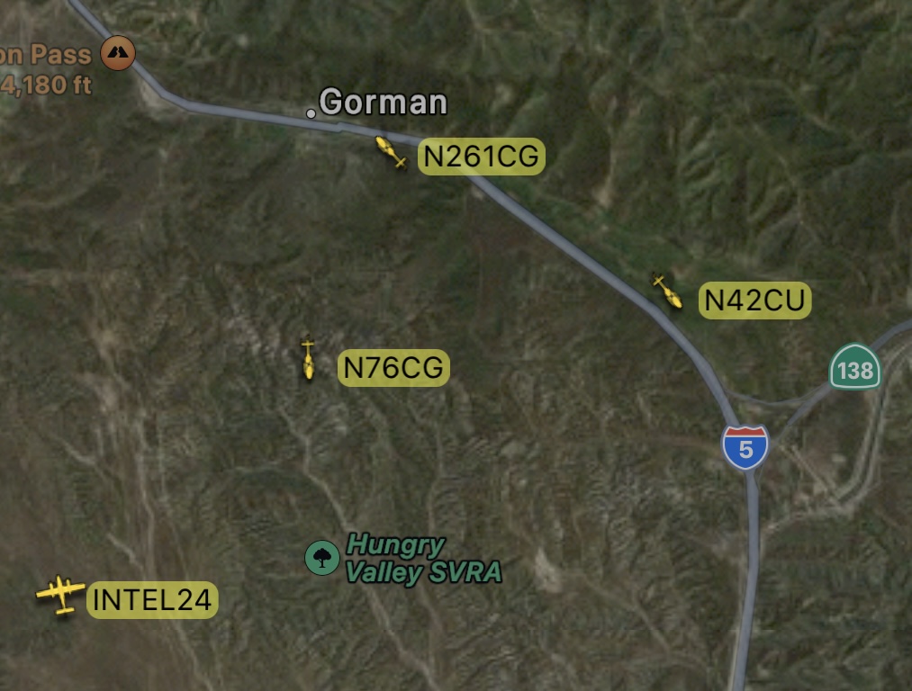
Intel and Coulson working the night air shift. Both of these technologies have definitely make an impact and a great tool in the wildfire toolbox.
3 Likes
One has to think that if it gets established across Hungry Valley road the fire should slow down in the heavier less receptive fuels. Further south towards Castaic fuels probably have much more moisture. A few days ago the LA County brush fire training was going on at Wayside detention center in Castaic, and it looked like the fuels were barely burning.
6 Likes
4 Likes
All helicopters are off the fire now.
2 Likes
The fire is burning approximately 1,000 acres an hour with the worst of the winds expected Sunday PM.
4 Likes
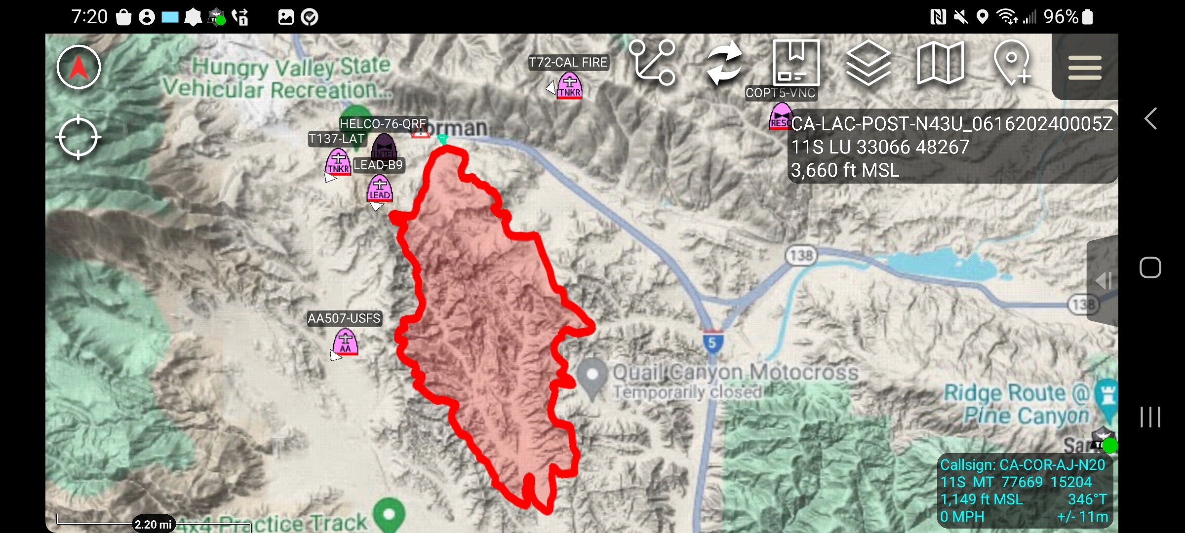
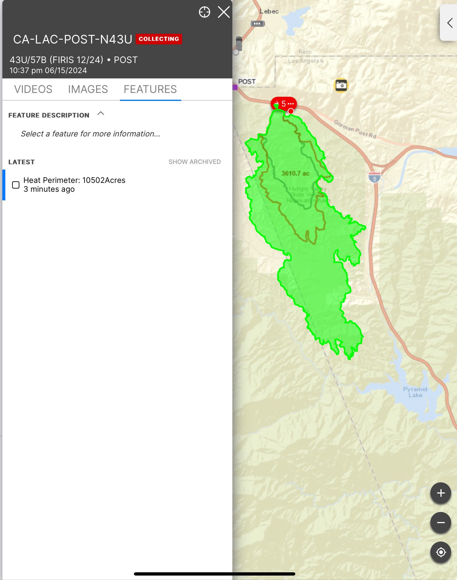
Official acreage from FIRIS has the fire at 10,502
4 Likes
I agree with the higher FMs. I would be concerned with the eventual wind switch bringing fire across I5 and burning to the North. Though it is impacting Federal land now, the establishment of fire there is not nearly the concern it would be a month or so from now.
5 Likes
CHP shutting down southbound I5 at quail lake road per operations.
3 Likes
Appears they are setting up the ICP at Castaic Lake.
XLC 1201A (BUR BC1/MPK BC6, BUR E13 & E16, GLN E25 & E27, PAS E36) enroute to ICP at Castaic Lake.
Also, PAS WT34
4 Likes
Map of last FIRIS flight a little after midnight, a mix of Nasa FIRMS sensors and DPA layer. Red State, Green Fed
5 Likes
Good morning. Here are the extended attack frequencies assigned to Post. Did not see an A/G assigned but it is LAC so they might have their own internal procedure vs CalFire’s typical.
- Air Tactics 166.6125
- Rotor Vic 123.175
- CDF Tacs 28, 29, VFIRE 24, 25, 26
5 Likes
3 Likes