
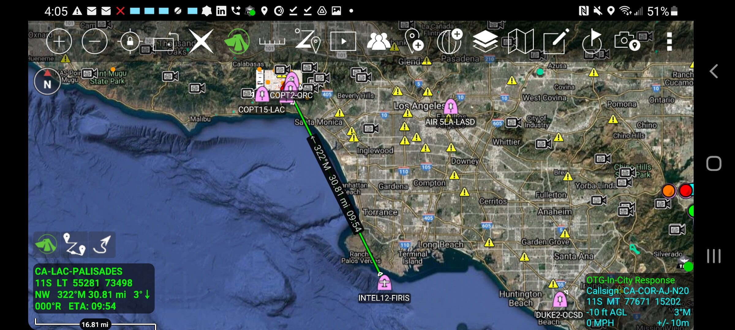
Ops map from LACoFD Twitter this morning: 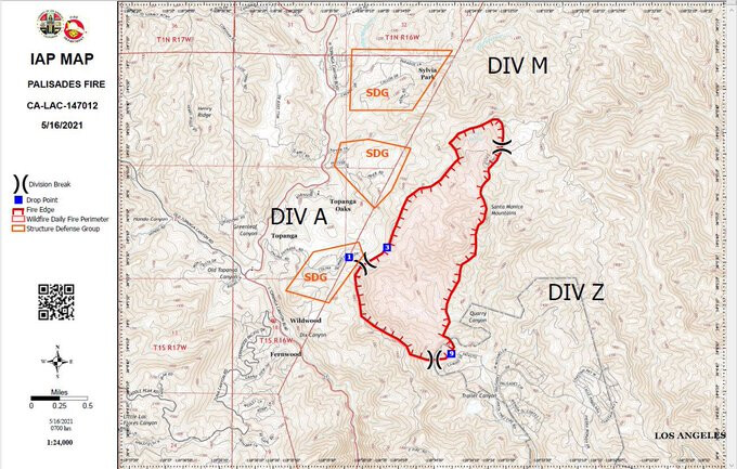
4 Likes
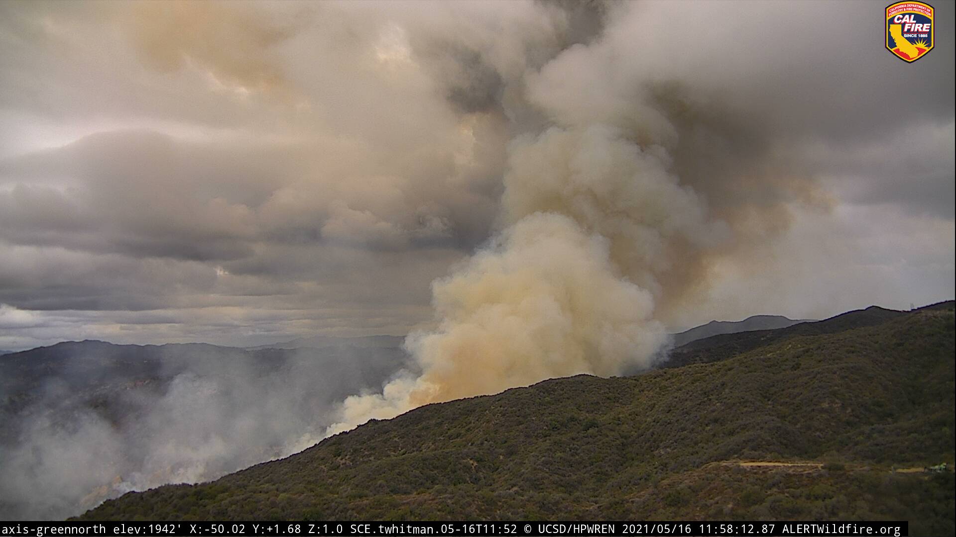
The marine layer is starting to thin out. With the upper level low overhead will have to monitor convective development as it was very active to the north yesterday.
4 Likes
Heat signature from GOES West, credit to 805 Weather on Twitter and Bensweather.com:
https://twitter.com/i/status/1393800411476201474
1 Like
Was there in 93 on the Green Meadow fire, it ran hard on a Santa Ana, almost to Peperdine, and then turned around on a “Catalina Eddy” and ran hard back in the direction it is going now. Very steep, I do not think it has burned since 93???
2 Likes

Looks like the most active fire is because it is now in Quarry canyon mid right flank, running up the slope to the east.
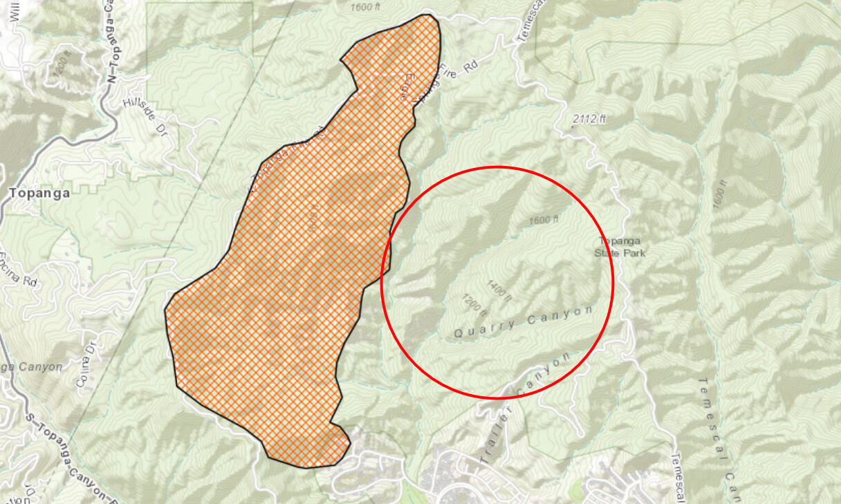
2 Likes
DIV Z reporting spot fires. Pulling crews out based on the spots and changing weather.
4 Likes
They are stating they have an AA on order as well.
3 Likes
I always thought the green meadow/steckle started off the conejo grade and burned west. The Malibu fire a week later I thought burned this footprint towards Pepperdine? My memory fades
AA12 ADSB transponder just fired up.
2 Likes
1,325 acres and 0% contained.
3 Likes
AA-12 over the fire now doing their first lap.
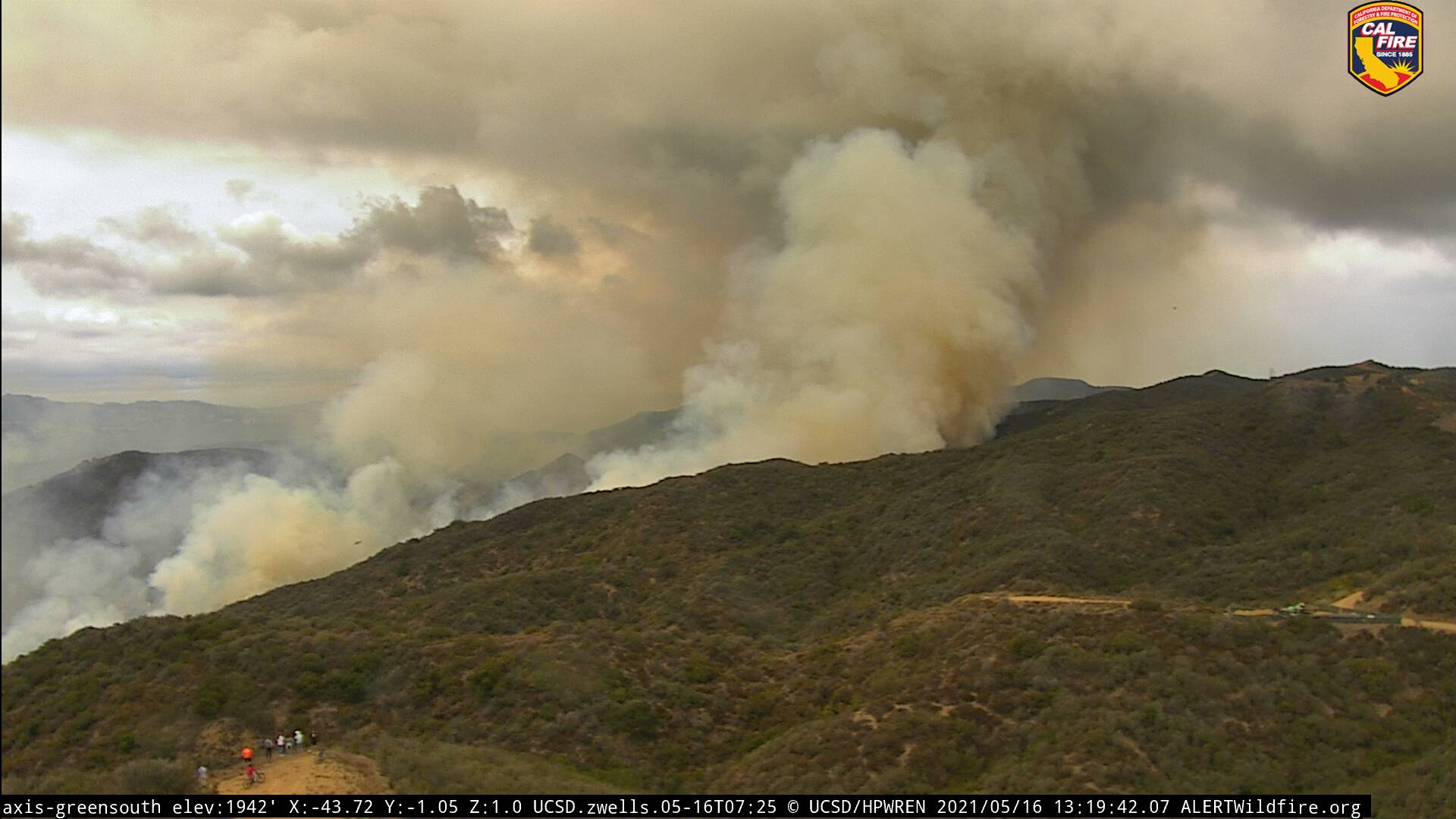
Notice the people in the bottom corner.
AA12 returning to SBD, unable to make it into the incident due to weather.
2 Likes
VNC Copter and OCFA copter are both being committed to the incident.
2 Likes
Flew AA relief on (Green Meadows) when onshore winds took over. Very rugged terrain and nasty turbulence for fixed wing ops. Grounded the air tankers, kept chasing main fire with the rotors.
Green Meadows (1993) vs Springs Fire (2013) maps.
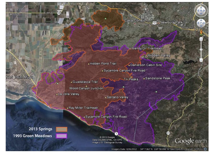
4 Likes
Per ABC7 fire up to 1,325 Acres, evacuations remain in place and LASO still looking for the suspect.
1 Like
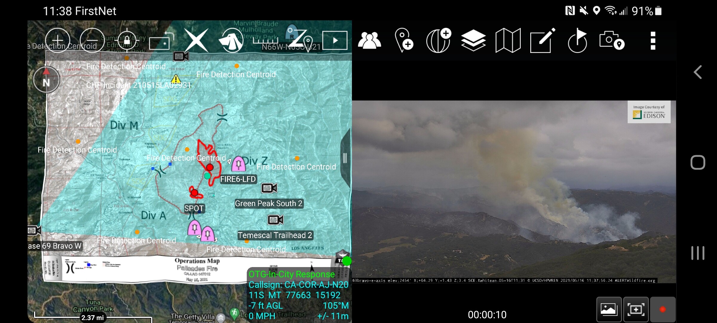
live video
2 Likes
Ops is ordering an AA again to try to get some retardant in on Division Alpha before sunset.
Helco thinks they will have a better chance this time.
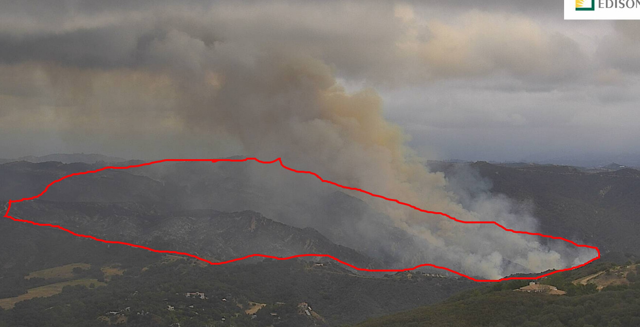
Looking at the live video, seems that it is a flanking fire on both sides. Handlines are going in, and there appears to be dozer contingency line down the flanks.
3 Likes