State ID: CA
3 letter designator: LNF
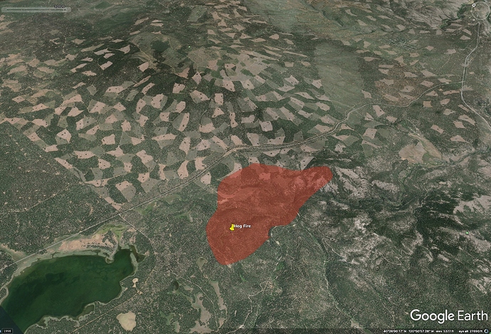
Fire name: Hog
Location: Highway 44 E/O Hog Flat Reservoir, Susanville, CA
Reported acres: 50+
Rate of spread: moderate
Report on Conditions:
Structure threat: yes
Resources: T88 T89 T93 T104 + 2 SEATs
Hazards: 7/19: CHP shutting down Hwy 44 from A21 to Hwy 36
Weather: 7/21: Red Flag Warning for thunderstorms, dry lightning, outflow winds, pyrocumulus development.
Radio channels: Command 10, 151.190/103.5
Air Tactics 167.075
Rotor Vic 118.075
A/G 159.450/192.8 (tac 23)
Scanner link: Lassen County Fire & EMS Live Audio Feed
Limited traffic: Lassen County Sheriff and Susanville Police Dispatch Live Audio Feed
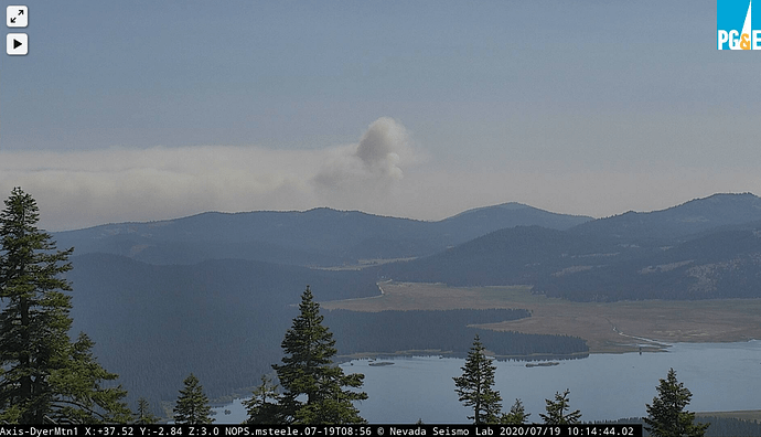
Webcam link: ALERTWildfire | Shasta Modoc
ALERTWildfire | Shasta Modoc
ALERTWildfire | Shasta Modoc
ALERTWildfire | Shasta Modoc
ALERTWildfire | Shasta Modoc
Agency Website:
Per CALFIRE the fire is 10 acres. (Looks a lot bigger tho).
https://col.st/AWdoo
GOES West 1730h
I should have used this view a bit farther north. It has the fire in La Pine, OR too.
https://col.st/87ddc
WESTWOOD (WWDC1) Severity:42
| TIME | RH | WIND | TEMP | FUEL |
|---|---|---|---|---|
| 04:56PM | 19% | WSW6G11mph | 86 | 3 |
| 03:56PM | 18% | WSW4G11mph | 87 | 4 |
| 02:56PM | 19% | SW6G12mph | 85 | 4 |
T-160 & T-102 northbound from SOPS. Not sure of their destination, but guessing this fire.
VLAT has been diverted from the Badger to the Hog.
Per CalFire, the fire is 261 acres and 5% contained. Looks like they also got a wind shift like the Badger did.
It looks like she woke up early today. The Hamilton Mtn1 cam has the best angle (link up top in the original post). She’s punching through the inversion already.
500 Acres. BTU, and NEU both have sent strike teams
LNU Sent
1 Charlie
1 Lima
1 FF Handcrew
Judging by the fire activity yesterday and early today, coupled with the fuel loading, I would think a team activation is not far off.
MDF (Modoc) Type 3 strike team in route.
SKU Charlie is assigned to the HOG, as well as an AEU Charlie assigned for cover LMU
Command 10, 151.190/103.5
Air Tactics 167.075
Rotor Vic 118.075
A/G 159.450/192.8 (tac 23)
She’s off and running. Making a large run right now
http://www.alertwildfire.org/shastamodoc/index.html?camera=Axis-DyerMtn1&v=81e003f
S-2’s are enroute.
CHP shutting down Hwy 44 from A21 to Hwy 36


