Looks like it’s making a push to the Southeast. Large column building.
New evacs
CIRCLE OAKS
Moskowite Corner to Wooden Valley Rd.
Atlas Peak from Bubbling Well Pet Cemetery at 2462 Atlas Peak Rd to dead end
Loma Vista Rd/Soda Creek Canyon Rd to dead end
1 Like
3 posts were split to a new topic: CA-LNU-Hennessey Photos
Mod Note: I moved the photos of the Hennessey into it’s own separate thread to ensure this thread remains focus on the actual fire intel primarily due to the immediate life safety threat to Spanish Flat and Moskowite Corner areas. Please feel free to continue to post those valuable intel pieces here: Hennessey Fire Photos
11 Likes
New Evacuation Order:
New mandatory evacuation orders have been issued for the following areas:
All areas on Berryessa Knockville Rd from Eastside Rd to Hwy 128 at the intersection of Berryessa Knoxville Rd / Hwy 128 (Turtle Rock Bar).
- Everything West of Lake Berryessa’s water’s edge
- Pope Canyon Rd from Pope Valley Rd to Berryessa Knoxville Rd.
- Including Hardin Rd and Including the Sufi Center
- The intersection on Butts Canyon Road and Snell Valley Road to all of Berryessa Estates Sub Division.
1 Like
Somebody(a BC?) is sheltering civilians in place at a Capell Cove Launch Ramp, Knoxville Road, Napa, CA.
2 Likes
Looks like this one could possibly run into the 15-10 fire perhaps?
The East side of Lake Berryessa is all County Fire scar from 2017 I believe
Atlas Peak RAS showing 36 MPH, 100 deg F, 25% humidity and the fire is just coming over the ridge below it.
1 Like
If a Southwest wind comes up, then yes, it will run North towards the 15-10 but that is almost 20 miles. The more immediate issue is going to be the Spanish Flat area on the North head. The South head is going to hit Moskowite Corner and the entire Capelle Valley area. It is already in the Atlas Fire footprint and will continue marching up the slope.
1 Like
Expanded Evacuation Order
Expanded wildfire mandatory evacuation orders have been issued for:
- Wragg Canyon Rd – from HWY 128 to the end of the road, including Pleasure Cove Resort.
- Chiles Pope Valley Road from Lower Chiles Valley Road to Pope Canyon Road.
3 Likes
The fire is approaching the Mt. Vaca repeaters. Mt Vaca 5
It has reached Blue Ridge Rd and Mix Canyon Rd on the East side. Solano County is dispatching a 4 Alarm response to come in from the Solano side into the Pleasants Valley Rd and Quail Canyon Rd estates area.
There are resources sheltering in place in Wragg Canyon to attempt to save the homes along Wragg Canyon Rd.
Additionally, the North Head reached Lake Berryessa’s west shore in the Spanish Flat/Big Island area in the 19:00 timeframe today and is currently spreading laterally to the North along the shoreline. Berryessa
The fire is working its way up Atlas Peak, which is another major repeater site. If both Mt Vaca and Atlas Peak repeaters are lost, that will severely impacted the communications for the south end of this Complex. Atlas Peak
Approximately 20 civilians and a LNU Training officer had to shelter in place at the Steele Canyon Resort due to the fire blocking egress out Steele Canyon Rd.
3 Likes
Looks like the Mt. Vaca 8 cam has already been overrun!
2 Likes
RIP camera
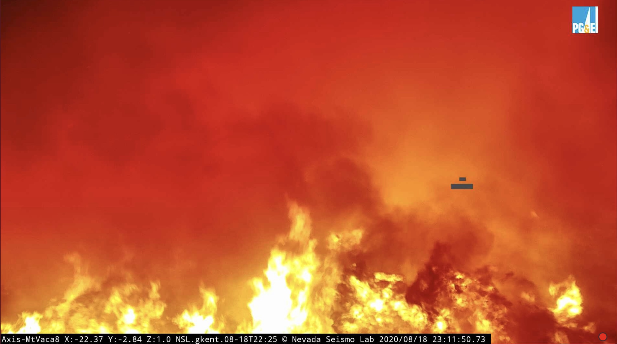
5 Likes
Has spotted across Pleasants Valley Rd to the East.
1 Like
They are losing structures along pleasants valley rd north of Vacaville, reports of people having to take refuge in swimming pools, sounds like it made a hell of a run down off the mountain.
Well established in the flat, 200-300 homes out in front of it, hoping to hold it at 505
Large portion of the West side of Vacaville being evacuated.
1 Like
2 posts were merged into an existing topic: CA-LNU-Lightning Aug 2020
Impressive Goes 17 satellite heat map for 5:45am:
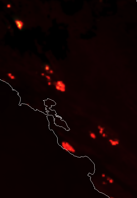
1 Like
fire is right below the atlas peak cam now on the NW side