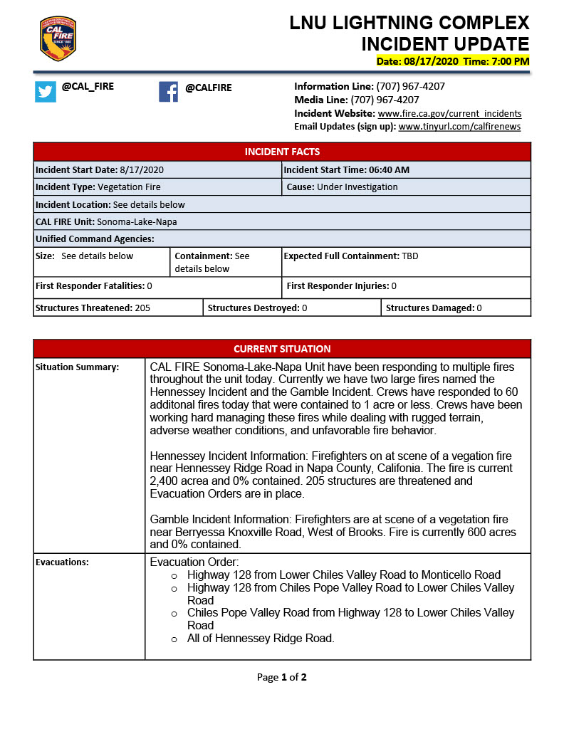
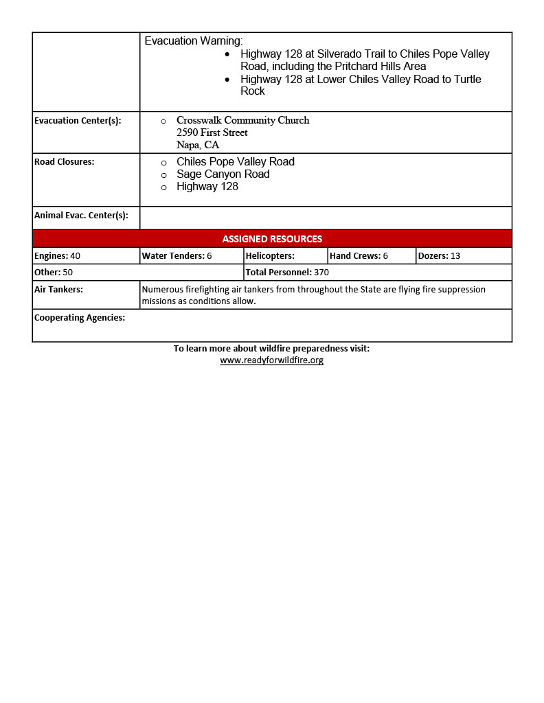
State ID: CA
3 letter designator: LNU
Fire name: Hennessey
Location: Hennessey Ridge above Lower Chiles Valley
Reported acres: 300
Rate of spread: Rapid
Report on Conditions: Moving south along Hennessey Ridge
Structure threat: Mandatory Evacuations are in place for Sage Canyon, Lower Chiles Valley Rd.
Resources: CalFire; Napa County Fire
Hazards:
Weather: Multiple TS cells working through the area
Radio channels: LNU East, CDF Tac 4
Scanner link: https://www.broadcastify.com/webPlayer/865
Webcam link:
Mt Sonoma http://www.alertwildfire.org/northbay/index.html?camera=Axis-SonomaMt&v=81e004f
Atlas Peak West http://www.alertwildfire.org/northbay/index.html?camera=Axis-AtlasPeakWest&v=81e004f (Atlas Peak is pretty smoked out at the moment)
Lake Berryessa http://www.alertwildfire.org/northbay/index.html?camera=Axis-Berryessa&v=81e004f
Mt. St. Helena South http://www.alertwildfire.org/northbay/index.html?camera=Axis-StHelenaSouth&v=81e004f
Agency Website:
Mandatory evacuation orders have been issued due to the Hennessey Fire, for the following areas:
- Hwy 128 from Lower Chiles to Monticello
- Hwy 128 from Chiles Pope Valley Road to Lower Chiles Road
- Chiles Pope Valley Road from 128 to Lower Chiles Road
- All of Hennessey Ridge Road
Evacuation warnings are for the following areas:
- Hwy 128 at Silverado Trail to Chiles Pope Valley Road, including the Pritchard Hills Area
- Hwy 128 at Lower Chiles Road to Turtle Rock
Road closures in area include:
- Chiles-Pope Valley Road
- Sage Canyon Road
- Highway 128
2 posts were merged into an existing topic: CA-LNU-Lightning Aug 2020
San Francisco ABC7 News has their copter over the Hennessey at the moment.
Live feed here: ABC7News Live Copter 7
Updated from CAL FIRE - now 2,400 acres
Captured this (as best as I could get given it’s rugged location and closures) about an hour ago of Hwy 29.
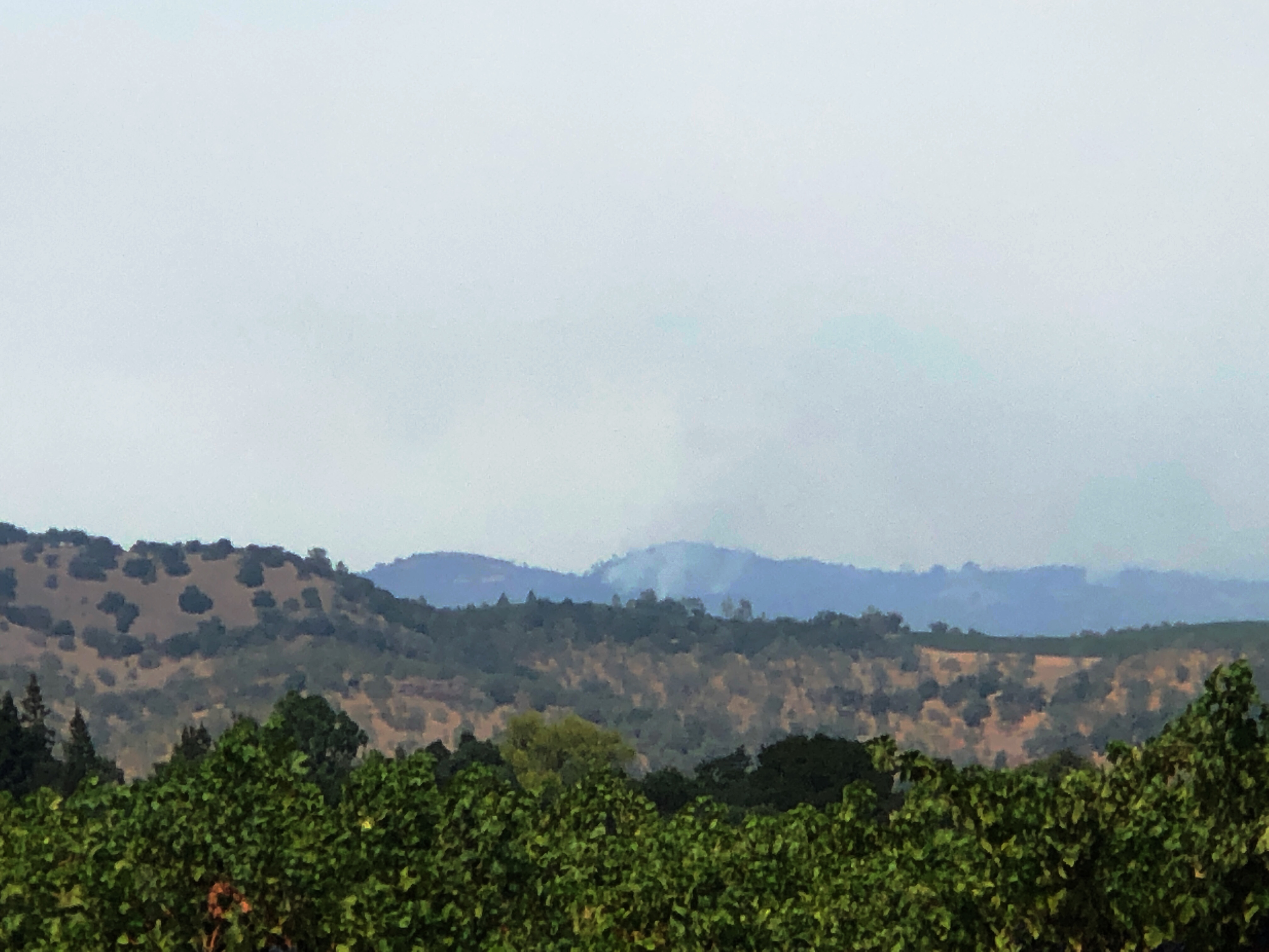
Unfortunately, you aren’t going to see too much from the 29 side as the original strike was 2/3 of the way up Hennessey Ridge and has backed down on the West side, (Napa Valley proper) and moved significantly East towards Lower Chiles Valley Rd & Reserve Rd. Most of the West side is isolated pockets as your photo suggests.
Yeah, I just happen to live nearby, and drove up Silverado Trail, captured some settled smoke at the vineyards (with the DSLR), and was shocked to see a small plume when I was heading home on Hwy 29 and took this one on my iPhone. I audibly said “there you are!” out loud (and I was alone  ) when I saw it.
Just published.
2,400 acres
0% contained
Same mandatory evacs, road closures and warnings in place.
So, to get ahead of those who will want to know, the ICP is the Napa County Fair Grounds in Calistoga, also known as the Calistoga Fairgrounds.
A lot of work for the Mods this week:) Thanks.
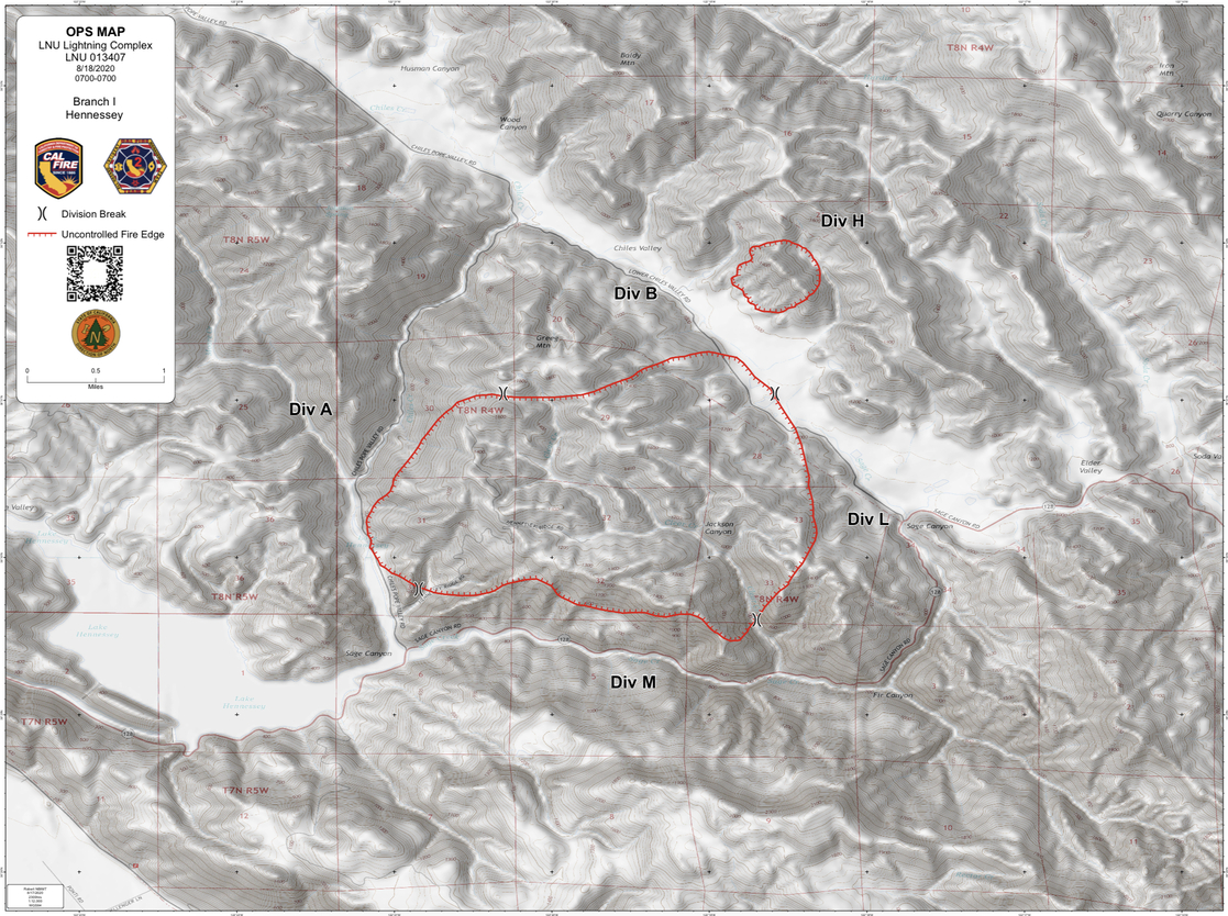
Today’s Ops Map:
Where is ICP located?
You’re kidding right???
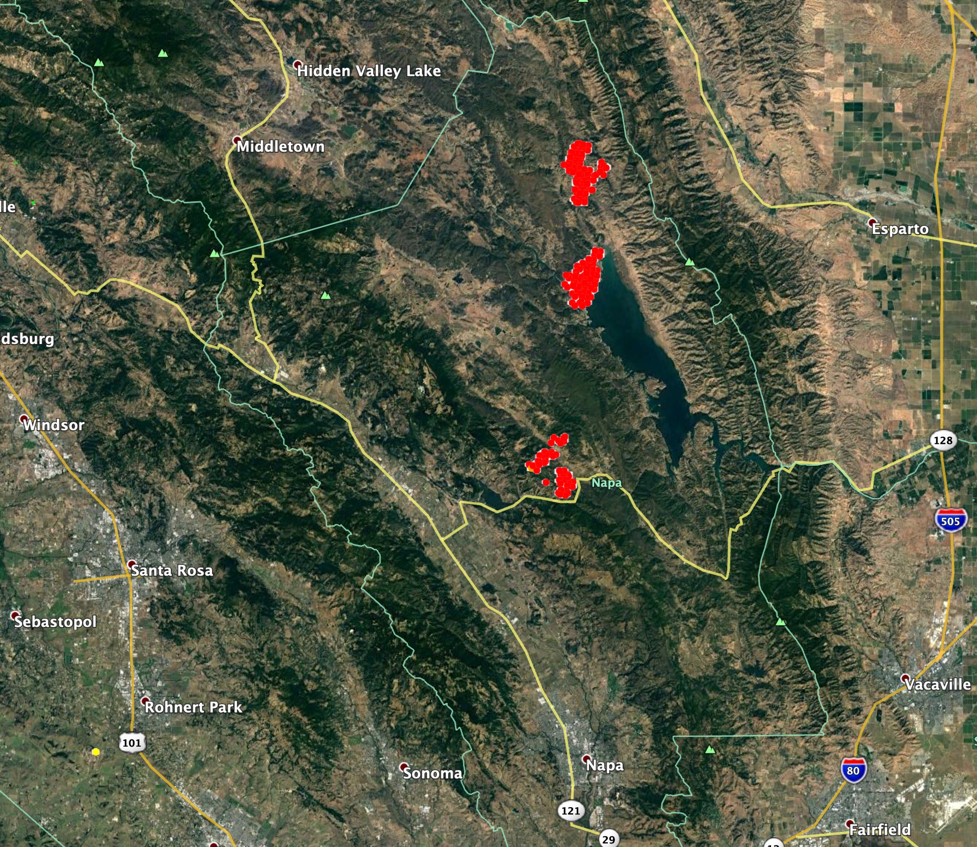
VIIRs heat detections of LNU fires from 0200 this morning.
Where did you find the map?
I’ve been watching the place I expected them to show up, but nothing yet.
To pyrogeography also,
Where did you find the map?
I’ve been watching the place I expected them to show up, but nothing yet.
Thanks
Thank You Dozer_Keith
The dates on the parent folders were throwing me off. By saying “Last Modified,” 2020/02/25, it makes it look like its an old folder, with nothing new in it. I guess you have to know to go deeper into it.