Thank for the clarification @ndp and @BlueZebra
3 Likes
Pge has 4 hawks one in Marin and one in butte, 2 for construction work but still carry buckets with them, they are flown and maintained by pj
6 Likes
Slight detour for background on the PG&E ships, and back to the fire…
4 Likes
Us as IC’s so to speak.. we never count on aircraft. Being diverted, fuel cycles, they crash god forbid.
4 Likes
We did a livestream on the fire, weather, and also, bonus feature on citizen burning with PBAs (Prescribed Burn Associations).
11 Likes
2 Likes
Can anyone provide insight on what would happen if this fire pushed out of the Glass scar? If it keeps burning to the east what does the fire history look like?
2 Likes
Fyi, Caltopo is free and has a fire history function. I just did a quick screengrab - sorry its a BUSY picture. There is some history for sure as that country likes to burn!
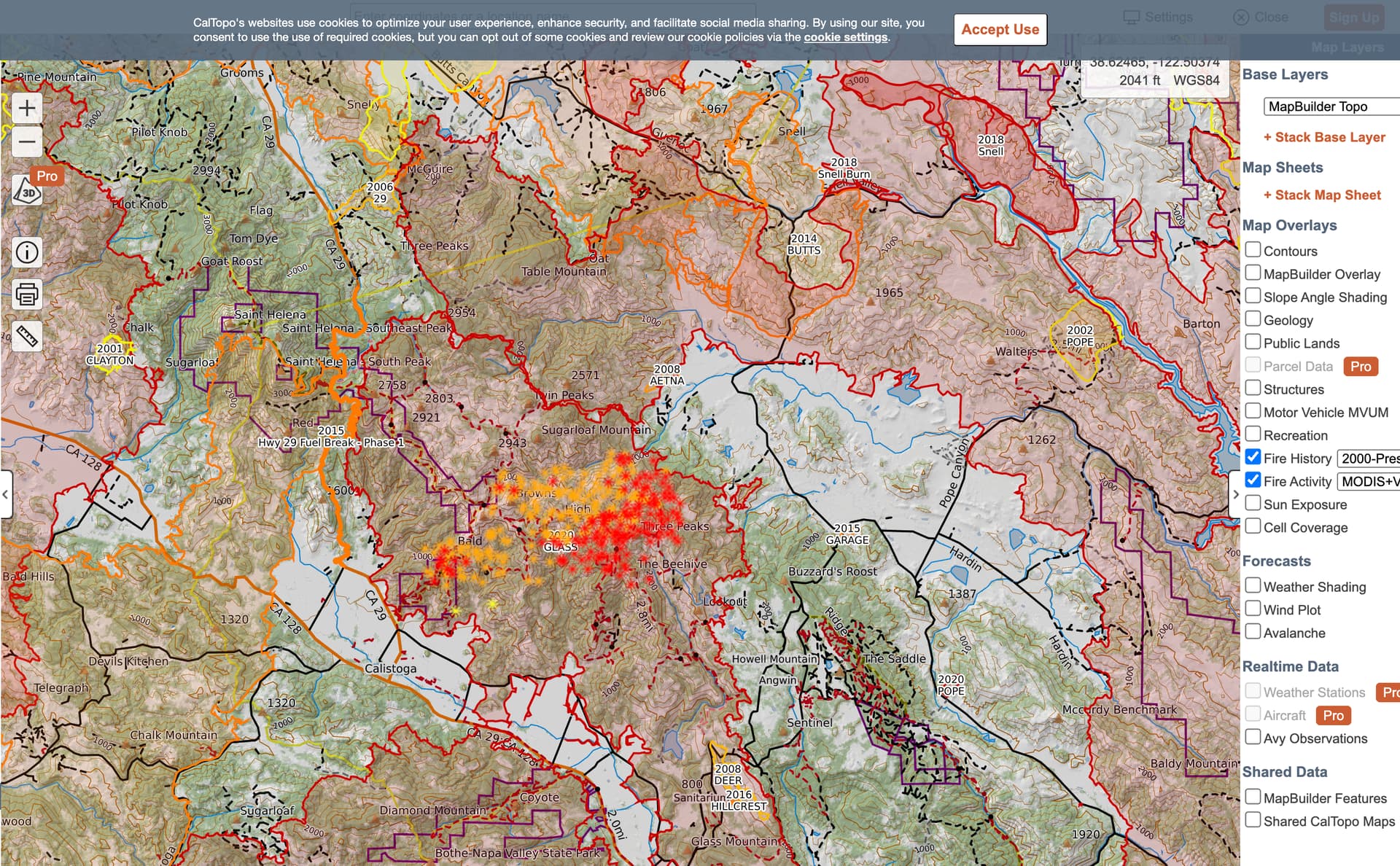
Edit: Thanks to @pyrogeography for the tips/tools et al…
6 Likes
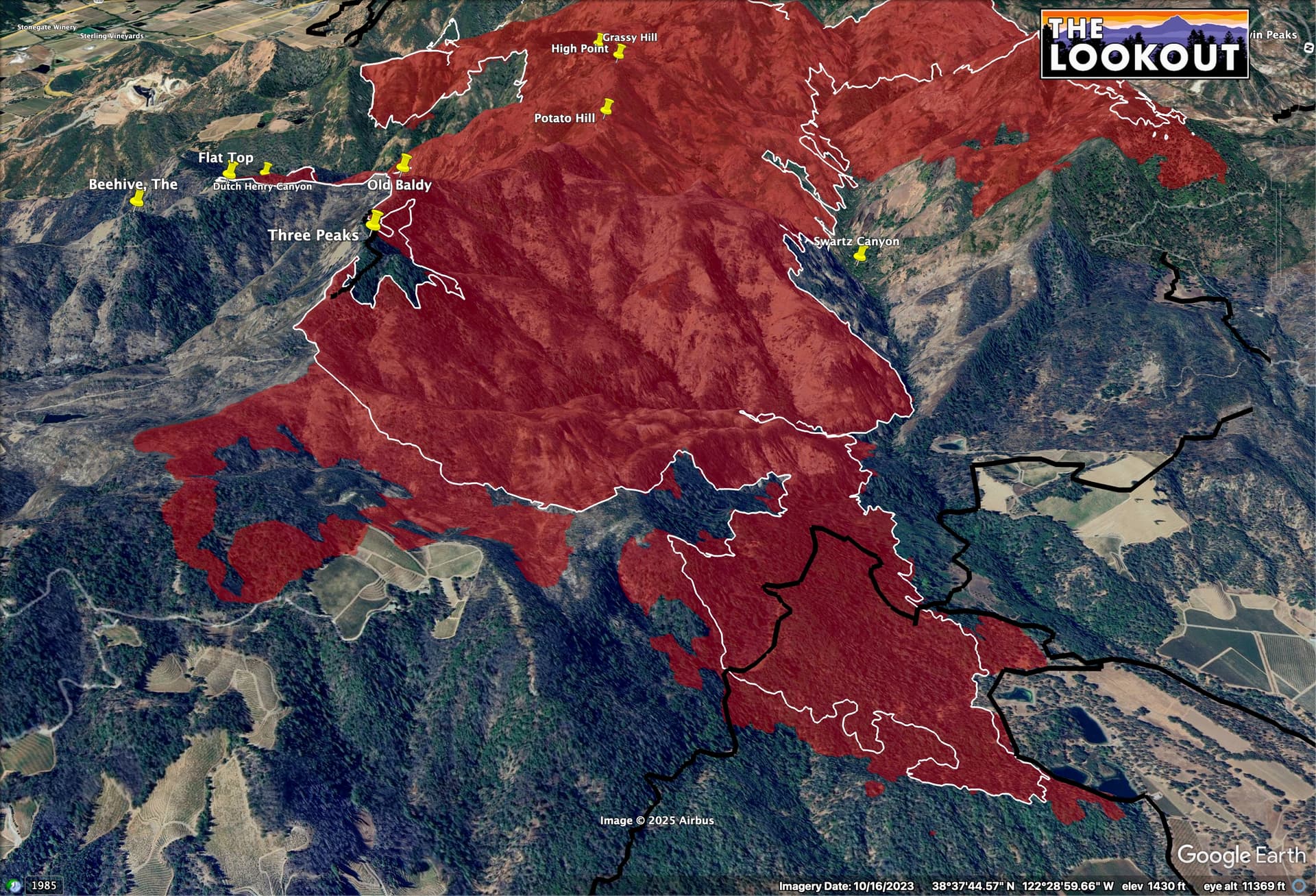
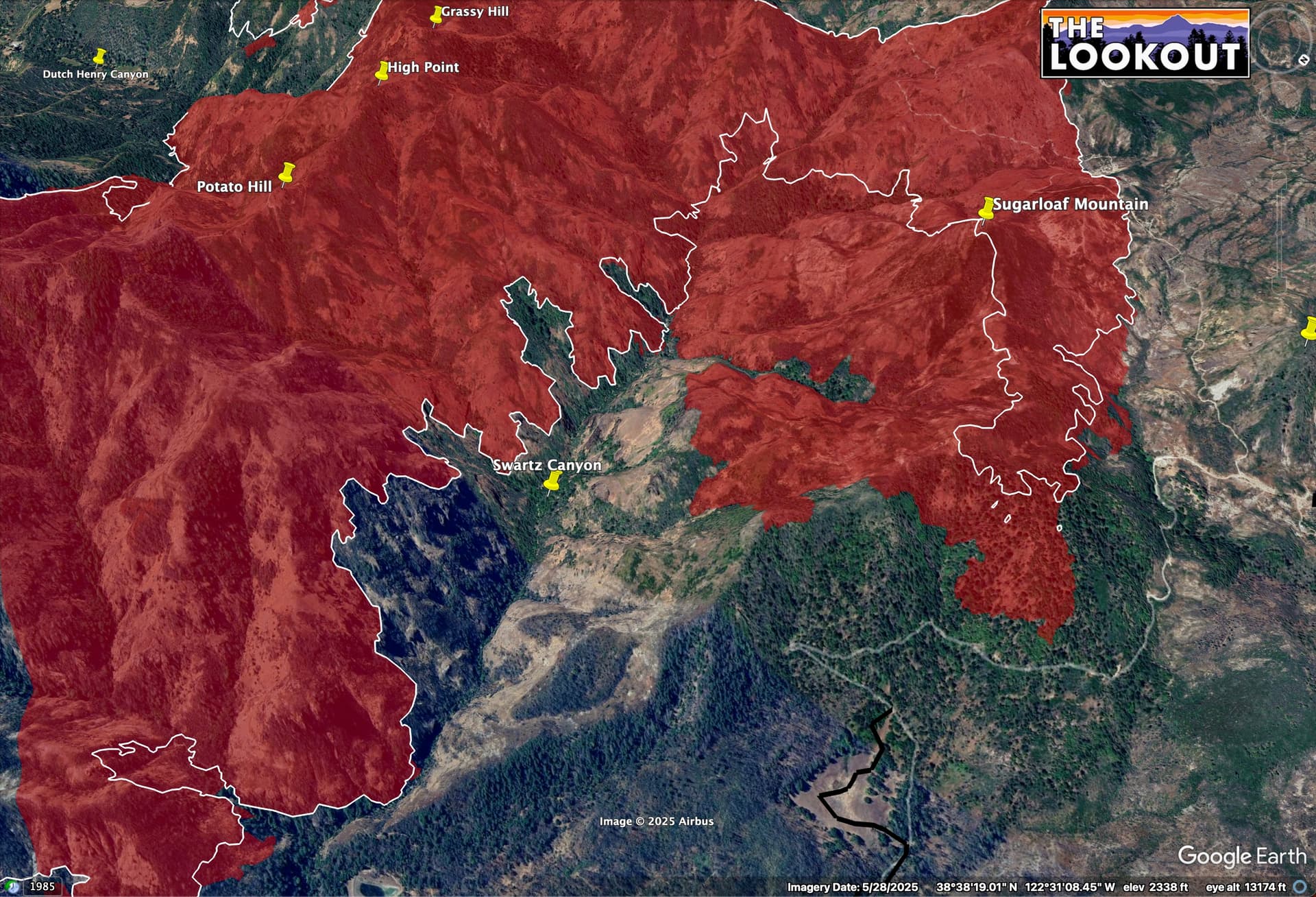
To the north, the Glass Fire ran into the Hennesey Fire, also in 2020, so there is pretty similar fuels for miles to the north, but there is no recent fire history around Aetna Springs.
Hennesey and Glass in blue, here.
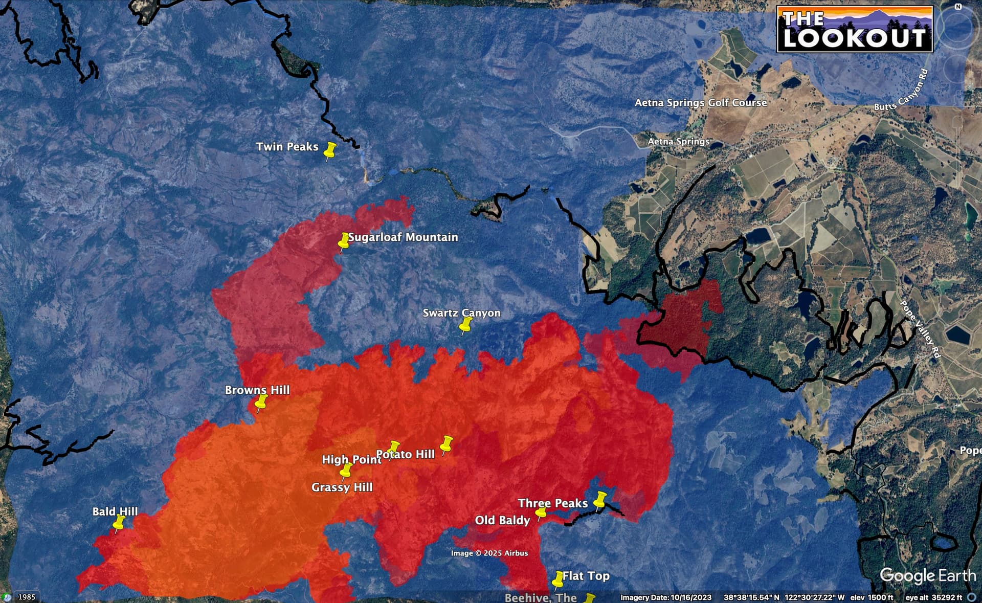
The fire squirted out on the north end a bit, this evening, and is into older fuels in that NE section of growth. Glass Fire dozer lines in black.
9 Likes
In reflection..
First estimated average potential = 25-50 acres. It was quickly followed by a revised potential for 500 and then several more estimates from several sources, some on scene, some close to the scene & some from behind their keyboards - like me. Given the scar it was burning in, the amount of avail resources, how the atmosphere was behaving & what happened on the AEU’s fire in timber from the day before i was seriously caught up in speculating that the troops would catch this one sooner than later - even knowing that piece of ground is #crap for equipment & humans.
So, as i once again look-in on this fire from the GOES i’m struck by the heat signature that has been un-relenting & persistent since ignition. Even now with what appears to be a noticeable decrease in activity on the camera network that hotspot shines bright. No point here other than analyzing my own “failures” & trying to sort out why the impulse to make predictions is so strong for current & former fire folks. T’s & P’s to all the responders in the arena doing all they can to protect life, property & resources for schmucks like me. Hoping the incoming Wx changes will help more that hurt their efforts up & down the state…
5 Likes
As of last night "The fire has been mapped at 3992.6 acres by CAL FIRE Intel aircraft.” per WD.
We may have reached a point in modern history where wildfires are more predictably unpredictable than in our recent past. Mind you, I’m a layman, living in the WUI for forty years. I am grateful for the resource that is this website.
10 Likes
4690 acres
4 Likes
Looking for updated comm plan
1 Like

ICS 220 Air ops plan had some additional Air Tac freqs yesterday. I believe 166.600? But hearing traffic that may have changed.
3 Likes
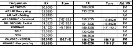
Thank you. That has changes I was looking for
4 Likes
Looks like it’s starting to pick back up for the day
4 Likes
Little over an hour ago Helco requested AA above the fire within 15 mins. Sounds like some tankers working the NE area
5 Likes