State ID:CA
3 letter designator: LNU
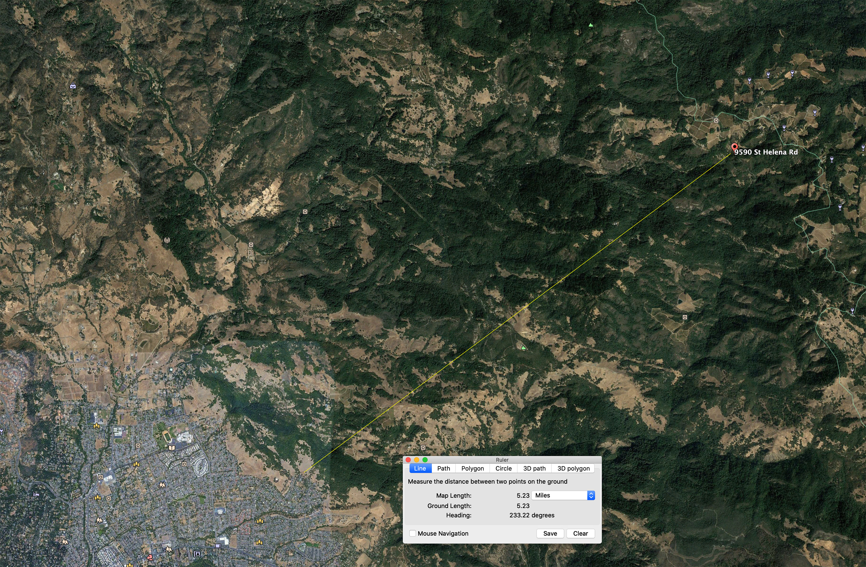
Fire name: SHADY
Location: St. Helena Rd & Spring Mountain Rd., St Helena
Reported acres: 5
Rate of spread: Moderate
Report on Conditions:
Structure threat:
Resources:
Hazards:
Weather: Red Flag
Radio channels:
Scanner link: https://m.broadcastify.com/listen/feed/14279
Webcam link: http://www.alertwildfire.org/northbay/index.html?camera=Axis-StHelenaSouth
Agency Website:
2 Likes
Night AA just stated 200 acres
1 Like
There was an emergency alert on the tv for evacuation in the Pythian and Calistoga Rd areas.
O.k.,totally confused on where to post. Yes, just requesting evacuations on Calistoga Rd all the way to Santa Rosa city.
1 Like
Per Shady Air Attack: 2104hrs “High potential for this to burn into Santa Rosa”
3 Likes
Wow, that’s gonna be moving than.
2 Likes
In regards to that, he specifically mentioned the Howarth Park area
There’s a ton of homes between the fire and Howarth. That’s another coffee park situation on a much larger scale.
2 Likes
So this would squeeze s/e of the Tubbs and north of the Nunns. To Howarth Park, Annadel, Sonoma Mt. Now it’s getting close to home.
2 Likes
They sound pretty frantic on the radio. I have been monitoring SRPD/SO/LNU West 10 and Redcom. Sounds like they are planning for a full scale evac of eastern SR.
3 Likes
What did AA just say? An hour or two to what, hwy 12?
1 Like
Yes, Hwy 12 and Howarth Park Area
AA reporting fire will impact Howarth Park in a couple of hours.
Is there some confusion? Howarth park is well in SR limits. Could they be talking about Annadel State Park?
2 Likes
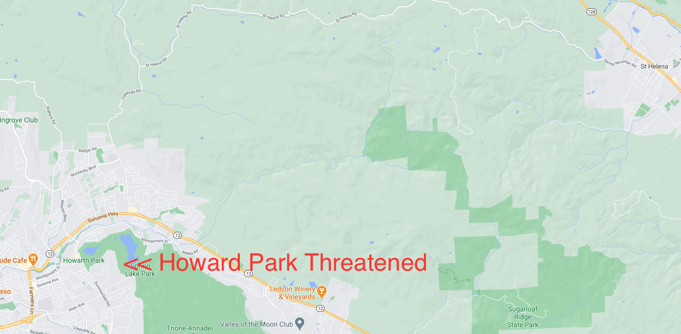
I heard them say Howarth Park. AA and IC
2 Likes
I heard a request to AA about “timeline to effecting Hwy 12” and the response was “about 1 or two hours”