State ID: CA
3 letter designator: LNU
Fire name: TOLL
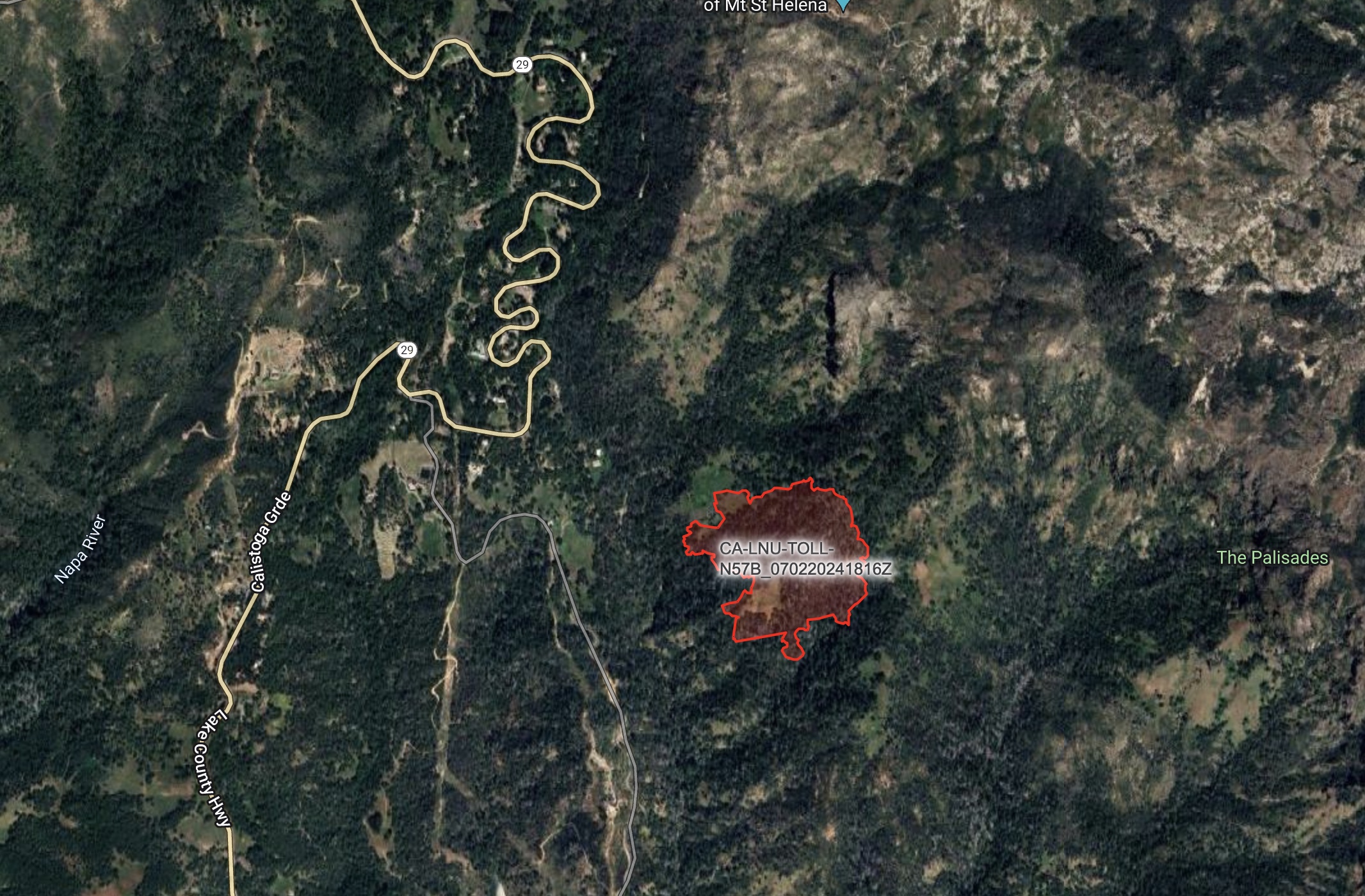
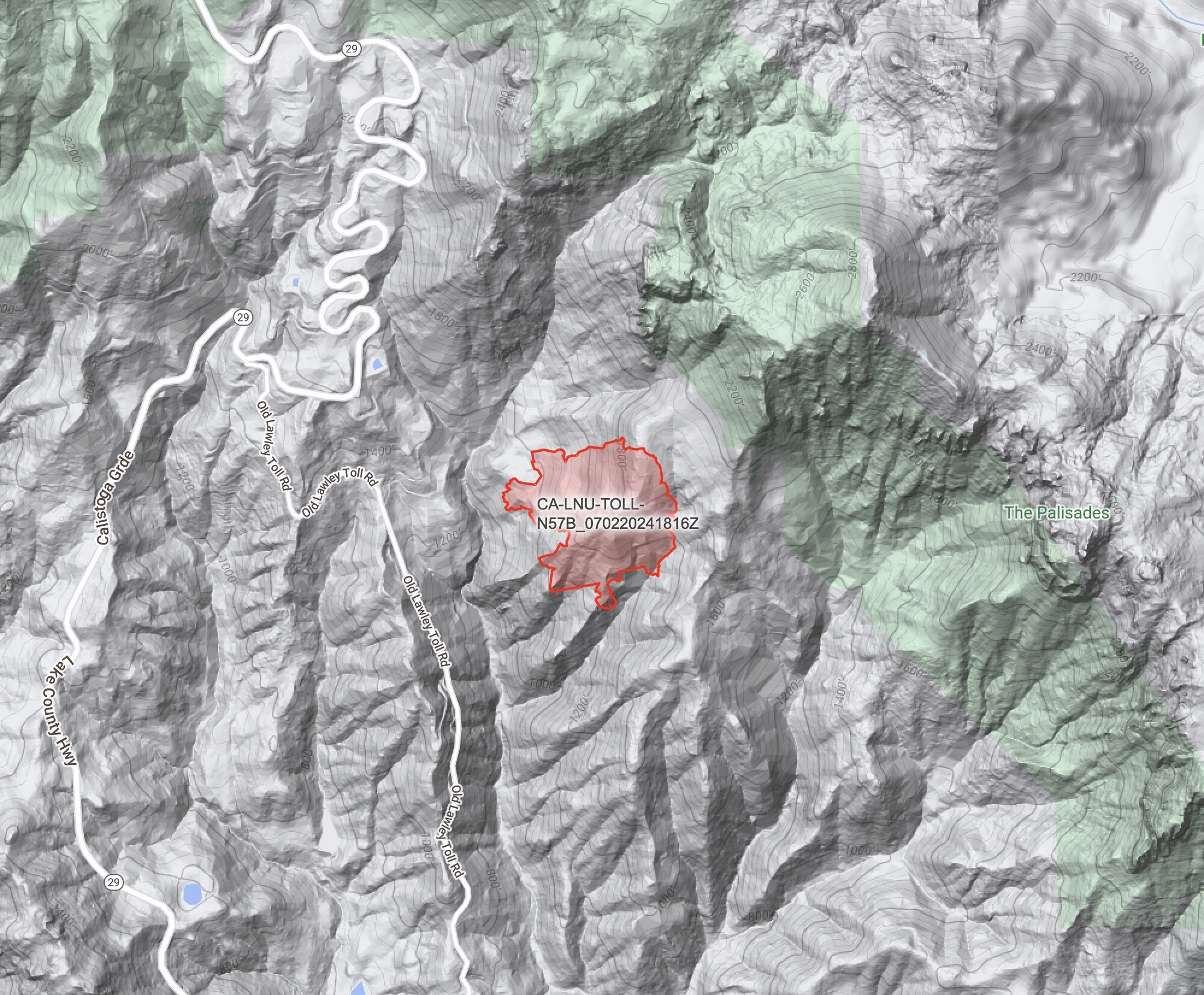
Location: Old Lawley Toll Road, Mt St Helena
Reported acres:25+
Rate of spread: Dangerous
Report on Conditions: Heavy fuel moving away from the road.
Structure threat: Yes, Evacs ordered
Resources:
Hazards:
Weather: Red Flag. 95+, RH 20, Wind NNE at 20
Radio channels:
Scanner link:
Webcam link: ALERTCalifornia - St Helena South Napa
https://alertwest.live/cam-console/11026
Agency Website:
2 Likes
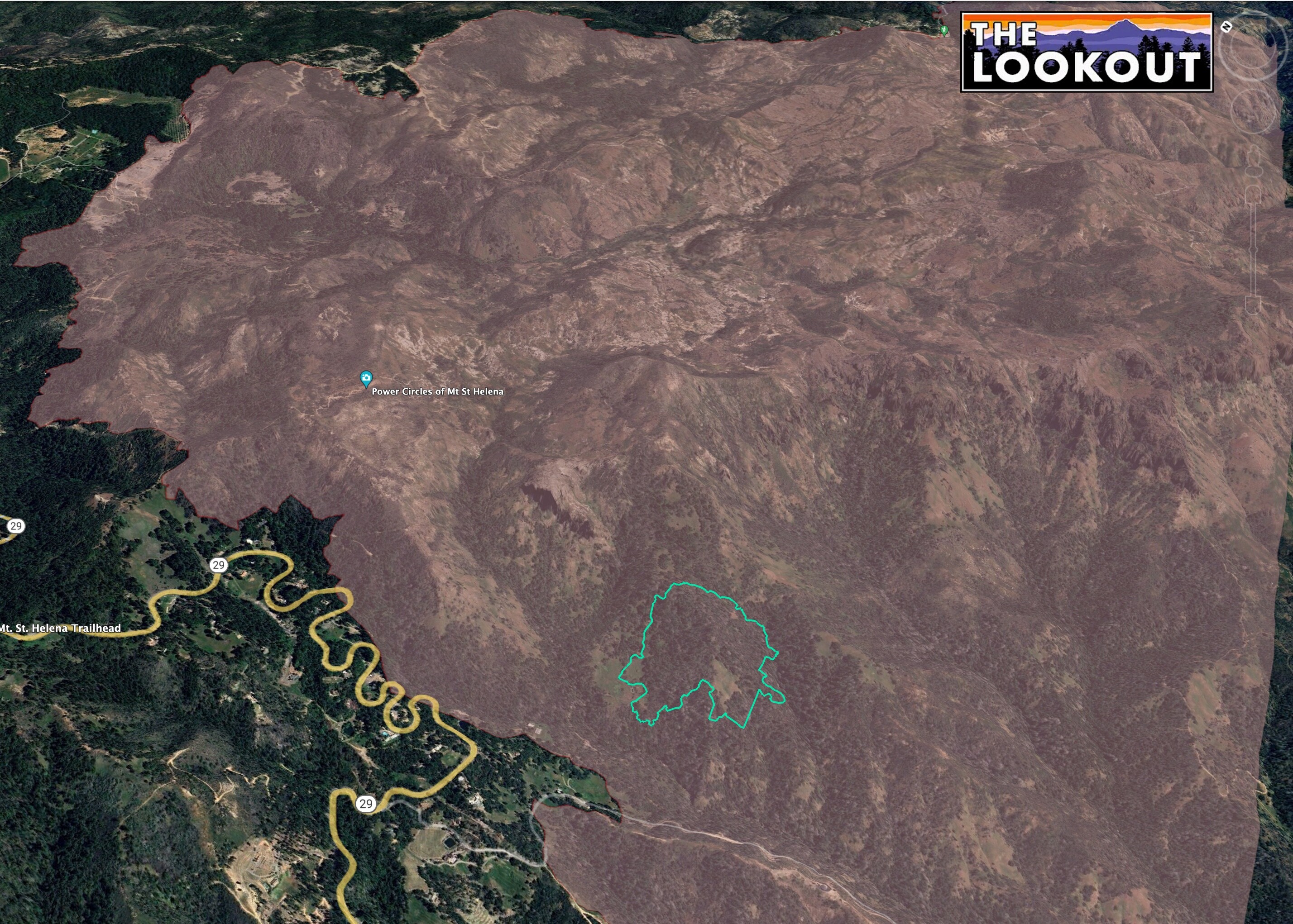
FIRIS mapping at 40.6 acres
Air Attack 140 (440?) says potential for 100 acres. It sounded like he requested a second agency copter w/crew, but that is assuming one was punched out initially.
2 Likes
Yea it is 140, assigned to the fire currently A140 T85 T86 C601 C35S I believe the order is for 1 additional Cal Fire copter and 4 additional tankers ?
4 Likes
Just added requests for VLAT w/lead and HELCO.
3 Likes
approx 25 acres now; added requests for engines, overhead, crews
2 Likes
Temp mid 90s. RH 25% Winds NNE at 20.
6 Likes
Local evacuations requested by IC, no details on evac zones yet
3 Likes
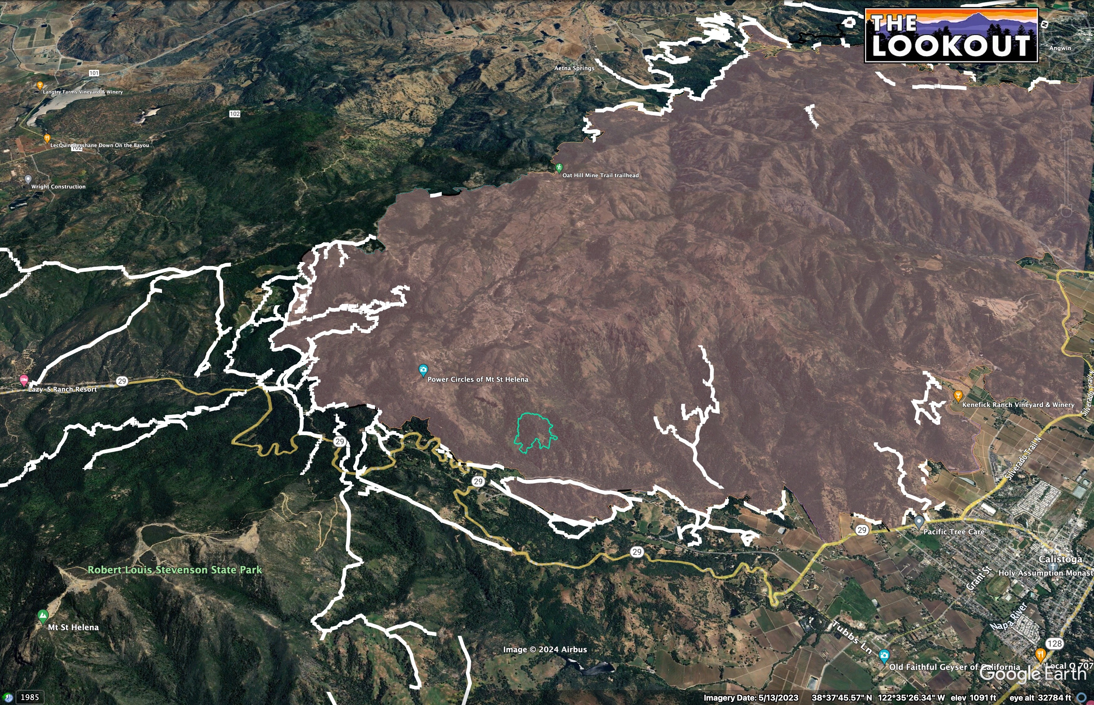
Here is mapping from about 11:15am from FIRIS.
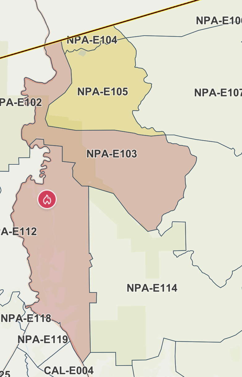
It’s east of Highway 29, all inside 2020 Glass Fire.
2020 Glass Fire in pink. FIRIS in green.
There’s not a lot of old dozer line from Glass Fire in the immediate vicinity, according to the final dozerline map from 2020 (white).
8 Likes
As can be inferred from the switchbacks along Hwy 29, that area is really steep and rocky.
Tubbs had a similar issue on the other side of the highway in 2017.
3 Likes
Putting the fixed wing on Load and Hold
6 Likes
I have been on wildfires in the Old Lawley Toll Rd before. Steep, difficult to access and unusually gusty winds. The firefighters have a hard day ahead of them.
6 Likes