It’s out of the box !
3 Likes
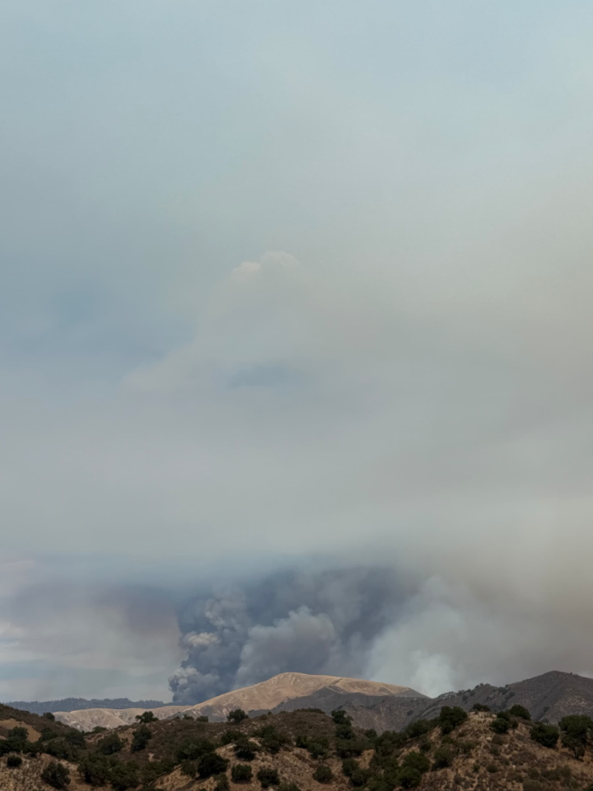
Pretty active night on the north end…
The fire is now 96,106 acres and 15% contained, per the National Interagency Fire Center (NIFC).
5 Likes
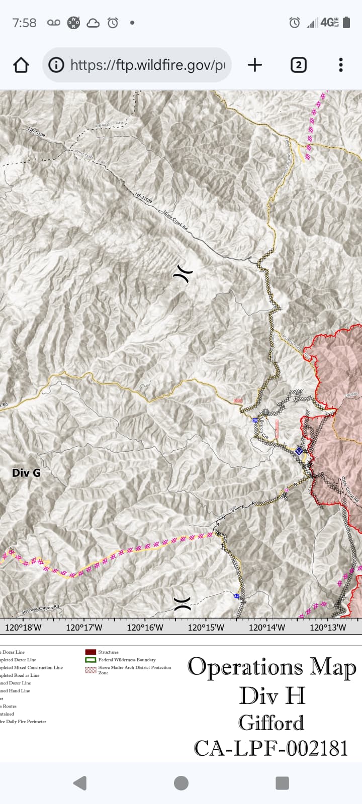
Looking at the Ops map for today, it looks like there is dozer line around ~85% of the fire. I would think they’re about to turn the corner on this thing
7 Likes
It blew out between division h&g and is still moving pretty good.
Its established along huasna road and pine ridge.
8 Likes
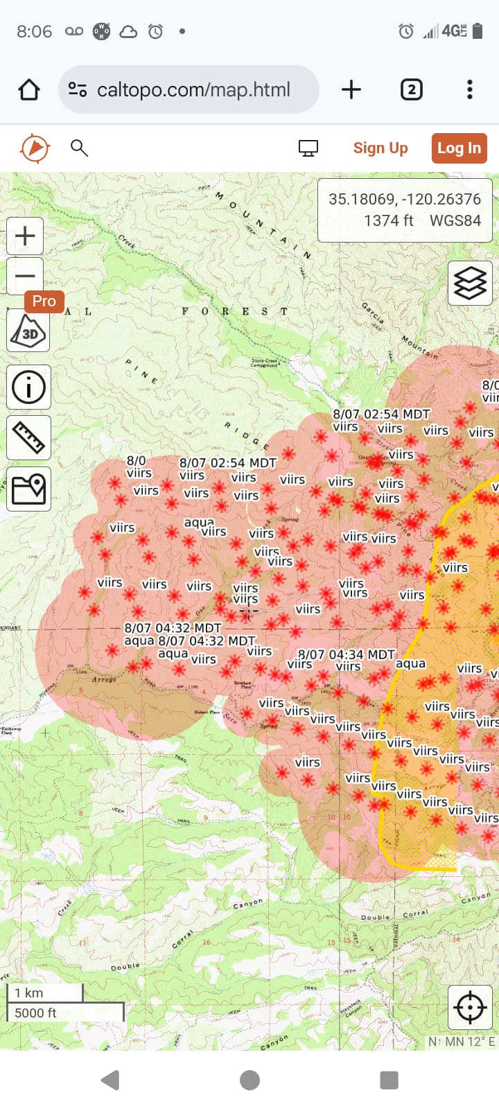
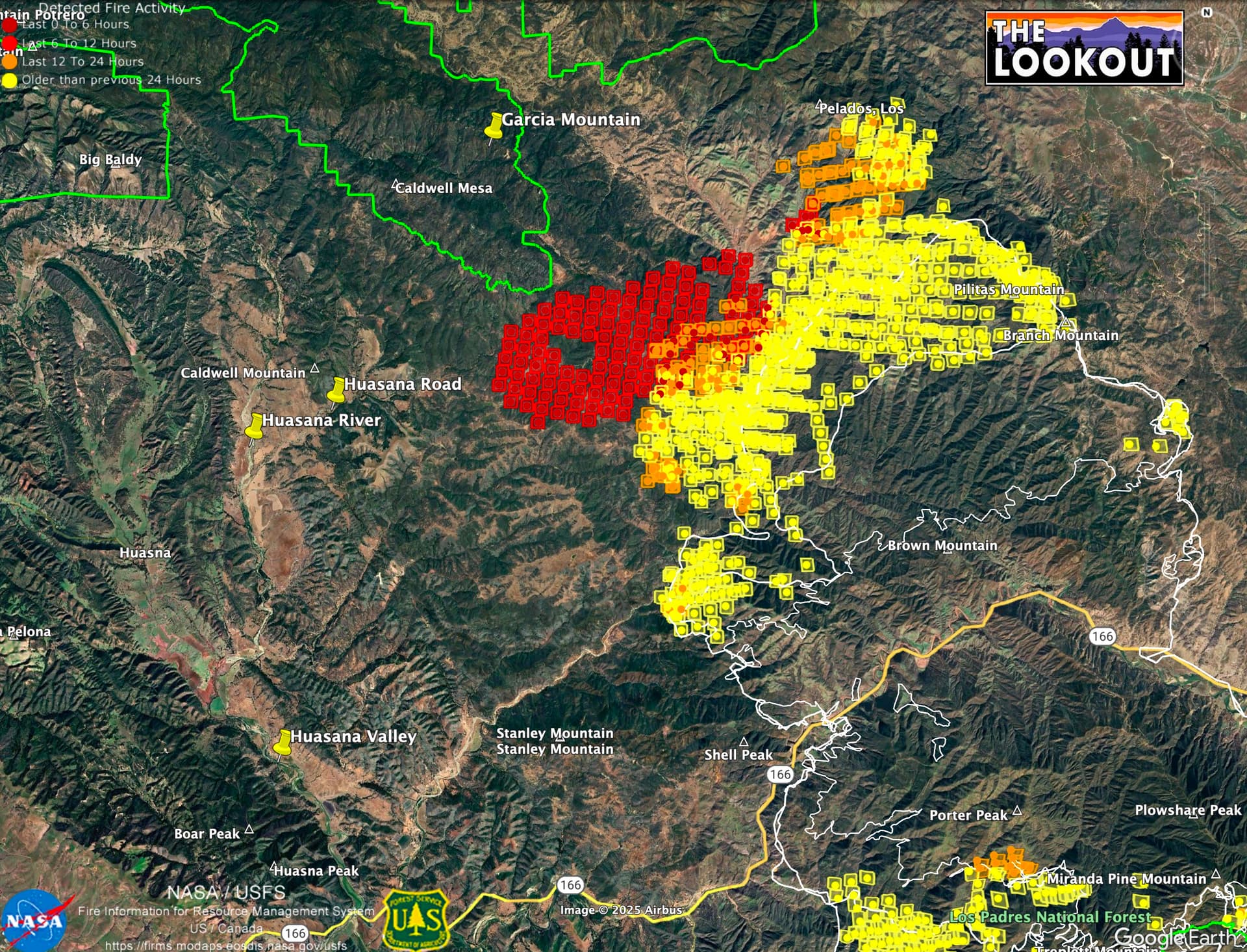
The 12 hour growth on the VIIRs heat detections, captured about 3am, is about 6,000 acres, getting close to the Garcia Wilderness on the north.
10 Likes
Current Situation: Overnight winds exceeding 30 MPH for over an hour pushed the fire toward Huasna and Willis Ranch, with active spread between Pine Ridge and Haystack Canyon. This prompted new evacuation orders west of those areas in San Luis Obispo County. The rest of the fire area saw minimal activity last night.
Today, the priority focus area for crews to construct control lines will be west of Pine Ridge and Haystack Canyon taking advantage of anticipated northwesterly winds. On the north end, crews continue direct attack along Avenales Ranch Road and scout contingency lines further north. A UAS flight on the south end identified heat spots for crews to target today. Crews also added containment on the east and west flanks and will monitor for interior smokes and heat.
Weather: Very hot and dry conditions are expected today with temperatures ranging from 92-104°F and relative humidity dropping to 8-20%. Typical daytime winds with upcanyon/westerly gusts of 15-20 MPH are expected Thursday afternoon.
9 Likes
Thanks Zeke.
Good clarification…as always
5 Likes
5 Likes
Timelapse on the La Panza cam looking out across the burn towards main fire really showing just how complex the air movement is just above the surface. Its a vortice party today!!
8 Likes
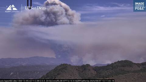
That rascal is breathing very well today - really strong signal on the goes sat once again. Its very much still trying to get to lopez lake & the pozo saloon!! ![]()
6 Likes
Moving northwest fairly quickly.
6 Likes
Pretty sure it’s gonna be in the Garcia Wilderness soon enough, just chewing through that ridgeline (pine ridge?) towards the caldwell mesa. Real tough area to be cutting &. burning line tonight, no matter how many dozers they can get up there…
6 Likes
Not sure, but it looks like it is there.
7 Likes
Expect the wind to shift from west to southwest to east to northeast before 11pm which has occurred nightly and contributed to the spread we early this morning.
8 Likes
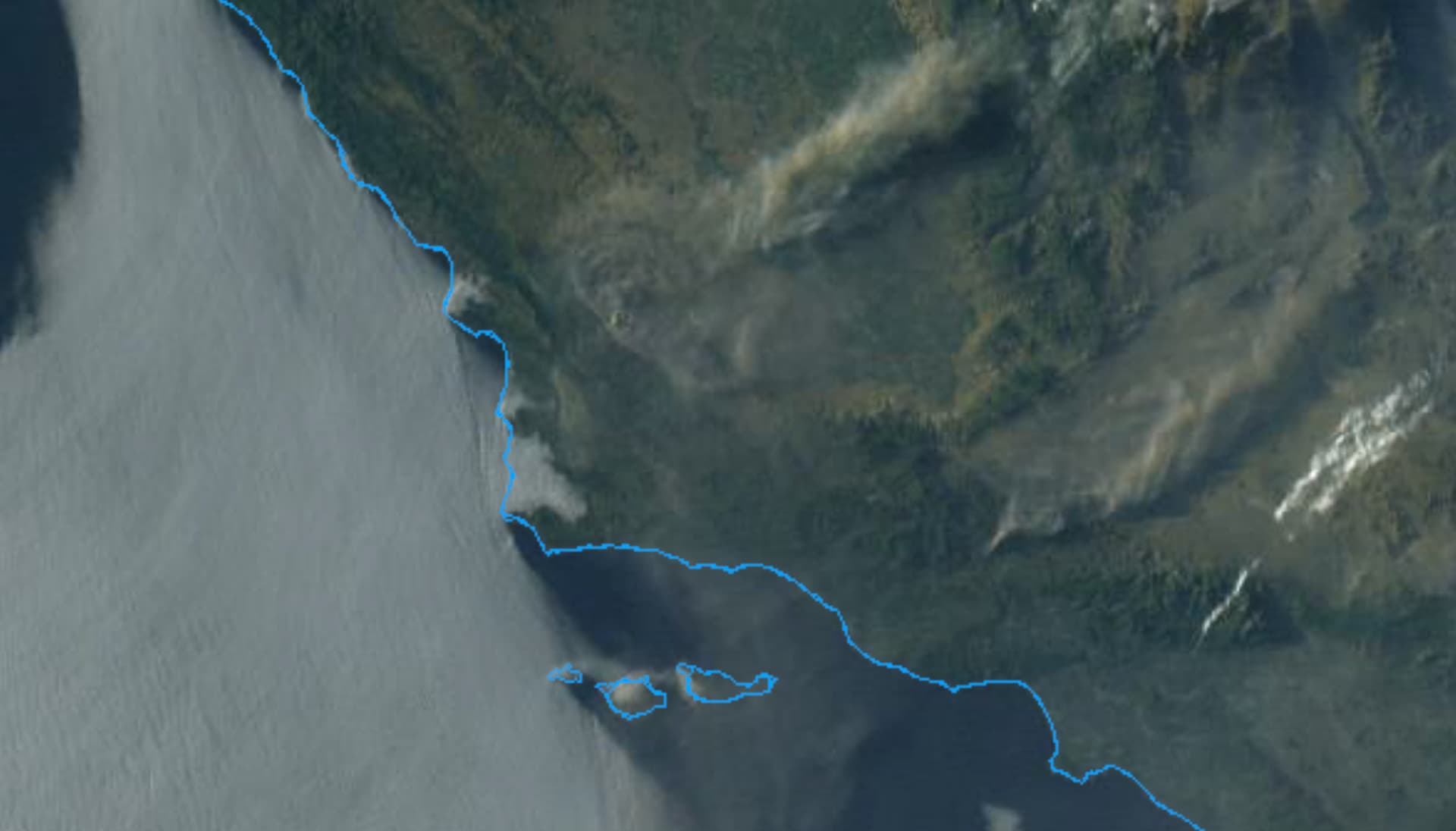
Very interesting clockwise “swirl” to the smoke mass above Gifford tonite can be seen on the GOES. Not sure if shadowing effect from setting sun is enhancing that view but its for sure neat-o x 100 from a student of fire perspective!!
5 Likes
My guess is topographic effects from the general wind flow.
6 Likes
Its like how the smoke on the bigger fires in eastern Madera county always splits northwest to southeast in the evening.
5 Likes
Looks like the marine layer is a little bit deeper.
3 Likes