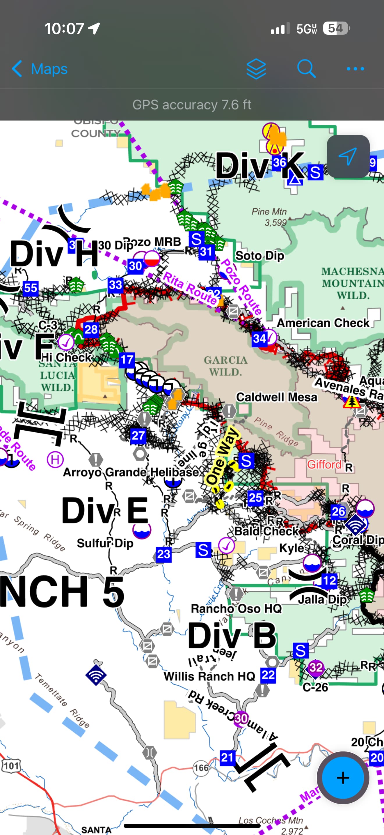
How do I know where DP 33 and DP 34 are? I think they refer to the red squares on the topo map, but there are lots of 33 and 34.
Referring to this assignment “Prepare for holding for firing operation from DP 34 to DP 33.”
Is there a place (website, books, etc) I guy could learn more of these basics?
Here is the Ops map for today. The Drop Points are noted with blue squares and white lettering. 34 to 33 are along the NE portion of the footprint.
Additionally: The 33 and 34 numbers you are referring to are most likely Range And Township Sections, each one representing 1 square mile or 640 acres.
Given what all that has transpired on this fire i can imagine it’s a cautious relief that the troops & local communities might be feeling today. Thinking some if not many of them are also remembering that 46 yrs ago today - not far as a crow flies from where this fire burns - the Spanish Ranch Fire took the lives of 4 brave souls. Theirs is a story worth remembering as many lessons continue to be learned from their sacrifice.. #neverforgotten
Having the ability to work a slop over past pumpkin with multiple CH-47’s and a HLCO over head into the early morning hours has changed the game.
With out this resource there is no doubt in my mind that the slop overs that occurred during the burn operation would have continued to burn throughout the night. Instead of holding the biggest slop to 150 acres it would have been a 3,000 acre mess come morning.