
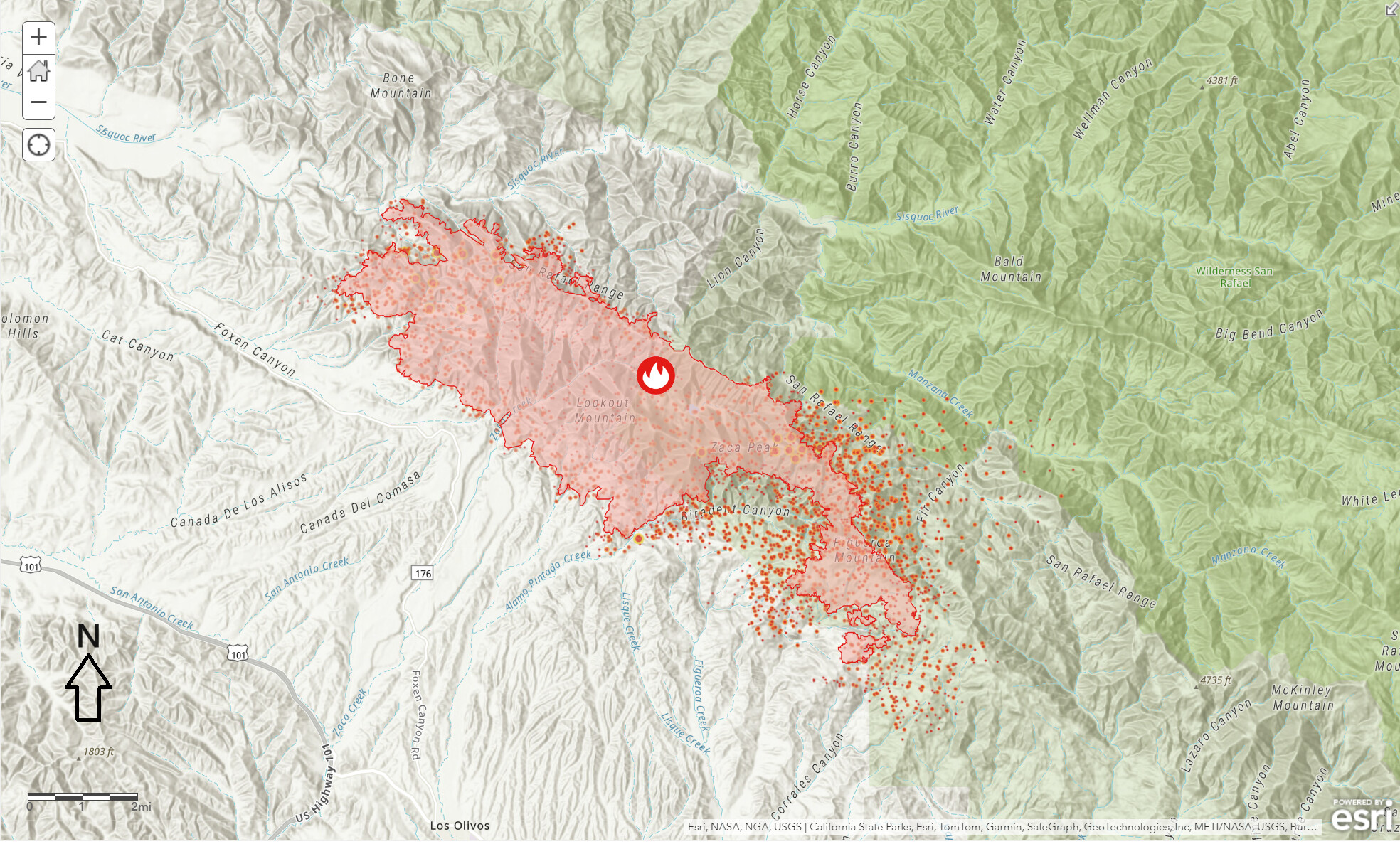
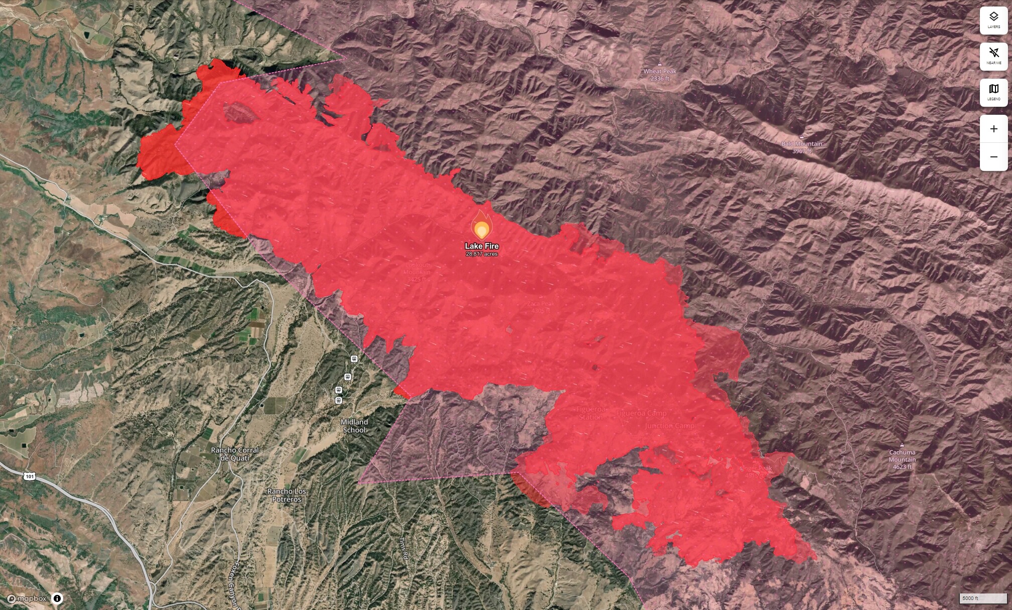
Hoping MODIS and VIIRS is a little off with this one. The data doesn’t look right and the confidence says “n” along that eastern section. It has that uniform spatial pattern that looks suspect. The Biradent Canyon looks correct and from what I saw on camera this afternoon, I think it filled in and up to Fig Mt Rd. .
The Battle Of Forest Service Road 8N32

Looking east. One of the hoppy-chopters was out this way for a minute, they may have been trying to do something there out on the White Rock - Munch Canyon Loop. Will have to wait for the next Intel flight to see how the day went for Forest Service Road 8N32.
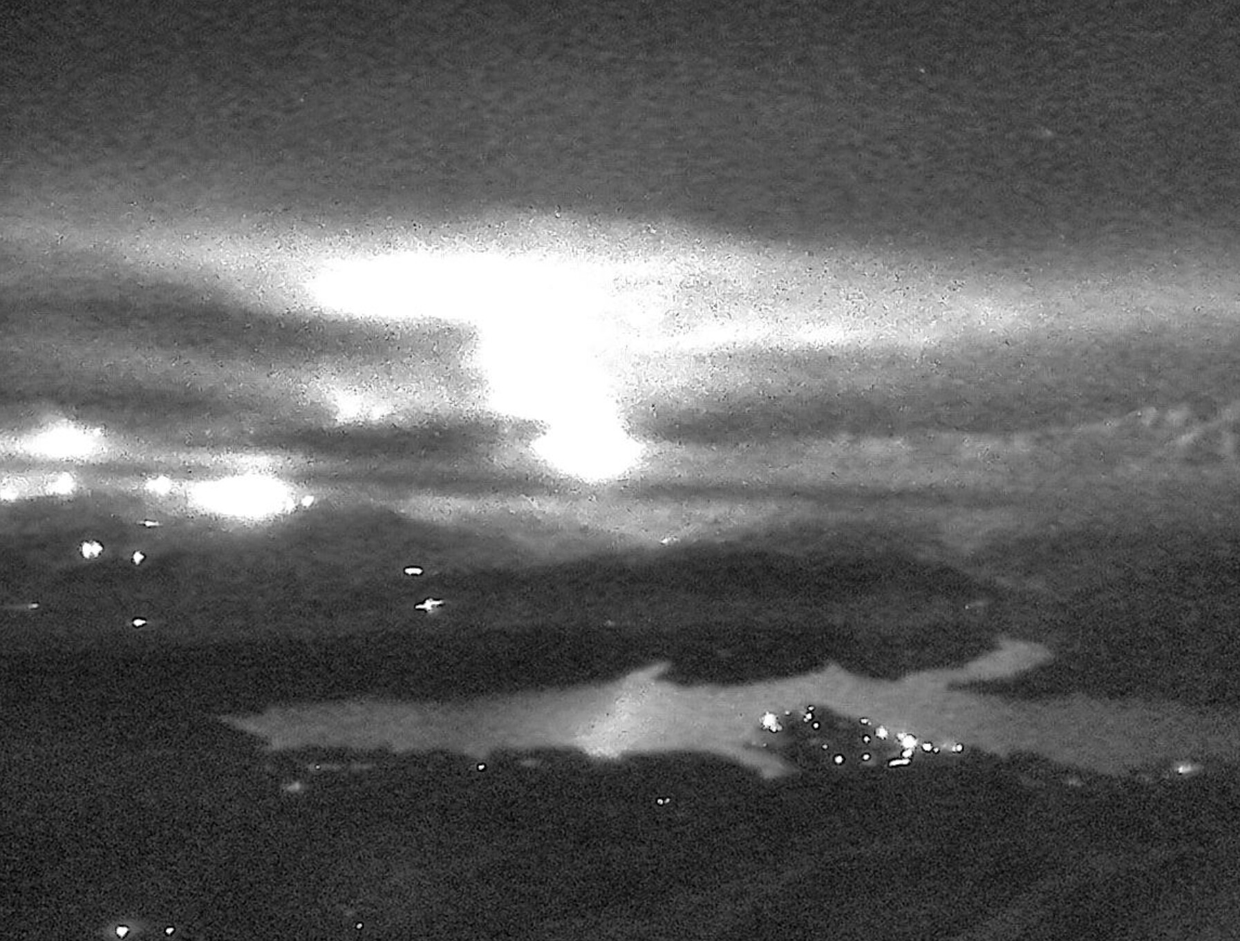
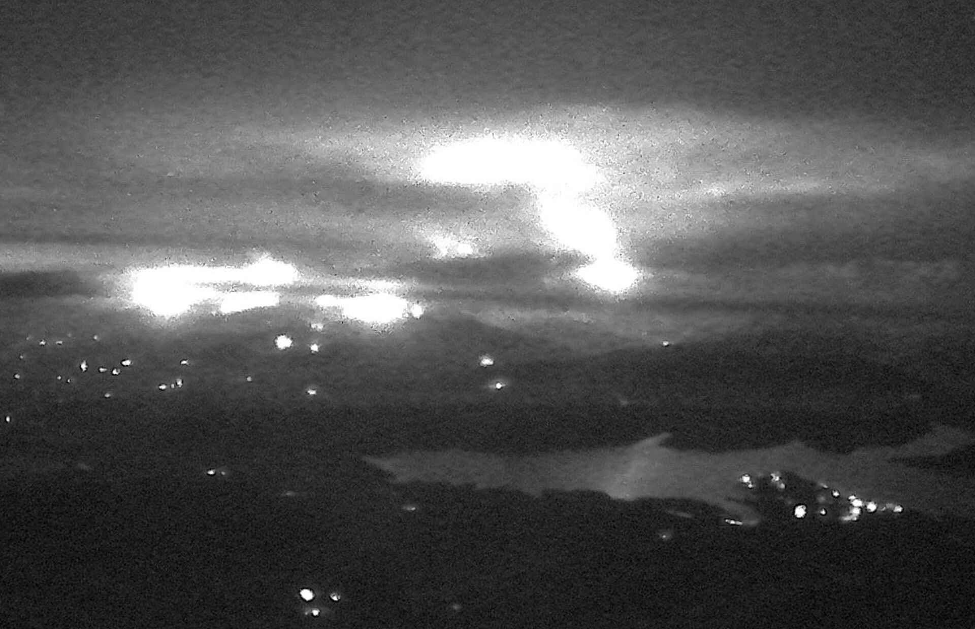
Tonight you can see the fire reflected off Lake Cachuma, from the Santa Ynez Peak camera approximately 17 air miles to the south of the actual fire. Appears to be very active. Same story from the Refugio camera. Screenshots from Alert CA website.
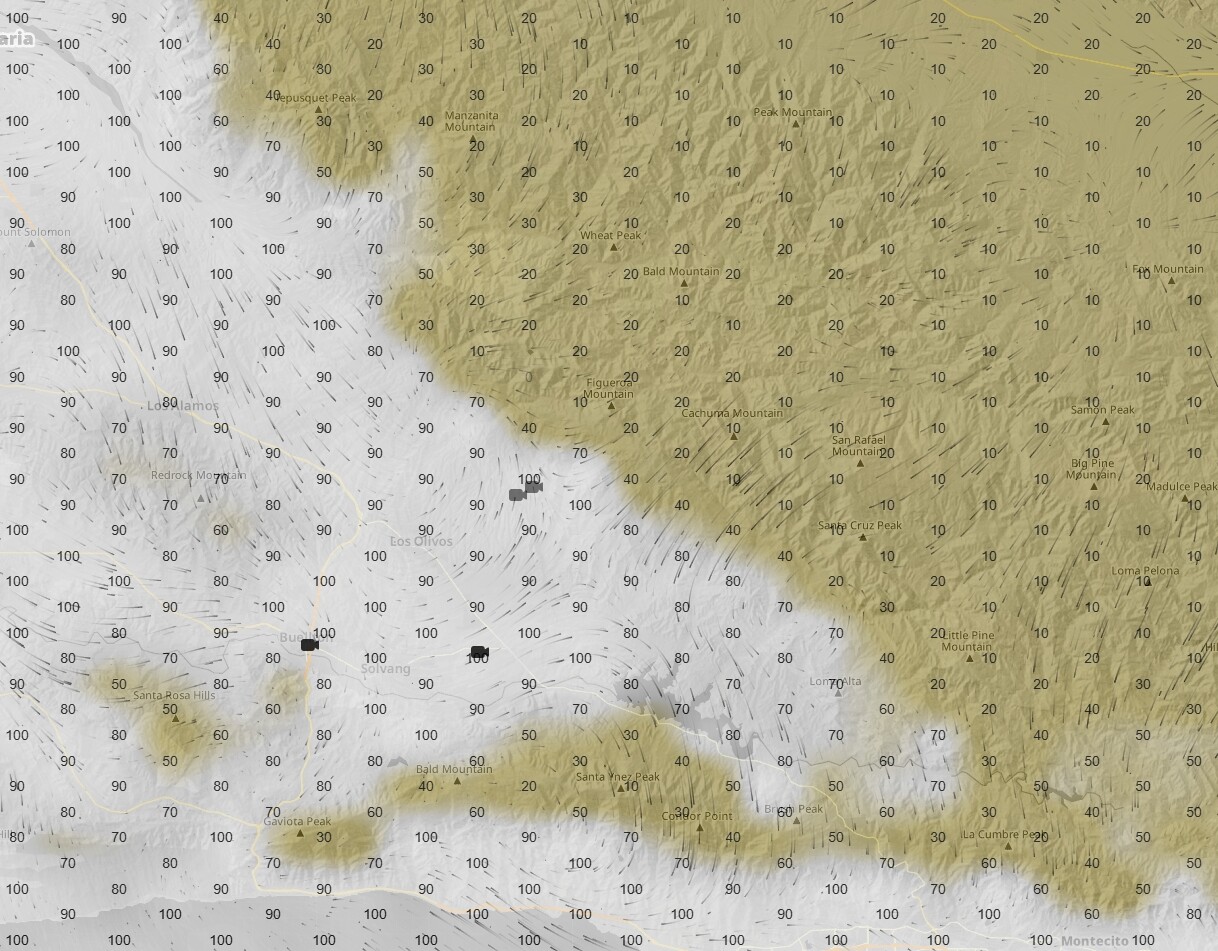
The marine layer just isn’t making it up to that last 500 ft of altitude. Looks like about 2500 ft or so is where it starts drying out real fast.
Nah. I think they did good work, today, good public service, and deserve to read it.
Eureka.
I can’t explain just how long my crew spent clearing Davey Brown & Munch Canyon trails last year.
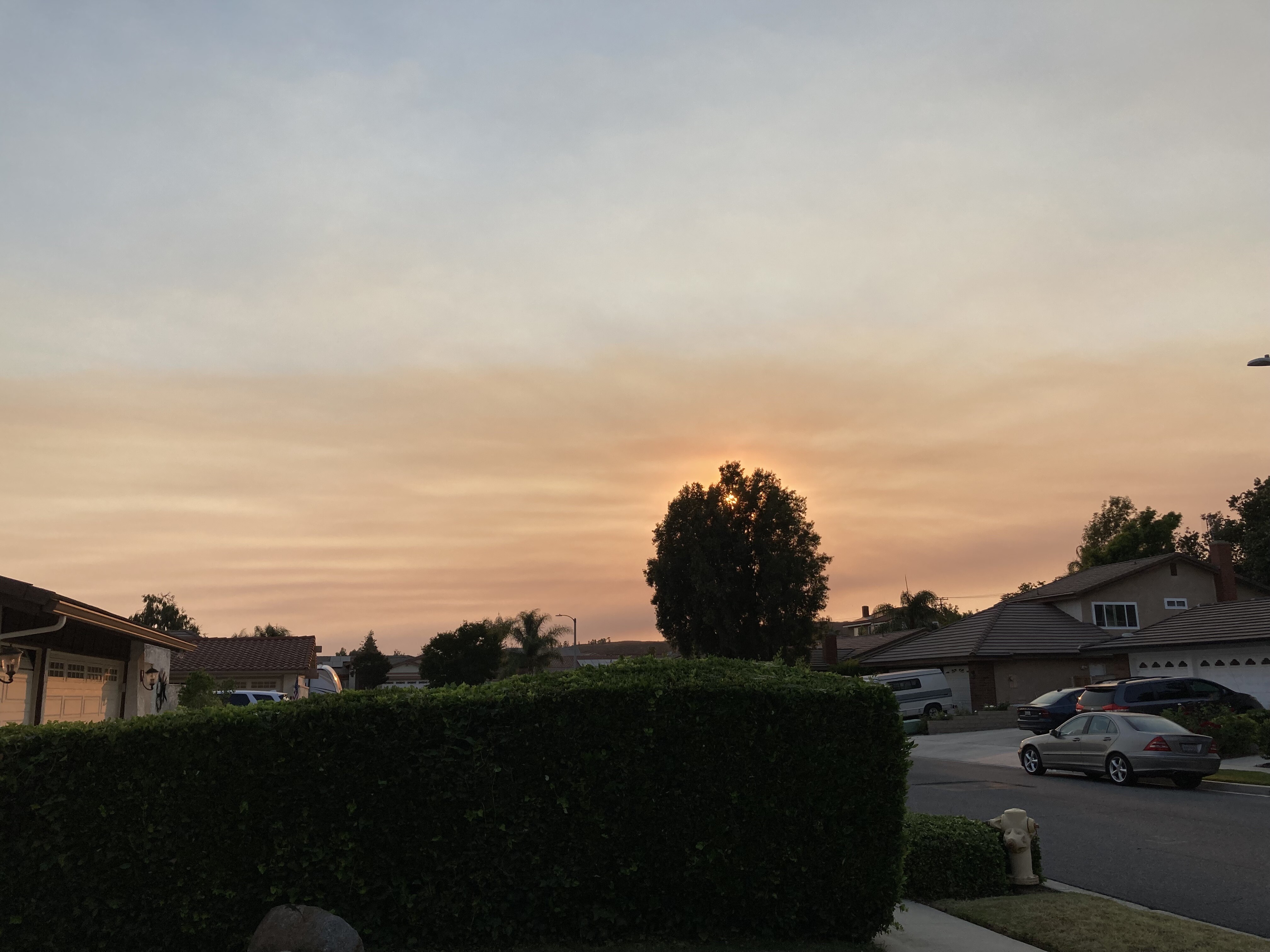
Drift smoke moving into Eastern Ventura County a couple hours before sundown. (hopefully in right topic this time).
Good news and bad news. With wind and slope alignment, there just isn’t a lot that can be done on that mountain. Bad news, is the trail got burned over. Good news, is the land will return to something looking healthy and green to the public a bit faster than it does in timber country, so to speak.
Talked with DivP tonight. Sounds like Team 5 will take part of the fire (west) and Team 13 will hang onto east. AA said fire was at Davy Brown as he was turning back to the base for the night and thought it would be at Nira by morning. They are worried about explosive fire behavior (large runs and long range spotting), which thus far they haven’t seen. Based on the IR I studied (attribute point data), a lot of the eastward push on VIIRS looks legit. I asked why they haven’t used more tankers (obviously I know visibility is major factor) in the afternoon and he couldn’t say why. He was tired so we didn’t talk too much fire. I still think that we may see some big pushes yet to come.
Out of state crews offloading at Goleta Airport. I hear 20 crews were ordered.
Cautionary tale about show business (and really foul mouths) included at no cost to all arriving out-of-state firefighters.
Sounds like wiilderness anticipation and firing ops.
Just got eyeballs on the beaches, little to no marine layer penetration across the shore line. I would not be expecting miracles on Lake Fire, today.
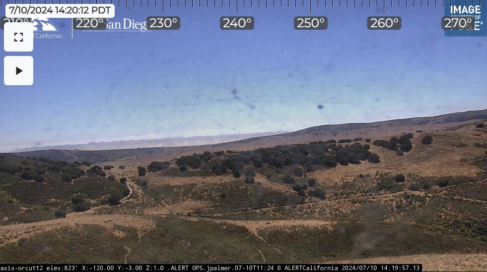
This is looking west from Orcutt. In the center-left, that isn’t a ridge, or smoke. That is humidity condensate getting squeezed up and away into the sky as it passes through the temperature and pressure gradient between the sun heated dunes and cooler waters.
I suppose more fire up there may have a medium-term impact on the Lake Cachuma watershed water quality for a while, but it’s not worth the risk of futile attempts to get in front of it for things that would ‘just be nice’.
In the long term, once the fire is out, Burned Area Emergency Response (BAER) teams, or the like, will be able to do some things to mitigate water quality issues in the Lake Cachuma watershed.
Where this fire is currently burning it would not impact lake cachuma. It’s burning in the Sisquoc and Santa Maria River drainages. For the most part.
Ah. Thank you. Same thing applies. USGS Water Dashboard provisions this easy-to-read map of the watersheds and may be a good entry point for people wanting to start looking at long-term impacts and planning issues.
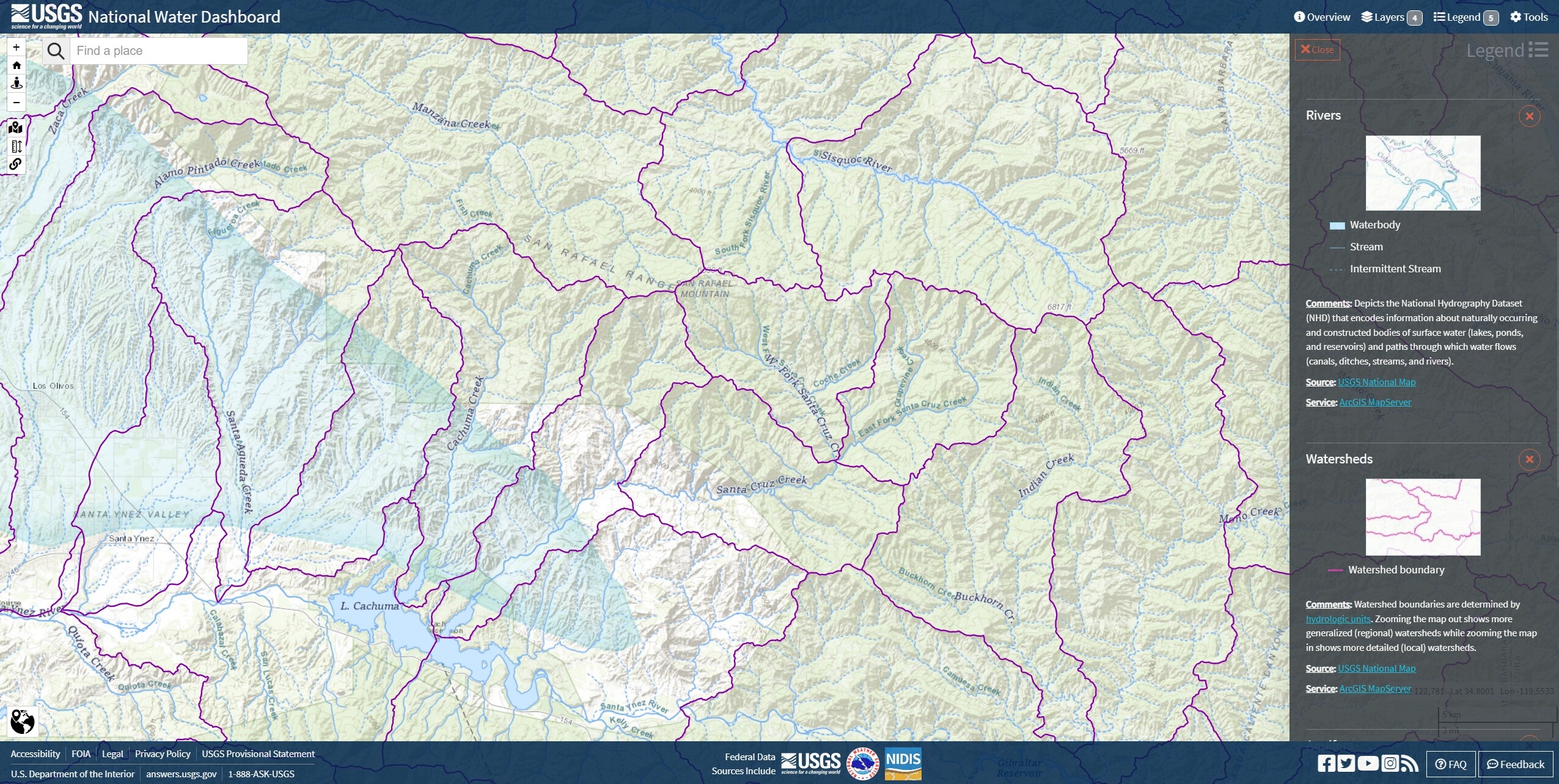
USGS | National Water Dashboard