I’m sure a ton of orders have been placed, but once the team is in place a large number or orders will be forthcoming. I don’t think we’ll see that list here nor should it be posted here. An incident of this scope and size will have tons of orders.
11 Likes
XVE 1550A Oxnard B81, E68, E81 VNC E54, E51 VTA ME2 enroute this morning
3 Likes
LPF-Lake extended frequencies assigned:
Air Tactics FM - 168.3375
Air/Ground - 168.500
AM Victors - 119.225, 134.175
Also not confirmed, but possible problem with that A/G and they might be using A/G 41, 167.475 until a new one can get assigned.
2 Likes
Tankers 101 and 163 are off base San Bernardino and enroute to the fire.
2 Likes
anybody have a scanner link?
2 Likes
Just saw 910 I believe coming into SMX. Correction 911.
4 Likes
Tanker 911 is at Santa Maria now
5 Likes
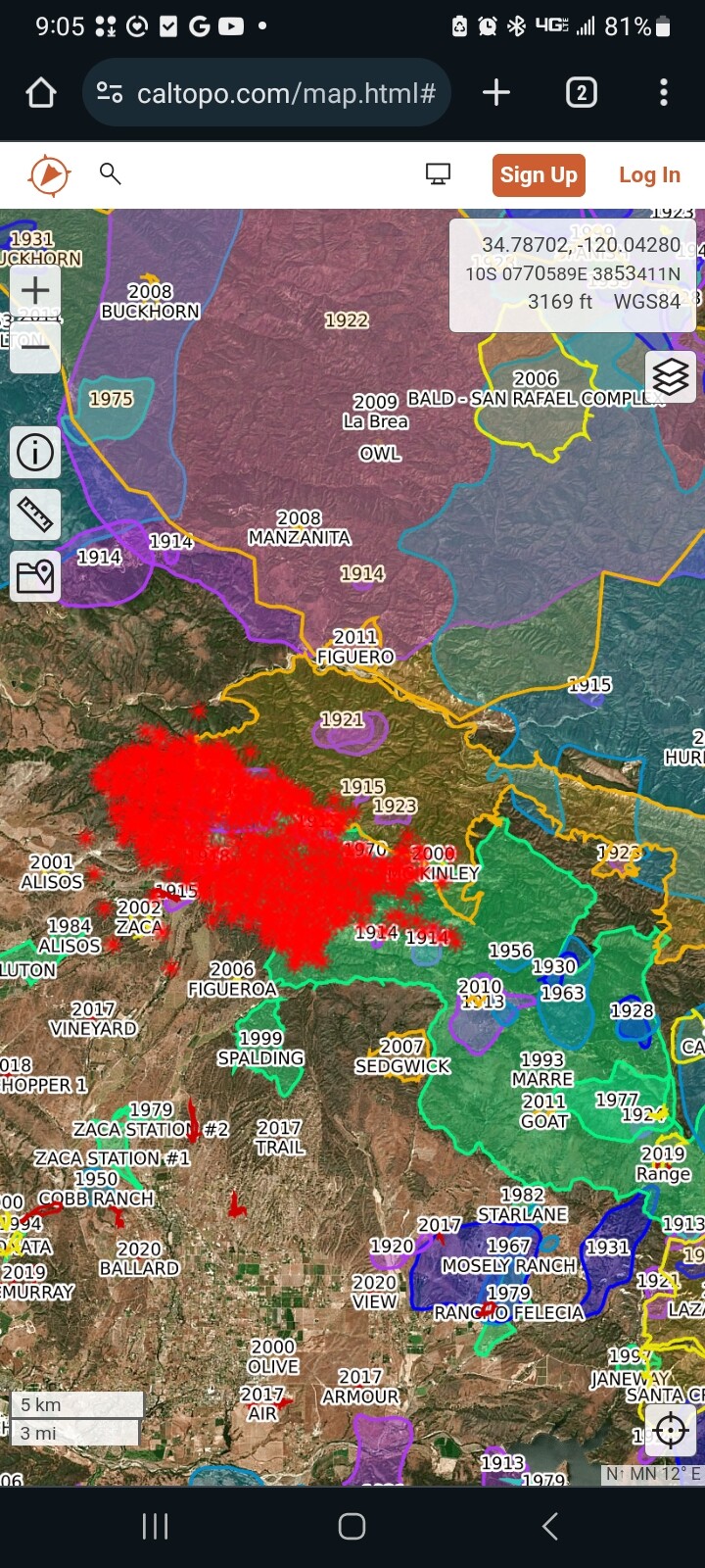
Great shots. Great info too. I was on Zaca I and II. Zaca I started 7/4/2007 at 11am ish. The fire behavior making broad cross slope sweeps is classic for local factors for Figueroa Canyon. Zaca was different in it’s directional spread which went from west to east up towards Figueroa Lookout. Last night was the opposite but still the same fire behavior with the steep slope (topo) alignment. That is definitely not holdable mid slope country. This will be a big box fire. It’d be worth getting the ops maps out for the Zaca I&II. Ridgeline contingency stuff and areal ignition tactics for the backcountry sides. Hopefully dozers and shots can do some good night ops work in the front country. God bless you sir. Stay safe.
25 Likes
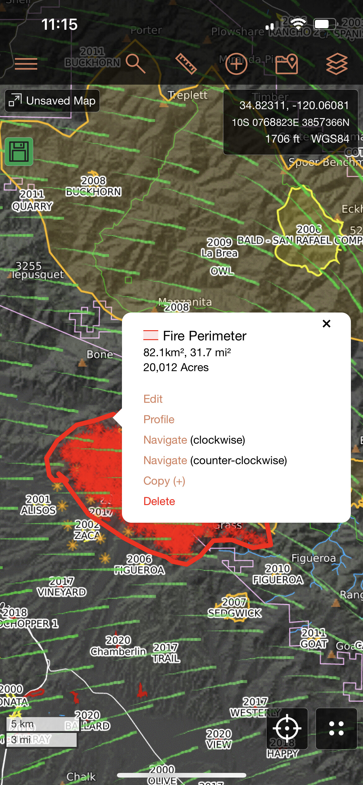
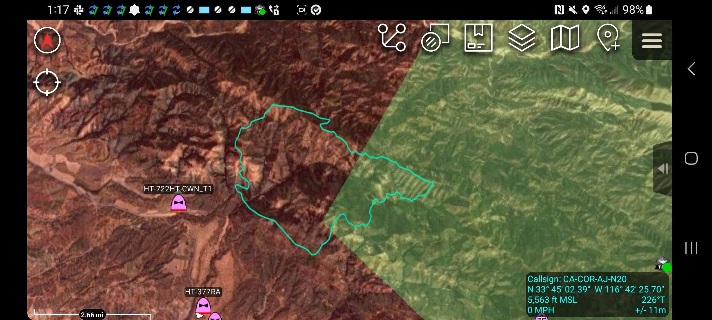
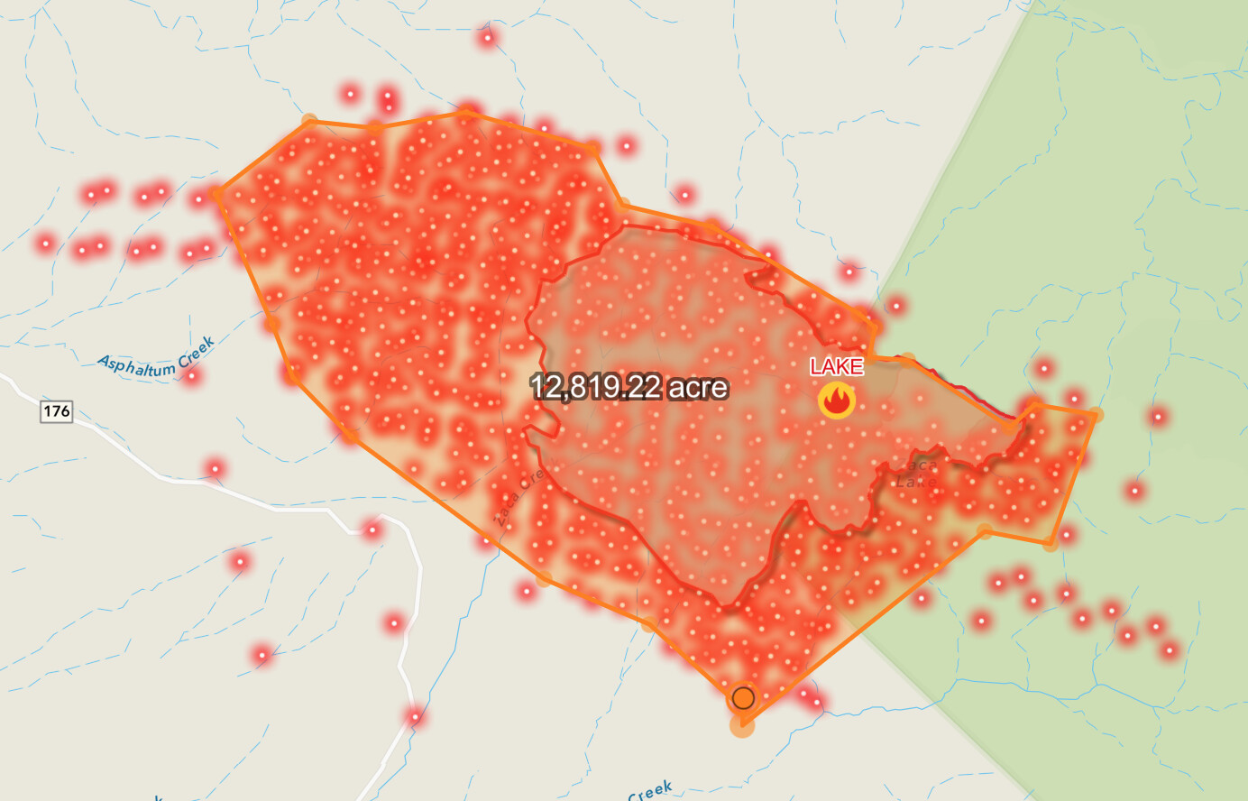
I get closer to 12,000–13,000 acres. The linear/evenly-spaced MODIS/VIIRS hits are probably detecting the heat in the column. I’m sure it’s already out of date!
7 Likes
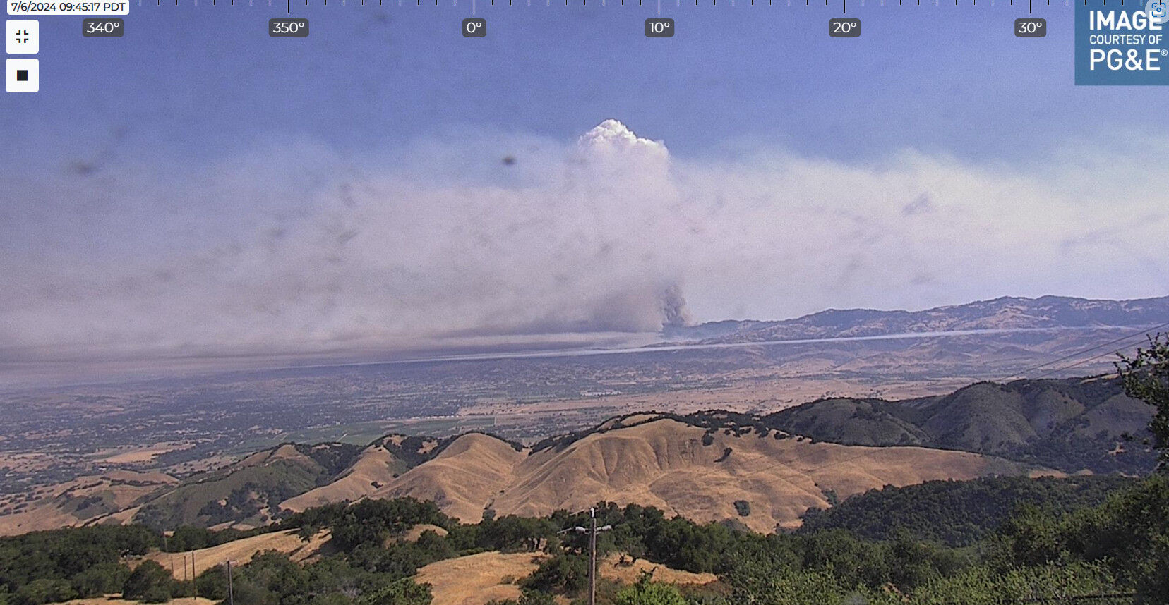
Intel ship is enroute so we should have some solid information in the next hour or so
4 Likes
What is the address/location of the ICP?
2 Likes
Probably more accurate… if this thing keeps pushing west, where’s the SRA delineation? I’d imagine CF is preparing for state mission
4 Likes
cal fire is in unified command along side lpf and sb county
edit: source: sbcfireinfo on twitter
3 Likes
If you look back at Post #90, there is a DPA map. I think it was mentioned the fire was at or across Foxen Canyon Rd. That should be in, or very close to SRA.
6 Likes
California Direct Protection Areas | California Direct Protection Areas | CNRA GIS Open Data
California Direct Protection Areas - Dataset - California Open Data
Here is a GIS link that makes it easier to determine
3 Likes
As currently mapped, most of this fire looks to be on State DPA.
3 Likes