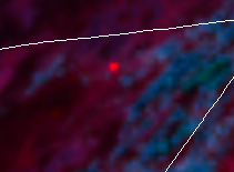
Screen shot from GOES WEST showing heat signature.


Screen shot from GOES WEST showing heat signature.

Per MDF Twitter; Structures affected are scattered out buildings. Powerlines impacted are large transmission lines. Firefighters report erratic fire behavior and rapid rate of spread.
Timber Mtn RAWS is just south of the incident at 5000ft near radio site and fire lookout.
https://www.wrh.noaa.gov/mesowest/timeseries.php?sid=TBRC1&num=72&banner=gmap&raw=0&w=325
Currently 89F RH15, W11G22.
Per MDF Facebook; Tucker Fire is now 2,000 acres. Multiple aircraft and ground crews on scene.
#TuckerFire continues to burn actively on all flanks. Estimated at 2,200 acres. 500 Kv transmission lines have been de-energized for firefighter safety. Structures, Sage Grouse habitat and historical values are threatened. https://t.co/9bmkd0qHw9
#TuckerFire last reported at 2,461 acres. No evacuations ordered and no homes are threatened at this time. Bull dozers made progress on all flanks. Hand crews will connect fire line today in areas bulldozers cannot access. Threat to power lines has been mitigated at this time.
@ModocNF Twitter
Just ordered 6 tankers
Hearing reports that this fire has gone big and that a Type 2 Long Team is being ordered. Looks like Team 14 is up.
Yes 11,000 now. 0%
ICP will be at the Tule Lake Fairgrounds
CIIMT 10 (Nor Cal Team 2) has been assigned. In brief at 1200.
Evacuation warnings have been issued for the following areas;
County Road 114 through 202
Coyote Butte
Horse Mountain Area.
Ops map for today
#CA #CAWILDFIRES #CALIFORNIAFIRES #FireSeason2019
#ModocCounty
@ModocNF
#TuckerFire
14,217 Acres
Contained: 51%
Red Flag Warning in the area today from 2-8pm
The #TuckerFire is 100% contained at 14,150 acres. Transition back to the local unit will occur at 6 am tomorrow morning. https://t.co/9bmkd0qHw9