CA-MEU-Mendocino Complex (contained)

The VLAT GST944 just got diverted to the complex from the SHU-Carr fire. There were a couple S2’s up earlier on the northwestern head east of Potter Valley. No other aircraft over the Ranch other than Air Attack. CalFire copter was on Goat Mtn earlier today - possibly emergency prep of the radio site.

High Glade showing winds picking up. 2pm had 14 G21 out of SW.

2 Likes

Dozers ordered to “High Blade it to the Safety Zones”

3 Likes

MAFFS 8, 9, 6, T944, T118 inbound

3 Likes

No divert all tankers for imminent life threat

all three headers just capped out and collapsed. no divert. looking nasty

A post was merged into an existing topic: CA-MEU-Mendocino Complex???

Right about the time you posted this, I was watching the visible sat and saw the plume shift significantly from a westerly influence to strong N-NW influence. In a matter of 20 minutes the entire thing leans over to the SE. High Glade RAWS shows westerly push most of the day up to 2pm. 3pm it changes interestingly from the south, then at 4pm on it quickly swings back to westerly, and now NW. Quite the afternoon.

1 Like

def saw three different column shifts with another one just happening about 30 min ago. pretty good fire activity on the river fire as we speak.

2 Likes

Hubby ( div A/B?) called a few hours after all this went down… “yup lost our SH$?, came from underneath… luckily only a few ( ?)away from Black, winds now in their favor” is what I was able to make out. Regrouping ready to do another round.

5 Likes

New evac orders…

Glad to hear they are ok.!

1 Like

IR mapping from last night about 11:30pm.

3 Likes

Currently the fire is in a Red Flag warning until 11PM Saturday for increasing W to NW winds over the fire 15-20mph gusts up to 35mph, and low humidity. Gonna be a long 24hrs coming up.

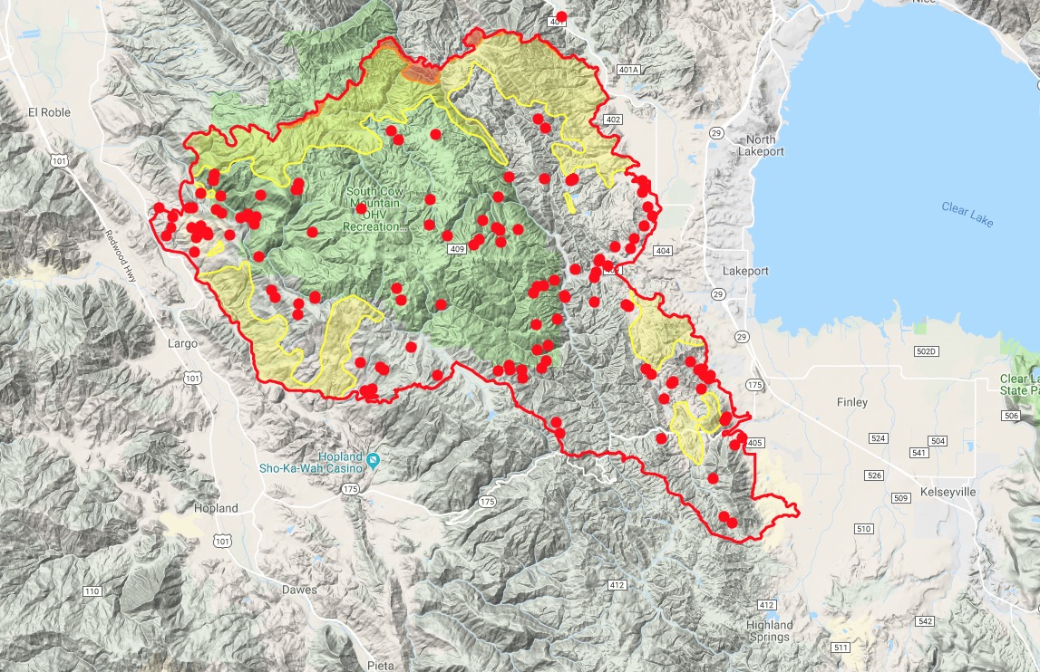
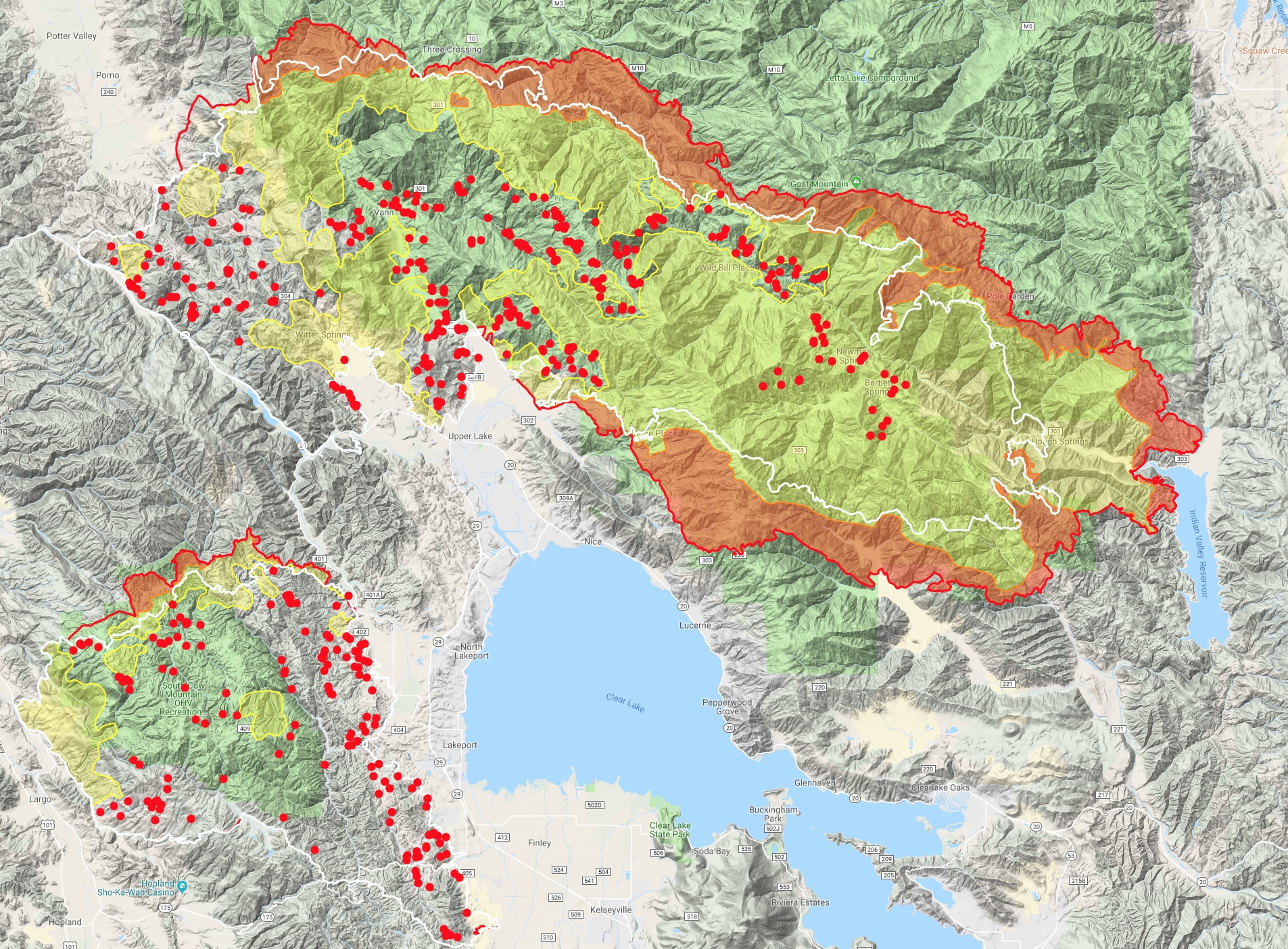
The IR map today, along with MODIS/VIIRS shows it pushing up against the Lake/Colusa county lines just east of Goat Mtn and the radio site last night into morning. It does show a little slop over right below Horse Rock. An MNF task force is assessing the structures today through that area of the M5, Pacific Ridge and Lovelady. With the forecasted winds, any establishment on that north side, or if it wraps around near Black Oak Campground and Trough Springs Ridge, won’t be good for Little Stony drainage, Lovelady and potentially Pine Ridges.

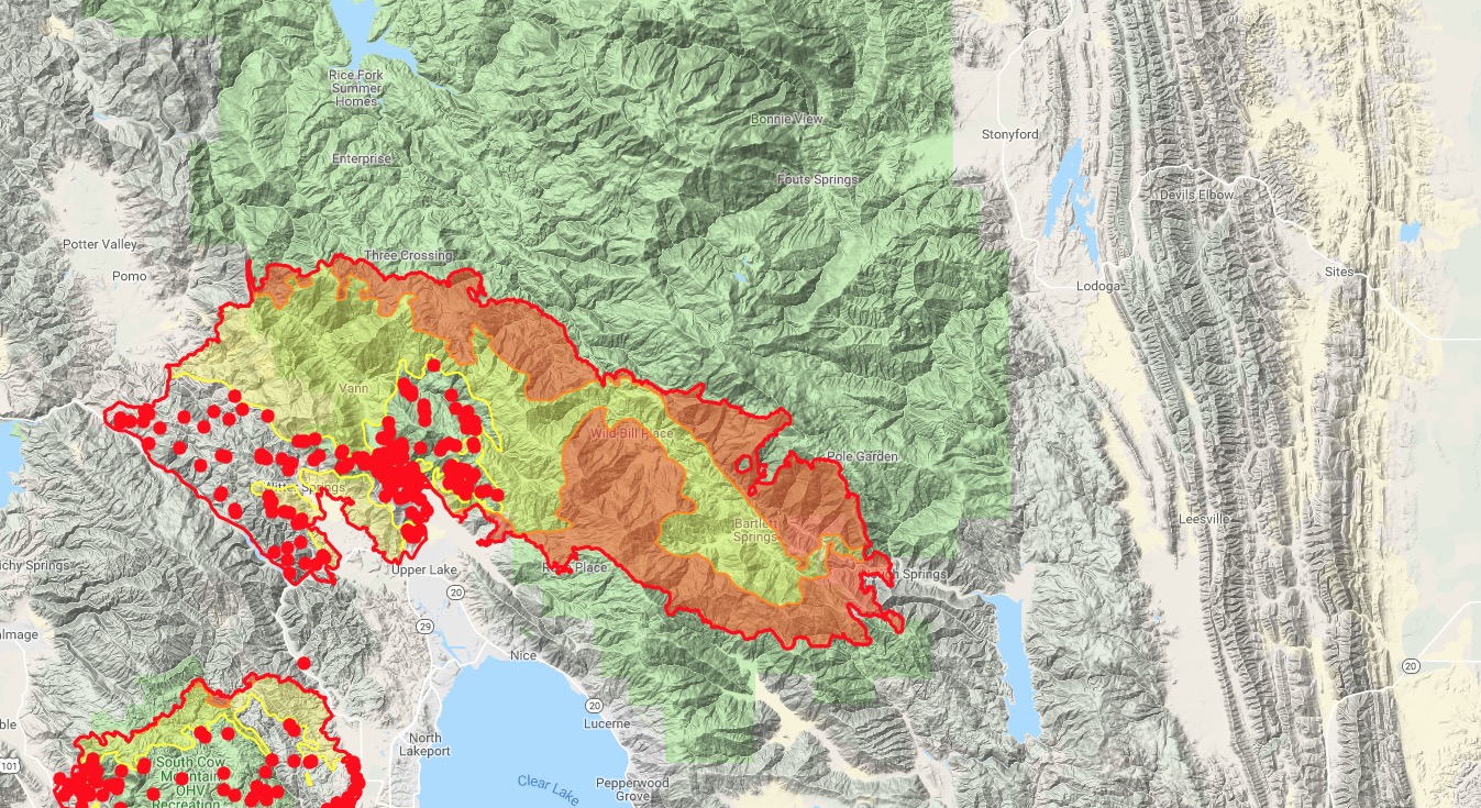
On the south side of the ridge it’s getting well established into the mouth between Indian and Hough Ridges. The Hough Ridge side has plenty of black from the Pawnee Fire and earlier fire dozer lines, but the Indian Ridge side doesn’t have much of anything except a couple hundred acres on a southern aspect slope last year (15N 6W S7) if I recall.

4 Likes

Just talked to a friend in Clear Lake…Ranch fire is taking off and capping out

Live Clear Lake cam with weather: http://www.rntl.net/clearlake.htm

1 Like

Here is an IR map from about 11:30 last night.
The white line shows growth over previous 24 hours.

5 Likes

Wish this were a link instead of screenshot so I could zoom in & out. Thank you for your shares though.

1 Like

Here’s the link to the folder where they keep the IR maps.
(A Mod.Capt.Wife :wink:)
https://ftp.nifc.gov/public/incident_specific_data/calif_n/!CALFIRE/2018_Incidents/CA-MEU-008674_Mendocino_Complex/IR/20180804/

2 Likes

This is what I have bookmarked. You can find all the goods.

https://ftp.nifc.gov/public/incident_specific_data/calif_n/!CALFIRE/2018_Incidents/CA-MEU-008674_Mendocino_Complex/

1 Like

Type 1 IMT ordered for this fire. Federal.

2 Likes