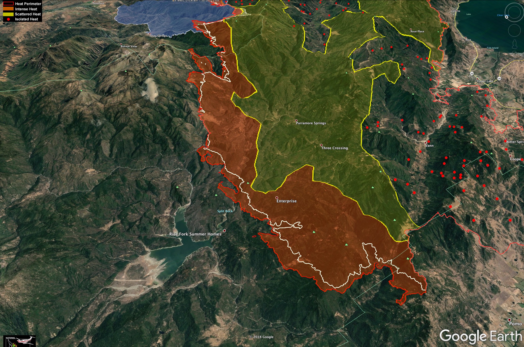
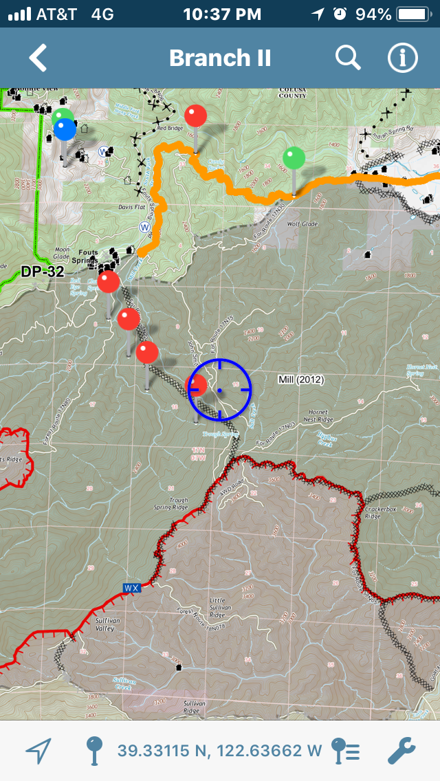
Here is where the IR showed it at 1am this morning.
White line shows 24 hr growth. Blue are on top is 2012 Mill Fire.
Dynamic map here (Last night’s IR for Carr Fire and Donnell are also on this map if you zoom out).
http://www.firemaps.us/files/IR.html
Our local government strike team is on the line today. As of this morning there was no plan to fire, but things always change. I keep seeing notices of evacs so if they had a plan , something changed. They have no cell service up there, so I will have radio silence until tomorrow morning  if I hear anything I will update the post for you.
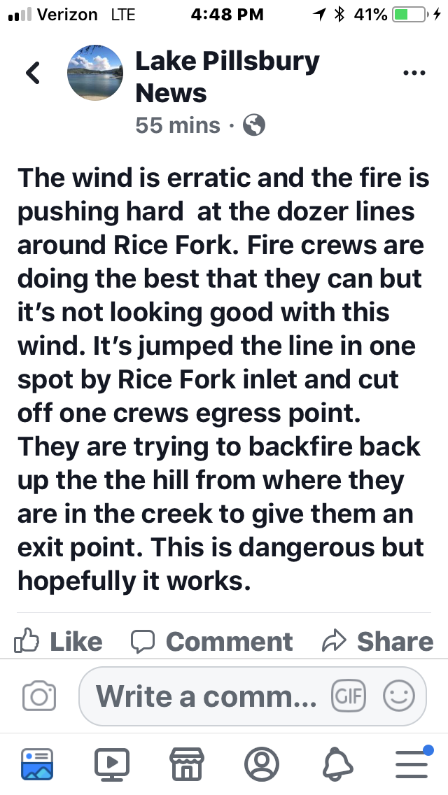
Per a live feed from Lake Pillsbury it’s crossed the dozer lines at several points along Rice Creek. It’s within a mile and half of the “resort” at the lake and spotting a half mile out.
I have Mendo Complex command on priority 1 for http://norcalscan.live live scanner. It has plenty of SHU-Carr CMD and Air stuff as well but with tonight’s movement into Lake Pillsbury and what MODIS is showing a huge push up and over Snow Mountain, this will be some interest for a while.
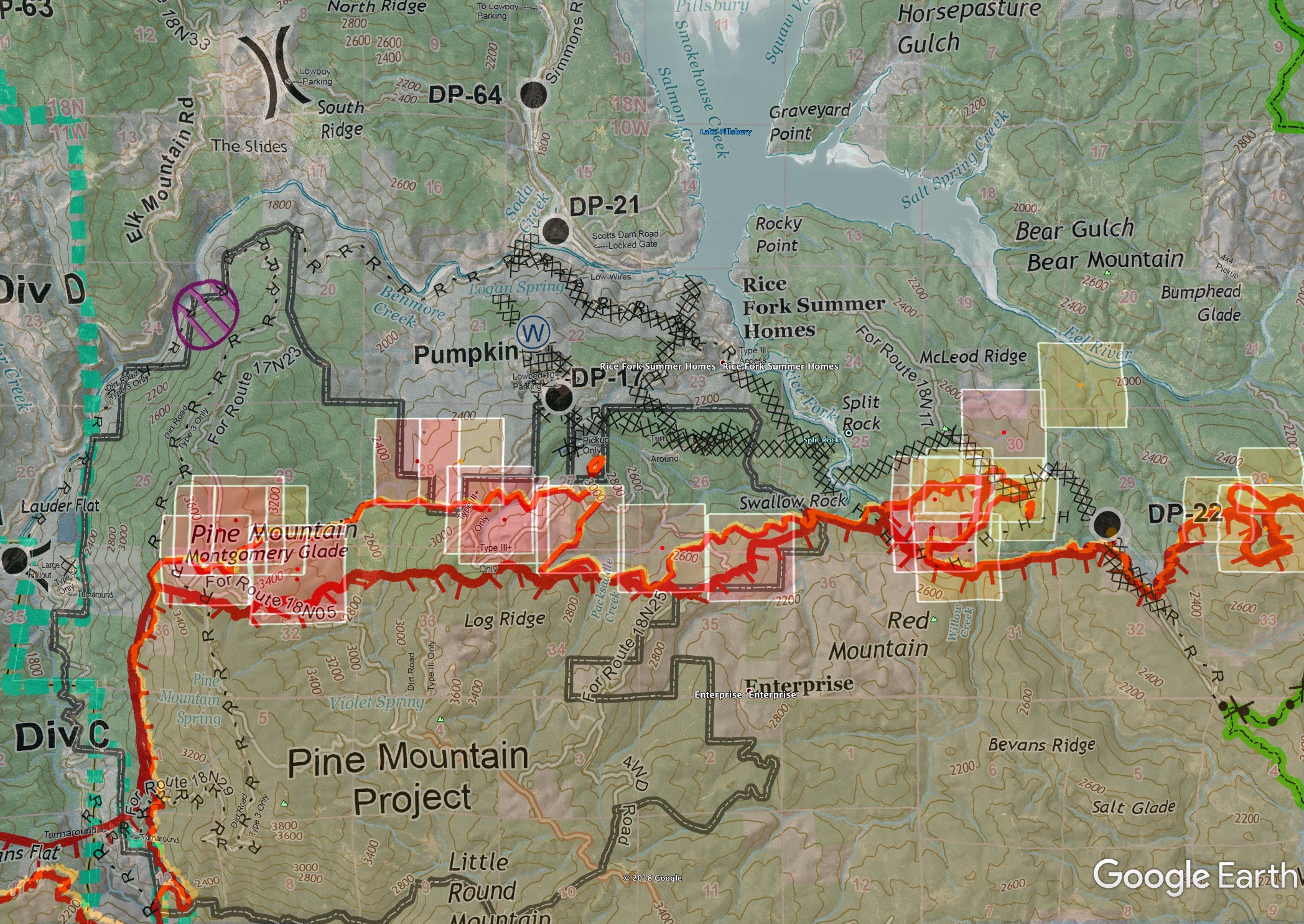
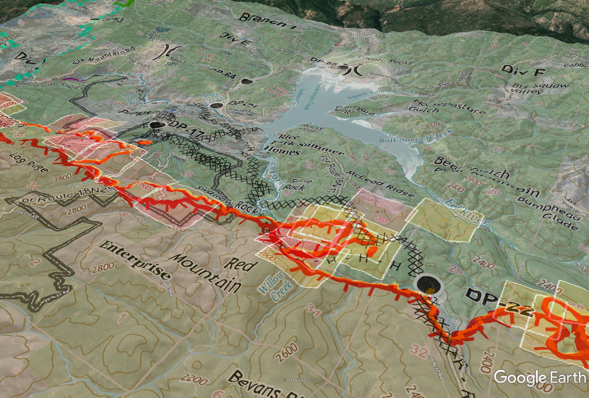
Lots of tanker work today around the Lake. The fire has moderated in the area of Rice Creek. No structure loss as of 1855 tonight in Rice Creek and they feel it is no longer in immediate threat as they had with previous fire conditions. Working on getting resources in there to stay the evening. Lots of OES engines in there for 24hr resources, they’ll keep any 12hr resources as late as possible. There were a few losses along a spur road I believe near DP17. There was a lot of structure protection in and around DP17 this afternoon. Per AA, main fire will cross Eel River tonight and they already had a few spots they were trying to keep in check.
UPDATE 2020: Fire will be approaching south of Eel River below the dam near DP-21. They hope to hold it there and use the M8 road to keep it from spreading north and west. Not sure if he was on the same page as AA’s report earlier. Fire is roughly a line of fire from DP17 west to DP22 east, with push into the McLeod Ridge area but no eyes on how far it’s made it up/over the ridge.
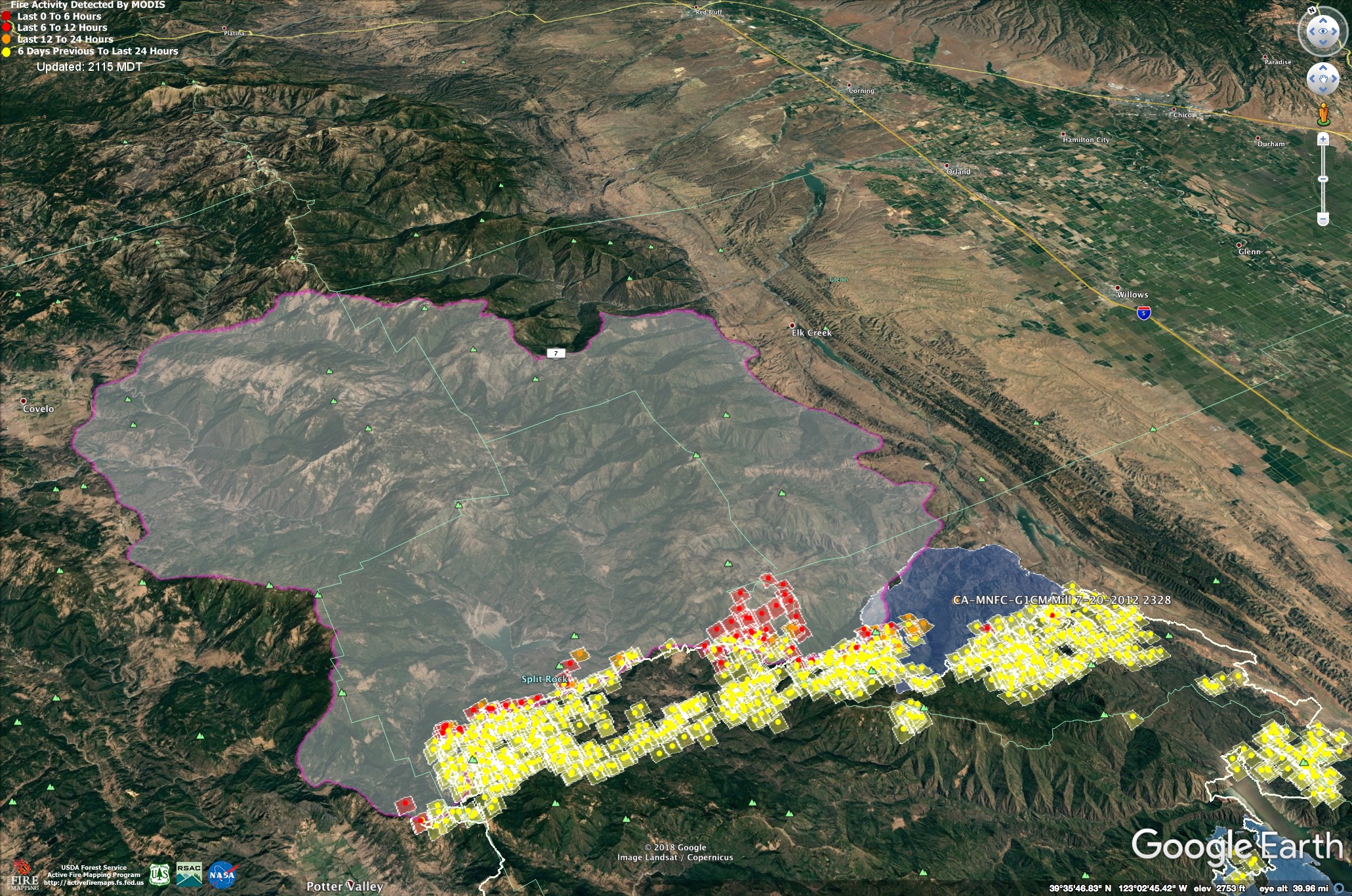
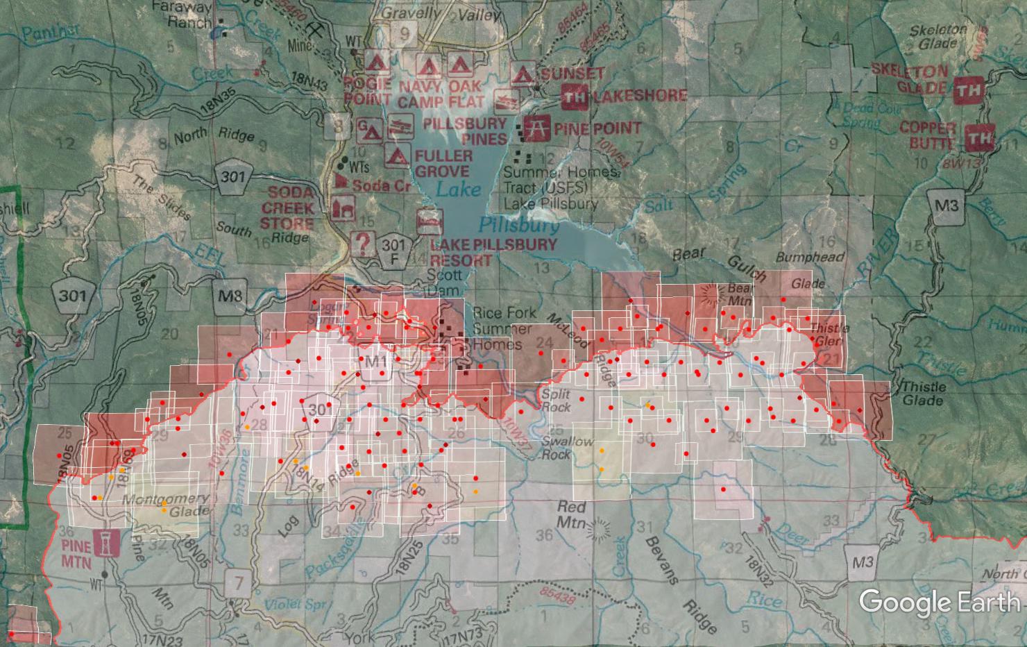
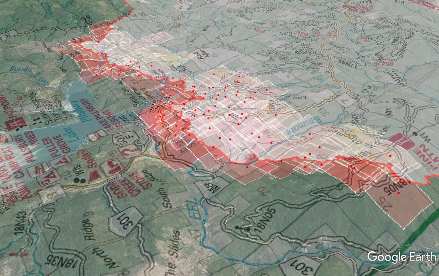
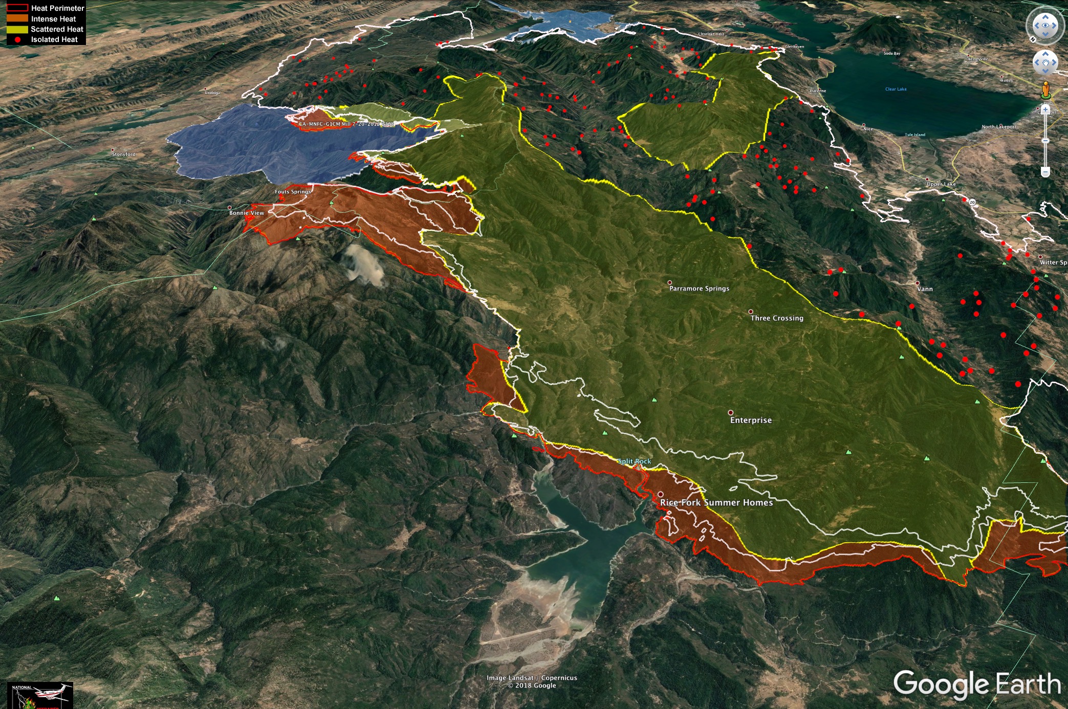
I threw the MODIS hits (which are pretty old today) on the Ops map for the Lake Pillsbury area, and threw the view around to see the terrain from a SE to NW perspective.
Smoke Complex I think was last fire in there early 2000
Forgot to mention current RAWS at the lake is Soda Creek on the west side of lake.
https://www.wrh.noaa.gov/mesowest/timeseries.php?sid=SOAC1&num=72&banner=gmap&raw=0&w=325
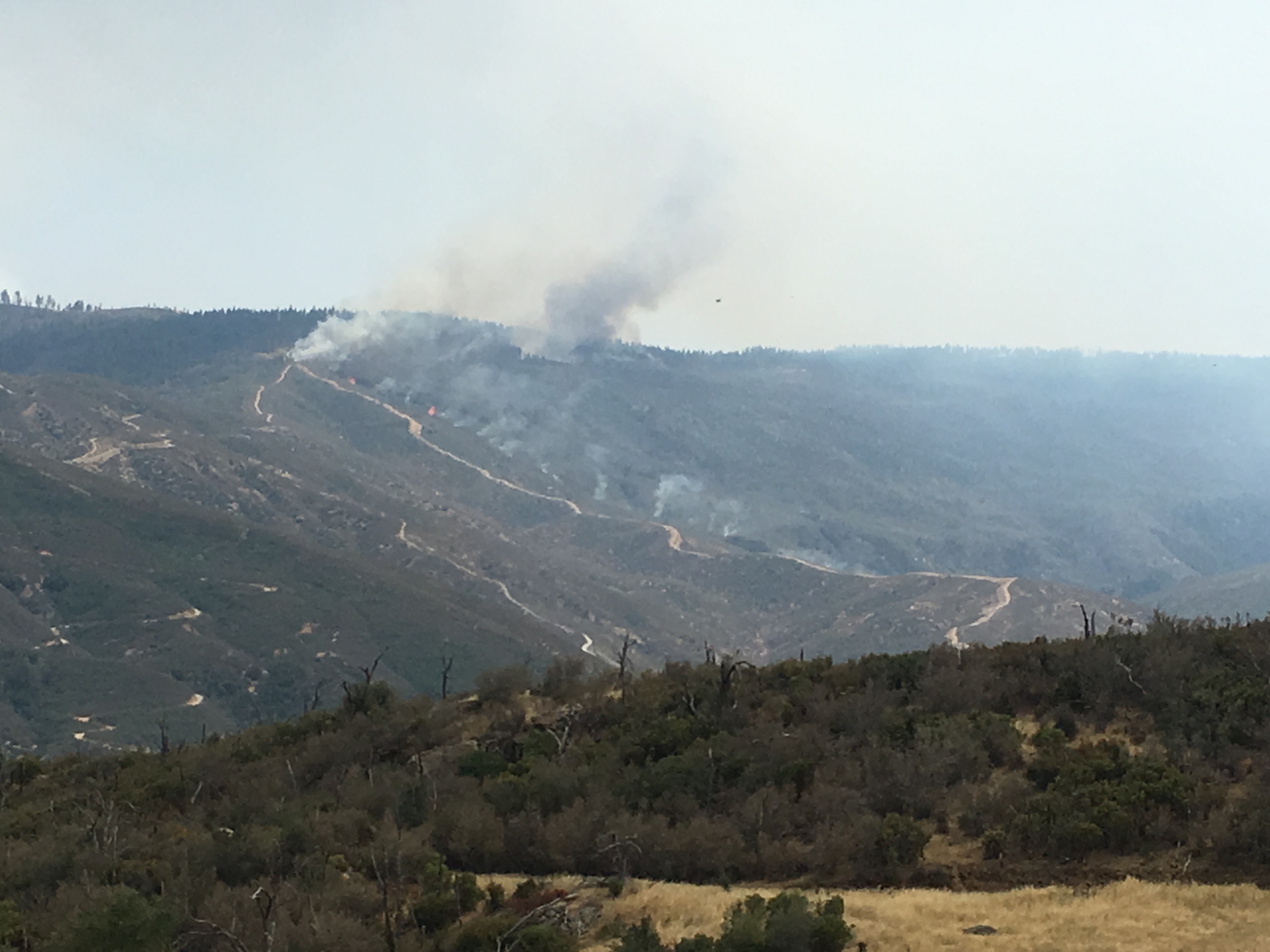
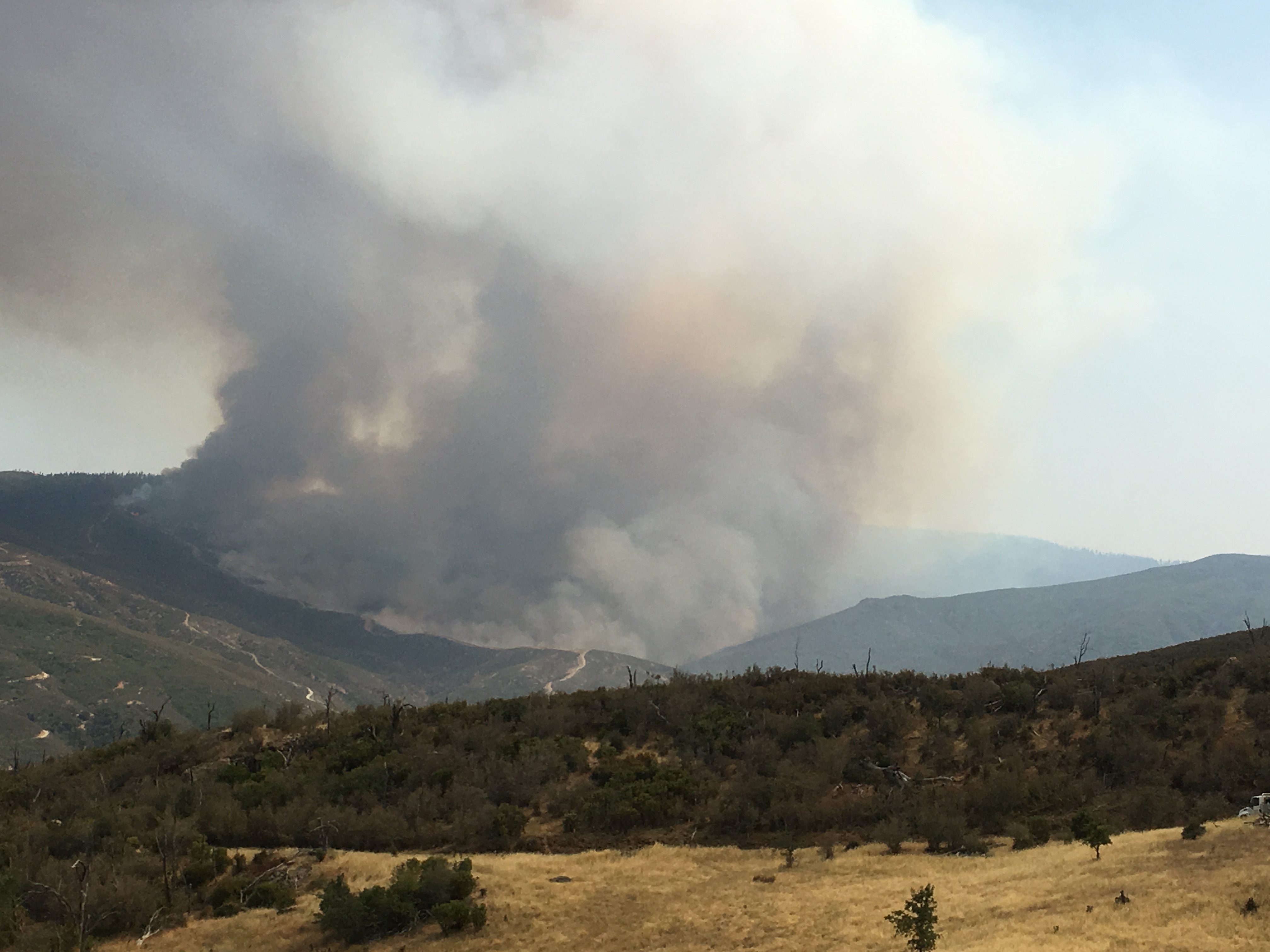
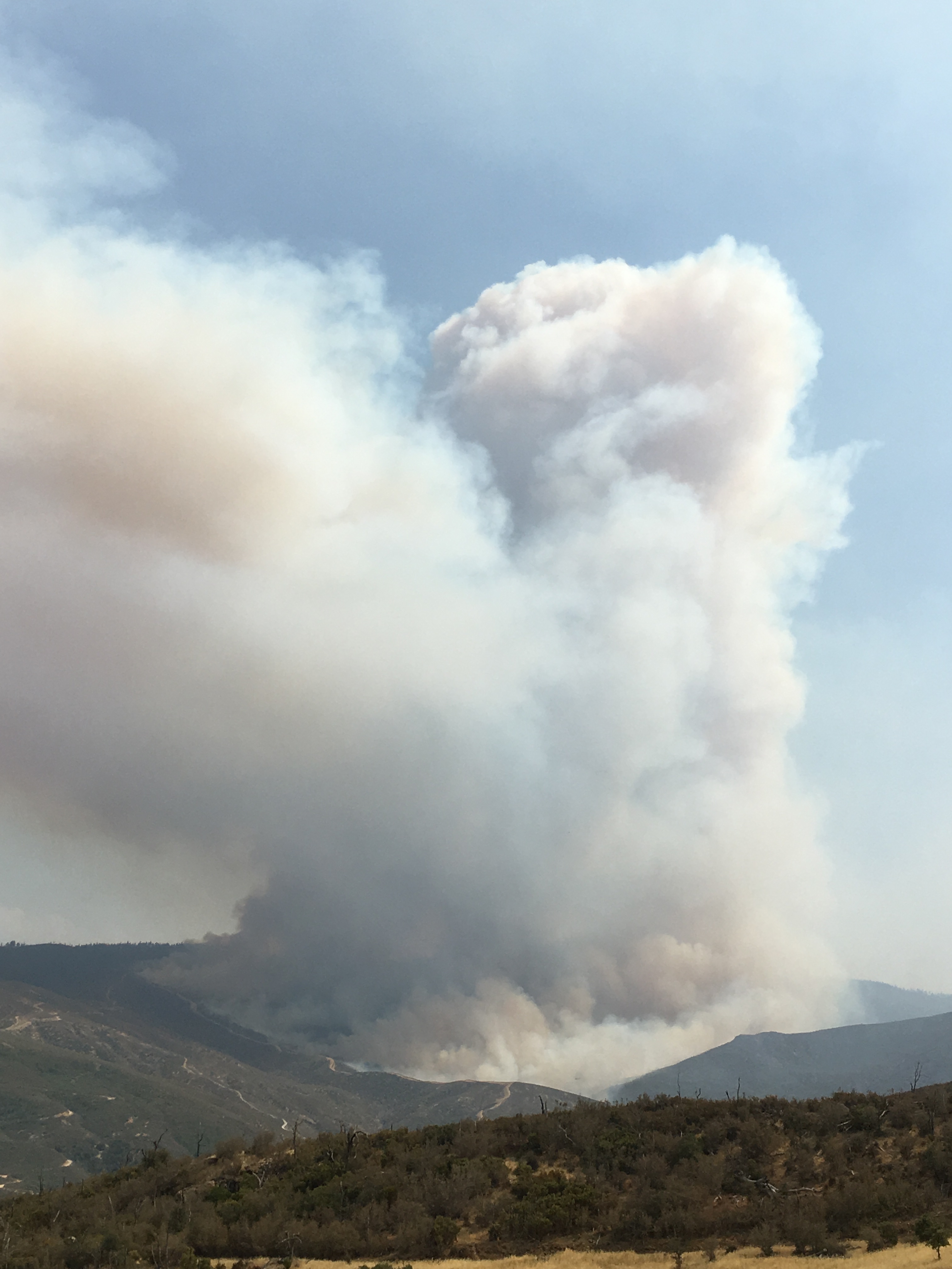
Blew up pretty good this afternoon!
Satellite loop:
https://col.st/a0kIP
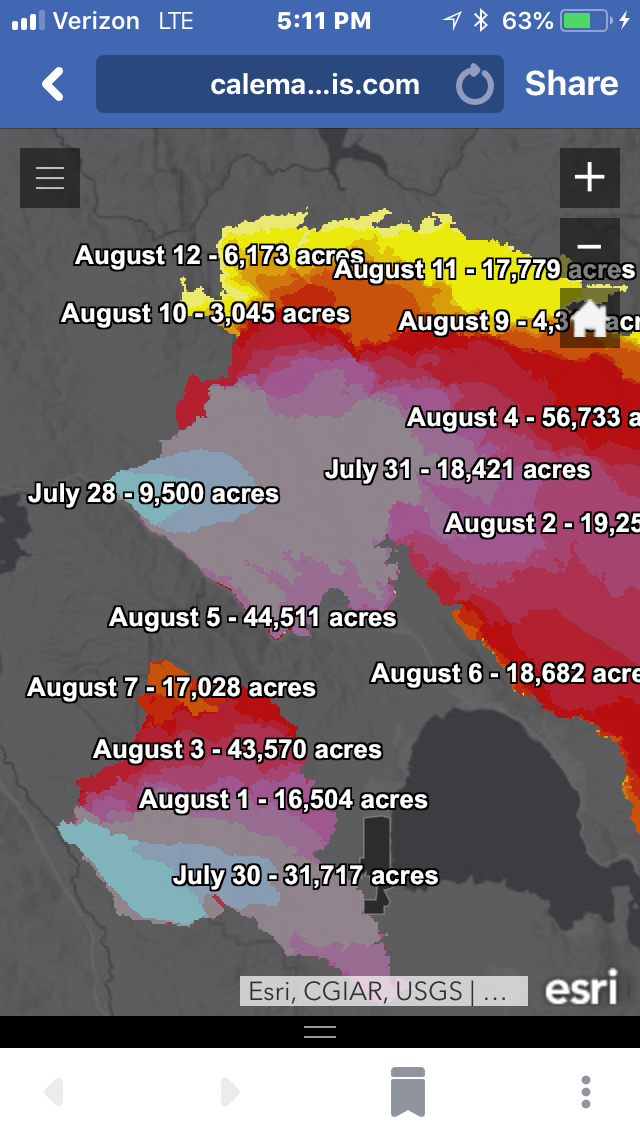
Just for reference, and not suggesting it will get there, but here is a map with a 500,000 acre box that extends from the current fire edge all the way to Forest Highway 7, between Elk Creek and Covelo. This is the first major East-West road system to the North.
While days are getting shorter and nights are cooler, it’s worth remembering the Valley Fire blew up not far from here under strong NW winds during a frontal passage in the second week of September, and the Wine Country fires were pushed by wild NE winds in October.
No matter where the fire ends up, we’ll surely have some days of major growth during weather events over the next month or two.
Thank you for posting- I’m a noob to this Forum and I am trying to keep my head wrapped around the now and planning for the next few months fire and weather-wise for the Mendo-Lake corridor. It looks like there’s a better than average chance for an El Nino weather pattern for fall/winter. Debris flow is going to be a big problem anyways, so trying to get “my words” right on sharing with residents. Any insights are gratefully received.
Looking at the IR perimeter map from 1045pm last night, and MODIS/VIIRS this morning, it looks like it’s still south of Eel River below the dam. It crossed Eel River on the east side though, over Bear Mtn. Looking at the new Konocti Fire Cam and the timelapse over last night you can see the furthest western head either in Div C/Pine Mtn that then died down, another significant head through the night in the area it crossed the Eel, and then up and over Snow Mtn with a strong westerly wind pushing it all afternoon and evening. Posted about Snow Mtn over in the Continuing IA thread.
Looking southeast to get a little relief of the terrain.
IR of North part of Ranch Fire about 10pm last night.
Snow Mtn. is big peak it ran up and over on middle right.
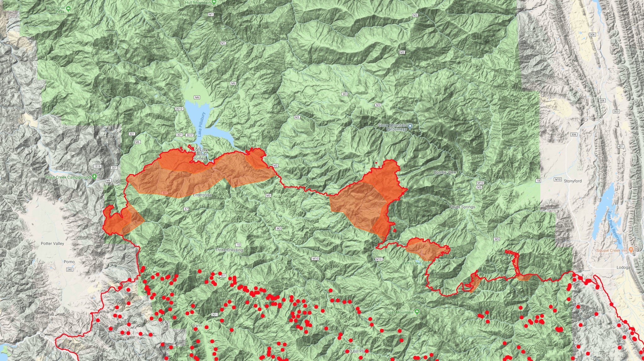
And fire spread into 2012 Mill Fire.
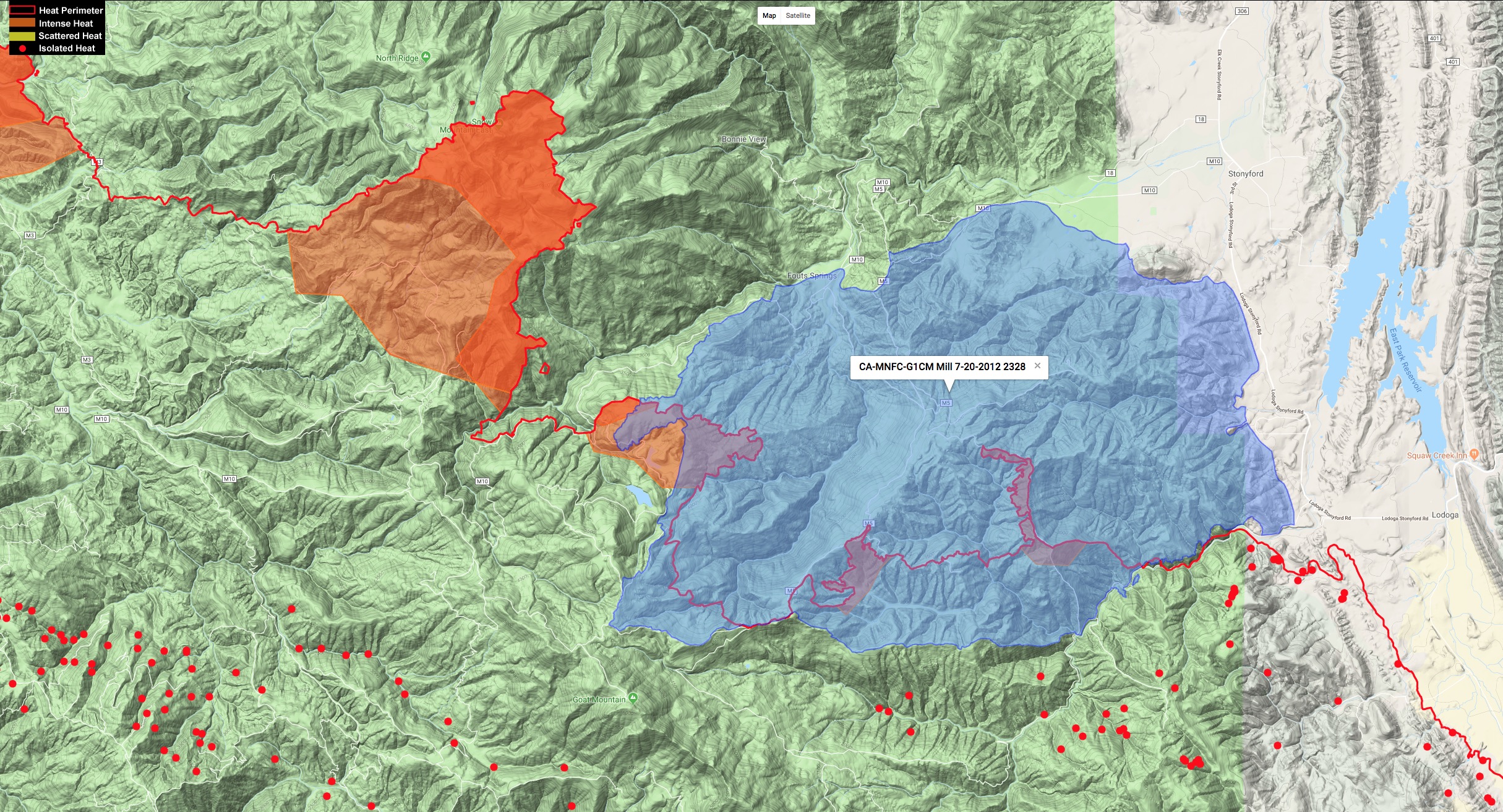
Dynamic map at: http://www.firemaps.us/files/IR.html
I just wish they would stop going on about the largest fire in state history. It is two separate starts that had nothing to do with each other and will not likely merge. Just under the same management.
I believe the Ranch Fire is the largest in state history without the River Fire?
And call it whatever you’d like, for sensationalism, politics, or newspaper sales, we still handle it the same way, regardless of the monicker attached to it. Lives are being lost this season at an alarming rate, and I for one am hoping for an early Fall/Winter! Everybody out there THINK SAFETY!
Right you are, I did not notice it had gone so big on its own.
@LG1724 thanks for the info. Do you know where they are firing from to the Fouts area? Is it down the M5 extending off the Crackerbox firing op, or off Letts Ridge or a new independent burn? The smoke off the Konocti cam was definitely further east than Snow Mtn and something off the M5 past Crackerbox would coincide with that.
I’ve spent some time in the Snow Mountain Wilderness and up on North Ridge is an old burn scar. Not sure what or when that fire was but if it gets past that then I’m assuming M3 would be the northern and western line?
Pretty impressive cap seen from Auburn. Is that another firing op?