Just speculating, plus the River is 100% in SRA, and the Ranch is majority (~80%) in FRA.
The logical place to zone it out is SR20 dividing north/south.
Just speculating, plus the River is 100% in SRA, and the Ranch is majority (~80%) in FRA.
The logical place to zone it out is SR20 dividing north/south.
Or two state teams
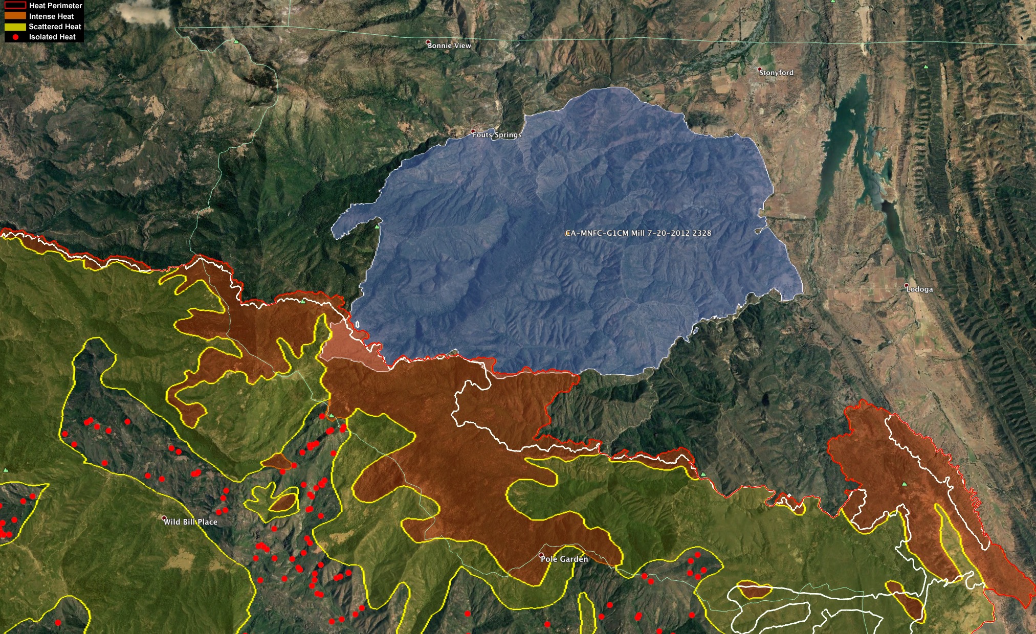
Updated IR maps at http://www.firemaps.us/files/IR.html
Yesterday was about 15 degrees cooler in Chico. We had heavy ash fall at times, but it was the first day in about a month that my AC didn’t kick on.
It looks like the NE flank of the fire hung up yesterday
Any update ? Cover ST just got booted from BTU to the Mendo Complex.
Listening to radio sounds like the lost it in the area of SPring valley rd, on the Ranch fire. Structures burning again. REquested 3 strike teams from base to fire and copters , they dont think they will be able to get air tankers in.
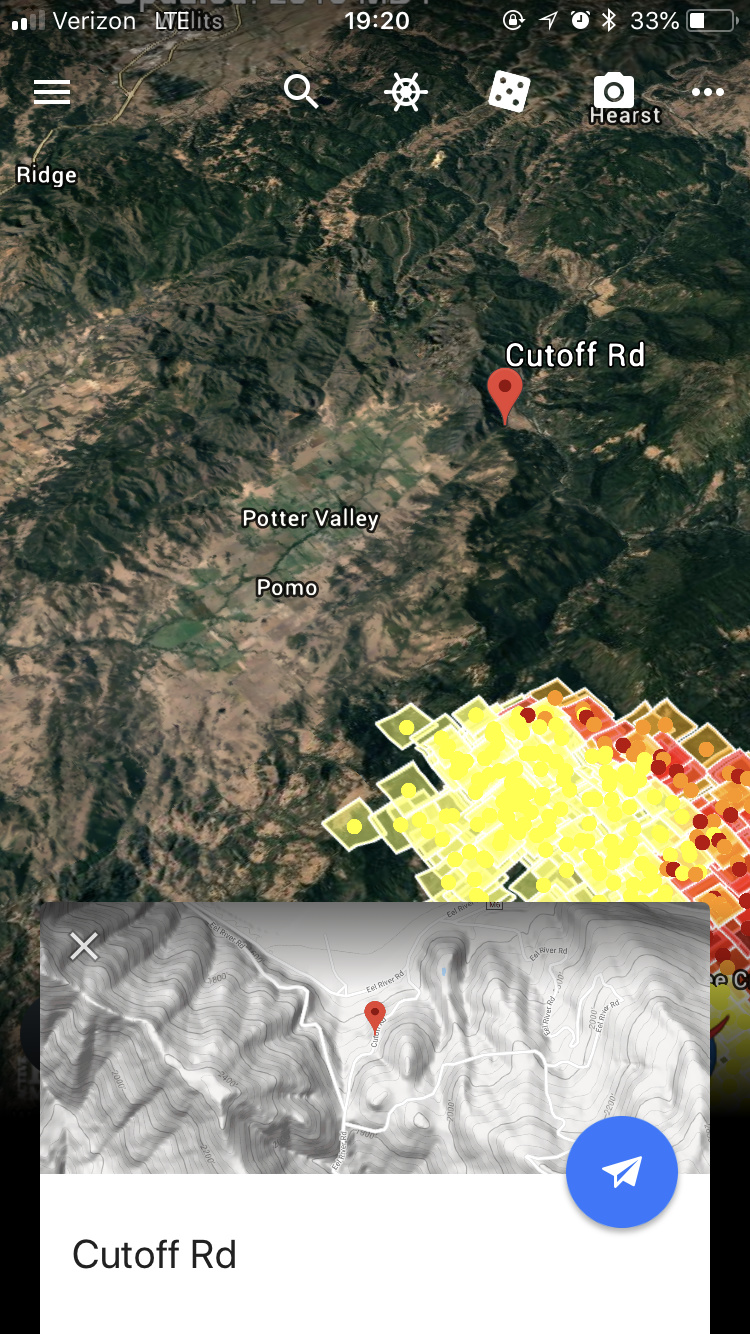
Is there another name for cutoff road? & there are so many roads that aren’t labeled! I’m not from the area just know the hubby is near that road. Thank you.
Could you be looking for Nice-Lucerne Cut-off Rd.? Runs North of Lakeport from Hwy 29 to the town of Nice. It’s a shortcut off the highway that runs along the Northwest shore and marshy area.
I found a Cutoff Road near Potter Valley on Google Earth.
That’s the area they’ve been prepping road, I believe.
It’s east of potter valley that’s all I know.
Yay ty. Exactly what I was looking for.
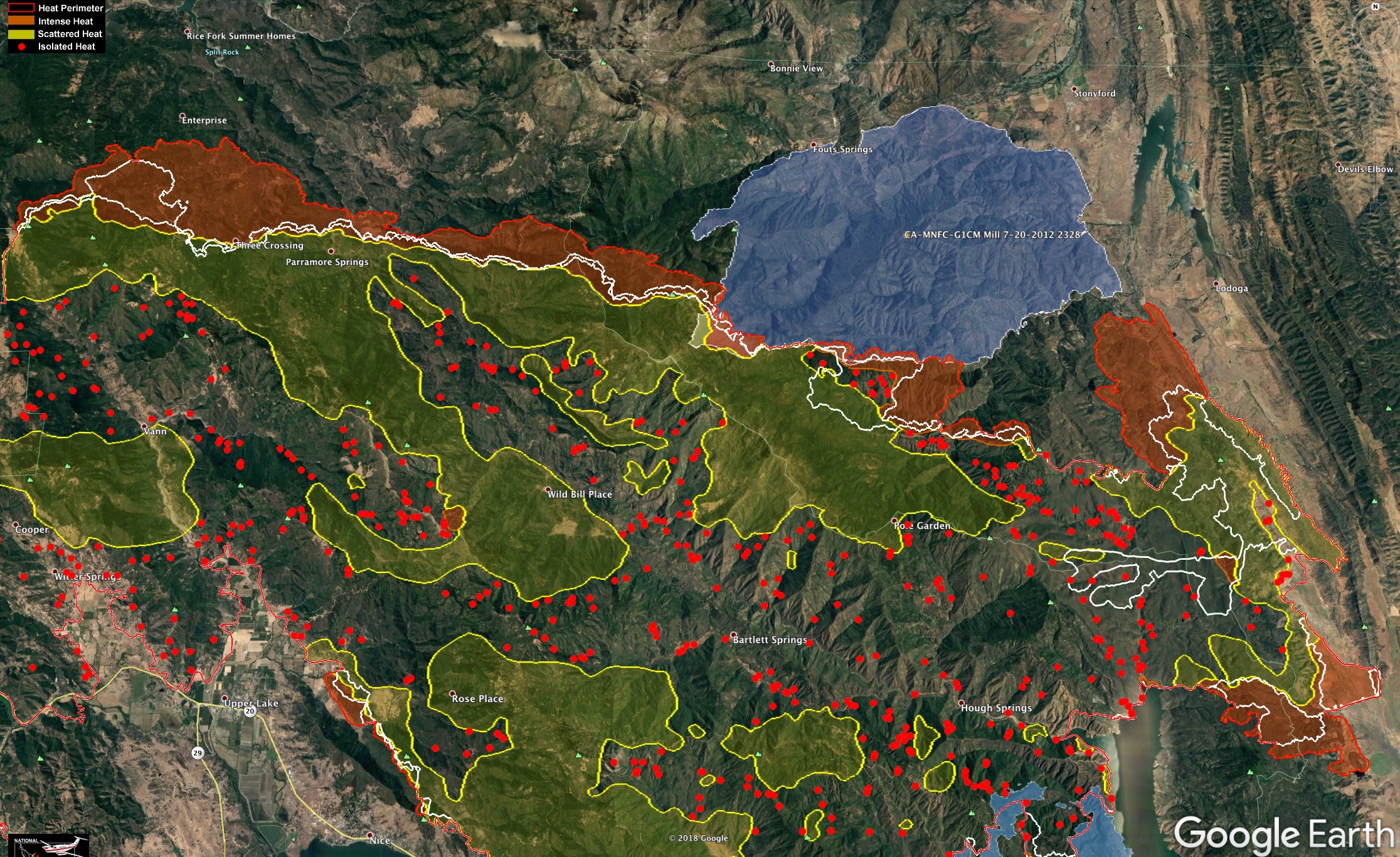
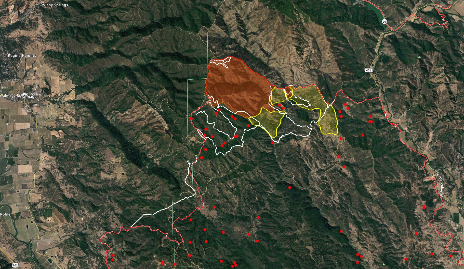
Here is last night’s IR of the North edge of the Ranch Fire. It is still holding up at the 2012 Mill Fire scar, shown here in Blue. Steady growth to the West of there. The 2 white lines show 24 and 48hr growth.
Good Afternoon, does anyone have info on any of the RAWSl in or around the north side of the Ranch Fire…I am wondering what the wind looks like there
High Glade Lookout - burned over earlier in the fire but has been spitting out data since. Great indicator of ridgetop winds in the entire north fire area.
https://raws.dri.edu/cgi-bin/rawMAIN.pl?caCHGL
Stonyford - just west of the USFS station of M10. Should give an idea of what the canyons are doing around Letts Lake
https://raws.dri.edu/cgi-bin/rawMAIN.pl?caCSTO
Thank you. I was just checking those, my daughter actually sent me the link…wind is not to bad at this time…hopefully the forecasters are wrong.
Looking at the weather satellite, winds have started to pick up from SW in last hour or two.
Visible loop:
https://col.st/SgMsF
Fire Temperature loop:
https://col.st/MvbPT
Gained some good acreage yesterday. Seemed like the first big day of growth for a few. Could tell the wind shifted as the ice cap was visible again for first time in three days. Wind shift!
Anybody know if their burning out on Br1,DivE on the fire breaks near Rice Fork At Pillsbury ?Have a place of interest their, thx in advance
I did hear of new mandatory evacs for lake Pillsbury area.
I’m not familiar with division layout but this link that @pyrogeography put up yesterday will give you an idea of the progression. It looks like wind driven to the northeast this afternoon Color fire imagery