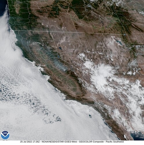
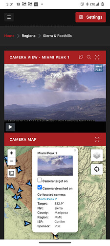
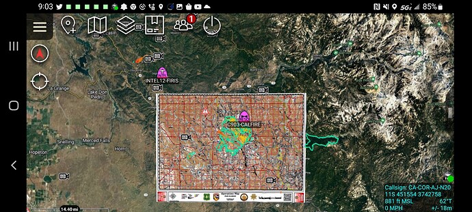
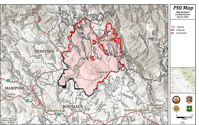
It’s down near Grub Gulch. Looks line they are getting a handle on it.
2030ish hours, FIRIS 16520 acres
IR flight underway
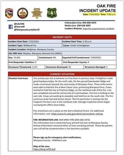
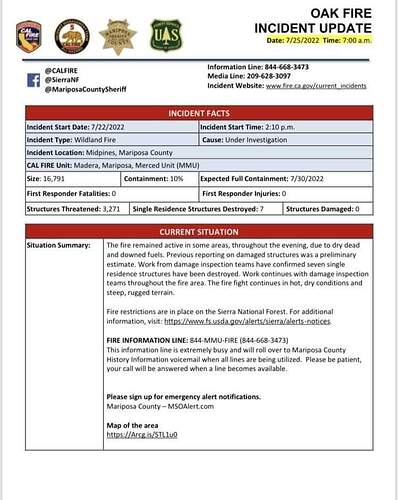
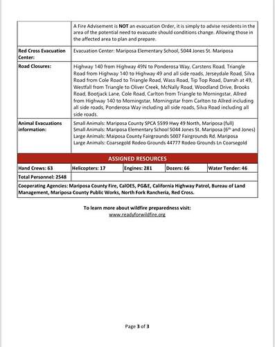
From this morning’s Cal Fire Update, 16,791 acres with 10% containment with 2,548 personnel assigned.
Situation Summary:
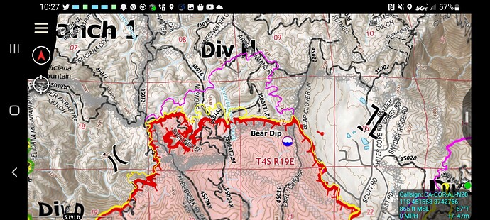
“Fire activity was not as extreme as it has been in previous days. Firefighters made good headway today. On the north side, the fire passed Sweetwater Ridge and made a hard push towards the community of Mariposa Pines. Three strike teams were able to hold the fire at Bear Clover Lane, protecting Mariposa Pines. Crews worked to hold the line at Footman Ridge, on the northeast side of the fire. Line was completed around the community of Lushmeadows. Fire line is holding on the east side. Crews are working to complete and hold line on the south side. The fire continues to be fuel and terrain driven. The fire perimeter is moving into the Furgeson Fire burn scar in the northeast side. Damage inspection teams began surveying the affect areas today.”
Updates Per this AM’s 209:
16971 Acres (+1,188) @ 10% Contained
Updated Structures; Destroyed Totals: 7, damaged 0. (Note this is always an in-progress number and will likely change to be more accurate as the incident progress)
2,548 Personnel Assigned
Critical Resource Needs:
18 strike teams Type 3 engines; 11 Type 1 crews strike teams; 25 strike Teams of dozers; 10 water tenders; 17 HEQB
Projected Incident Actvity 12 & 24hrs:
Branch I: West side, no growth expected in the next 24 hours. East side, expect growth ENE towards the Mariposa Pines community over the next 12 hours.
24 hours: Branch III: In the next hours the fire will be burning in the Ferguson burn scar and may moderate slightly based on reproduction fuels.
Branch V/X: The fire is smoldering creeping with occasional hot pockets of fuel. Minimal growth expected.
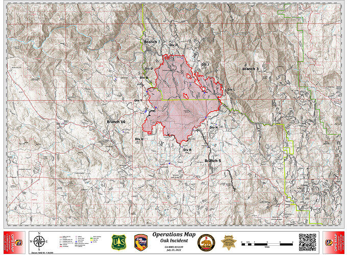
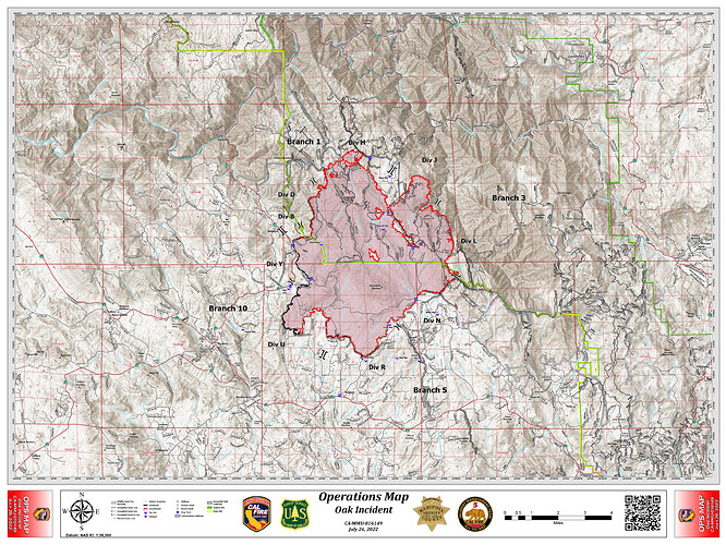
Ops Map 7/25:
shortened URL to get to the CAL-FIRE IMT box.com public folder for the OAK.
http://tiny.cc/CAMMUOAK2022
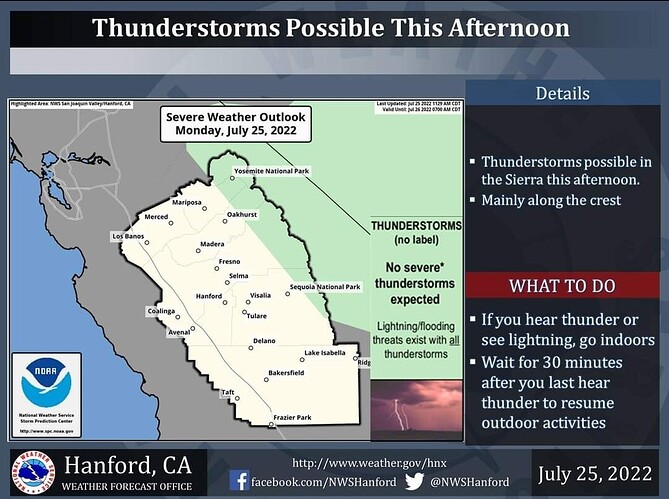
A few thunderstorms are possible along the Sierra high country tomorrow afternoon. Small hail and wind gusts near 40 miles per hour are associated with strong thunderstorms. In addition to dangerous cloud to ground lightning strikes, any thunderstorm can produce intense rainfall rates, leading to localized flooding. Thunderstorms are not expected over the Oak Fire, however winds can become gusty and erratic near thunderstorms.
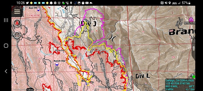
FIRIS INTEL-12 18008 acres
1100 mission yellow
2200 mission in pink to highlight growth in DIV L and J about 600 acre growth
DIV H roughly 355 acre growth
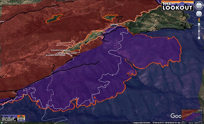
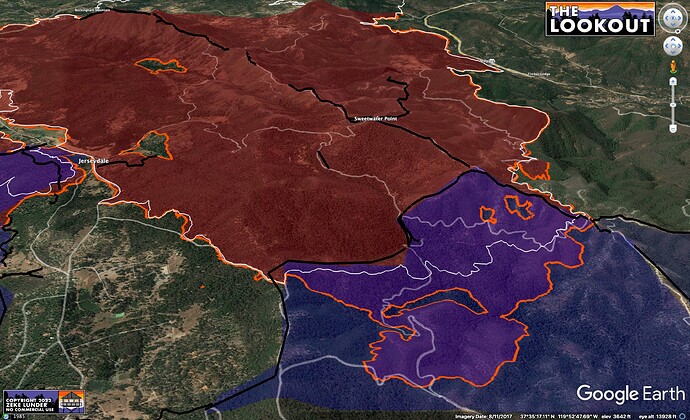
Another view of 24 hr spread into Ferguson Fire (blue) area.
Orange is tonight’s FIRIS perimeter.
White is last night’s.
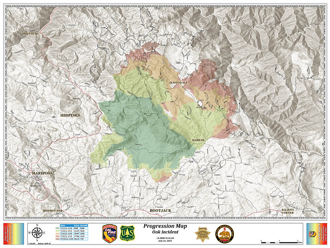
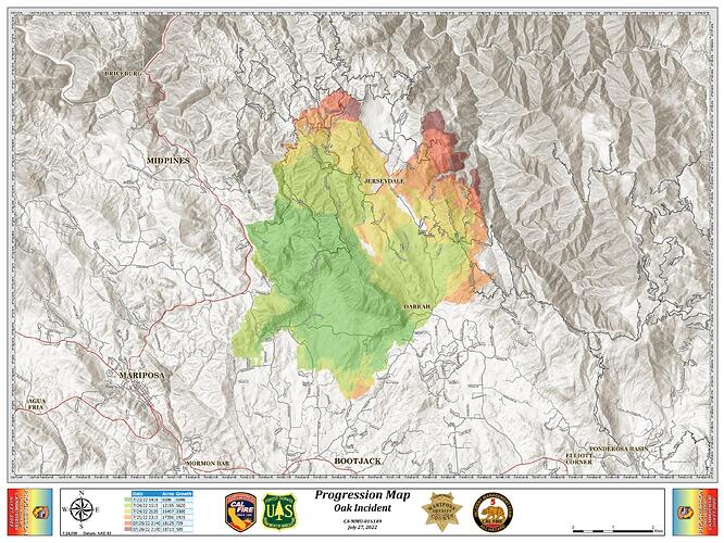
Per this AM’s 209 & current progression/ops maps:
1,8087 Acres @ 26% Containment
2991 Personnel Assigned
25 Residences & 16 outbuildings Destroyed
Projected Incident Activity:
Branch I: Potential for spot fires and growth to the East.
Branch III: If left unchecked, the fire will reach Devil Gulch.
12 hours: Branch V/XB: Fire is creeping, smoldering with occasional pockets of interior flare-ups. The fire is smoldering creeping with occasional hot pockets of fuel. Minimal growth expected.
Critical Resource Needs:
40 Hand Crew strike teams; 5 strike teams Type 3 engines; 10 strike teams Type 6 engines; 15 HEQB; 11 Falling Modules.
18,715 acres and 32% contained

