CA-MMU-Oak

The 3 to 5am heat map update on Caltopo:
(Usual 2-3 hour delay for signatures. Also smoke will give some false heat signatures with this size of fire -FYI )
https://caltopo.com/map.html#ll=37.54145,-119.86432&z=12&b=t&o=f16a%2Cr&n=1,0.25&a=mba%2Cfire%2Cmodis_mp

Last night:
Also Signal Peak lookout said the fire laid down once it hit the Ferguson Scar into creeping. Lacking a good fuel bed of regrowth…maybe that line is controlled, so to speak.

3 Likes

Per this AM’s 209:

CALFIRE IMT 5

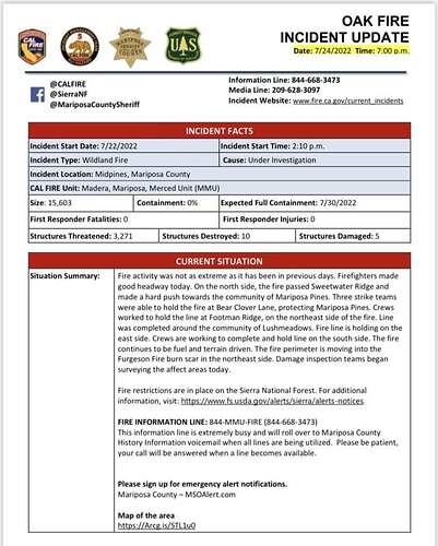
14,281 Acres (+2,381) @ 0% Containment

Observed Fire Behavior overnight: The fire remained active overnight primarily in Branch I and III. where the fire continued to back toward Jerseydale.

5 Structures Damaged, 10 Destroyed, 2,693 Threatened

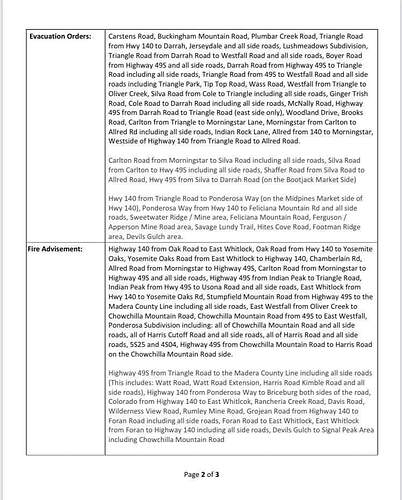
Evacuation Order:
-North of Highway 49, east of Cole Road
-Lush Meadows north of Highway 49
-Bootjack, north of Highway 49, east of Cole Road
-North of Morning Star, east of Lakeview Road and Plumbers Creek Road, south of Highway 140
-Jerseydale

Evacuation Warnings:
-North and east of Indian Peak Road and All Red Road
-South of Morning Star and Highway 49
-West of the East Fork of Chowchilla River
-North and west of Highway 140 near Mariposa
-East of East Whitlock Road
-North of Highway 49 near Mariposa
-East and south of Oliver Creek Road, west of Chowchilla Mountain Road
-Ponderosa Basin

*Previous reporting period indicated 6,052 civilians under evacuation order. More accurate census data was obtained and the number of civilians currently under evacuation order is estimated to be 3,027. The number of civilians currently under evacuation warning is estimated to be 1,909.

Critical Resource Needs: 12hrs 20 strike teams Type 3 engines; 15 strike teams Type 1 crews; 25 dozers; 20 water tenders; 15 DIVS; 4 OPBD.

2,093 Personnel Assigned, Projected Containment Date 7/30/2022

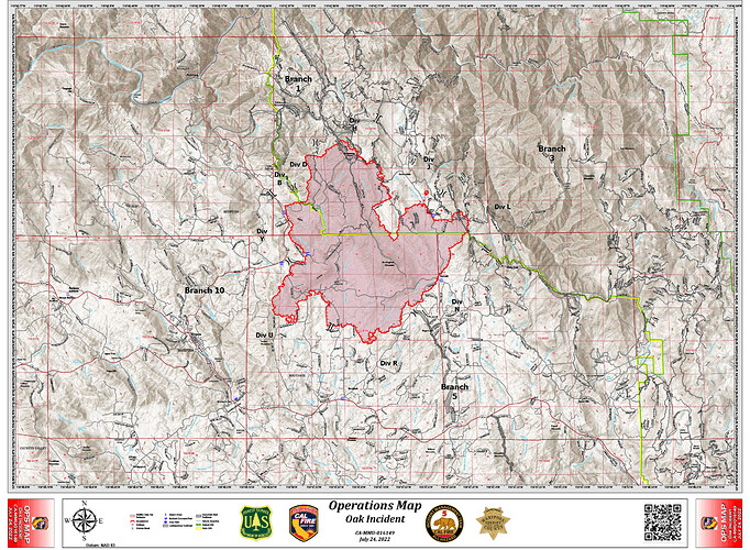
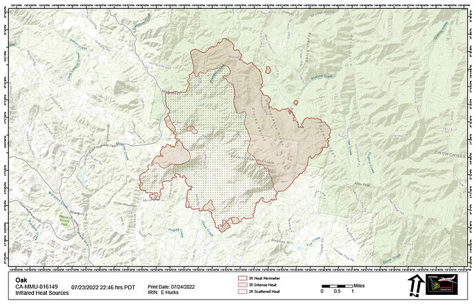
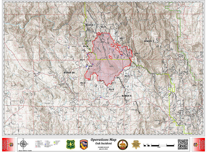
Re-sized Ops & NIROPS IR Maps for today:

21 Likes

Nice update.

5 Likes

image

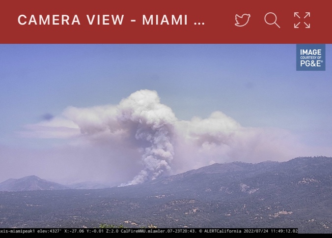
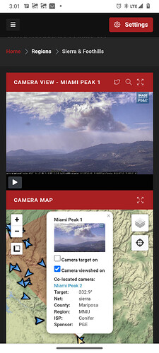
https://www.alertwildfire.org/region/sierra/?camera=Axis-MiamiPeak1

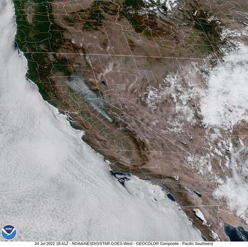
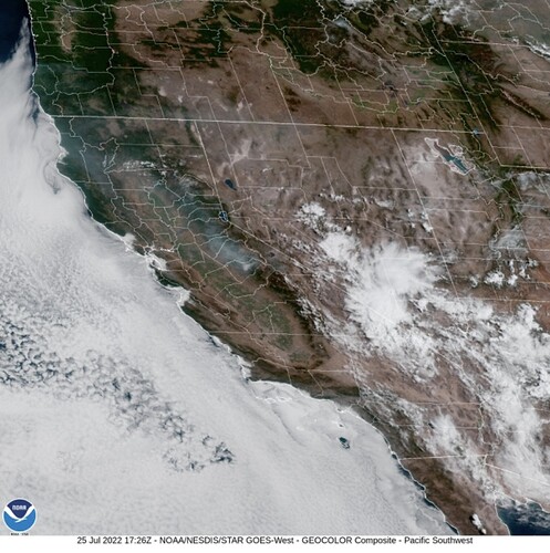
**Latest Visible Satellite **

8 Likes
5 Likes

New start Ahwanee area, loosing some aircraft:
https://www.alertwildfire.org/region/sierra/?camera=Axis-Deadwood2
Nice column on Deadwood2 cam

8 Likes

I have family at 42999 Wither Ranch Road(end of Bessie Jacob’s) confirming fire on crooks mountain.

3 Likes

It’s down near Grub Gulch. Looks line they are getting a handle on it.

7 Likes

The Oak Fire is 15,603 acres

5 Likes

A post was merged into an existing topic: CA-MMU-OAK???

2030ish hours, FIRIS 16520 acres

6 Likes

IR flight underway

6 Likes

A post was merged into an existing topic: CA-MMU-OAK???

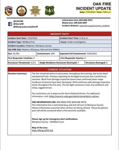
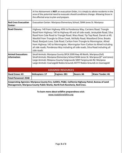
From this morning’s Cal Fire Update, 16,791 acres with 10% containment with 2,548 personnel assigned.

Situation Summary:

“Fire activity was not as extreme as it has been in previous days. Firefighters made good headway today. On the north side, the fire passed Sweetwater Ridge and made a hard push towards the community of Mariposa Pines. Three strike teams were able to hold the fire at Bear Clover Lane, protecting Mariposa Pines. Crews worked to hold the line at Footman Ridge, on the northeast side of the fire. Line was completed around the community of Lushmeadows. Fire line is holding on the east side. Crews are working to complete and hold line on the south side. The fire continues to be fuel and terrain driven. The fire perimeter is moving into the Furgeson Fire burn scar in the northeast side. Damage inspection teams began surveying the affect areas today.”

6 Likes

Updates Per this AM’s 209:

16971 Acres (+1,188) @ 10% Contained
Updated Structures; Destroyed Totals: 7, damaged 0. (Note this is always an in-progress number and will likely change to be more accurate as the incident progress)

2,548 Personnel Assigned

Critical Resource Needs:
18 strike teams Type 3 engines; 11 Type 1 crews strike teams; 25 strike Teams of dozers; 10 water tenders; 17 HEQB

Projected Incident Actvity 12 & 24hrs:
Branch I: West side, no growth expected in the next 24 hours. East side, expect growth ENE towards the Mariposa Pines community over the next 12 hours.
24 hours: Branch III: In the next hours the fire will be burning in the Ferguson burn scar and may moderate slightly based on reproduction fuels.
Branch V/X: The fire is smoldering creeping with occasional hot pockets of fuel. Minimal growth expected.

Ops Map 7/25:

8 Likes

3 Likes

Video from last night’s FIRIS flight 07/23 @ 2325 hrs)

9 Likes

6 Likes

shortened URL to get to the CAL-FIRE IMT box.com public folder for the OAK.
http://tiny.cc/CAMMUOAK2022

10 Likes

Moisture moving in woke it up.

6 Likes