Ah!! Excellent!! Thank you very much for linking to your site. Adding it to my bookmarks.
I’m more used to reading about USFS fires than I am anything else, so I was unsure on where to find their scanners. Much appreciated.
Ah!! Excellent!! Thank you very much for linking to your site. Adding it to my bookmarks.
I’m more used to reading about USFS fires than I am anything else, so I was unsure on where to find their scanners. Much appreciated.
Per North Ops- 746k acres burned. A Great Basin Team is taking over the fire tomorrow.
confirm: 746,000 ac???
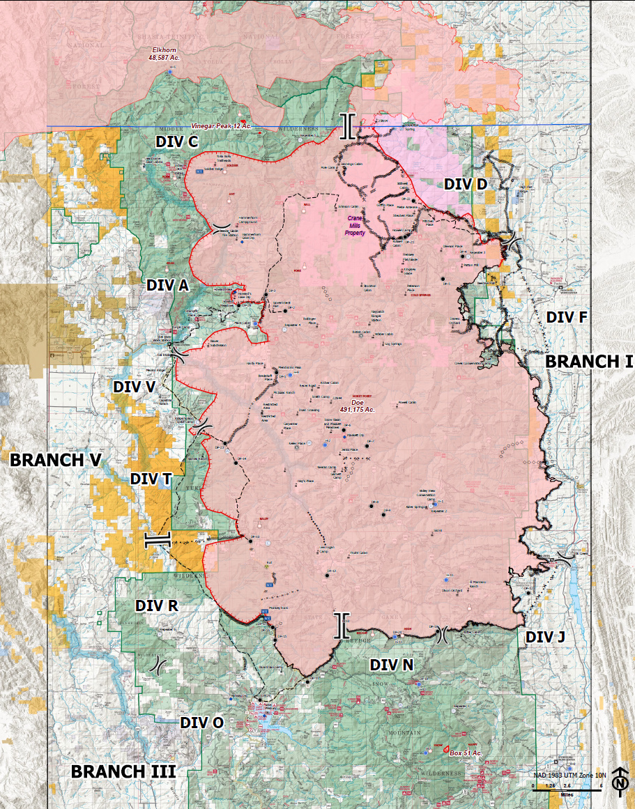
Here is the NOPS report, FakeFire missed a few details, mainly that 2 teams are managing the north and south parts of this complex, and that Elkhorn has been added to the complex.
CA-MNF August Complex: 746,607 acres grass, brush and timber, 25% contained. Active fire behavior with short crown runs, uphill runs and short-range spotting today. SHF Elkhorn has been added to this complex. Threat remains to structures and evacuation orders and warnings remain in effect. Road, area and trail closures in effect. Threats to private and Federal timberlands and ranchlands, powerlines, hydroelectric plants and communications infrastructure , numerous historic sites and critical wildlife habitat, Eel River and Black Butte Wild and Scenic River corridors and Mad River municipal watershed, and to Black Rock Historic Lookout, Penny Glade and Martin Cabin. 14th Brigade Engineer Battalion of the US Army assigned. Glade, Hull and Tatham Fires merged with Doe Fire. Active large fires within the complex: Doe: 437,090 acres, 23% contained, SHF Elkhorn: 255,309 acres, 27% contained, Hull: 13,177 acres, 100% contained, Tatham: 15,594 acres 100% contained, Glade: 25,378 acres, 100% contained. Naturally occurring asbestos poses a threat to firefighter safety. GB Type 1, Team 2 assume command of South Zone tomorrow. Southern Area Blue Type 1 IMT (Morales) in command of South Zone and Ca IMT 5 (young) in command of North Zone.
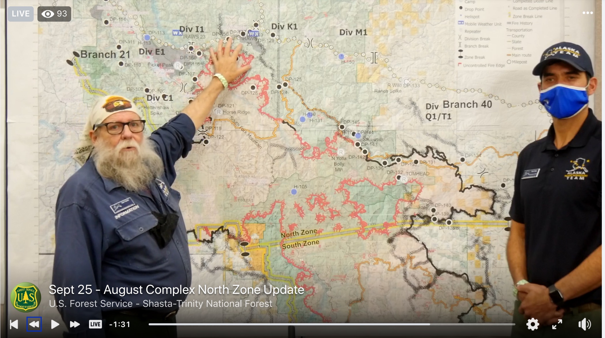
9/11 South Zone Ops Overview. Shifting some Branches and Divisions around. It’ll all shift again once Div Charlie burns through the last of the green up there and back into the State DPA once it leaves the Wilderness boundary.
West Communications is setup in Ukiah for MEU on CDF Command 8. Not sure on HUU prepping and ops.
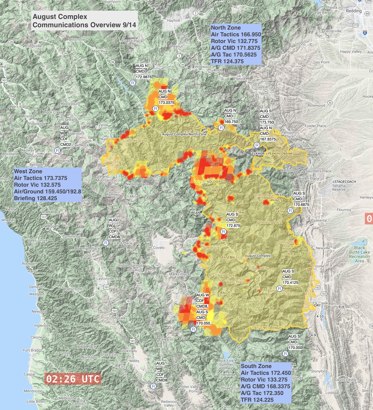
Communications overview for the entire August Complex as of 9/14, with MODIS/VIIRS and GOES sensor imagery as of 9/14 evening.
Aug North and South Commands are on highest priority on scancal.org/live.html live scanner, north over south. I also have North and South Air, although not sure I’ll hear much air from Red Bluff with the east side all buttoned up.
796,651 Acres burned.
Pretty good size fire! Not a lot of information coming in looking at the thread!
I would not be surprised if this fire hits the Hwy 101 corridore before all said is done.
The west side of this fire is looking much better, especially in the HUU area. If there was another off shore event in the near future, maybe the southern portion would make a push west, but the northwest portion is pretty locked in. I wouldn’t be surprised if the northern part east of Ruth pushes over highway 36. That’s not a great holding point and there’s not alot of good options past that for making a stand.
Except most everything around the trinity pines area is still black from the ‘15 fires. So not a whole heck of a lot to go through on that end. Just my two cents as a local of near there.
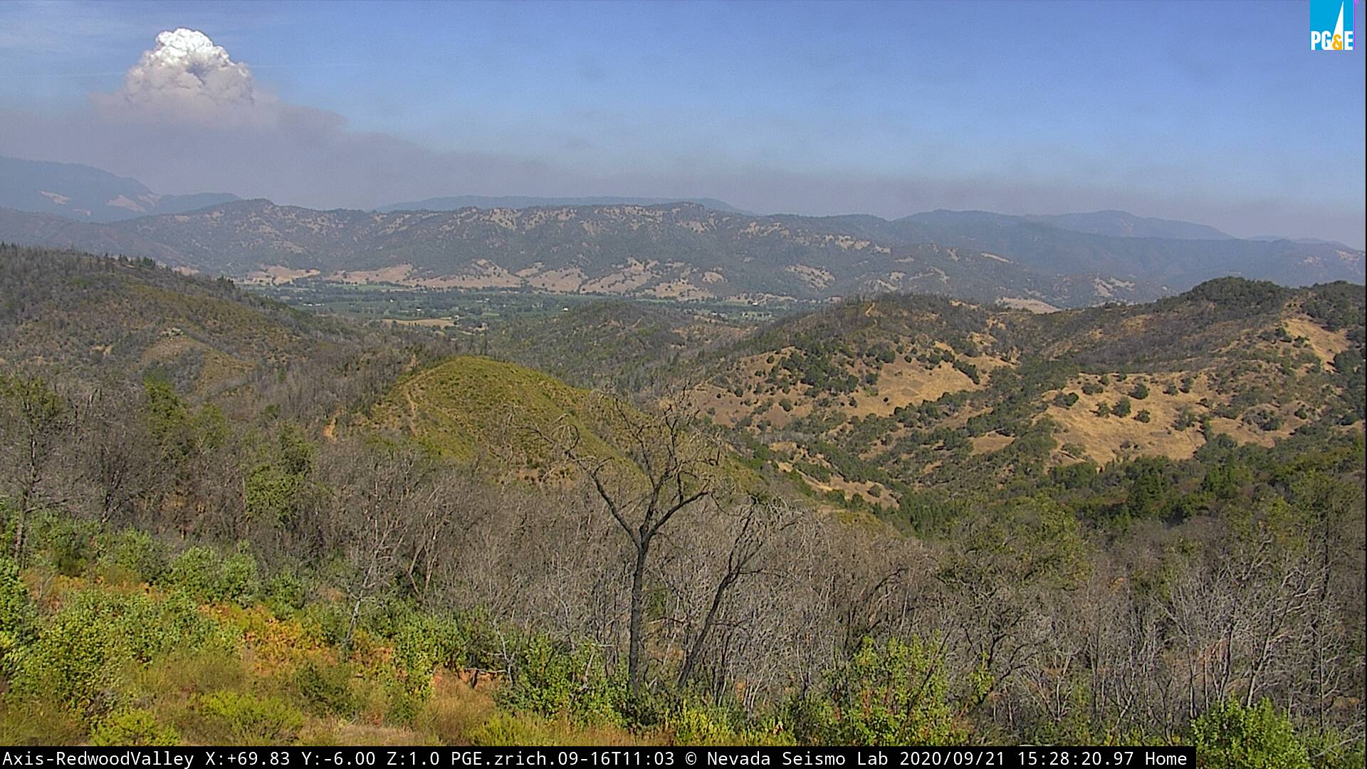
This is the first time you can see the west zone of the August Complex from the Redwood Valley camera.
Its a ways out, but it is visible.
http://www.alertwildfire.org/northcoast/index.html?camera=Axis-RedwoodValley&v=92b5045
The camera is located on my families property. I have been watching it to the north from this moutain, but nothing this far south.
Does anyone know where the ICP is for the West Zone?
The ICP for the West Zone is at the fairgrounds in Ukiah.
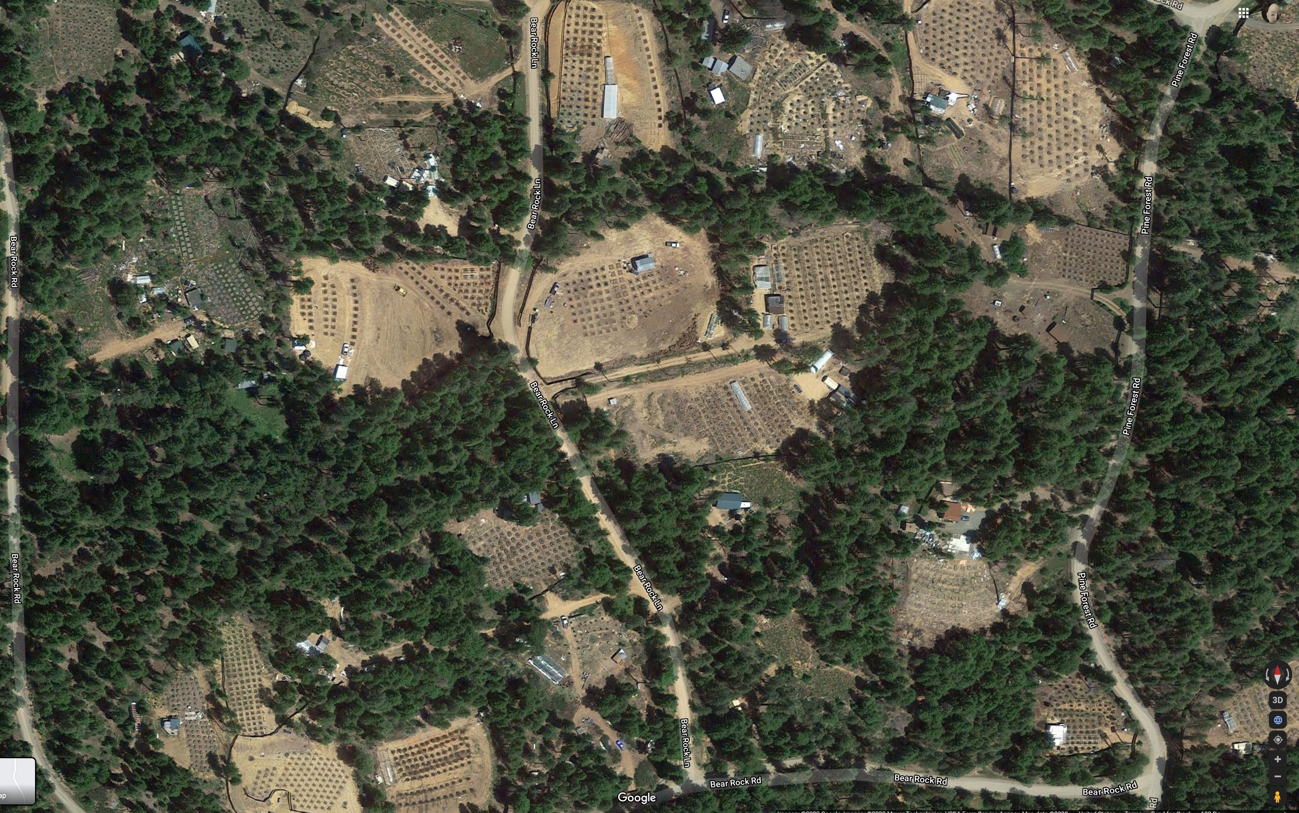
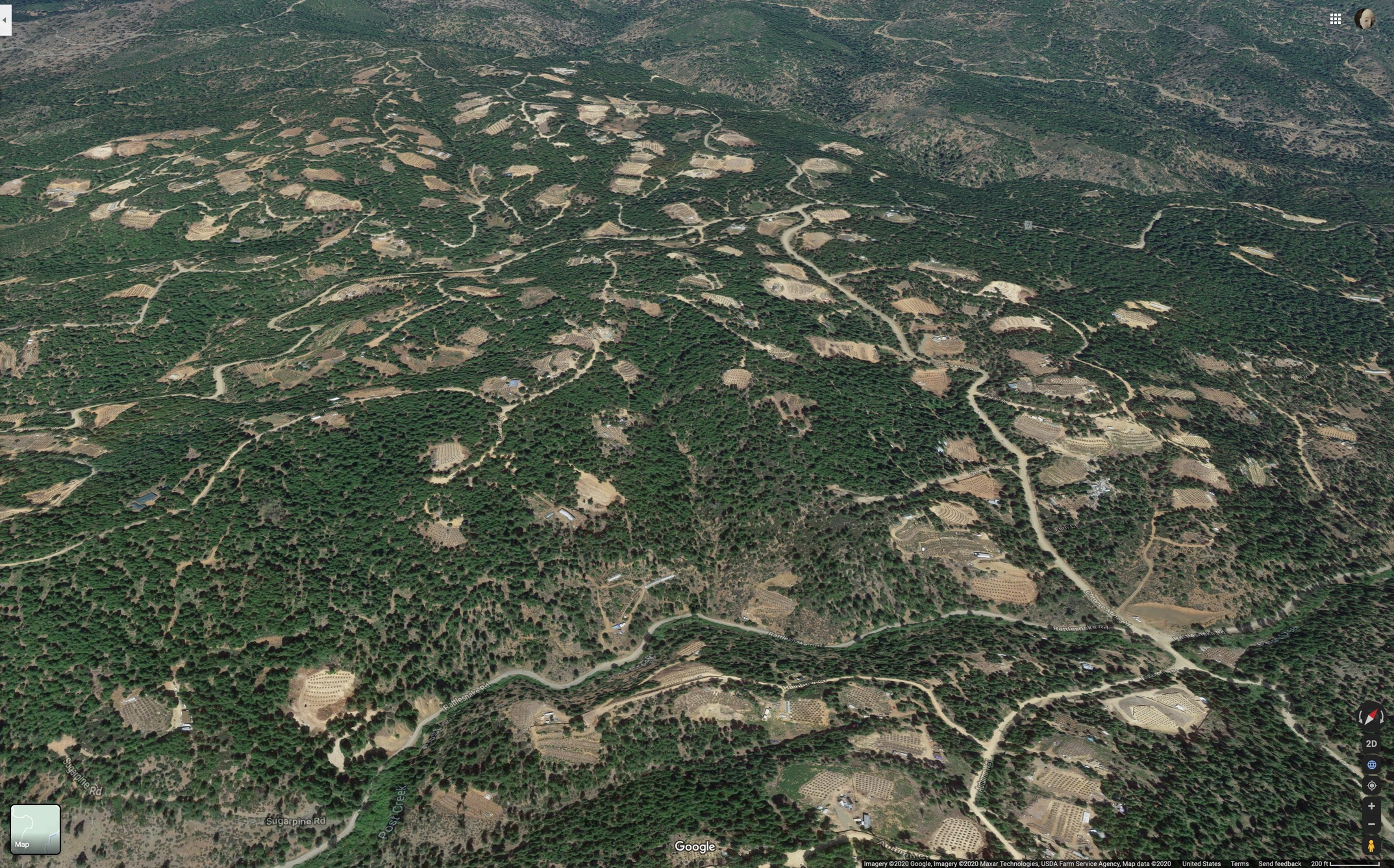
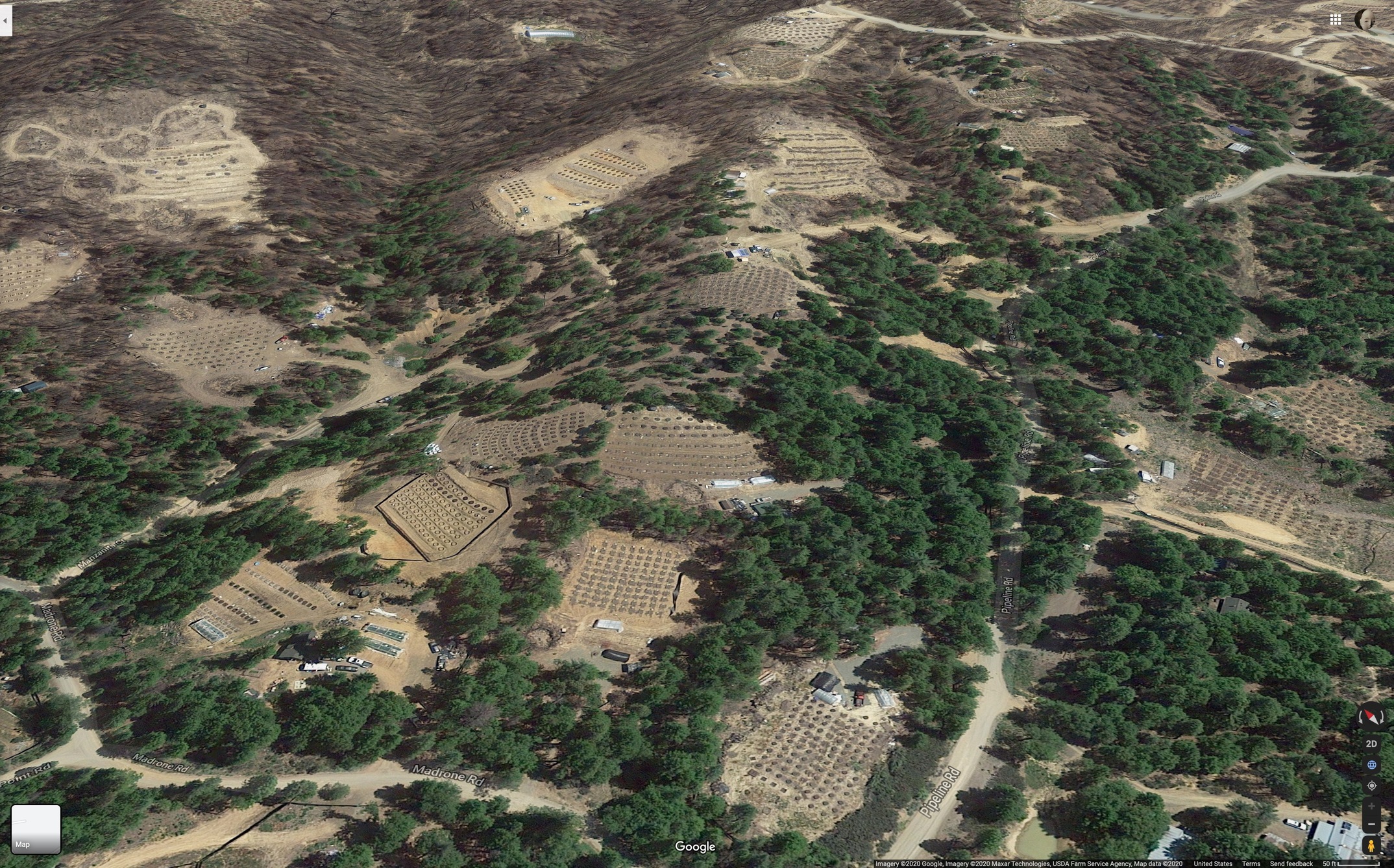
North end of fire is near Highway 36, and Post Mountain.
If you are not familiar with the area, Post Mountain aka Trinity Pines is the throbbing electric emerald heart of Trinity County’s agricultural economy. https://goo.gl/maps/9GcbC6XYaFSjih5H8
It’s harvest season and the growers are jumpy, so the Alaska Team has (wisely) brought in the Mayor of Hayfork to translate for the PIO (who looks like he has been sampling the local merchandise). Both of them still have their wristbands from the Trinity Tribal Stomp… https://www.facebook.com/watch/live/?v=636672773692279&ref=notif¬if_id=1601048395850278¬if_t=live_video
(This post is an attempt to bring humor to a very dark situation. Hayfork doesn’t have a Mayor. PIO Sam is amazing, I am a big fan).
I have been keeping tabs from a high level (no pun there) on the north complex, just not enough to really contribute here. They have been prepping and planning all week to eventually fire off 36. Today they’ll start closing the highway and potentially start some firing ops. They’ve been optimistic for Post Mountain due to these plans, however they have plumbed most of the community and have pumpkins filled throughout ready to support any defense.
It is an interesting area for sure. Almost wild west. Very skittish people, some of which are locals doing their thing, and others are definitely pushing the law and going for pure profit. PGE has transmission and gas going through the area and they have to thread the proverbial needle in public relations when needing to work in there, especially with helicopters, not to mention day-to-day medical responses requiring law escorts etc.
Post Mountain reminds me of Paradise or Feather Falls. We have expended an enormous amount of effort and kept fire out of there under several lightning busts in the past decade, but they’ll get their fire one of these days, and a lot of that weed will get smoked. Then we’ll have 20 years of melted plastic bags, five gallon buckets, rodenticide, trailers, and deferred dump runs moving in liquid form down into the South Fork Trinity River.
The absolute truth !!!
Friday 3pm: 1 VLAT, 4 LAT, 3 firebosses to the north side along hwy 36. Heavy rotors supporting the continuing fire ops above Ruth that have been going throughout the week, trying to straighten out that line and make it stick up the slope from Ruth to Southfork Ridge/Horse Ridge