Lots of starts on the MNF ready for its own thread, scattered intel on other threads including TGU-Lightning (mods, can you move some of those over?)
MNF Lightning Plan has eastern incidents on Fire Net, and western incidents on Admin Net.
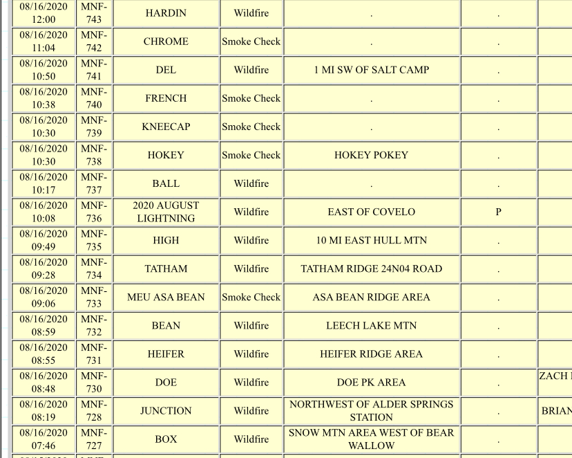
Doe Fire - Valley View Mtn (St John and Round Mtn cams have this). Starting to get some aircraft love now at 1230pm. Also, TGU LCA is making their way into S20, T22N 7W on the Hardin Hole Ridge just north of Hardin Hole Springs, was 10-15 acres in the understory. They thought it might be SRA. Might be a bit to tighten these locations and names down between the MNF and TGU.
Heifer Fire - east of Doe Fire potentially Box Fire - south of St. John Mtn, east of Snow Mtn on the NE slope, west of Fouts Kneecap Fire - on Kneecap RIdge area, portion of fire along the M6. Taham Fire - on Tatham Ridge, west above Paskenta. Local report of mastication done in the area
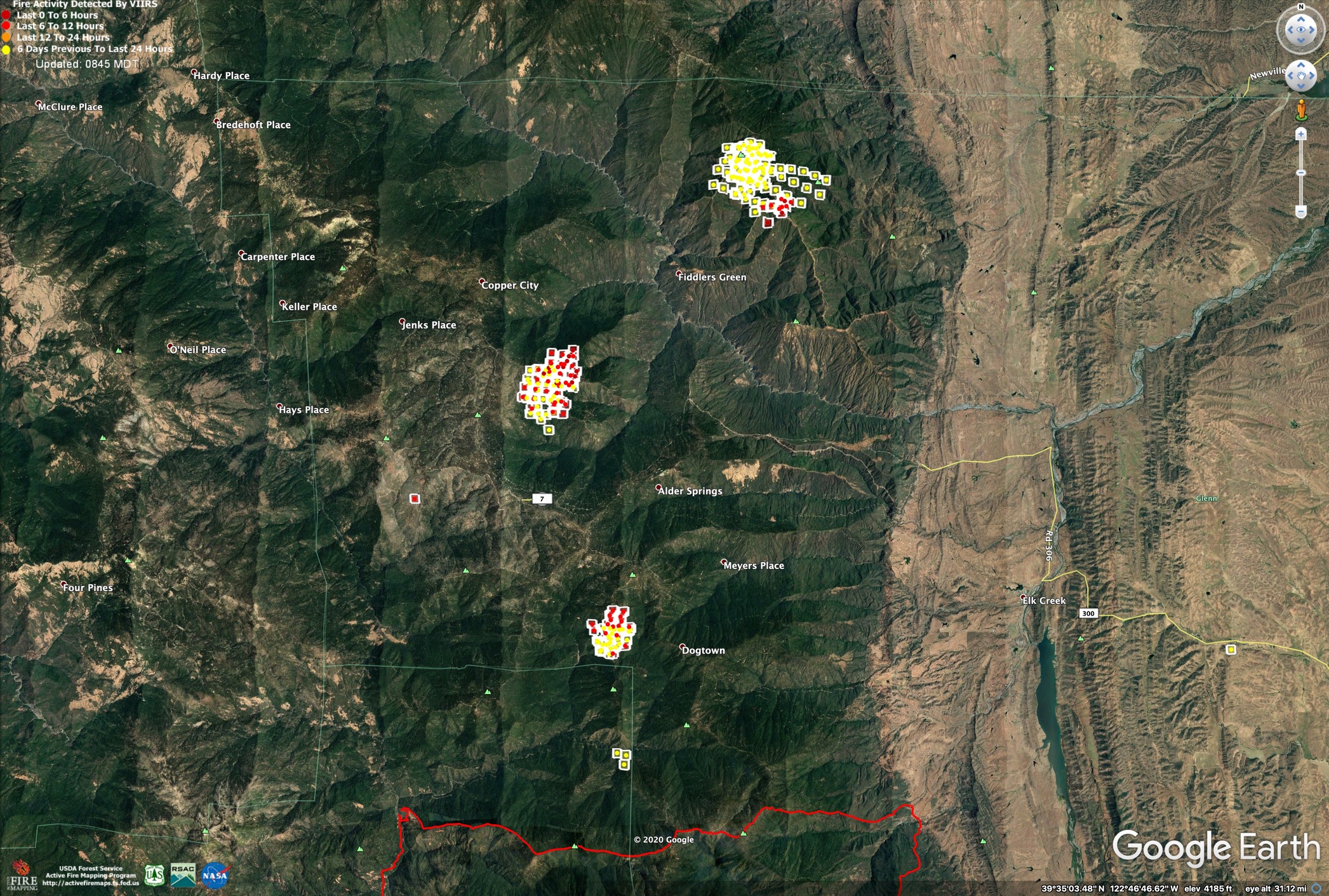
MNF has 3 significant fires showing on GOES this afternoon into the evening on the east side in Glenn County. On the St John Cam1 you can see the Rockwell furthest west/right (and currently the hottest on GOES of the 3 at 10pm), as well as the Doe on the far left. But there is a third closer fire to the camera, in between and in line with Rockwell and the camera.
I believe this is called the Pine Kop fire, on Cedar Ridge (with Pine Kop being the peak on the southern tip of Cedar Ridge). It is off the 20N106 road and slowly backing down into the creek and drainage.
The Kneecap fire is holding within a handline. IC is putting it in patrol status and all resources off the line to Alder Springs.
There is another fire with just the top smoke barely making it on the St John Cam earlier this evening, closest from the other 3. I believe this is will be the Happy Fire, for Happy Camp Ridge, and was earlier being referenced as “the fire near Corbin Creek.” The IC there reported smoke dissipated and laid down, but can still be seen. He couldn’t gain access to see the main fire for any size up. No heat on GOES, but MNF wildcad, the forest map, and camera sightings all align pretty confidently.
MNF has an dynamic situation going on. With over ten fires on wildcad, with more probably undiscovered, this will get interesting. Some precipitation was received early this morning (local report) we will just have to see how today plays out. Figuring with the other continuing fires, new starts, they will be lower priority receiving little to no resources.
Jumper 63 looking for a fire to jump this morning. Sounds like they were going to do the Happy Fire, but it is “lined and out” so if that’s the case, they’re looking to put everyone on the Box.
Shepard Fire has either a spot, or close neighbor. They’re calling it the Shepard 2.
Heard two acreage updates but not sure which fire they were attached to, 150-175 acres and approx 300 acres. That should be both the Doe and the Rockwell.
The assigned the same air tactics freq to the Doe as the Air Ground for TNF-Loyalton and Air Attack hears everything on the Loyalton, so huge commo issue there that they’re working out. Might go back to yesterday’s IA AG-14 for the day…
These took off this afternoon once the sun popped through the upper layer. Rockwell had a dirty estimate of 3000+ acres tonight, the Doe Fire “also doubled in size easily” tonight and Pine Kop clocked in at 900+ acres earlier this evening. Huge growth compared to this morning.
The GOES 17 IR signature has now blurred all three together into an ugly black hole of heat that I’ve only seen reserved for some pretty intense major incidents. And just noticed a new heat just SE of that blob, which could be another start I was hearing this afternoon at the Grindstone Overlook/Rattlesnake Fire Memorial (always remember).
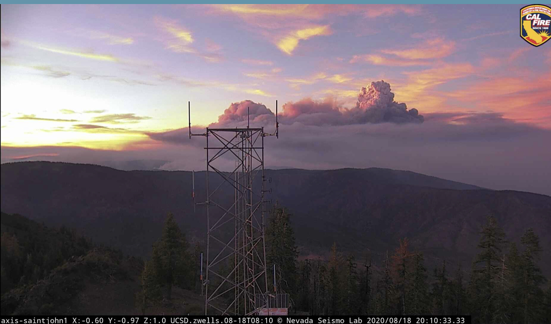
1300 Wed: Tatham Ridge just west of Round Mtn and above Paskenta just took off. Round Mtn Camera watching the north head of Doe kept getting smacked in the face by smoke off to the right. It just turned to face torching timber head on. Here we go.
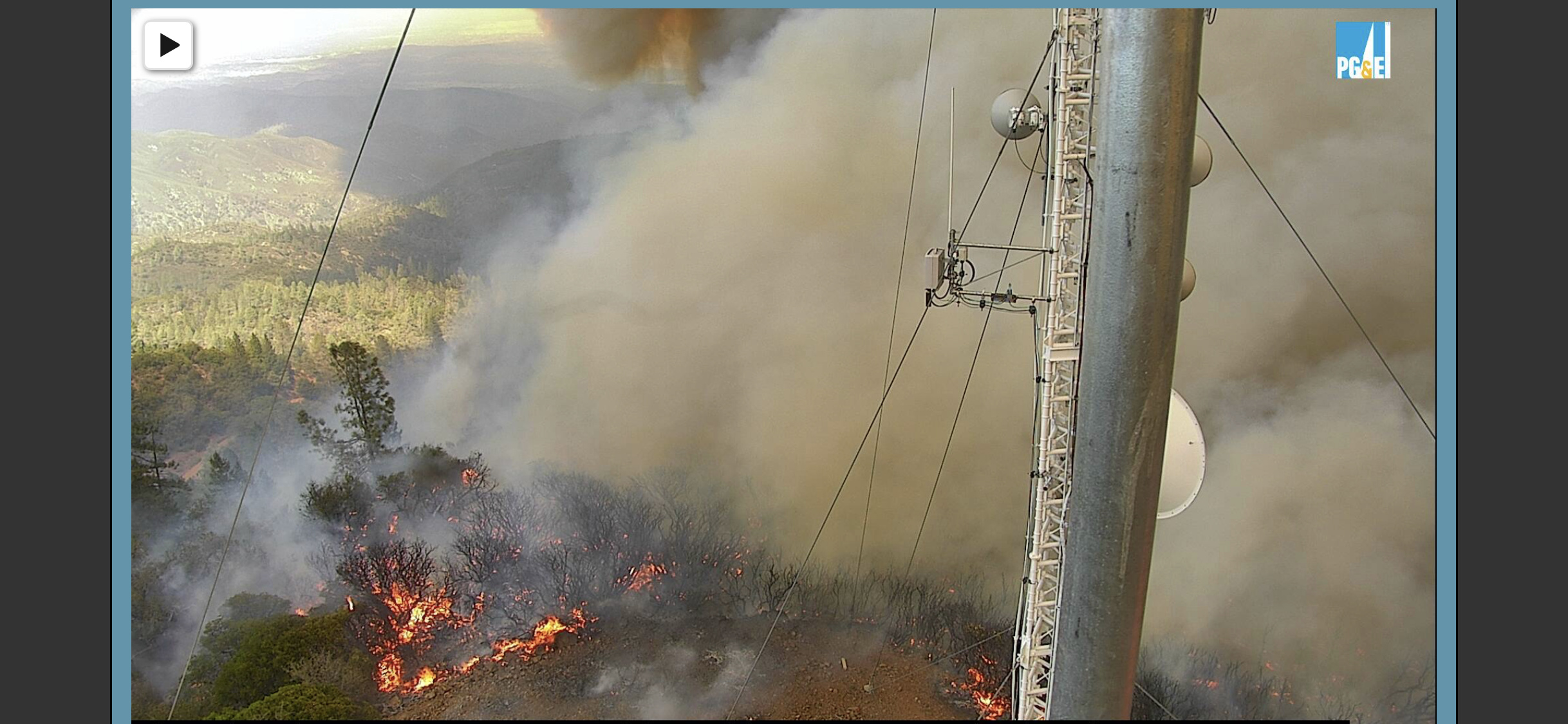
Round Mtn Comm Site where the camera is has PGE trunked, commercial trunked, federal p25 trunked, USFS MNF Fire and Admin Tone 3, WAPA microwave, and some FM Broadcast. Other FM broadcast on a ridge south, which have burned through a few times, requiring total vault (shipping container) replacement.
The cameras are on the PGE/WAPA tower I believe. The white tower seen in the camera view is the Crown vault…
And the Round Mtn2 apparently refuses to witness its own demise…
Here is VIIRs data from about 1400, 8/19/2020.
Orange dots on east side of fire are inaccurate, fire has not run into the Valley like shown.
Red is growth between 0800 and 1400hrs.