Banner Mountain Cam Looking at it now
https://www.alertwildfire.org/region/tahoe/?camera=Axis-BannerMtn2
Banner Mountain Cam Looking at it now
https://www.alertwildfire.org/region/tahoe/?camera=Axis-BannerMtn2
New fire to the north.
Have a identifier for it? or is it a spot
Not a spot, well away from the incident.
Definitely not a spot.
Oregon Peak has it, Off Willow Glen Rd.
https://www.alertwildfire.org/region/tahoe/?camera=Axis-OregonPeak1
Jacobs Ladder has it (I think…)
https://www.alertwildfire.org/region/tahoe/?camera=Axis-JacobsLadder
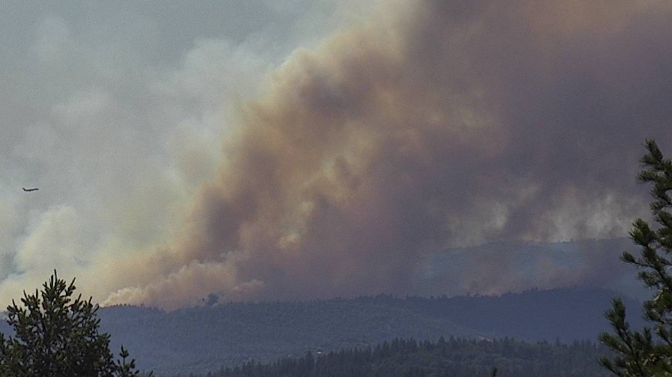
Some thoughts on this fire for the next 24 hours. If it slops into the canyon, then everything changes. It certainly looks like it could. It is late enough that the delta breeze should let off in a bit. It looks long and narrow and the flanks are not moving laterally, mostly its the head.Decent dozer country until is goes into the river. The next 7 days should see some cooling and stronger west winds, but also higher RH’s. They have a chance to catch it tonight, provided they can get the crews to cut down into the river canyon.
Agreed. Looks like High Plateau camera is looking at it from directly behind the heel. Be interesting to see how that left flank holds when the sun goes down and the winds start to shift. Area can have some unstable winds there
https://www.alertwildfire.org/region/tahoe/?camera=Axis-HighPlateau
Indeed. I ran a WindNinja on it and the winds do shift to south/southeast to almost east as the sun goes down, intensity isn’t very high (less than 10) but if that left flank isn’t buttoned up tight I’d expect to see some growth that direction looking at the topography and fuels
That PGE Lake Francis Rd WX station is across the canyon on peak above Colgate Powerhouse. It has 10min resolution and the 3day history shows the similar SSE to E transitions and back.
AA advising high potential of the fire spotting into the bottom of the canyon
Pyro, isn’t this the area you said must be the worst UWI in the state?
I may be wrong, but I believe he said Alta Sierra was, between Grass Valley and Auburn, due to the amount of homes and lack of multiple evacuation routes
5:25:00 PM
Fire last mapped at 398 Acres. Continued short range spotting out 1/4 to 1/2 mile to the East and N/E. Priority is the right flank (south side of the fire). Earlier an additional 20 engines and 6 dozers were requested immediate need.
It is as I live here in Alta,Sierra. 8269 people with 4 routes out of a winding, multielevation forested area. Think Pebble Beach with very little street signage and no street lighting. We have completed 50% defensible space work on residences and have Air attack at our local Nevada County Airport. Cal fire is very concerned about our area. River fire last year was an eye opener.
Alta Sierra evacuation routes lead to Highway 49 to the West and on Dog Bar Rd a windy little 2 lane road to the East.
There is certainly a lot of ground in that country with limited fire history.
We don’t have the news copter up any longer, but the fire is still hitting that ridge line above the river pretty hard. Keeping it out of the canyon, or from jumping the canyon entirely may be next to impossible.
9140C punched out, immediate need to the fire