
Does anyone have a link to the IAP?
My chief just called to let me know we might be headed to Rices.
Lamb/FF
Eastern Alpine Fire
Don’t believe the team is in place yet so most likely will not have an IAP on line yet,
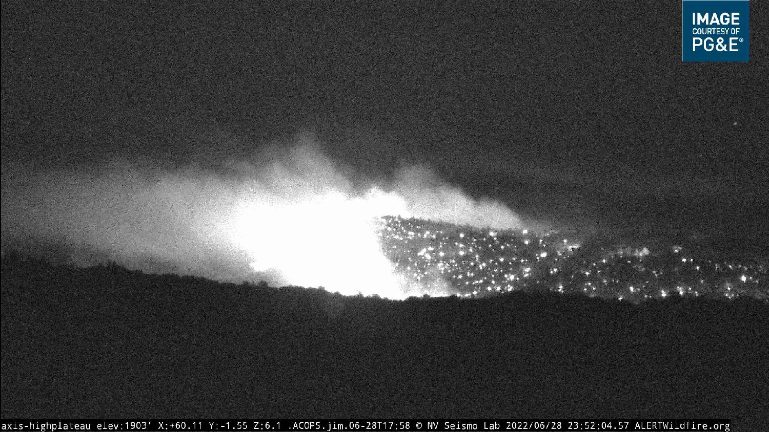
Jun 28th, 11:59:06 PM
Nothing new reported in the past couple hours. Fire continues to be active above the Yuba River and along the Eastern to S/E edge.
Freq assignments for today:
Air Tactics FM 166.9375
Air/Ground 159.405 (CDF Tac22, tone 192.8)
Air/Ground alternate 166.600
TFR victor 132.825
Rotor Vic 125.675
Helibase Deck 163.100
Addl tacs include CDF Tacs 29,30,31
And for this size of fire, probably only one of those two A/G’s will be used at least for this operating period. They’ll split the two into Cmd and Tac on larger incidents.
7:29:53 AM
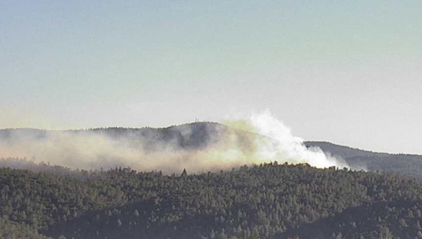
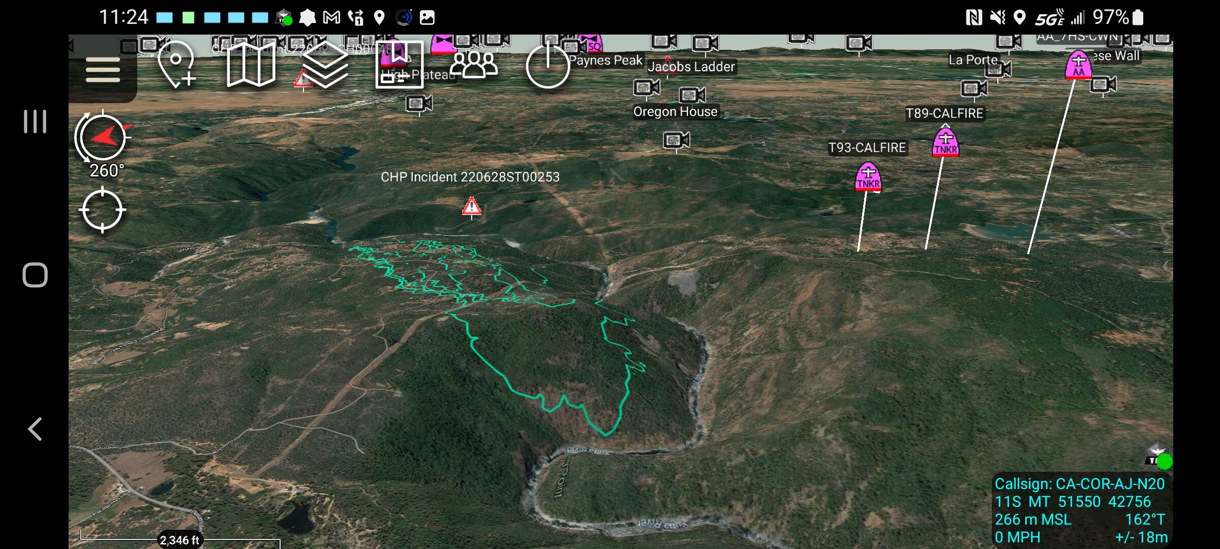
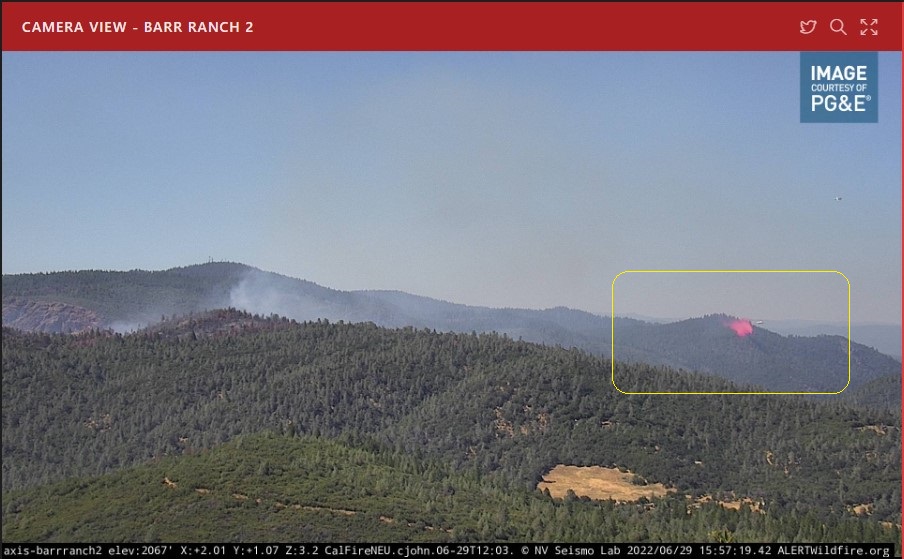
As of this morning the fire is 769 Acres and 0% Contained. Fire remains active along the northern and eastern edges in and around the Yuba River drainage.
They have a reasonable chance at success today. The fire is under 1000 acres and most of it is in favorable terrain. The head has backed down into the river which is tough ground. There are some ridges downriver from there it went down that they most likely will take advantage of.
The trick will be to keep it from crossing the river once the Delta Breeze kicks in and the column bends over.
Without competition for resources they should have everything they want including a solid stable of rotors with a quick turn around from the river. The smaller fixed wing can refill at GVAAB and the larger aircraft have a relatively short flight to MCAAB.
Yesterday the retardant did a good job and the flanks did not expand. The up canyons will will be an issue today and some channeling will be an issue .
800 acres in one burn period is not huge, especially when compared to what we have seen. The Pawnee, County, Hog, Gold and others did a lot more in one burn period at the same time of the year.
Today will be interesting, hope they can pound it with the copters and allow the troops to get some line in.
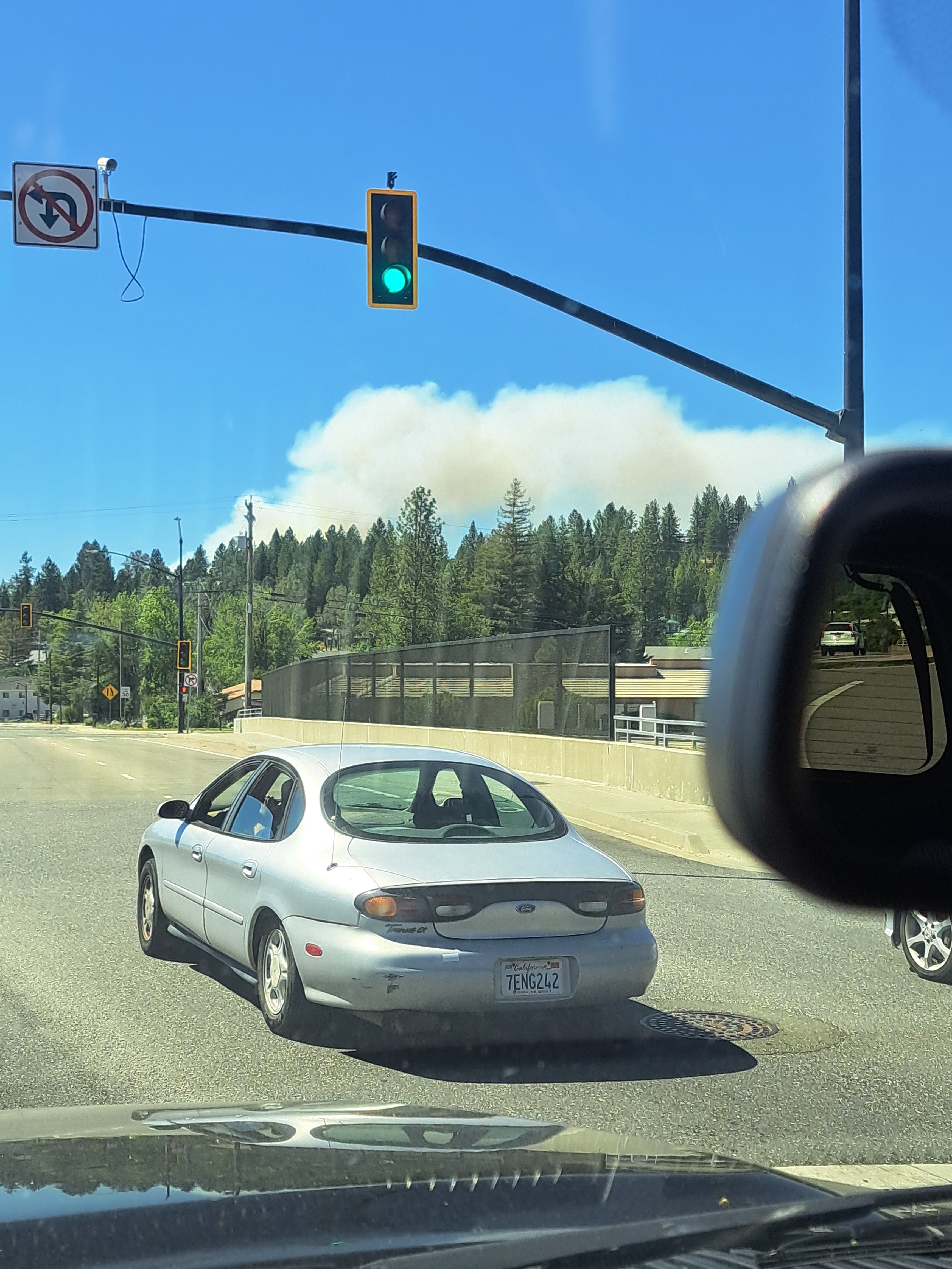
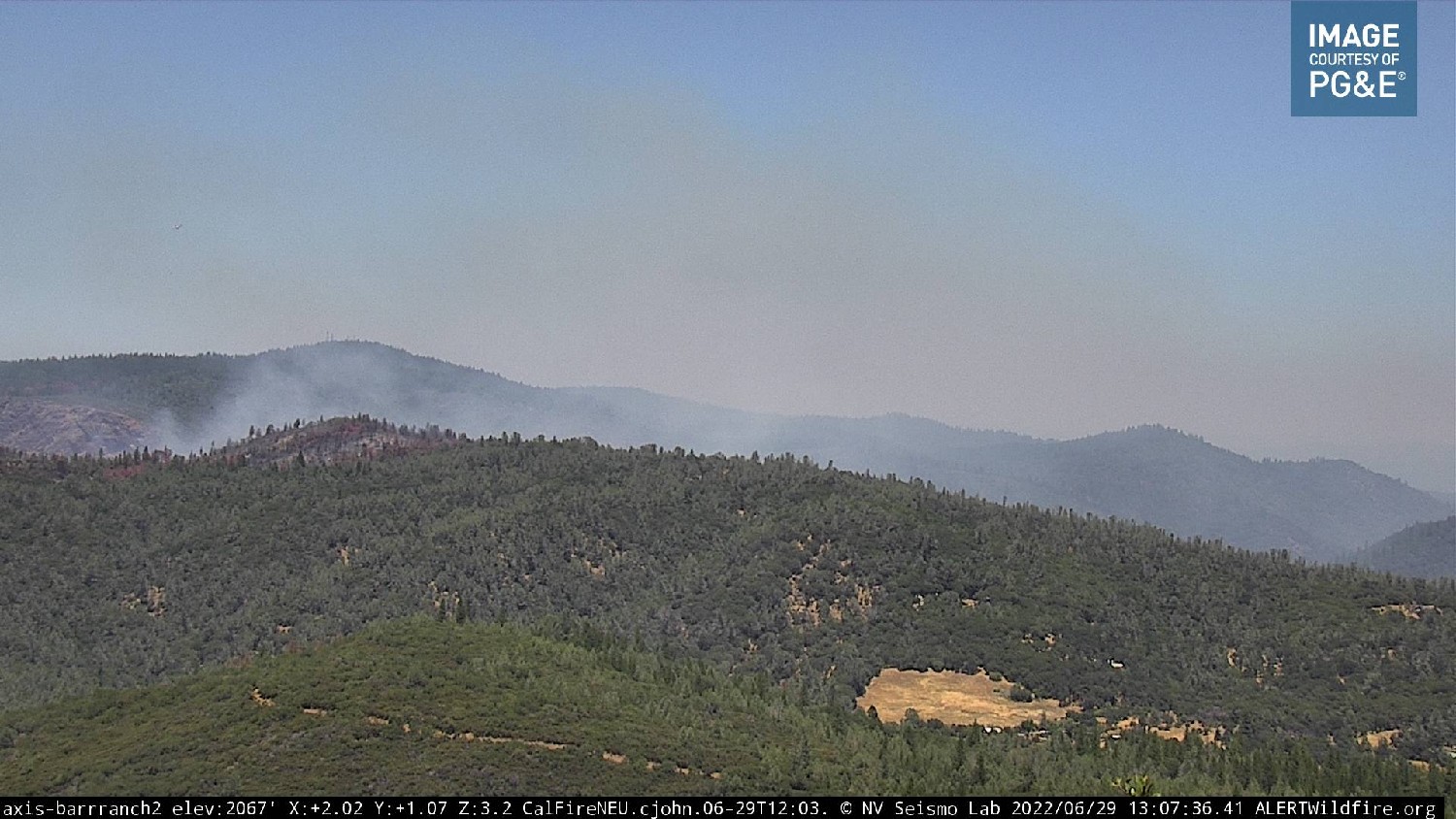
Edit… not looking great on the camera…
https://www.alertwildfire.org/region/tahoe/?camera=Axis-BannerMtn1
San Mateo County sending their OES Type 6 strike team out to the Rices at 0930.
There is damage to PG&E electrical 66KV Transmission Lines (1,676 customers without power), PG&E electrical 230KV transmission lines remain threatened. Some stats from this morning’s update. 250 people have been evacuated. No injuries have been reported. The strategic objectives have not changed.
- Keep fire North of Rices Crossings Road.
- Keep fire West of Pleasant Valley Road.
- Keep fire South of Sweetland Creek.
- Keep fire East of Yuba River.
Good summary. Ty
1:11:25 PM
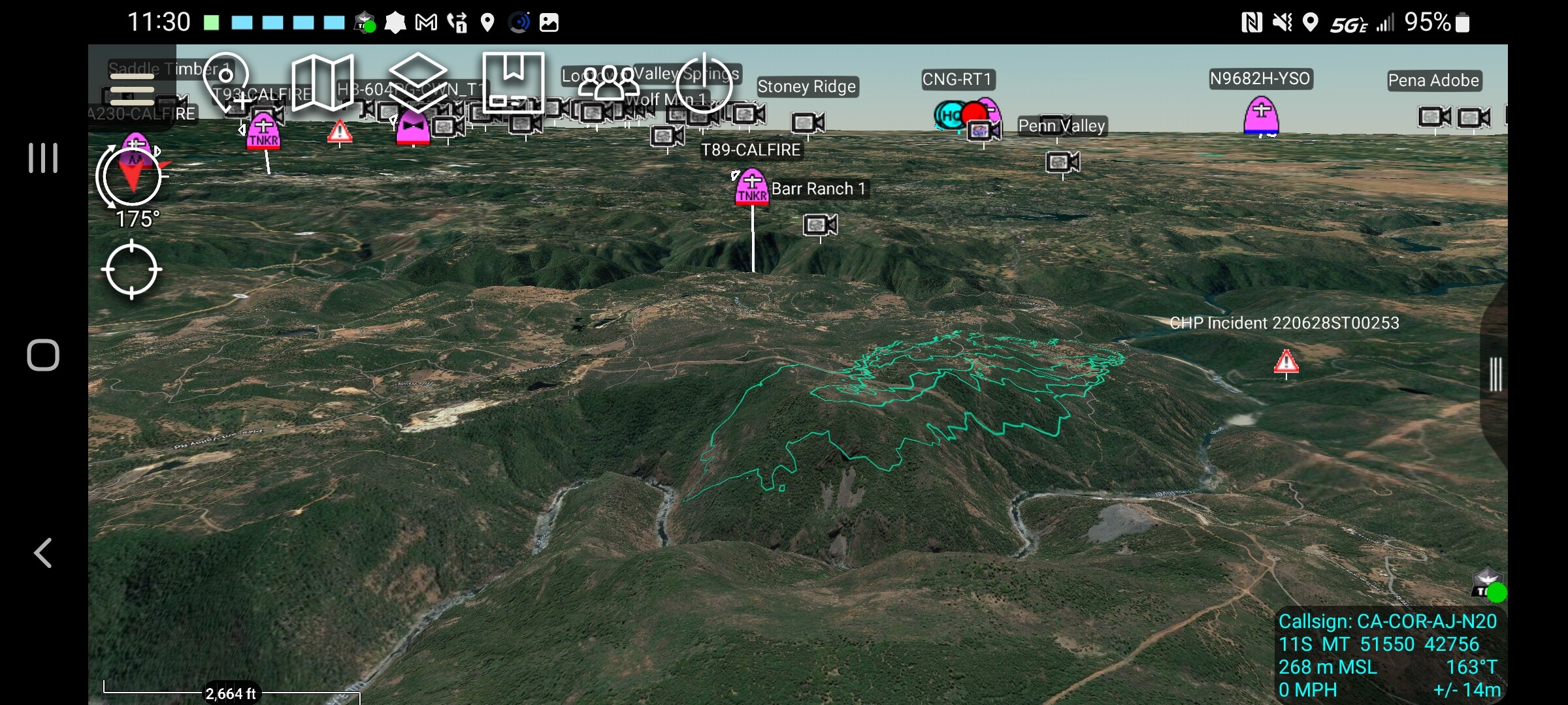
Per CalFire - Fire is approximately 900 Acres and still 0% Contained. Fire has backed down to the Yuba River in a couple locations without spotting across. Contingency lines are being built on the north side of the river in Yuba County in the event it does spot across. All evacuations and road closures remain in place at this time. Several tankers and copters are currently working the incident.
Dare I say this but it’s looking much better. Still a ton of work to go but looks like they’re doing good work out there
2:01:47 PM
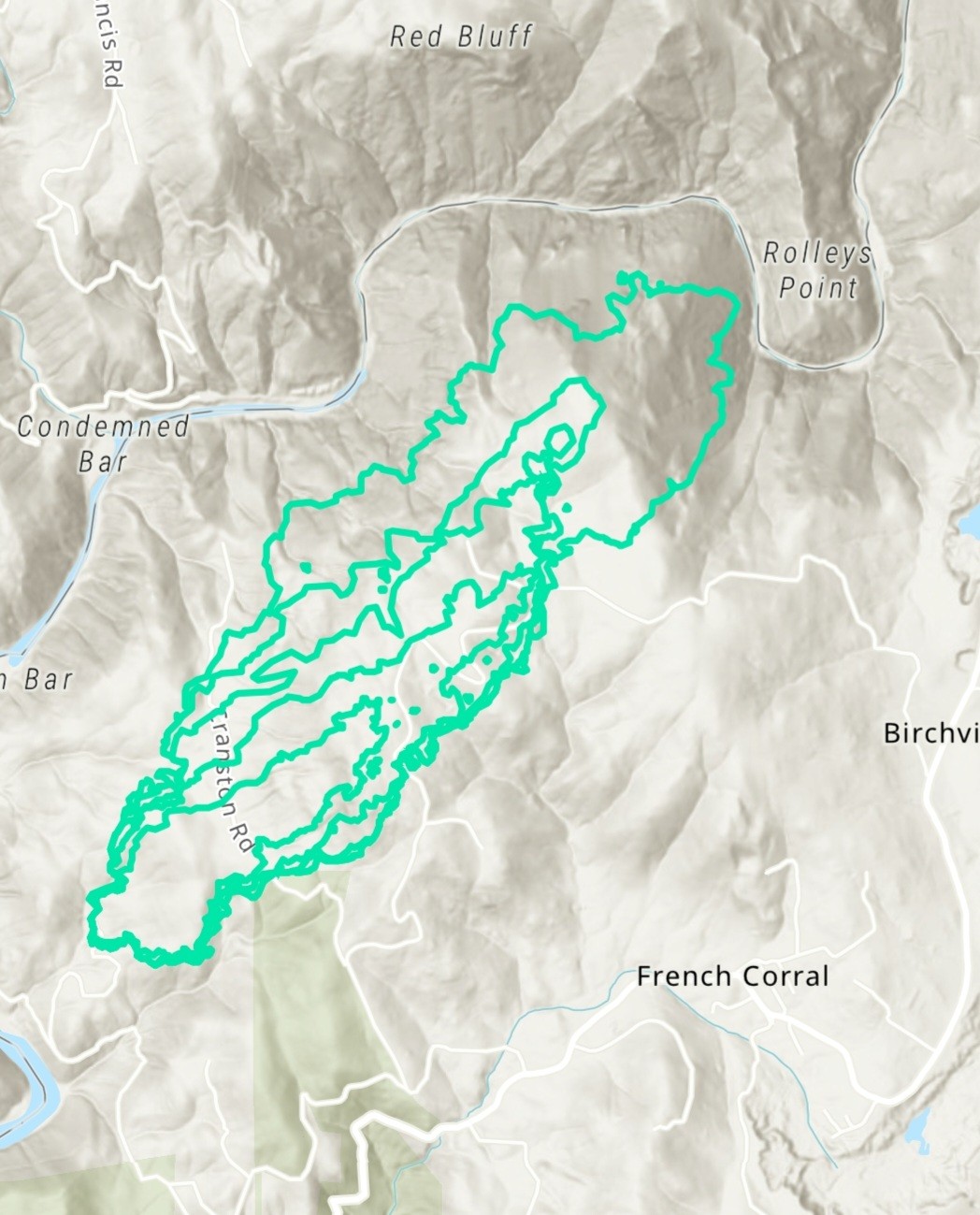
Updated mapping from FIRIS at 1:45pm has the fire at 877 Acres (updated perimeter map above)
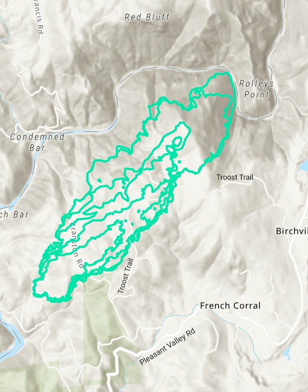
Was that a jettison to clear the ridge or pretreating? Either way that plan is down the alphabet a ways.
Playback shows a series of drops - they’re painting