Todays Freq Line Up CNF Forest Net Repeat Rx 171.4250 tone 2, to 164.8000 tone 2 air tactics 170.500.
3 Likes
Are there any new updates? I haven’t seen any on Acreage or Containment today
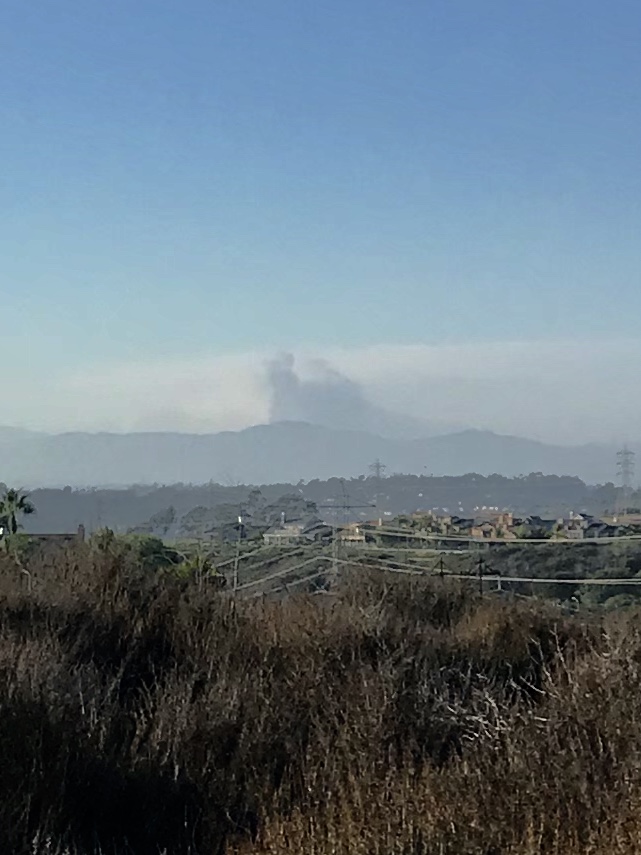
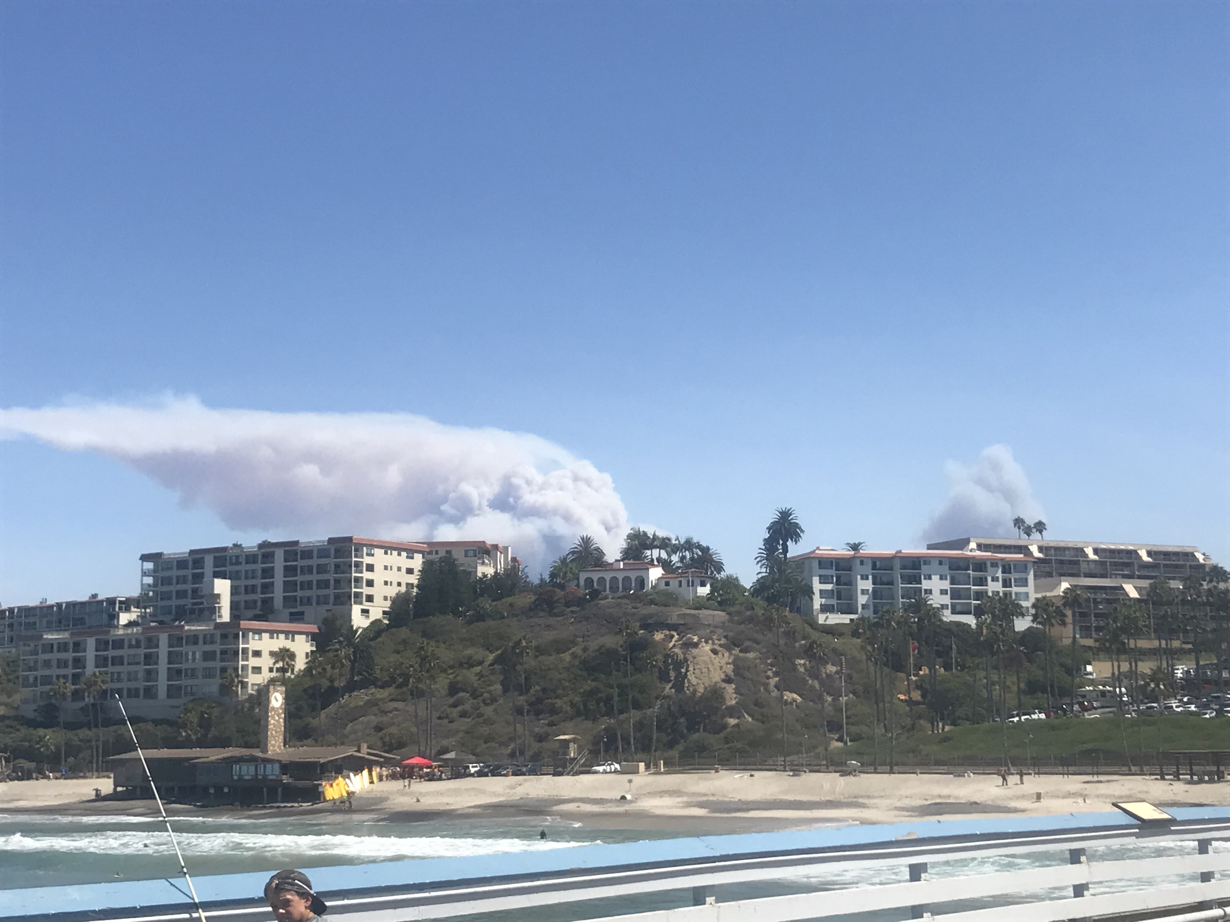
No idea on size but its very visable all the way to Northern SD
Not putting on the show it did yesterday afternoon but certainly burning well
1 Like
2% 4000 acers
That has not been updated since this morning, and it has actively been burning all day. So far, it looks like it is still burning up on the ridge lines
1 Like
Current Fire size has been reduced to 3,399 acres with 5% containment. Fogle Type 2 SOCAL Team 1 has transitioned. Fire continues to spread south, east and north with limited spread to the west. Increasing chance of monsoonal flow will bring increased RH and cooling. Change in wx could help limit fire spread potential.
1 Like
If you’ve got family in the area…it sounds like a lot of residents are confused on where to get info.
Alerts: "If you have a landline, you will receive a reverse 911 call. If you have an alternate phone number such a cell phone or VOIP, you will need to register for your county’s alerting system. Orange Co. - https://member.everbridge.net/index/453003085613900#/signup … Riverside Co. - @RivCoReady "
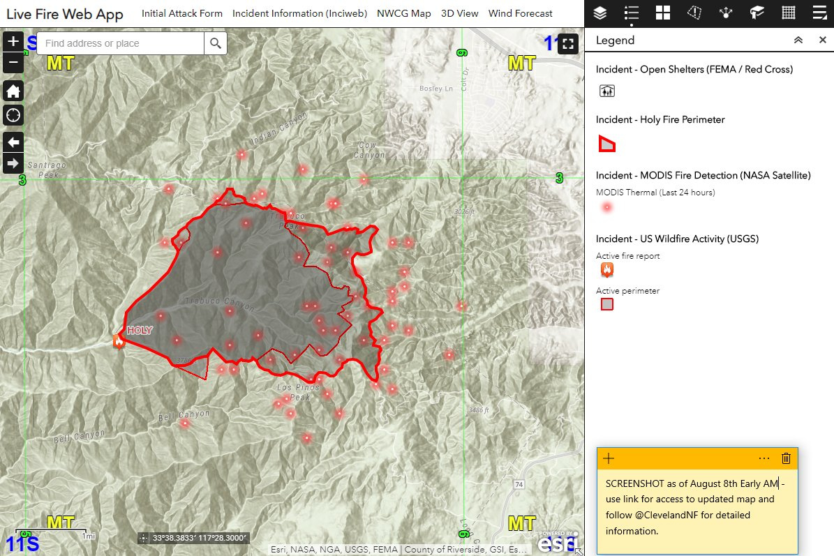
General Info: Inciweb should be a good source of information for this incident https://inciweb.nwcg.gov/incident/6106/
Map: Here is a web map app you can use to get a general idea (albeit outdated) of where the fire is / was burning: https://arcg.is/9fXmP
3 Likes
Just posted the latest perimeter from NIFC FTP to the map here: https://arcg.is/9fXmP
MODIS should update soon, but VIIRS satellite shows more progression to the East.
5 Likes
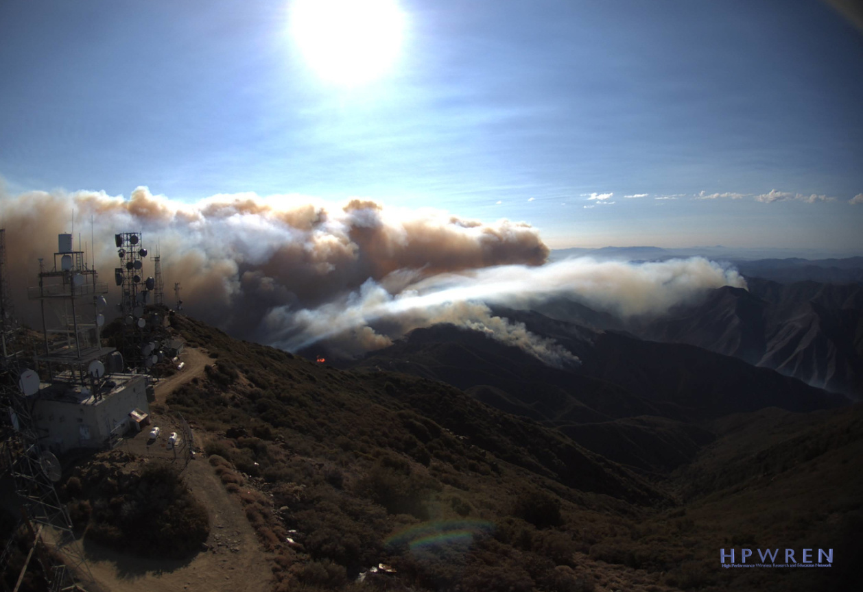
Looks to have pretty significant fire activity this morning on the eastern perimeter. There wasn’t as much of an inversion layer (if any) over the fire this morning compared to yesterday.
5 Likes
live feed:
this is burning in the 1980 #Indian foot print of 28k acres
http://www.holyjimcanyon.com/history/indian_fire.php
Started on the Indian truck trail side.
1 Like
Report of a new start in Santiago Canyon.
Looking from Santiago Peak East things have become much more active and moving closer to the communication site this morning versus yesterday…
1 Like
I assume they consider the site prepped and ready for the imminent fire front that will hit it. If i recall this is a somewhat frequent experience for the site?
Is there an update on size at all it’s been at 4K acres since the 1st night it seems
1 Like