State ID:CA
3 letter designator:PNF
Fire name:Dotta
Location:39 54.654, -120 23.406 North of Beckworth
Reported acres:10
Rate of spread:
Report on Conditions:
Structure threat:
Resources:BC-12 PNF BC-13 PNF BC-14 PNF DIV-1 PNF DZ-1 PNF DZ-2 PNF E-13 PNF E-311 PNF E-324 PNF E-332 PNF E-35 PNF E-9906 FSM H-512 MOD 19
Hazards:
Weather:
Radio channels:
Scanner link:
Webcam link:ALERTWildfire | Shasta Modoc
Agency Website:
Reported at 30 acres
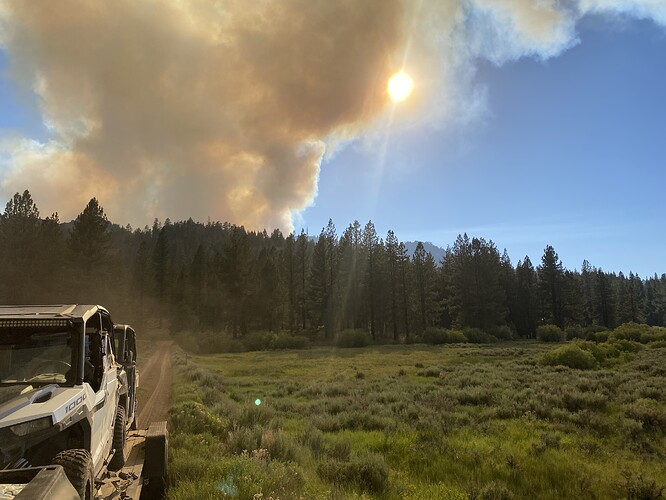
Looks to be spotting well ahead of itself.
The plume places it in the hundreds of acers via the beckworth cam. Check the PNF fire net traffic. Looks like the bowl is burning up hill on several sides.
https://caltopo.com/p/7P5A
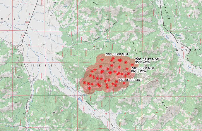
Rough estimate of fire location from the cams. This is for discussion and not for tactical decision making. Looking like 175-250 acres(Estimated not official or verified acreage).
PSA for evacuations in Dixie Valley…
Yeah, it’s taking off. The Air Attack … wasn’t real happy with what tanker drops were accomplishing.
This one might be big:
http://www.alertwildfire.org/shastamodoc/index.html?camera=Axis-Beckworth
Not sure what this maps’ two color block overlay is, maybe potential spread… no heat on this map:
https://caltopo.com/map.html#ll=39.92547,-120.38389&z=13&b=t&o=f16a%2Cr2&n=1,0.25&a=fire%2Cmodis_g
The heat signatures will show up in a few hours. It will update with the perimeter in a few hours too.
Also, not sure how close this RAWS is to fire, but it did get windy in the 20’s:
https://wrcc.dri.edu/cgi-bin/rawMAIN.pl?caCPIE
AND
https://wrcc.dri.edu/cgi-bin/rawMAIN.pl?caCMOH
Click on daily summary, then submit info for current data.
looking at webcams, this fire looks pretty docile this morning. Hopefully they get on it aggressively and early
GOES heat detections, colored by age (click the “fire info” link in the legend at the bottom) and disappearing after 12 hours, at which point there should be more accurate MODIS or VIIRS data (change the fire activity layer dropdown to “MODIS+VIIRS” to see those heat detections instead, or “all satellites” to see everything).
This fire is starting to put up a decent column and getting more active or else they are doing a burn operation. No data coming thru on this one on the forum.
Wildcad showing 350 Acres.
Anyone have any updates on the Dixie Valley side of the Dotta Fire? Looks like it’s spotted over Horton Ridge. This was Thursday night when I evacuated the family.
Incident has a more current update
Inciweb has a more current update
This fire is currently getting a good rain, but on the Cam there is a new smoke column in the bottom right corner which is where the cell was a few minutes ago.
Copy that. Ready to head out on the phone call.
Looks like they might be calling it a new fire.
Interesting. Thanks for the heads up

