State ID:CA
3 letter designator:PNF
Fire name:Murphy
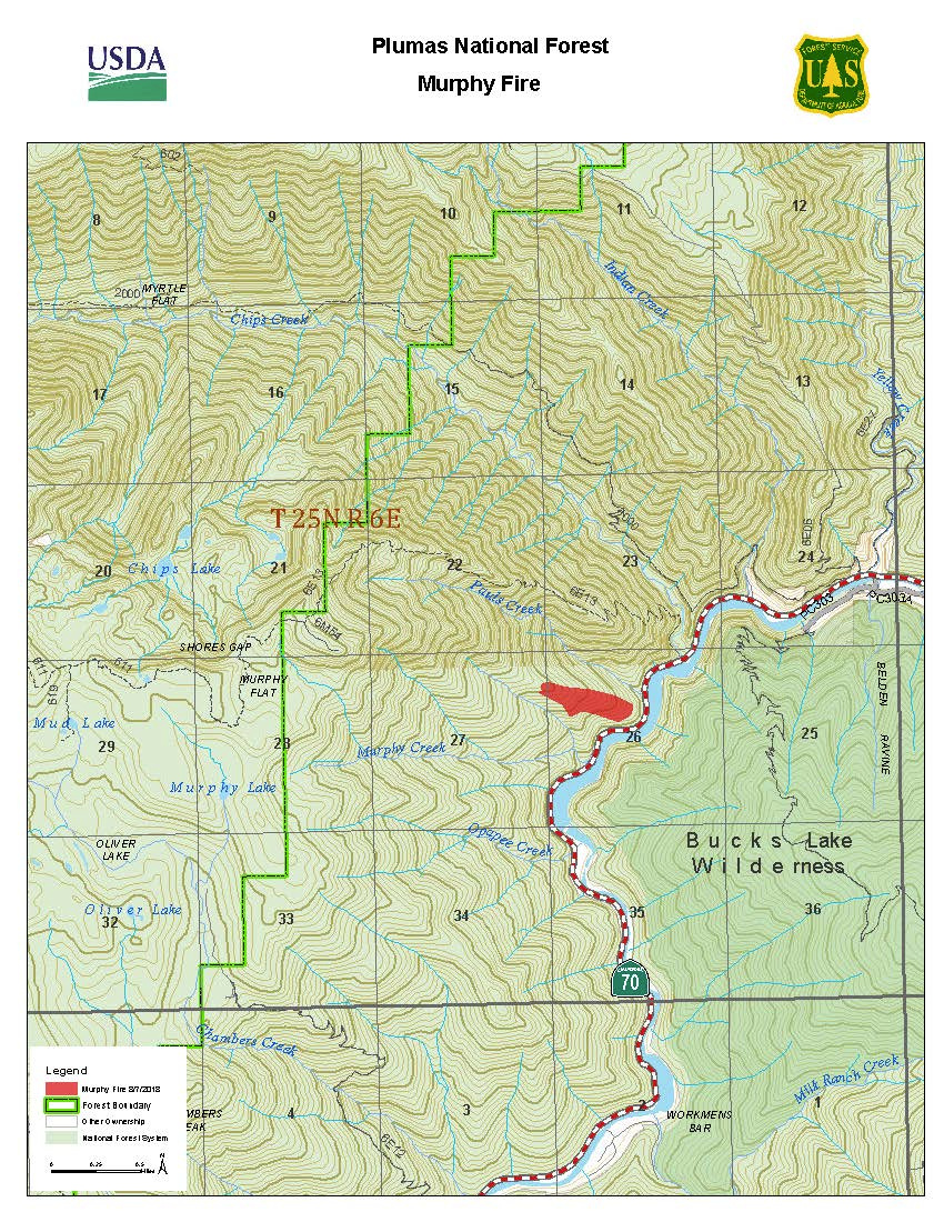
Location:Between rock creek and chips creek
Reported acres:100
Rate of spread:moderate
Report on Conditions:Activity burned throughout the night
Structure threat:Yes
Resources:
Hazards:
Weather:
Radio channels:
Scanner link:
Webcam link:
Agency Website:
1 Like
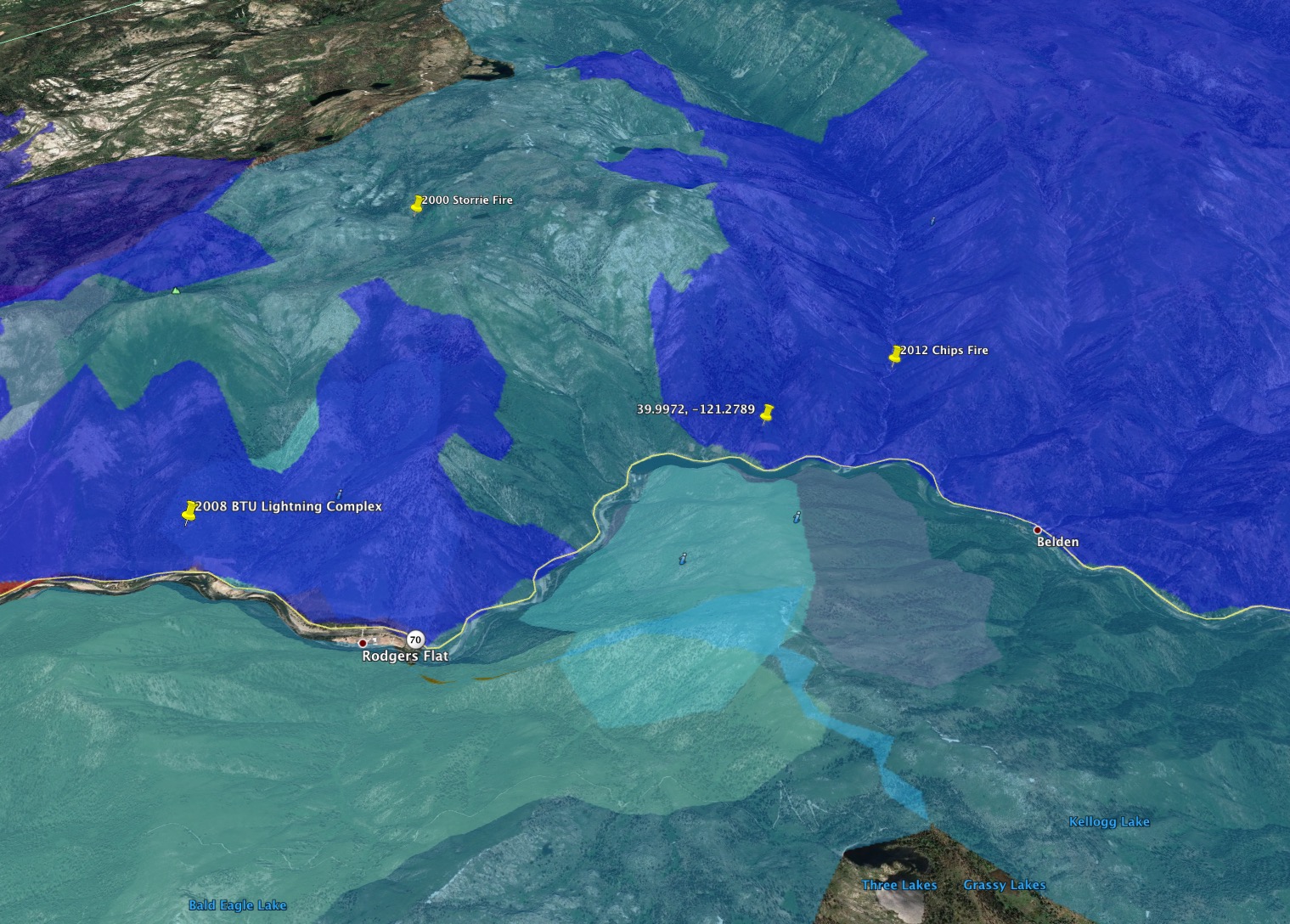
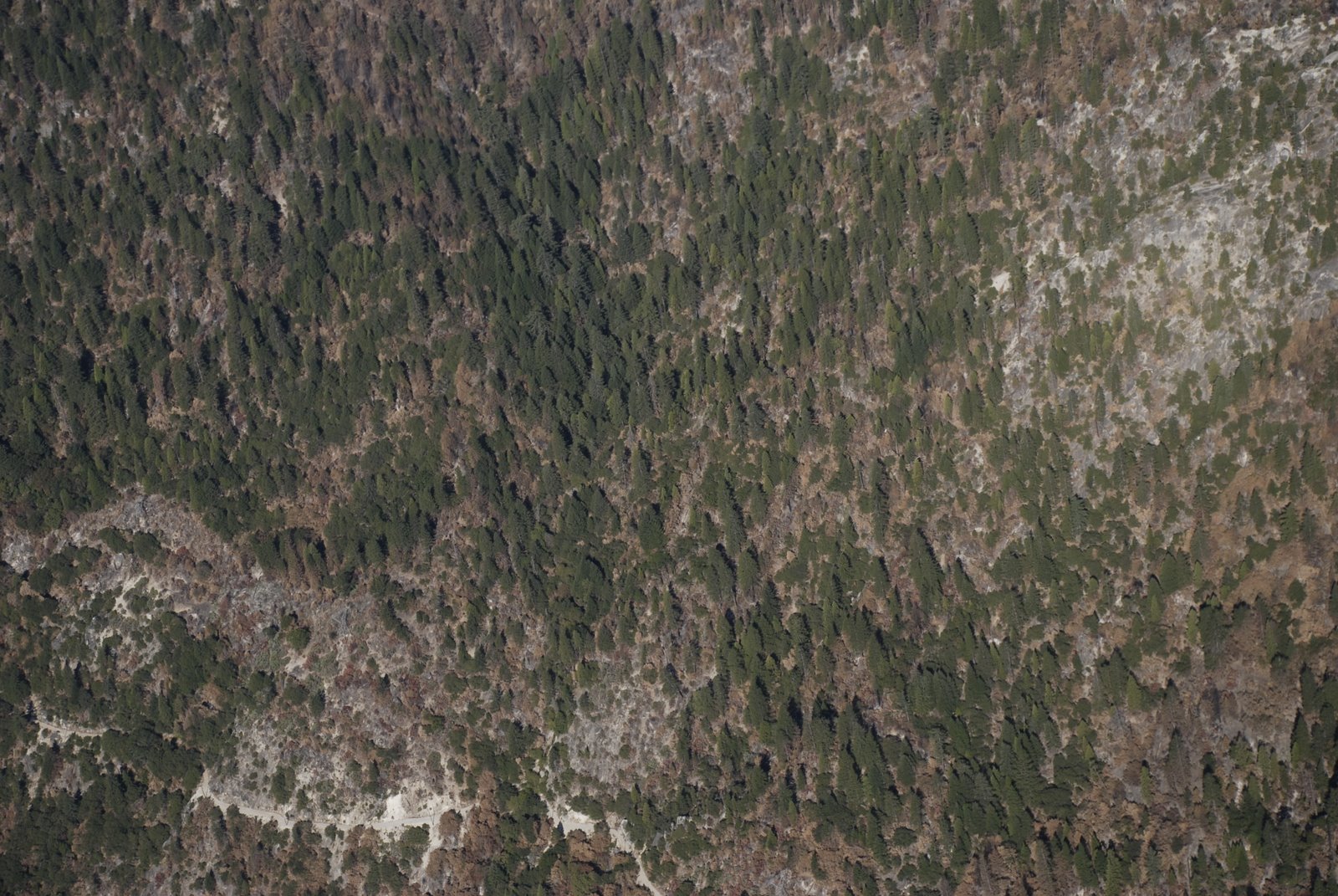
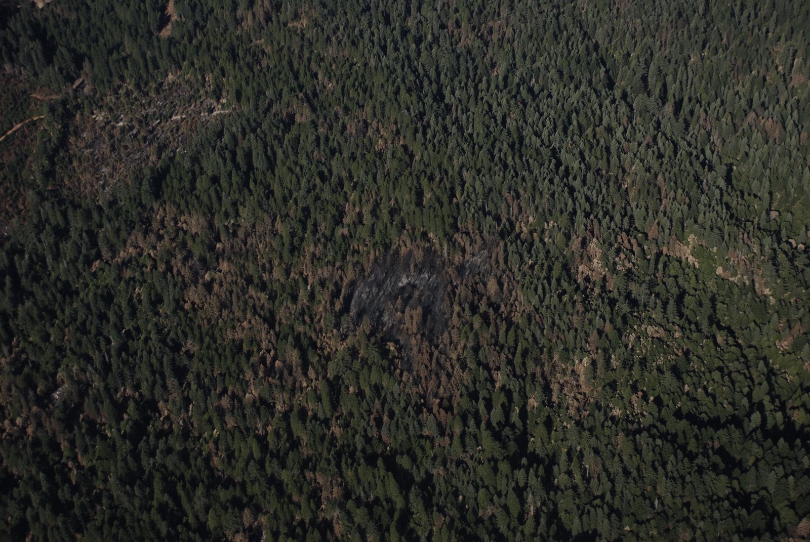
The upper slopes here burned hot during 2000 Storrie Fire, and again in 2008. Lots of heavy heavy dead and down in areas that didn’t get reburned in 2008.
1 Like
Where is the exact location of the fire area?
39.9972, -121.2789
1 Like
Hwy70, north/west side, at Rock Creek Reservoir.
From GACC updated at 1300hrs:
CA-PNF Murphy Fire: 50 acres, grass, timber, 0% contained. Fire is actively burning with uphill runs. Infrastructure currently threatened includes 240kv power lines, hydro-electric resources, railroad infrastructure, and natural resources. Depending on local weather conditions throughout the day, the community of Maggie’s Place could become threatened. Highway 70 is currently open to controlled traffic.
1 Like
Not time for humorous emojis. Not a good place for a fire.
1 Like
“Not time for humorous emojis. Not a good place for a fire.”
Well, there are lots of different value judgements we make about fire on the landscape. This is a good place for a fire if the goal is to clean up after a bunch of 6,10, and 18 year old burns.
The Storrie Fire burned hot in this area, and a lot of the trees that survived the recent fires are likely to survive this fire, and the fire will do a lot of work that we don’t have the capacity to get done any other way. The land in the canyon isn’t managed for timber, so we aren’t burning up anything we were planning to log, anyway, and this is about the natural fire return interval we’d have had here before fire suppression.
It’s hot and dry, but the area is smoked in under a heavy inversion, and fires burning under similar conditions in 1999 and 2008 did a lot of good underburning, getting good fire back on the landscape. The fact this fire isn’t already 5,000 acres tells you something about the burning conditions out there.
I agree that it’s a terrible place to FIGHT fire - I’m hoping we don’t commit too many people to stand on a cliff under a bunch of rolling rocks trying to put out a fire that’ll probably do more good than harm.
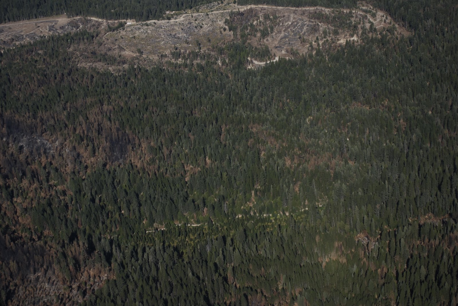
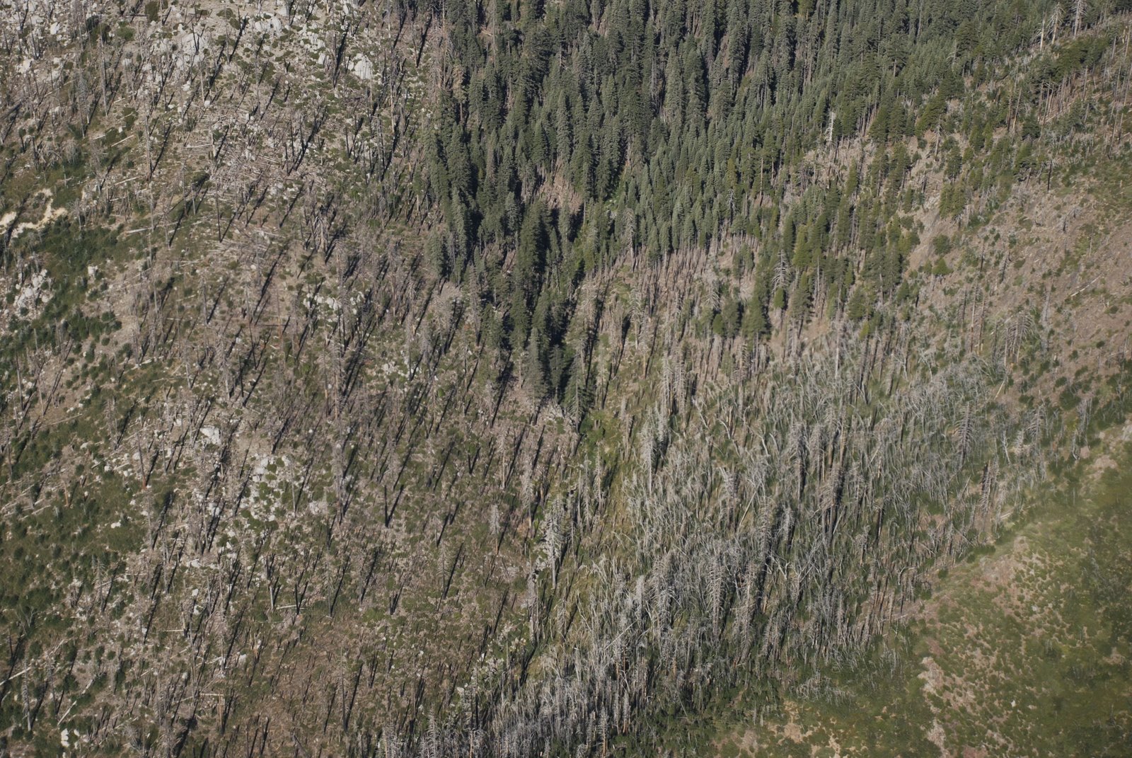
Here are a couple photos of fire effects in the Feather River Canyon after the 2008 BTU Lightning Complex. Note that 100% of the area in these photos burned about a month before the photos were taken.
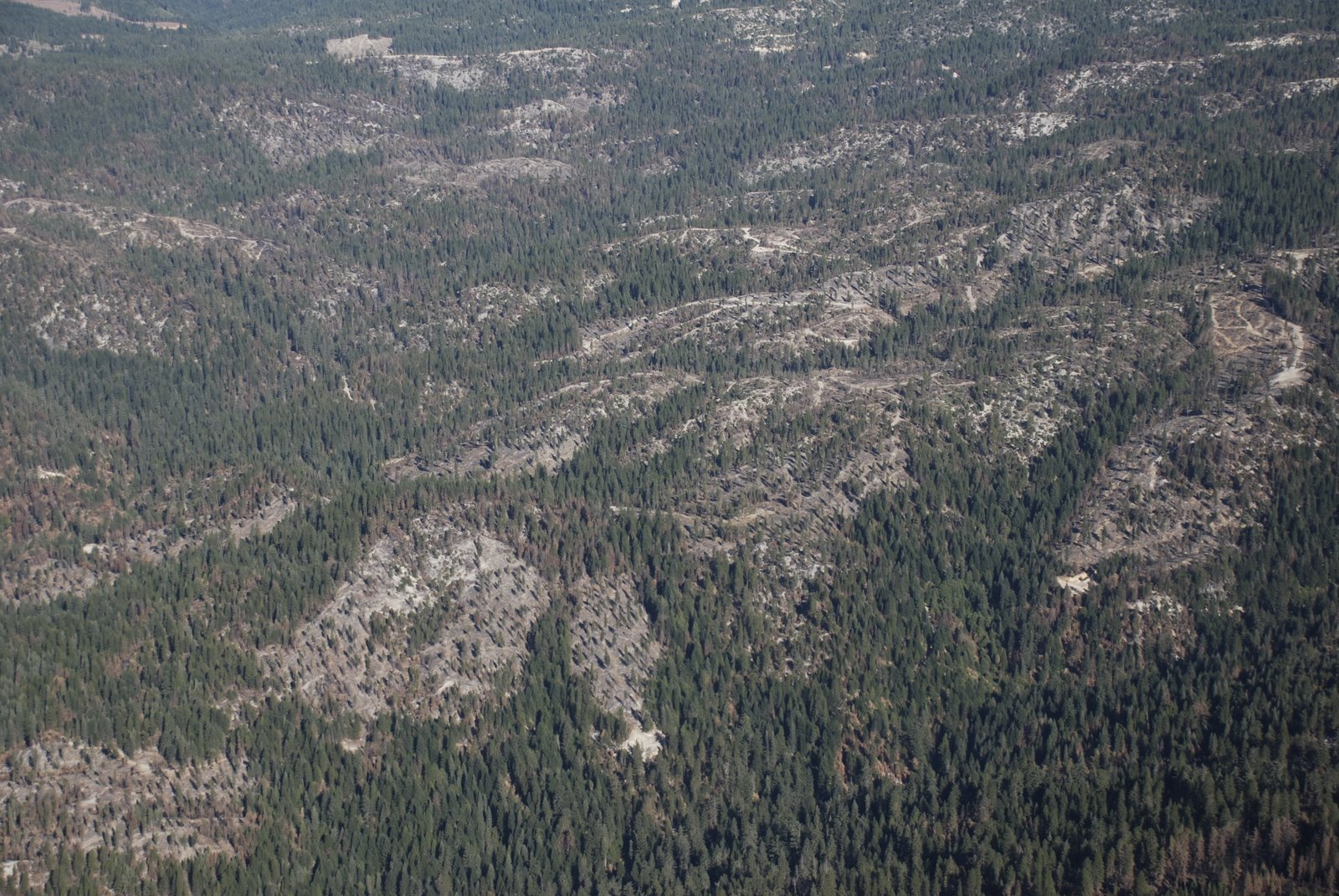
And a 2008 photo of the hot burn from the 2000 Storrie Fire near where this current fire is burning.
9 Likes
Well I doubt it but maybe they’ll manage it?? They might have too with the current lack of resources.? Probably the smarter thing to do. But what do I know…
Managed burns should happen more in areas like this… It seems works well on the sqf.
1 Like
If I ever used emojis this would be the time. I like that critical distinction between place to fight fire and place to have a fire.
3 Likes
Folks please take general conversations to the “General Discussion” section. Let’s keep the IA section dedicated to specific incident info. IA isn’t a place for speculation, past fire behavior info or General Discussions. Thanks!
13 Likes
Status check - any current or final intel would be appreciated.
1 Like
I heard NorCal 2 IMT is being assigned.
No idea on a status of the fire, though.
2 Likes
This is off the PNF Face Book Page…at least it’s something.
UPDATE - 10:30am
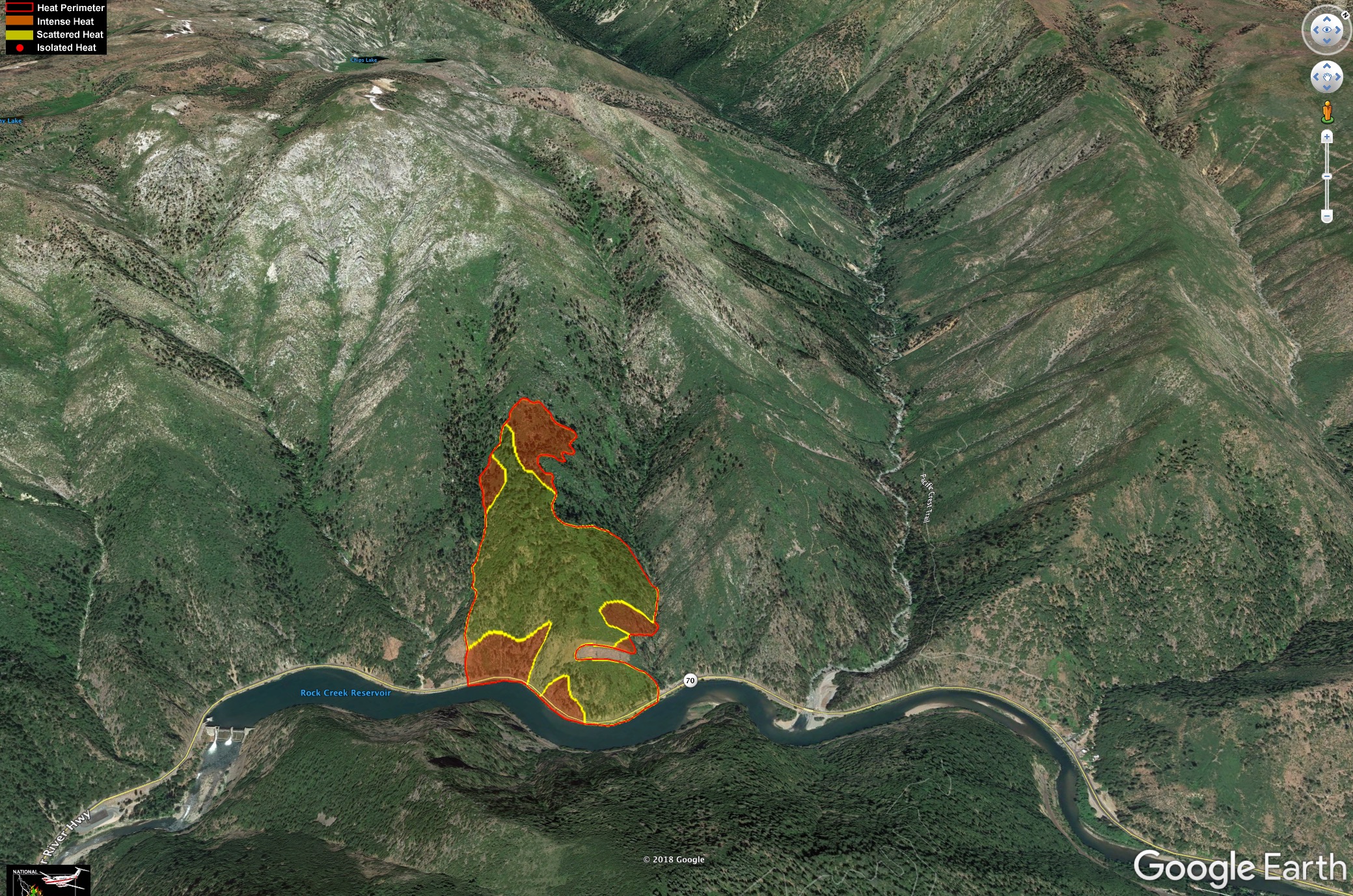
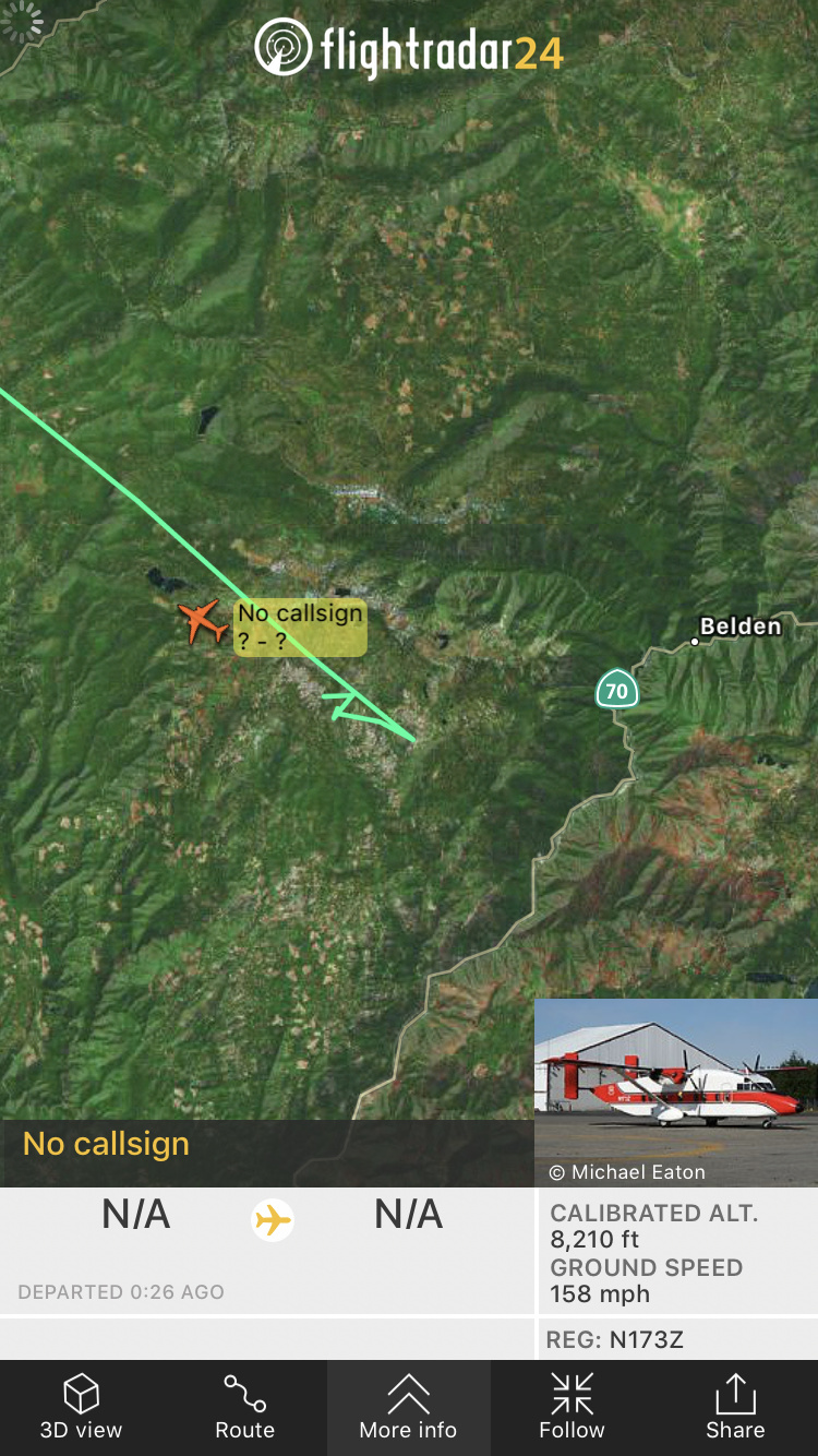
Attached please see a map of the Murphy Fire. This is for general placement purposes and boundaries will/have changed somewhat. The fire remains north/northwest of Hwy 70. Typical to fires in this area, there are occasional flare-ups, short runs, rollout, and what firefighters call “skunking” around. The air inversion has kept a lid on things (quieted it down) but has also lessened visibility for aircraft. Expect similar fire activity today.
Along Caribou Road, the Gansner Bar campground is being used as fire camp currently. North Fork and Queen Lily Campgrounds (just up the road) are under the same precautionary warning (voluntary evacuation) as the immediate area.
The Pacific Crest Trail is closed from Belden to Highway 36 as are smaller trails in the immediate vicinity of the fire including, Chambers Creek, Yellow Creek, Ben Lomond and Indian Springs.
The Murphy Fire was reported in the early hours of Tuesday, August 7 and started between Murphy and Paul Creeks, north of the Rock Creek Dam along Hwy 70.
Wednesday, August 8 - 8:30am
Good morning Belden area and surrounding communities! Per usual, the nightly inversion pushed smoke to the ground. This will lift as the day progresses. Although there was some active fire (#MurphyFire) last night, acreage has largely held (100 acres (ish)). CalTrans has one-lane controlled traffic in the immediate fire acre along CA Hwy 70. The soft and hard closures last night were due to rolling rocks and other debris. The same type of scenario may occur later today as well. The Plumas County Sheriff has indicated the voluntary evacuation (precautionary warning) will remain in place today and be evaluated after the burn period early this evening. We continue to be on the receiving end of smoke from fires south of us. Kudos to the Red Cross team for their efforts on behalf of our communities and having a center in place (274 Lawrence Street, Quincy) in case it’s needed
1 Like
You’re correct, In brief at 5pm
1 Like
Thanks for the info…be safe out there!