State ID:
3 letter designator:
Fire name: Sheep Fire
Location:Near Fleming Sheep Camp on the Mt. Hough Ranger District, Plumas National Forest
Reported acres: 300 acres
Rate of spread:Monday August 17th, 2020 approx. 09:00 AM
Report on Conditions:
Structure threat:
Resources:
Hazards:
Weather:
Radio channels:
Scanner link:
Webcam link:
Agency Website:https://data.rgj.com/fires/incident/6997/north-complex/
1 Like
40.274 latitude, -120.757 longitude Doesn’t look like either many aircraft air committed or available?
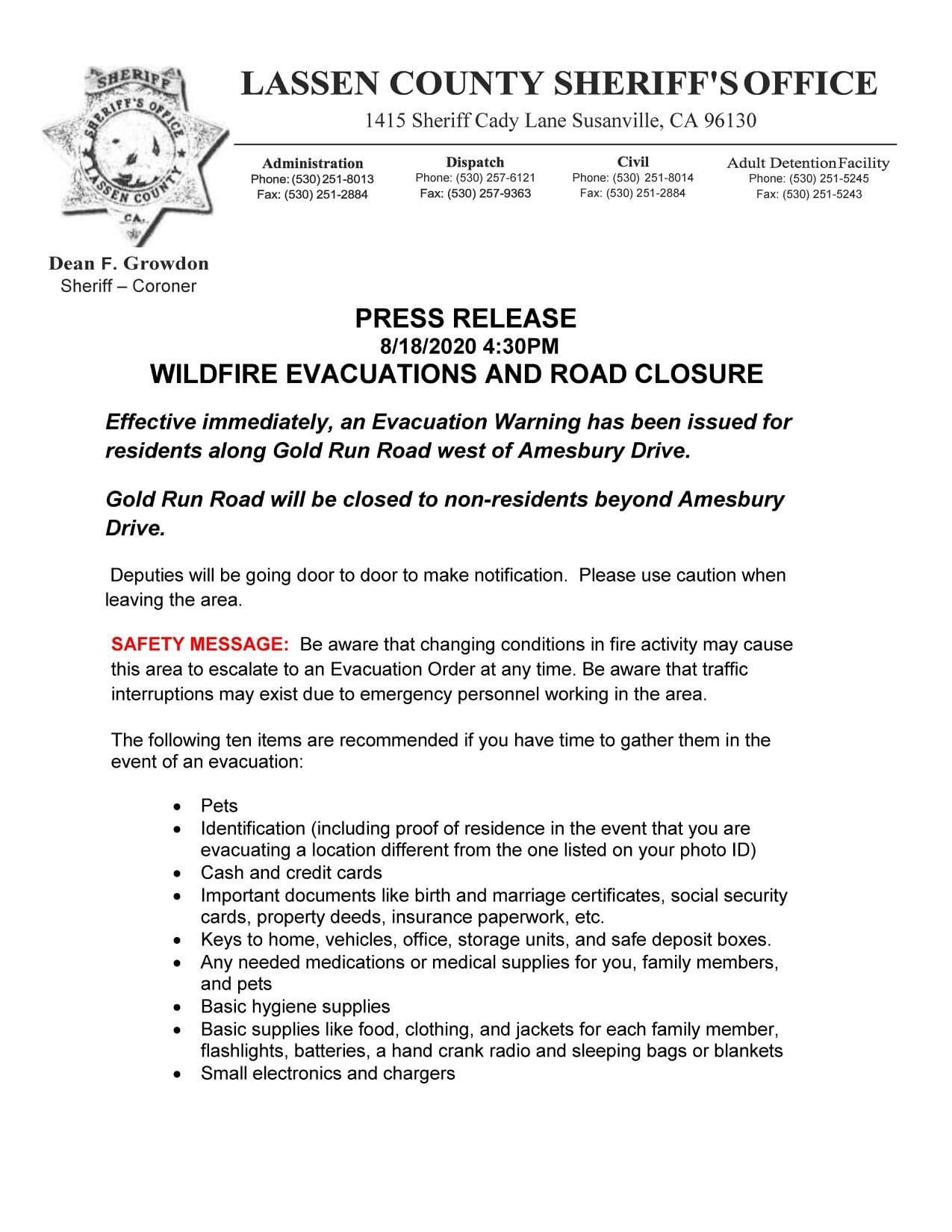
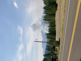
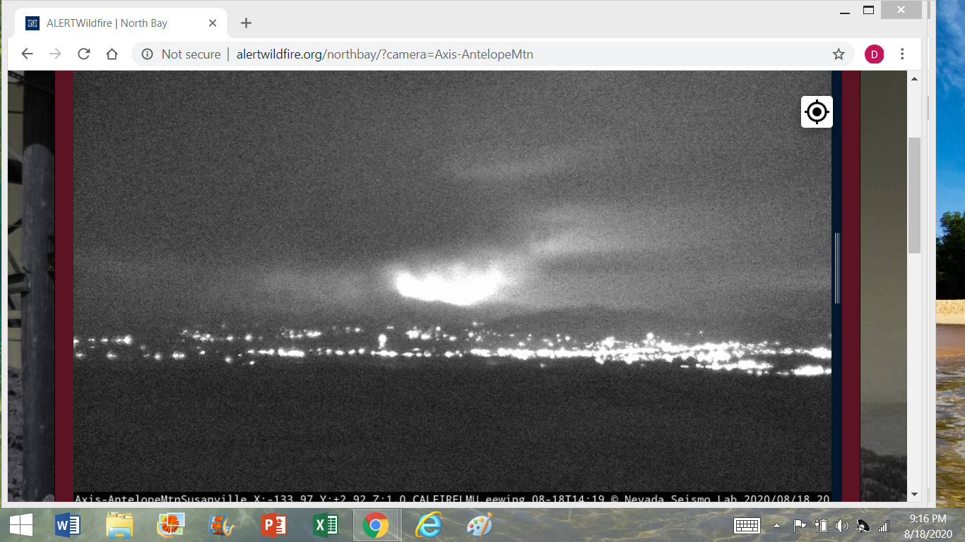
From Antelope Mtn camera at Susanville looks like a column is building
Aircraft is at a premium currently. As well as crews. We’re in it for the long run at this point.
2 Likes
California Interagency Incident Management Team 1(Type 1 Team) is being requested to the Plumas NF. In-Brief at 1000 hrs at Supervisors Office. McGowan IC.
1 Like
I think it’s safe to assume that resources are woefully stretched thin at this point. This situation has echos to the 2018 fire season.
1 Like
Lassen County SO issuing evacuation warning for areas of Gold Run Rd.
Scanner Link(s): SO- https://m.broadcastify.com/listen/feed/28384
Fire (LMU, NOD & LNF)- https://m.broadcastify.com/listen/feed/33299
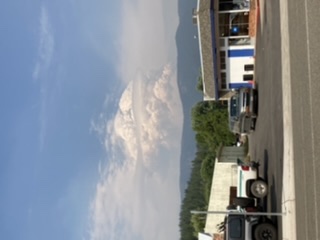
Taken at 1630 from greenville
From Susanville Antelope cam.
Also 2003 and 1970.
1 Like
Fire is making a run down Diamond Mountain towards the Gold Run area.
Mandatory evacuations for Gold Run Rd. west of Amesbury Dr.
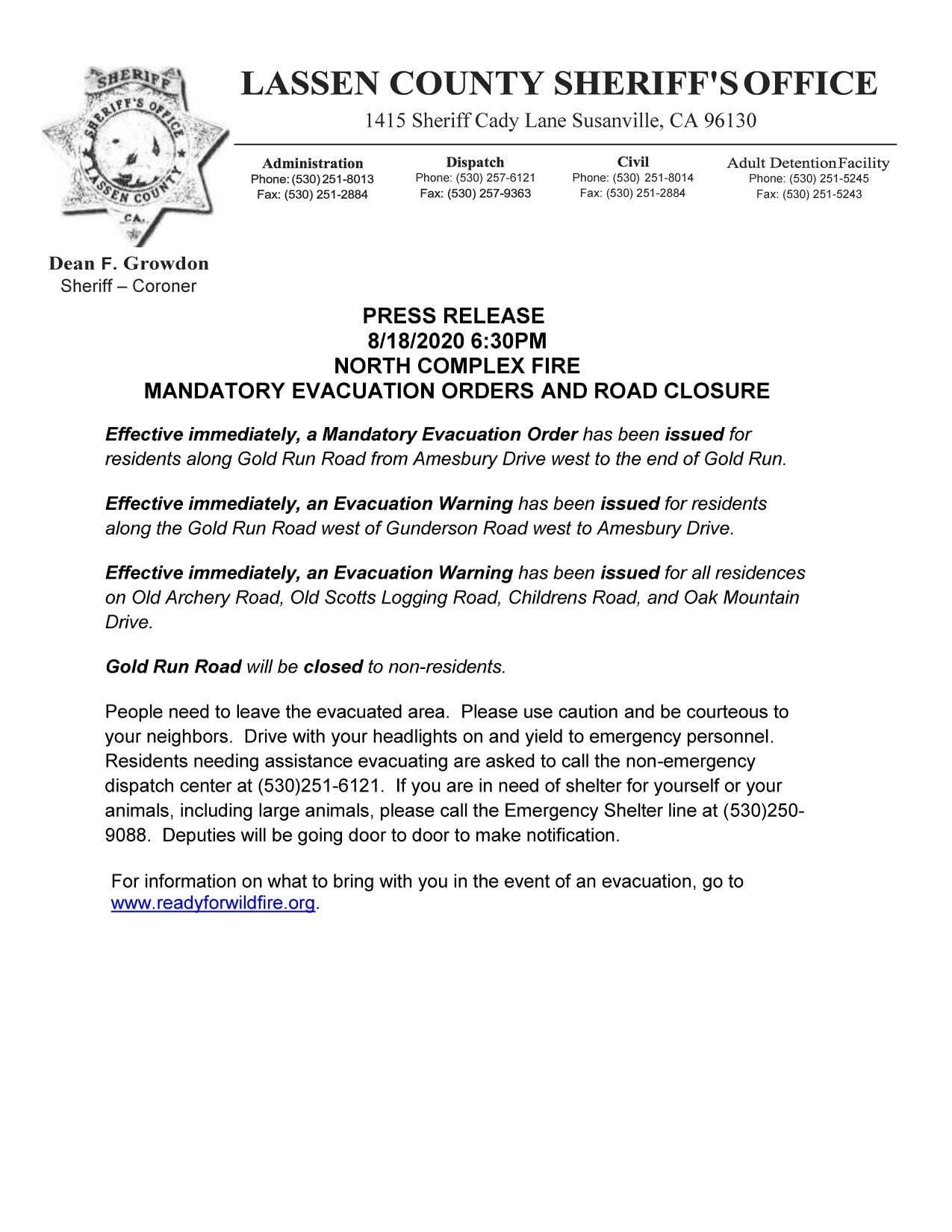
1 Like
Has crested Diamond Mtns at 1800 acres as of this afternoon
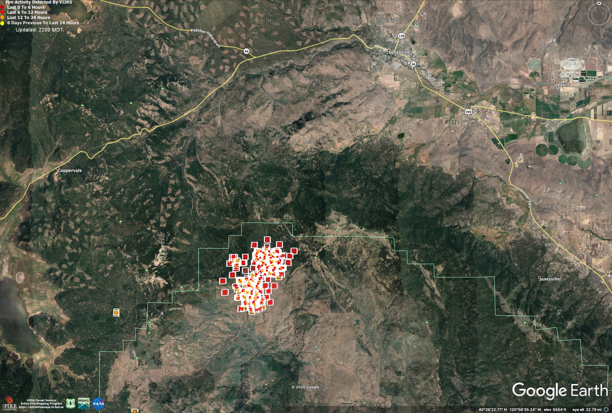
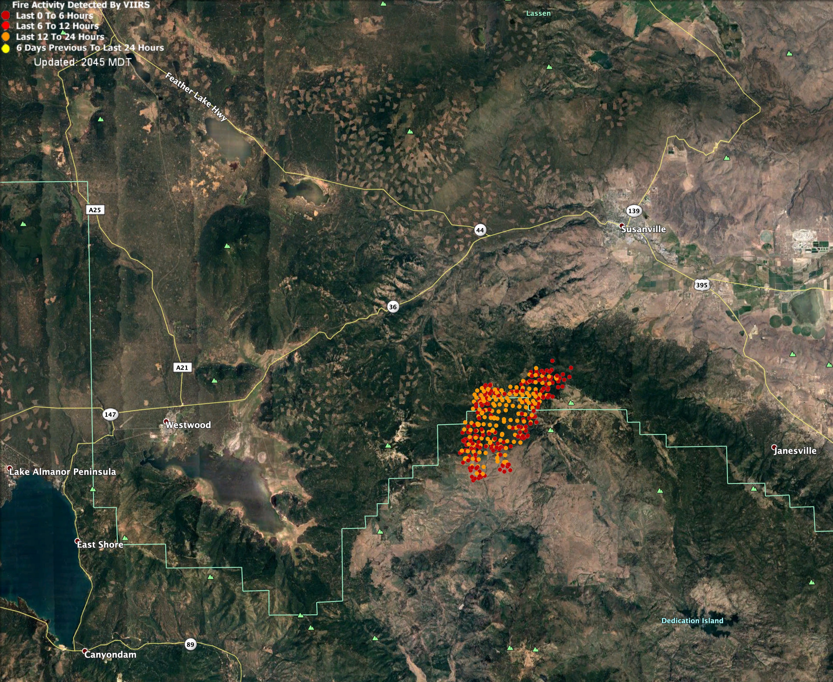
VIIRs heat data from 1500, today. Since then the fire has moved over the ridge to the NE, becoming established in the top of the Gold Run watershed.
Tomorrow’s forecast is pretty dire, fire weather will be severe, and suppression resources are extremely tapped from major fires all over Northern California. It is likely the fire will run NE all the way to the Valley floor.
Spot Forecast for North Complex…USFS
National Weather Service Reno NV
556 PM PDT Tue Aug 18 2020
…RED FLAG WARNING IN EFFECT FROM 1 PM TO 9 PM PDT WEDNESDAY FOR
GUSTY WINDS AND LOW HUMIDITY…
.DISCUSSION…
Temperatures will remain hot with a mixed bag for humidity recoveries
overnight. Drier air begins to work into the region for the middle into
the end of the week with poor RH recoveries Wednesday and Thursday nights.
Gusty southwest winds are likely Wednesday afternoon, which will likely
bring critical conditions to the area as humidity falls. More typical
westerly zephyr breezes are likely Thurs-Fri.
.WEDNESDAY…
Sky/Weather…Sunny. Smoke and haze in the morning.
Temperature…63-66 at forecast start…Max 85-88.
RH…46-49% at forecast start…Min 12-15%.
20-Foot Winds…Upslope 3-7 mph becoming southwest 15-20 mph
with gusts up to 35 mph after 1300.
LAL…1.
Chc Wetting Rain…0%.
Mixing Height…3700 ft agl in the morning increasing to
6700-7700 ft agl around 1200.
Transport Winds…Light winds becoming southwest around 30 mph
after 1300.
Ventilation…Fair increasing to excellent in the afternoon.
Haines Index…4-5.
$$
Forecaster…LaGuardia
Requested by…Kelly Mosinski
Type of request…WILDFIRE
.TAG 2011123.1/REV
.DELDT 08/18/20
.FormatterVersion 1.0.26
1 Like
Great update! Thanks. 35mph after 1300 hrs. Look out!
1 Like
VIIRs heat detection data from 2am, 8/19/2020
1 Like
Can you post a link to VIIR please?
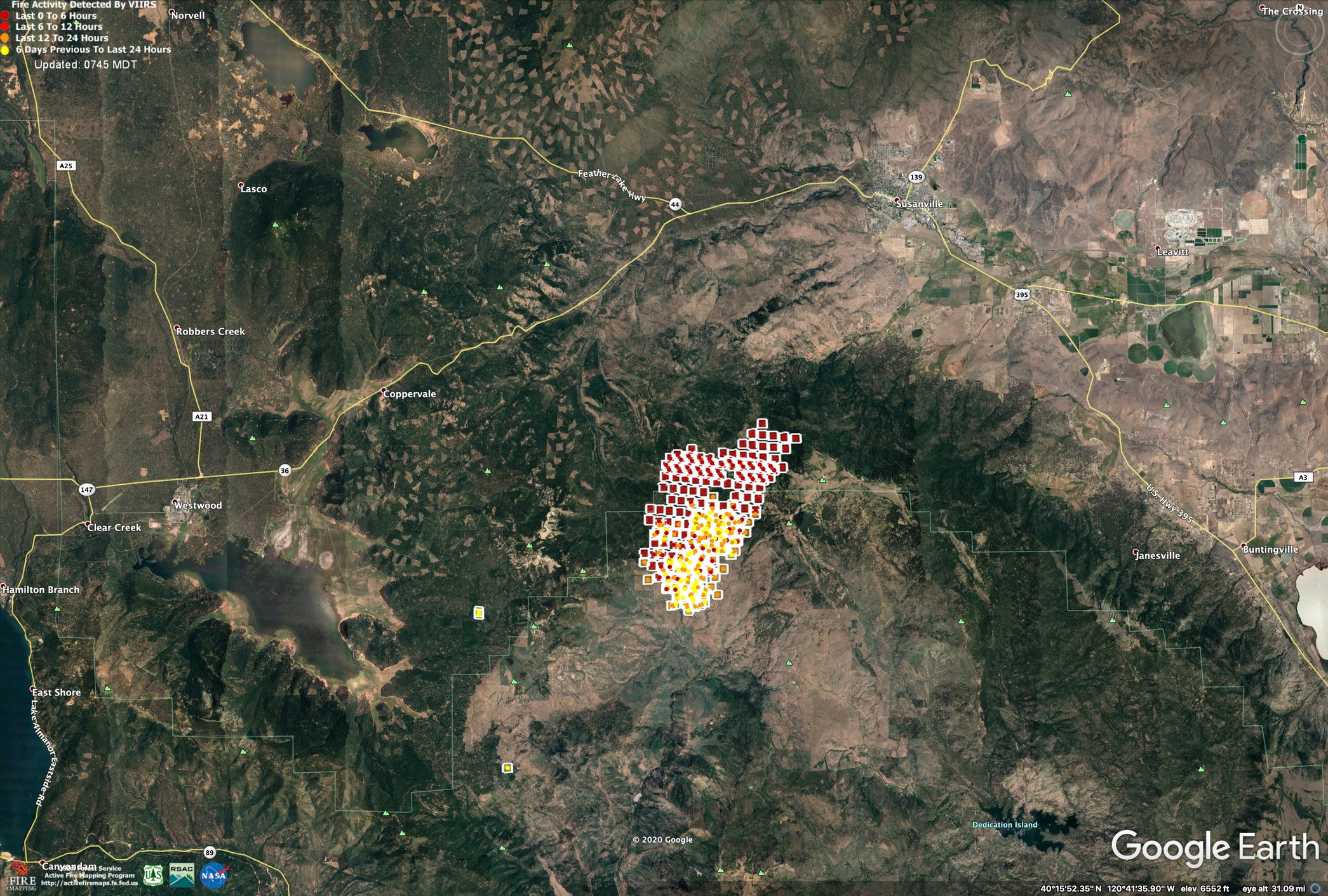
Here is VIIRs data from about 1400, 8/19/2020.
Orange dots may have some inaccuracies.
Red is growth between 0800 and 1400hrs.
The infrared view on the Antelope Camera seems like it shows fire quite a ways down the hill toward the Valley floor.
Additional evacuation orders have been put in place. Fire is making a rapid push down the slopes of Diamond Mountain towards the area of the Diamond Mountain Gold Course along Richmond Rd.