@Theengineer was just reporting how the BCSO was reporting:
FROM THE TOWN OF PARADISE:
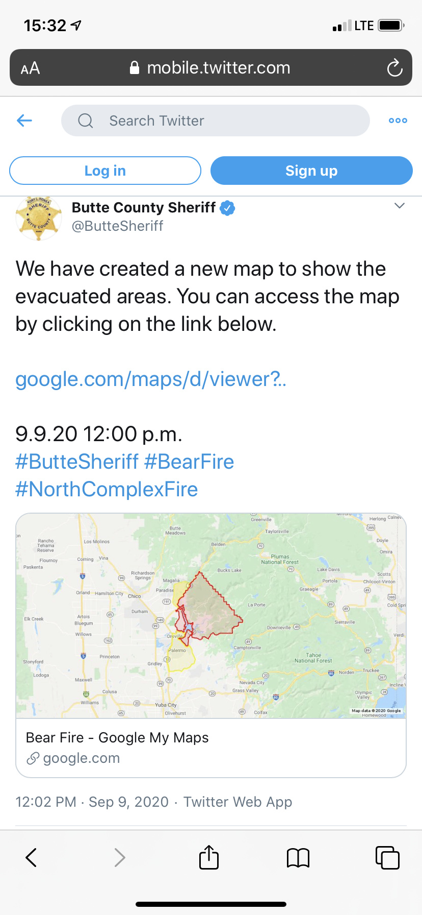
Bear Fire Update 8:45 am 9.9.20
An Evacuation Warning has been issued for Paradise Zone 14, east of Pentz Rd. Evacuation warnings have been issued for the Concow area. Cal Fire is closely monitoring Pentz Rd. for spot fires. We will update as the situation progresses. Click here for a zone map: https://www.townofparadise.com/…/1757-2017-paradi…/fileClick here to look up your zone by address: https://buttecountygis.maps.arcgis.com/…/Inform…/index.html…
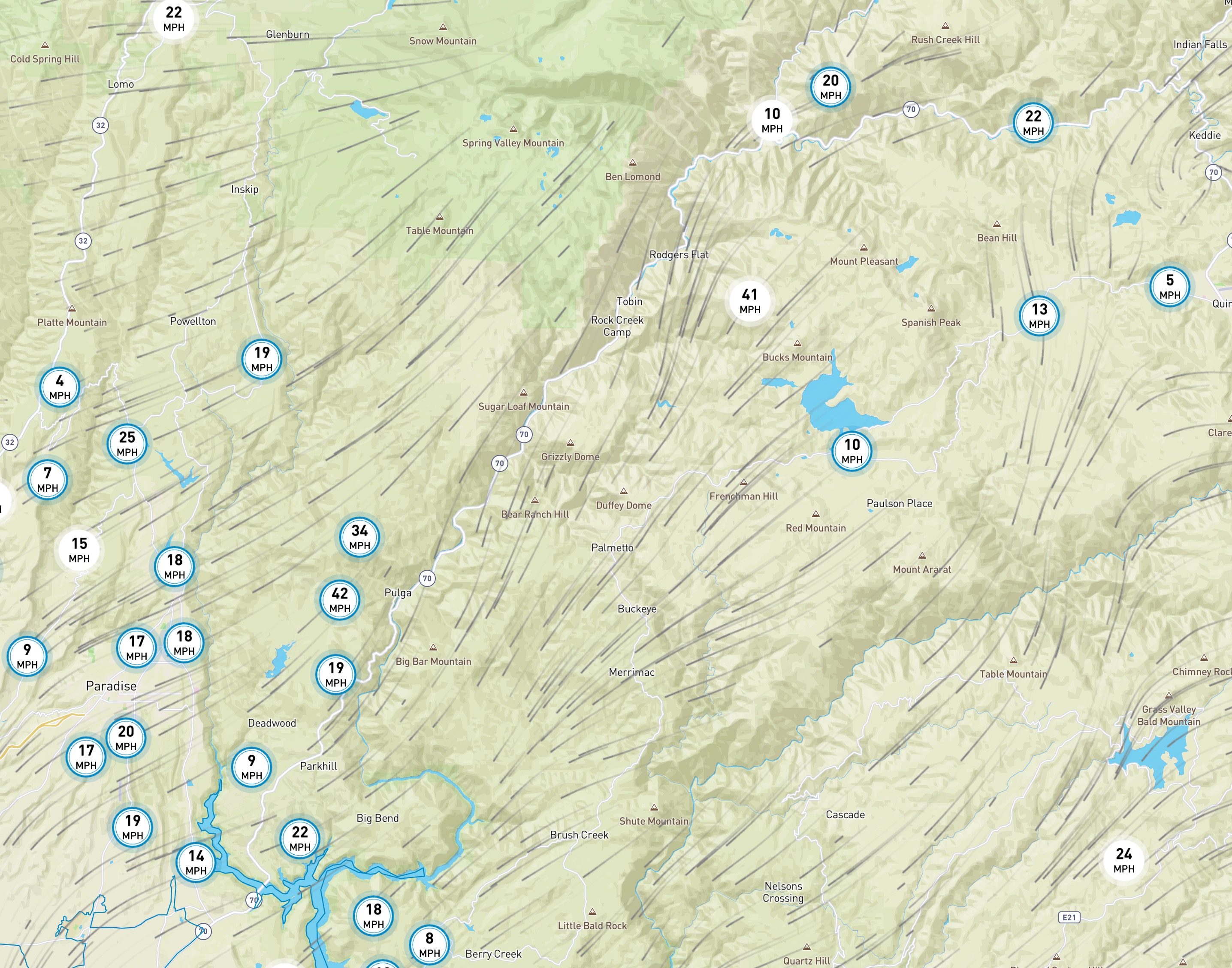
Please be aware of dark intersections due to the current PSPS. Treat dark intersections as a 4-way stop.
If you feel you need to evacuate, please do so. If you feel unsafe, please take action, do not wait for an evacuation order or warning to do so.
Sounds like my buddies house off Stringtown Road in the Hurelton area is starting to be impacted by fire. Knowing the fire ran towards Oroville below him, it was only common sense it would possibly make a run up canyon.
I have friends that live right on the edge of southern paradise and they said they were told by LE to pack everything up and leave if they had a place to go to.
I don’t have any ground verification, and may be off by a ridge or two, so take this with a grain of salt…
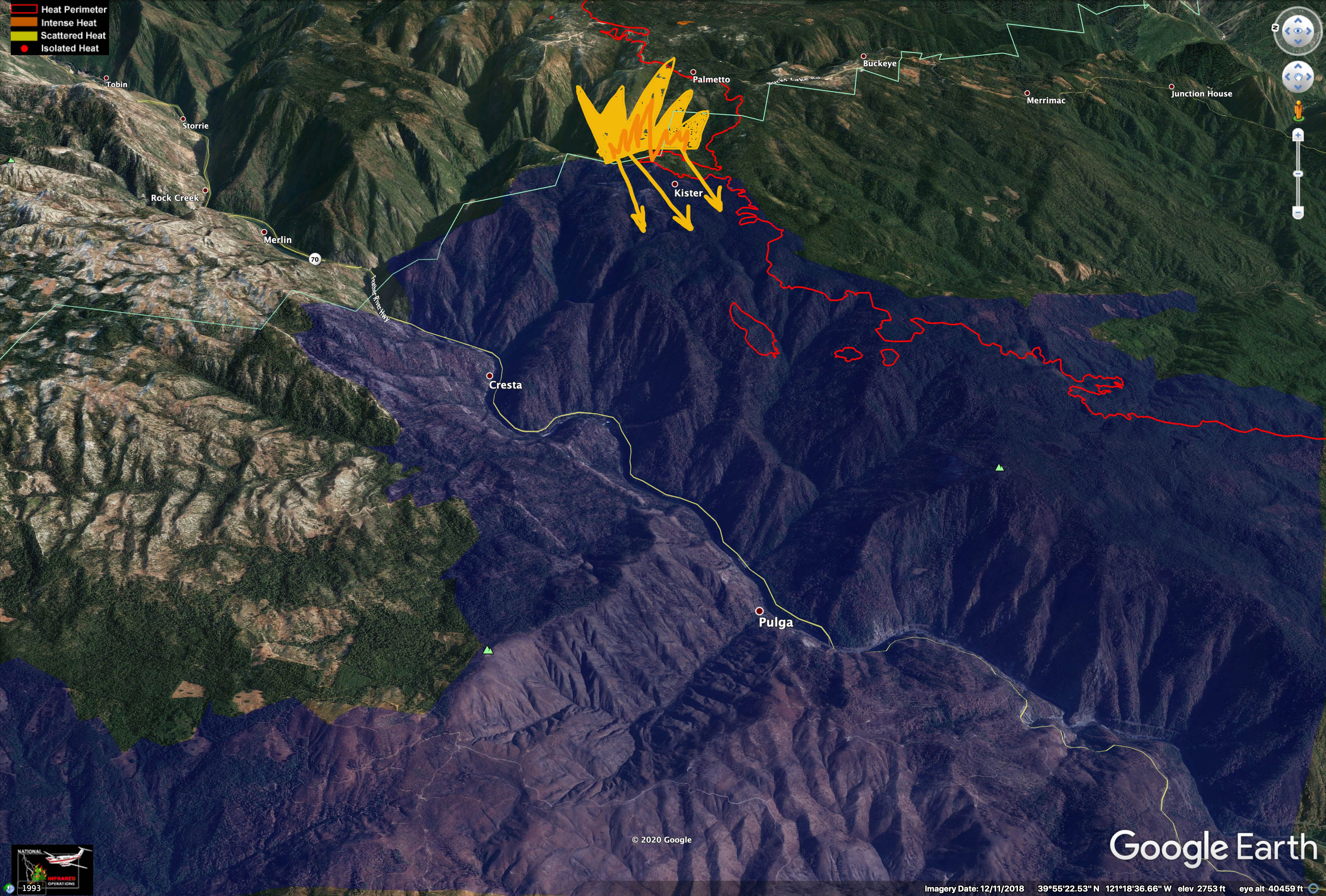
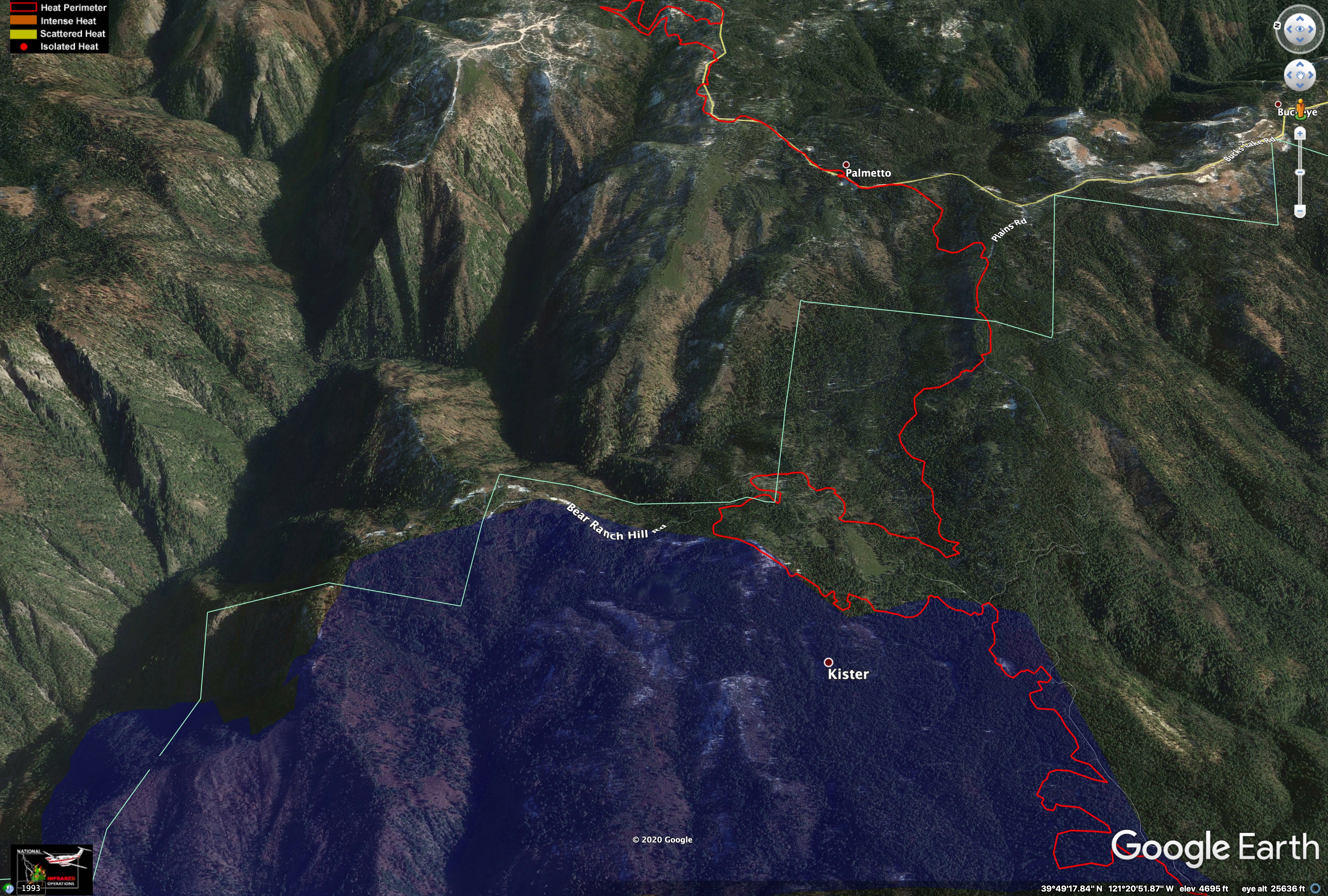
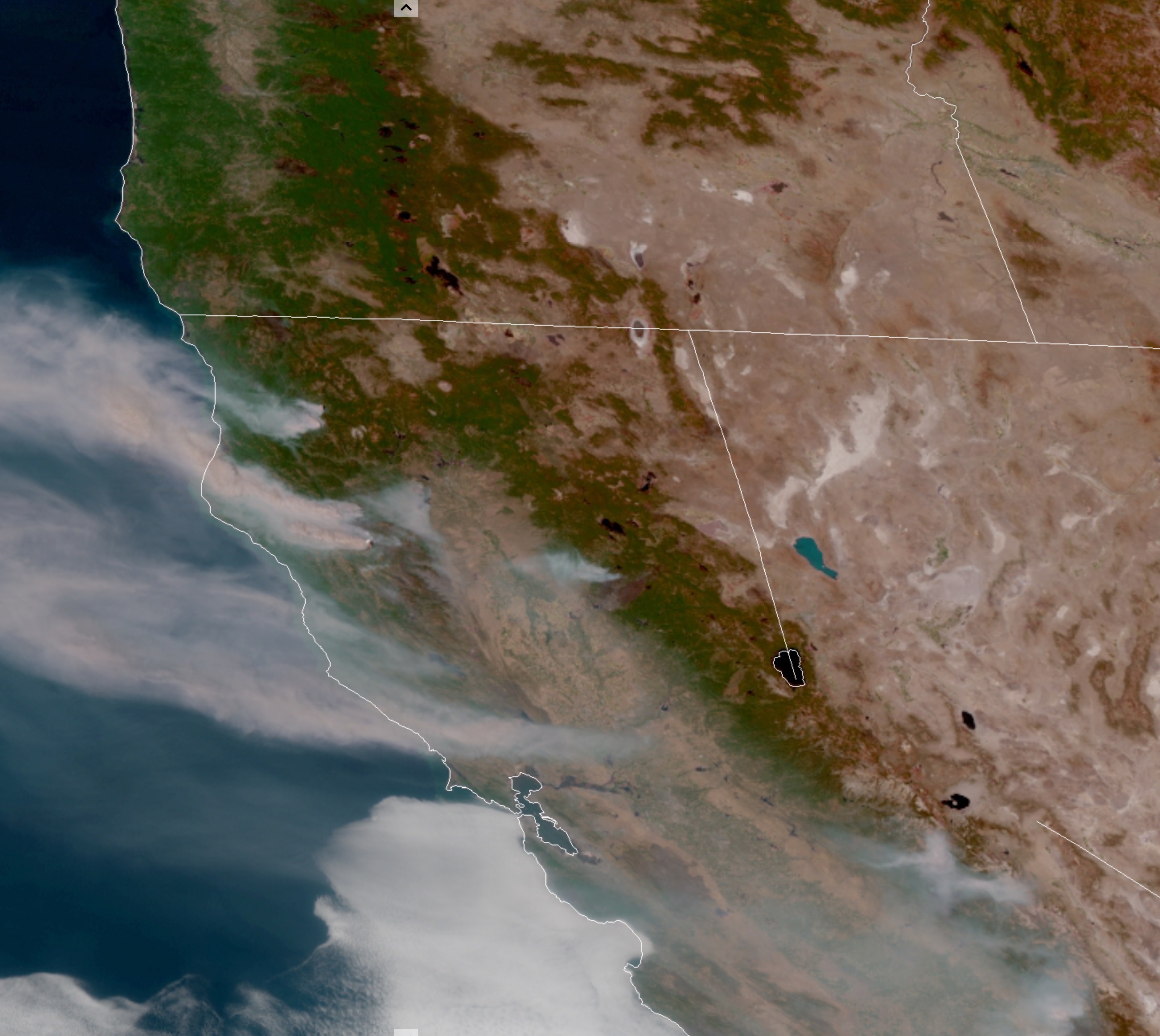
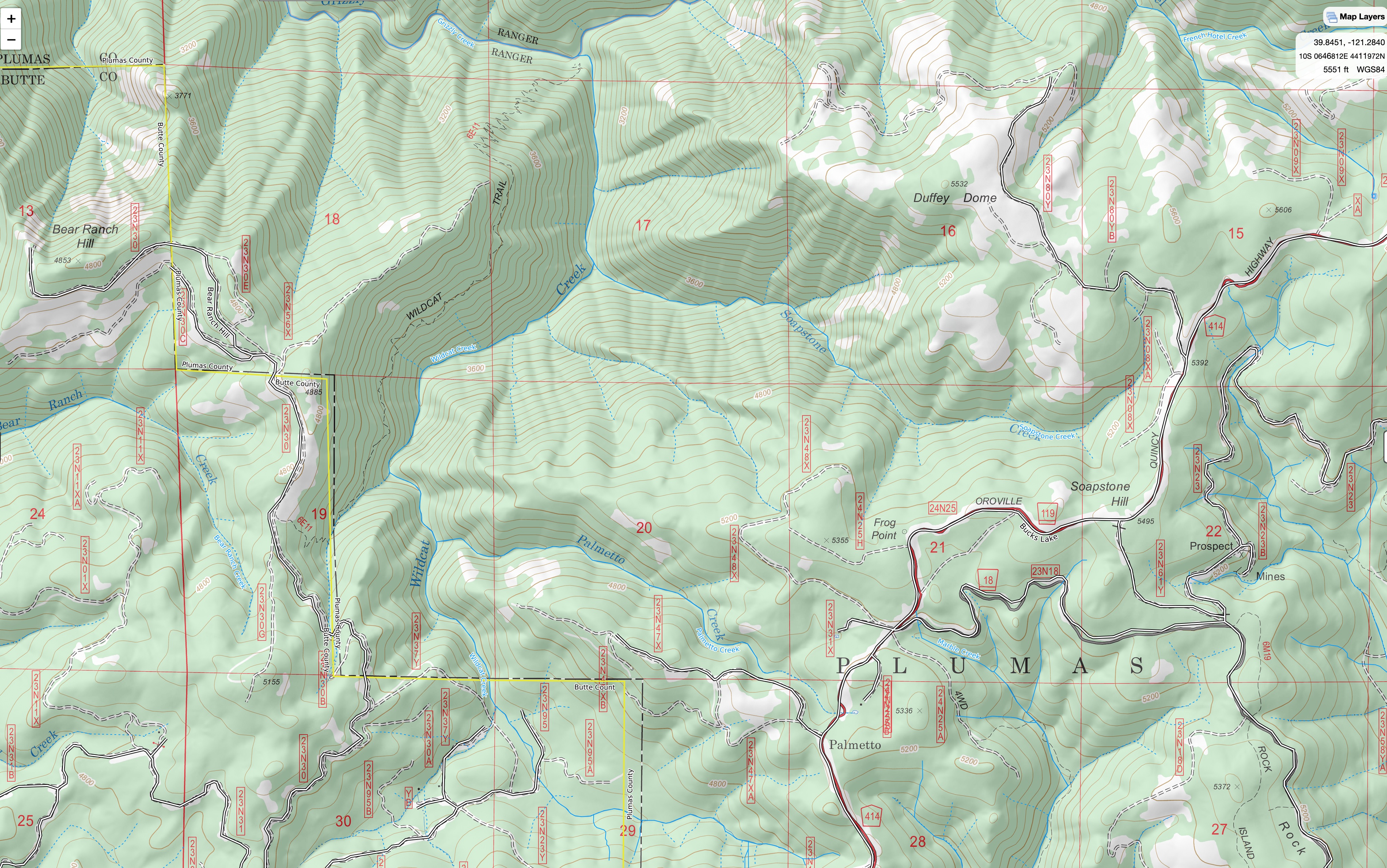
From the Flea Mountain Camera, it looks like the westernmost blowup on the North Complex has been along the SE rim of Grizzly Creek tributaries, Palmetto and Wildcat Creeks. The fire has been making a run up out of the drainages, still headed fairly SSW, generally in the direction of Big Bend Mountain, though still many miles to the North.
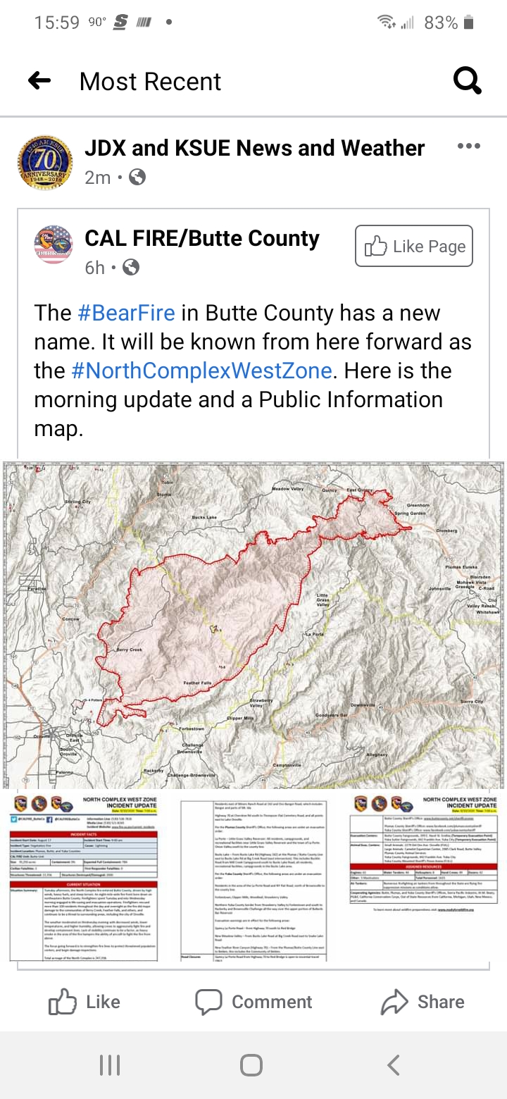
As soon as it hits the ridge it will be into the Camp Fire burn area (blue on map), which didn’t support much fire spread when the Bear Fire ran into it 2 weeks ago. Winds and temperatures were lower then.
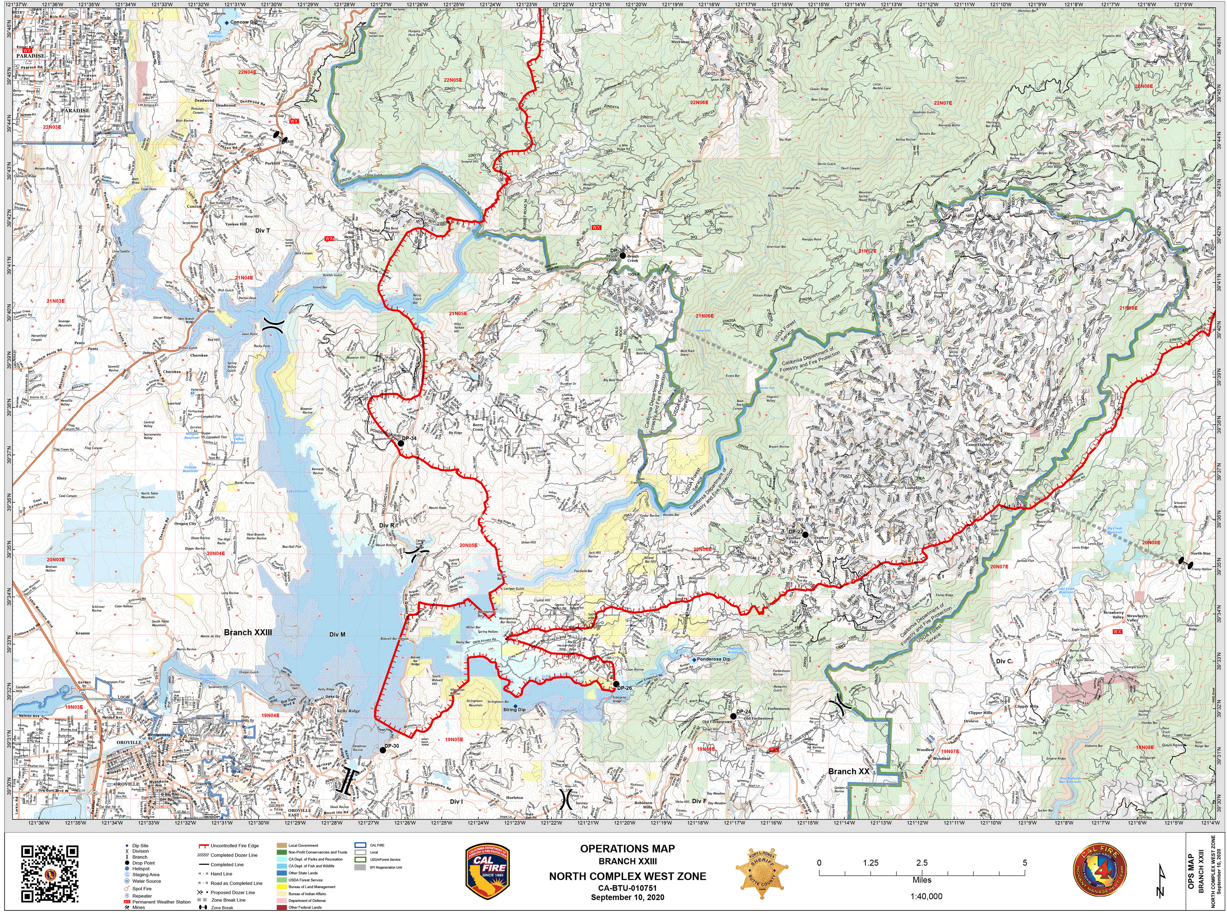
Red line on this map is fire perimeter from 9/27/2020 at 4am.
If the blowup is hugging the main fire to the east, and is between Kister and Palmetto on this image, it will run into a large buffer of black toward the top of those drainages that was fired out over a week ago.
The 2018 Camp Fire burned with a real mixed severity on the east side of the NF Feather River. Everything to the right of the red Bear Fire perimeter in this map burned in the Camp Fire.
It will be interesting to see what we get for fire behavior in the 2018 burn. A lot of the Camp Fire area along the top of the ridge underburned, as the fire got there with cold weather and mild winds in the middle of November. A lot of these underburned stands were so thick before the Camp Fire they should have no problem supporting crown fire when the wind is blowing. Once you drop into the canyon, there was a lot more high-severity fire in 2018 that should help drop any crown fires, but there is a ton of fine fuels, so these areas will pick up a ton of spot fires - they probably won’t slow the fire down much.
I hope I am wrong and the fire slows down once it is less exposed to the winds, and into the 2018 burn, but if the winds keep howling, I wouldn’t be surprised to see the fire make a big run tonight.
OES and LG resources have been getting released over the last few days. Those are probably the resources that went to the Glass Fire earlier today. New start in LNU taking more resources isn’t going to help getting stuff into position to fight this one.
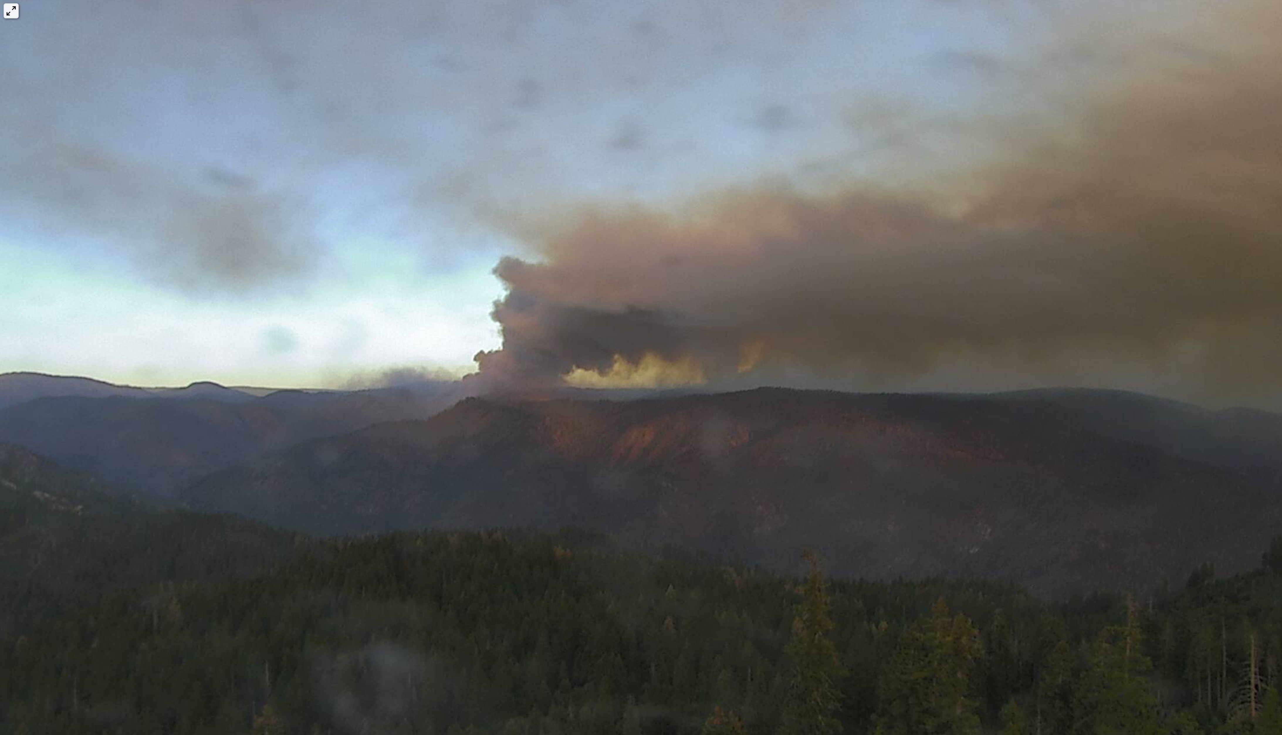
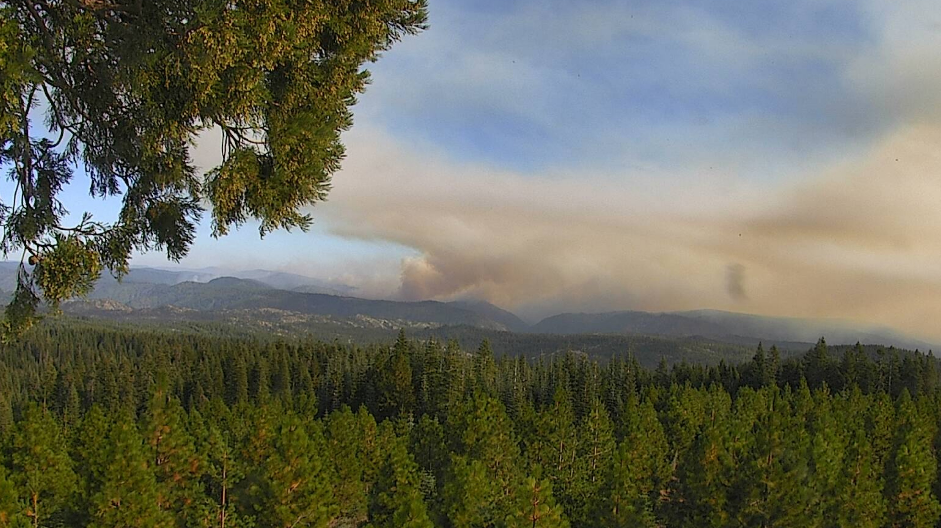
Lots of smoke, but not a lot of action on the webcams today.
Fire is still cooking in French Hotel Creek and Soapstone Creek areas, starting to pick up a little in past hour or 2.
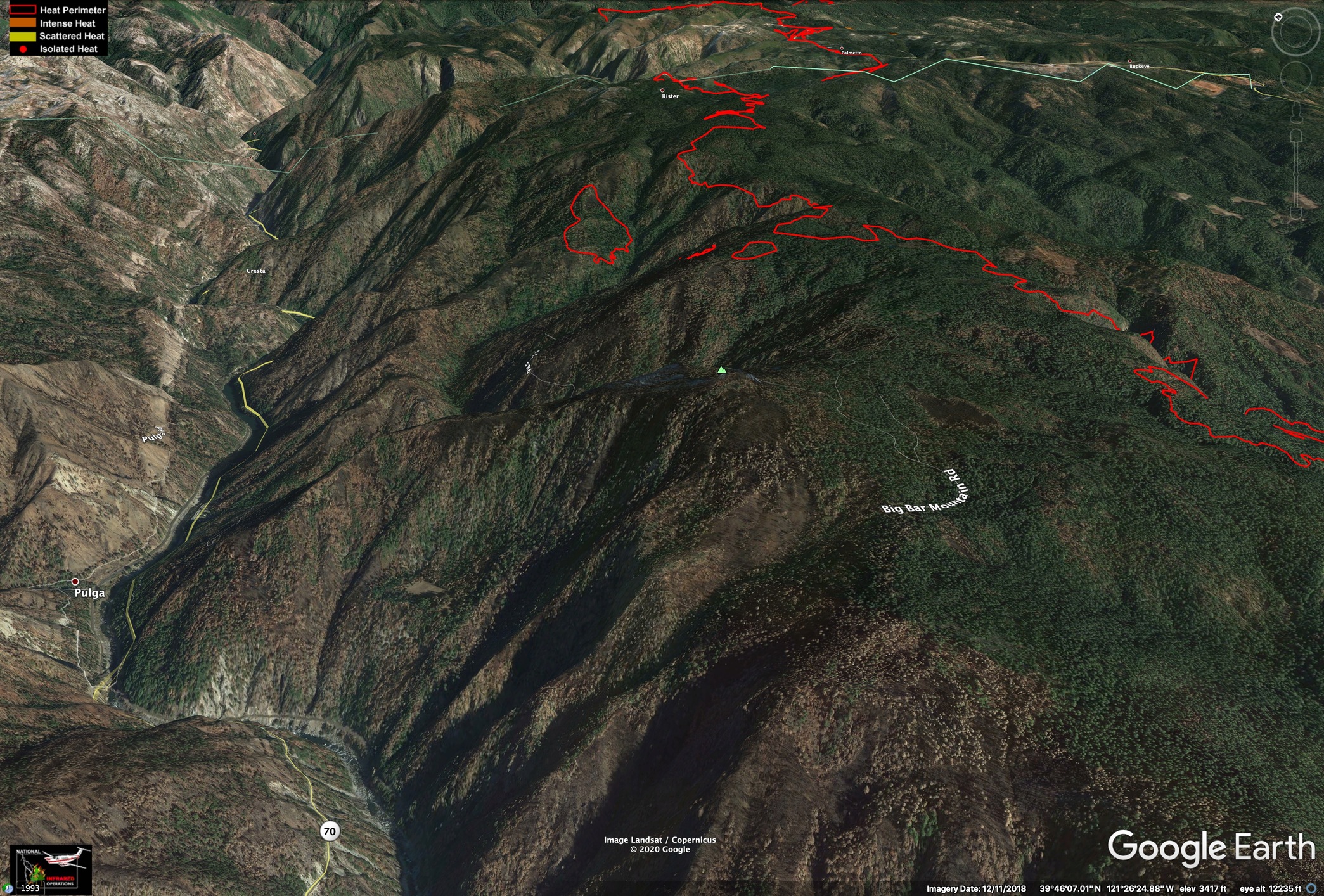
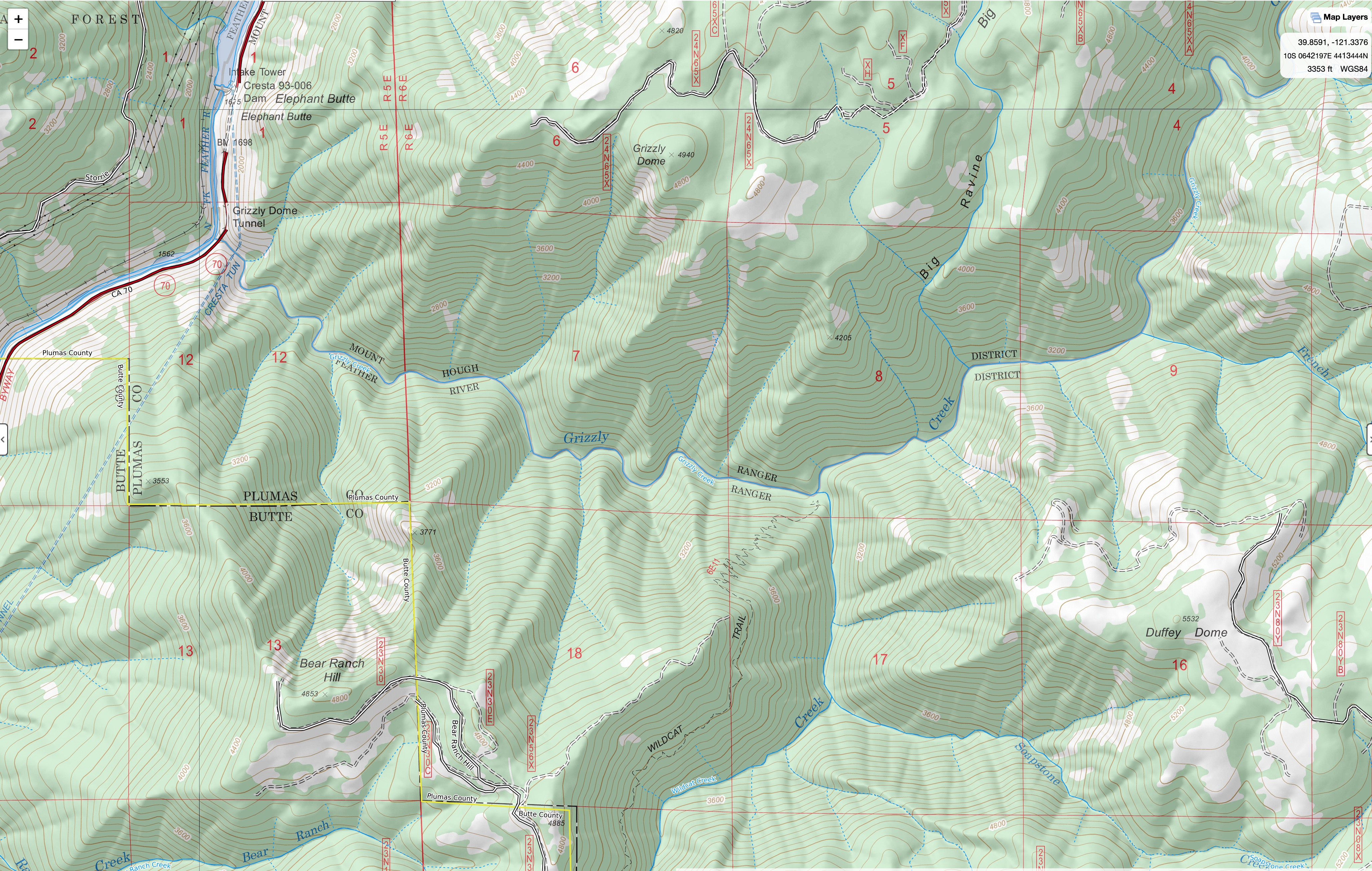
From the Bald Mtn webcam, it looks like the fire is making a pretty hard push down the main stem of Grizzly Creek, around Big Ravine, aiming for Bear Ranch Hill. If it crosses the ridge there, it will be into the NF Feather Gorge, proper, and visible from Flea Mtn cam.