That about lines up with when the SEATs started working from Chester. AA06 diverted a bit to Little Grass Valley for a small fire, but sent the S-2s back to Nevada City when it was put out on the ground. There’s been a mess of tankers all over the place on FR24, but pretty regular MAFFs & MD87s to Beckwourth.
[Sugar Fire/Beckwourth Complex Photo Gallery Courtesy @noahberger3884 via Twitter ]
(Noah Berger Photography)
Cant really get much better than photos 29 and 33. The faces of the next generation of firefighters.
Babies - they look like 15-year olds. Safe travels, kids.
Column is already up and poking through the inversion layer this morning. ALERTWildfire | Shasta Modoc
“The Doyle Disaster”
This fire deserves an investigation.
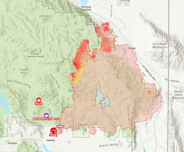
Anyone have the IAP and map
https://inciweb.nwcg.gov/incident/7601/
this is tonight’s USFS community meeting
Redirecting...tn=K-R
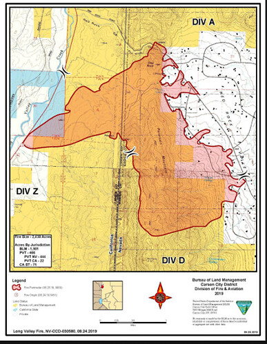
I have been looking at fire maps for this area for the last 2 years. It does not look like this is the first , second or third time a fire has burned thru Doyle , The long Valley fire of 2019 looks to be in a similar foot print. fire goes wild with the wind in the Sage Brush…
been more than a few years but I have spent some time at the Buck Inn. Hope the place made it… A old time small town dive bar… nothing better…
What would you like to investigate fake?
I second that
It is a shame indeed. As Doyle is such a nice little place… With the winds coming up long valley and the never ending Sage Brush this area has been a breeding ground for fire in the past… Been watching this since we drove by it as it started on the 2nd I think… Got to know the area… No Good Access , rough country. a lot of up and down. … just a crazy place for fires when the conditions are right… Wish there was something you could blame this on… But I doubt there is… Lighting, Dry conditions and afternoon winds… Nothing burns like sage brush…
Any discussion should be related to origin and cause, or taken to another forum.
The Laura 2 fire on Nov 17, 2020 burned 2800 acres, and according to press reports 19 homes, and 31 other structures in Doyle. According to the Damage assessment teams, 21 homes, and 19 Other buildings. As some one said in the CA-MMU-River ??? thread, history may not repeat, but it does rhyme.
The escarpment winds, flashy fuels, desert weather, tough access, and abundant lightning on plateau above set up everything between Bordertown and Susanville for an extreme risk of destruction by wildfire. And when you overlay the extreme poverty of the area, it’s just the Wild West.
So many of the structures are dilapidated or abandoned, lacking defensible space, surrounded with old cars and decades worth of other treasure - defending them is already pretty much impossible, even under the best of conditions, but add a fire tornado, just for good measure.
Check out this video by Craig Philpott. Firefighters trying to save a place, in scorching heat and shifting winds, under burning powerlines, sucking toxic smoke from a private junkyard, with no breathing protection.
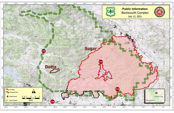
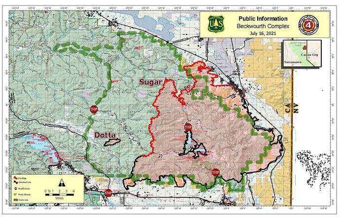
Does anyone here have a updated perimeter map of the forest closures around the complex?
Perimeter map with closure:
Fires been putting up a good column all afternoon from Reno and capped out for a bit around 1630
Here is the latest Map
here is the link to todays update
https://inciweb.nwcg.gov/incident/7601/
still has some heat to it
The Inciweb has Beckwourth complex 100% contained and controlled on October 27, 2021 at 105,670 acres.
