In Anvilheads picture there is a spot taking off about a mile ahead of the main front.
3 Likes
AA is requested multiple tankers back to the fire.
2 Likes
That there paints a picture
1 Like
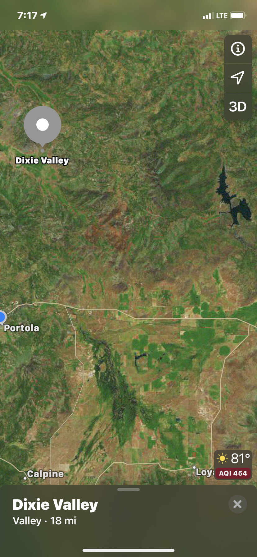
Plumas County SAR en-route to Dixie valley for evacuations.
4 Likes
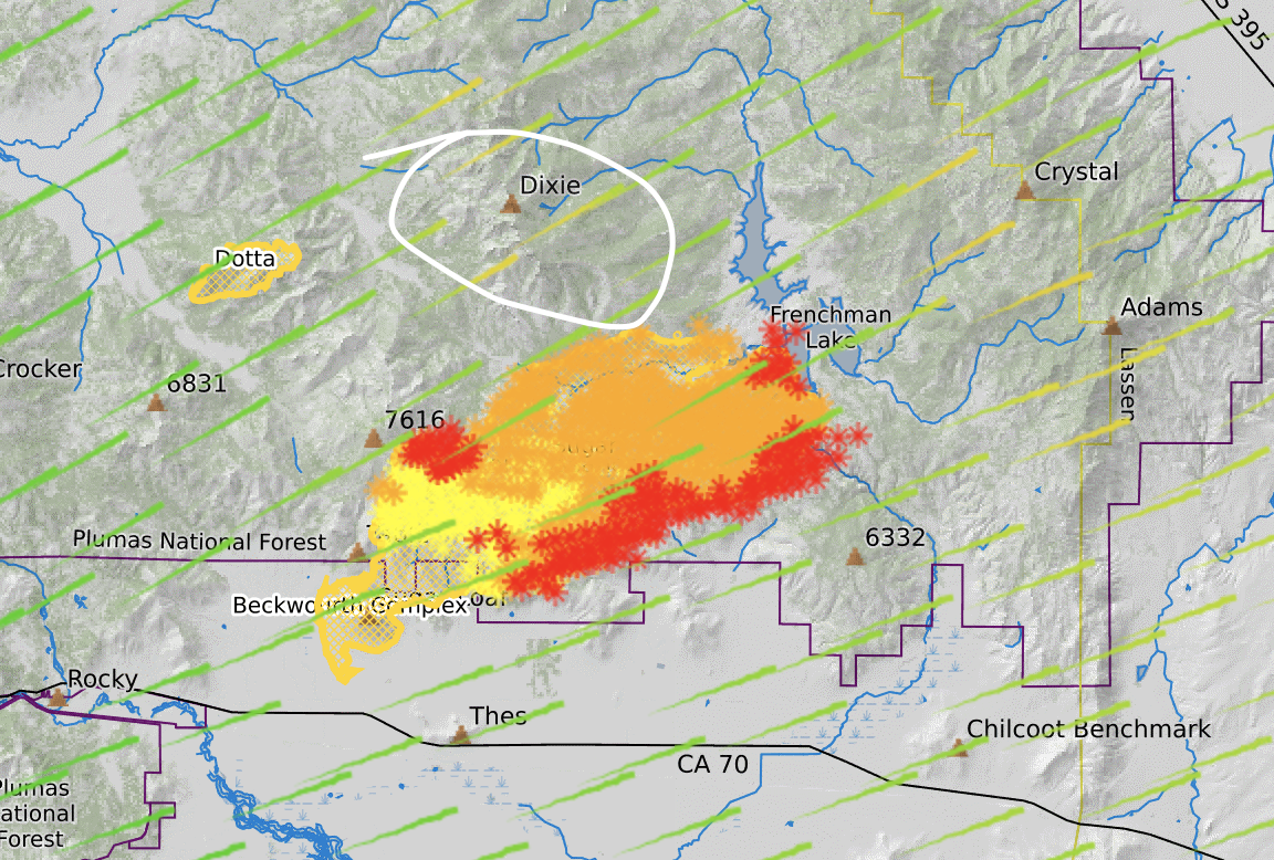
I think Dixie Valley is the large valley south east of the fire.
I mispoke. You are correct sir.
Dixie Valley is west of Dixie Peak, that valley just outside of the left side of your white circle. The only routes out of the valley are washboard gravel eastish and westish, and with the east route on fire, and should the Dotta flare up…Team 4 had a tough experience in the Plumas last year, so I’m sure they’re being extra cautious with the resident’s safety.
5 Likes
Tomorrow’s IR should be quite a bit different from today.
1 Like
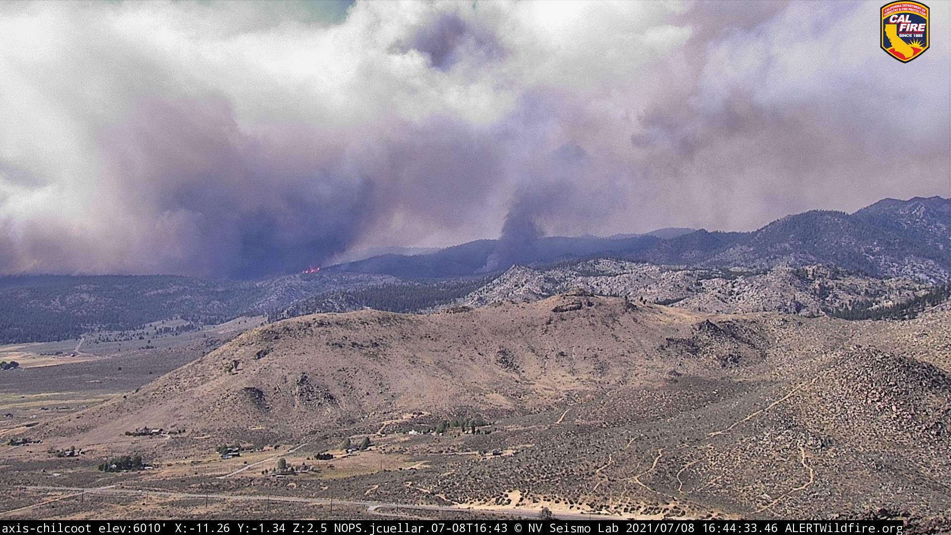
If you look at the Webcam the fire is well past Frenchman lake and almost to the crest above the 395. Also 2 columns have been visible most the afternoon in reno, the second smaller one appeared to be moving in a NE direction
http://www.alertwildfire.org/shastamodoc/?camera=Axis-Babbitt
3 Likes
From the North Portola cam it looks like the fire may be moving sideways also.
http://beta.alertwildfire.org/region/shastamodoc/?camera=Axis-NorthPortola
1 Like
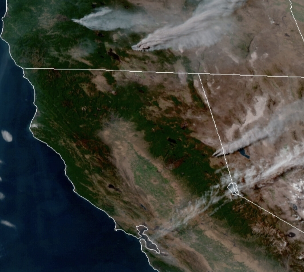
Here is Sentinel imagery from noon today.
Most of the heat was on SE flank.
2 Likes
Gotta be getting close to 395 now.
http://www.alertwildfire.org/shastamodoc/?camera=Axis-Constantia
1 Like
If I remember right, there was a fire just west of the Constantine camera site last year around mid July, and a few others that boarder 395 between there and Susanville last year. Hope those make for some good breaks.
Safe days and speedy travels.
3 Likes
Oh yeah, the Adams Fire south of Omira last July! Yeah, that fire was long forgotten by the world when the onslaught of firestorms came in August. Tho I think I recall it burning about 700 acres or so before it was contained. All in relatively flashy fuels that may have grown back if it was almost all grassland
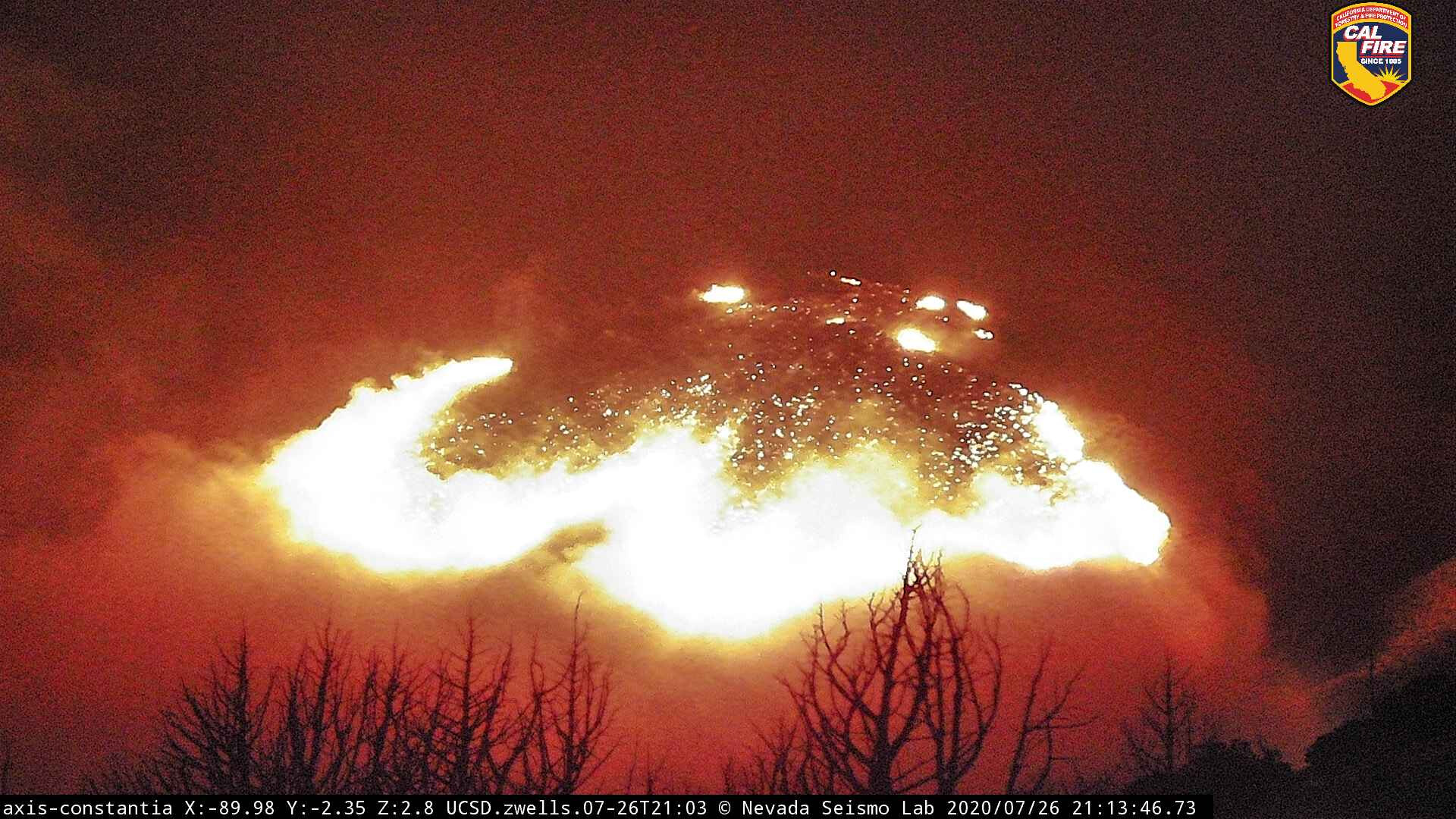
DISCLAIMER: This is a screenshot of the Adams Fire from the Axis-Constantia camera last year.
3 Likes
The Langston? Fire last year? was just south of there and made a hard push down the hill to the 395 just south of 70.
Edit: it was the loyalton fire, as mentioned below had a rotating column with a significant fire whirl prompting a NWS tornado warning
1 Like