That’s on Scanner Radio Pro app.
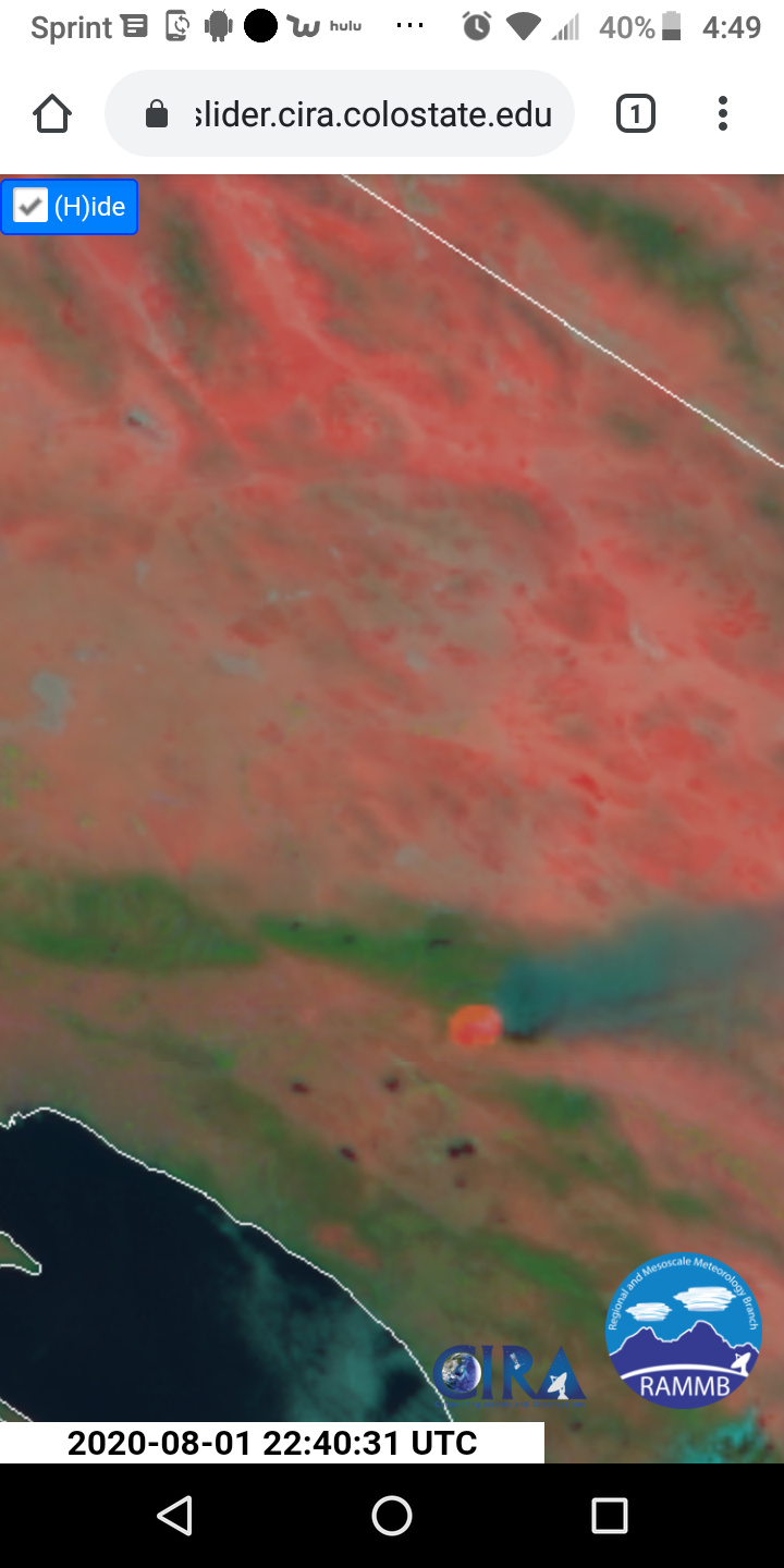
Just from a potential perspective, if this moves down and across that next drainage from the Oak Glen Fire Camp, there is nothing to stop it until it gets to Forest Falls
It will tend to go north east
That ridge should be easy to hold. Bigger concern is burnt canyon, gunsight pass, and upper mias Cyn to the east towards burro flats.
Any one have the Comm plan for today, CMD, A/G?
lotsa people worked lotsa years to prep this inevitable event. Kudos to the dedication of the team.
Yep
Sad we couldn’t complete the update to the OG fuel break the last few years
@firedog yup, NE is the concern. We will be chasing this thing for weeks now.
Oh I don’t think so. With some aggressive firefighting and smart decision making it should go fine.
Lots of good country to work to the east.
Side question about the radio app. I have been using Broadcastify… Is there a better app available?
That Snow peak Cam is gonna get interesting in the next few hours
That fire gets into the wilderness and it will be weeks. Lots of bug kill dead fuels and few roads.
I use Scanner Radio Pro App. it has both android and IOS apps.
CA IMT 1 Team 2 (Minton) mobilized In-briefing at 1900
When I say chasing it for weeks. I dont mean just flaming front head fire. When that fire behavior stops in the next xx days we will be chasing it the smokes and after math for weeks and really years
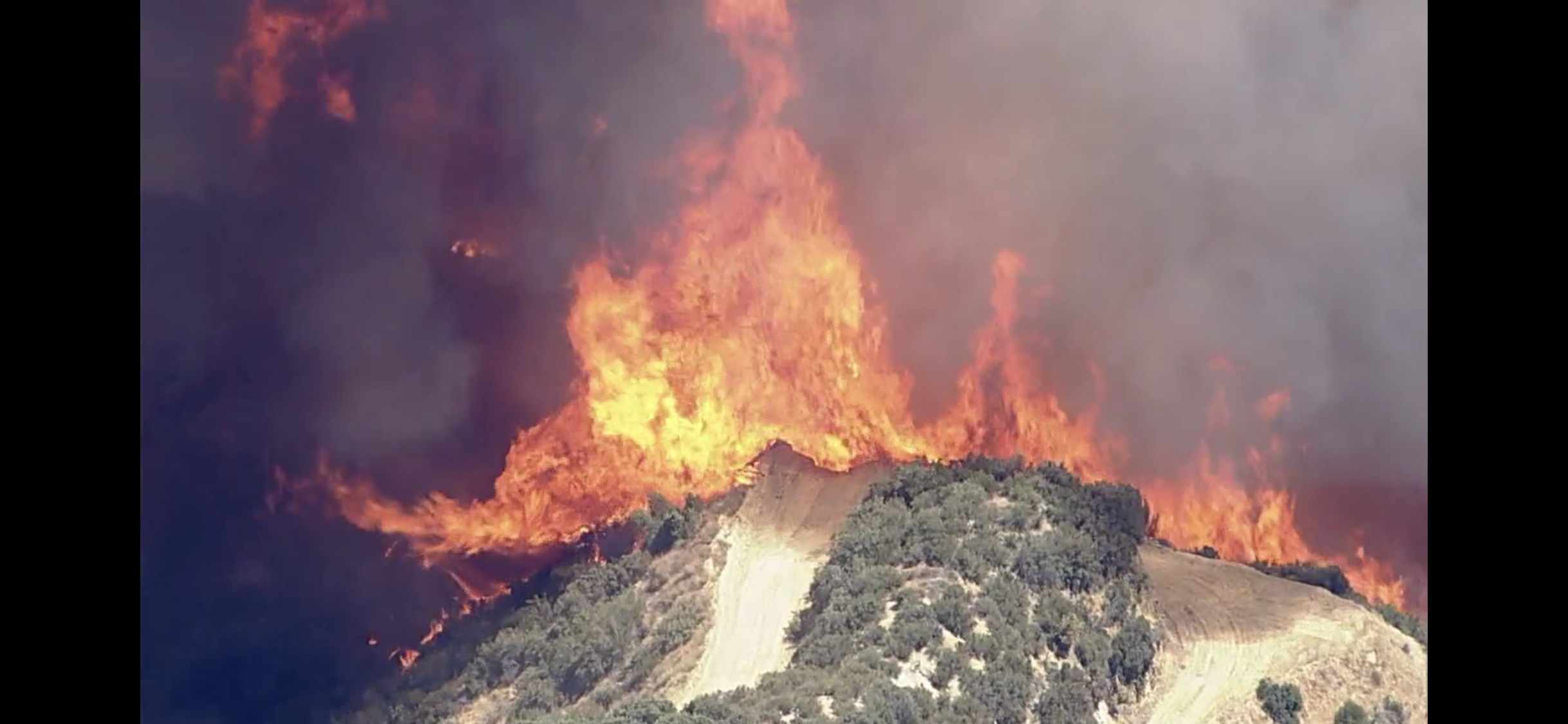
A little drama -
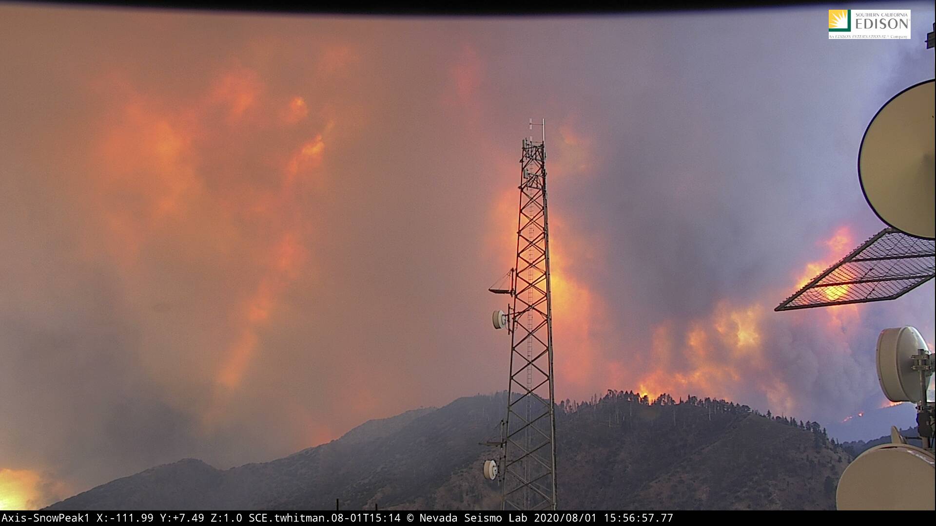
http://www.alertwildfire.org/inlandempire/index.html?camera=Axis-SnowPeak1&v=81e003f
Live Now
How do I find these live helicopter updates from the various TV stations? I go to their websites and all I can find to click on is “watch live” or similar and it is always recorded news or sometimes live news shows. Can you help me out? Thank you!
gotta save the link to a raw feed while it’s up, then re-use. The tv website always switches to whatever programming they are broadcasting. Nowadays, many copters also do live stream on social media.
Flames just now visible on Snow Peak 1 camera