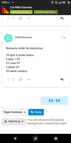
Per south OPS can fill 2 Lima strike teams. IC approved 6 hired vendor Dozer with 4 HEQB
Spotted across the canyon
What is the best scanner link for this fire ?
Wrong thread Baldy…
Sorry about that…I should know better about trying to post without my glasses on
Heard AA says it well established on the other side
anyone have a camera link
https://www.alertwildfire.org/region/inlandempire/?camera=Axis-Idyllwild1
https://beta.alertwildfire.org/region/inlandempire/?camera=Axis-ToroPeak2
https://beta.alertwildfire.org/region/inlandempire/?camera=Axis-SnowPeak1
The camera is looking NW. Fairview is the other way. But is a pretty impressive Timelapse.
Evac orders got a lot bigger, Mtn Center, Anza
They went unified with BDF a few hours ago also, moving into a lot of BDF country now.
How far is it from the 74?
Do you have a link to the evac map?
I dont know, MODIS hits are all over the place, hoping for a mapping flight soon, but given the fuels in that canyon, where this ends is a huge question.
It is up on the RRU page, its basicly the rim of Bautista Canyon around to Thomas Mountain and Anza Crest above Anza to the North
Current Evac map from RRU page:
Fairview Fire 2022 - Follow @CALFIRERRU for UPDATES - Google My Maps
thank you for the post. I am not sure how they came up with it…but that is for another topic
XLC 1202A Enroute
E12 BRK
E15 BRK
E21 GLN
E22 GLN
E91 SNM
BC3 PAS STEN
