State ID: CA
3 letter designator: SCU
Fire name: Oso
Location: West of Mt. Oso
Reported acres:
Rate of spread:
Report on Conditions:
Structure threat:
Resources:
Hazards:
Weather:
Radio channels:
Scanner link:
Webcam link: http://www.alertwildfire.org/southeastbay/index.html?camera=Axis-Oso&v=81e004f
Agency Website:
1 Like
If someone could zoom out just a bit…or a smidgeon…
1 Like
2 posts were split to a new topic: CA-SCU-Calaveras
Oso Fire is in the Mines Rd/ Del Puerto Cyn area, Sta 25/Sweet Water area
Part of the Canyon Complex Battalion 5,
Low on the aircraft priority list. It looks like only C106 is assigned.
T-88 and T-89 assigned now.
1 Like
It appears to be behind the radio site given the aiming of the cam. Due west. Been to that hilltop many times. It’s going to be along time to reach it by dirt road. Alot of forks in all those roads and no signage. There is one or two ranches back in the drainage that are near this.
Grummett Creek Martin Creek areas. Drainages align north and south.
1 Like
A lot of big fire history west of I-5. And this one looks to be headed that way also.
AA230 is pointed in that direction. So this fire is finally getting an AA. Most, if not all state fixed wing, are committed at this point.
1 Like
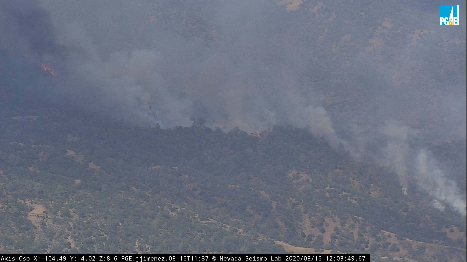
The fire has grown quite a bit overnight, exceeding the camera’s ability to see it all.
Usual Command channel is 151.445. Its on Oso. But, I don’t hear traffic
about this incident. Someone have a frequency for command?
Cmd2 is CZU traffic.
The glow was quite visible from Modesto all nite even though the fire itself is on the back side of the ridge. This morning it was putting up a good deal of smoke but the column was laid over due to north wind. In the last hour it has started to build and is putting up a pretty good black column
1 Like
Looks like it may be a “hold-over” that came to life. Whole new ballgame with a much bigger box…
http://www.alertwildfire.org/southeastbay/index.html?camera=Axis-Oso&v=81e004f
Wind is picking up, gust to 16. Canyon is aligned north to south. If it get over Mt.Oso ridge line orientation changes to east west. If there’s tankers working they may have controlled the heal. It’s backing down to Oso very slowly.
RAWS South of fire about 6 miles:
https://www.wrh.noaa.gov/mesowest/timeseries.php?sid=DBLC1&num=72&banner=gmap&raw=0&w=325
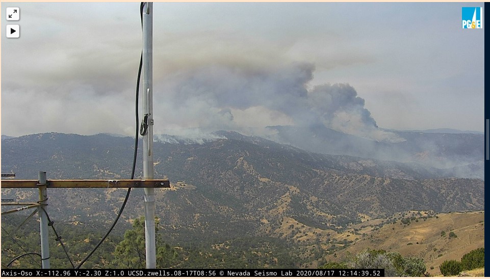
Looks like camera has changed direction to another fire in the San Antonio Valley area?
Edit, Fire has crossed Del Puerto Cyn at Frank Raines Park and threat to Junction/Sweetwater area in a hour, Evacuations in progress
These fires are called the Canyon Complex (and 3 other fires).
So, that’s four fires behind Oso. Total 1851 acres all 4 fires.
Branch5 is the Del Puetro Rd. side of the fires.
Cmd is SCU 151.445
VFire 23 Tac 154.295
CDF Tac 31
Evacuations of ranches and the housing track in Del Puetro. Firing out plans being developed and hand crews and dozers are cutting lines.
3 Likes
Where is ICP for this Complex?
Alameda County Fairgrounds
3 Likes