State ID:CA
3 letter designator:SHF
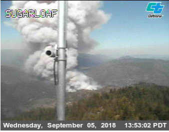
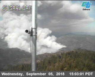
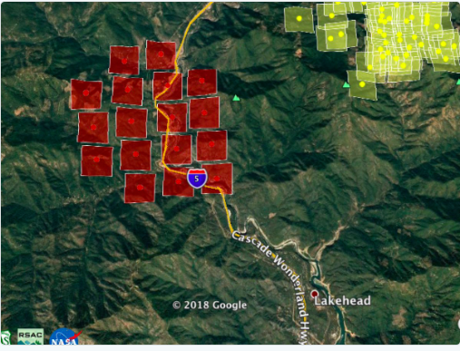
Fire name:Delta
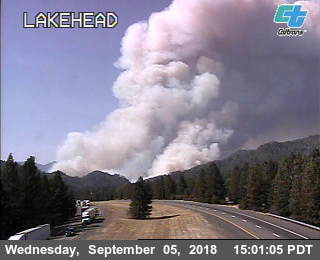
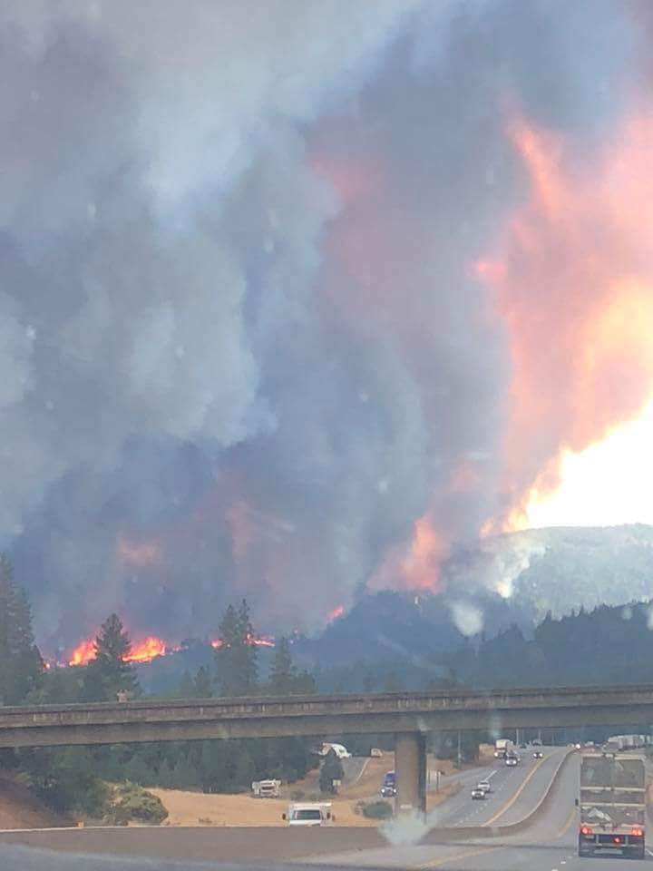
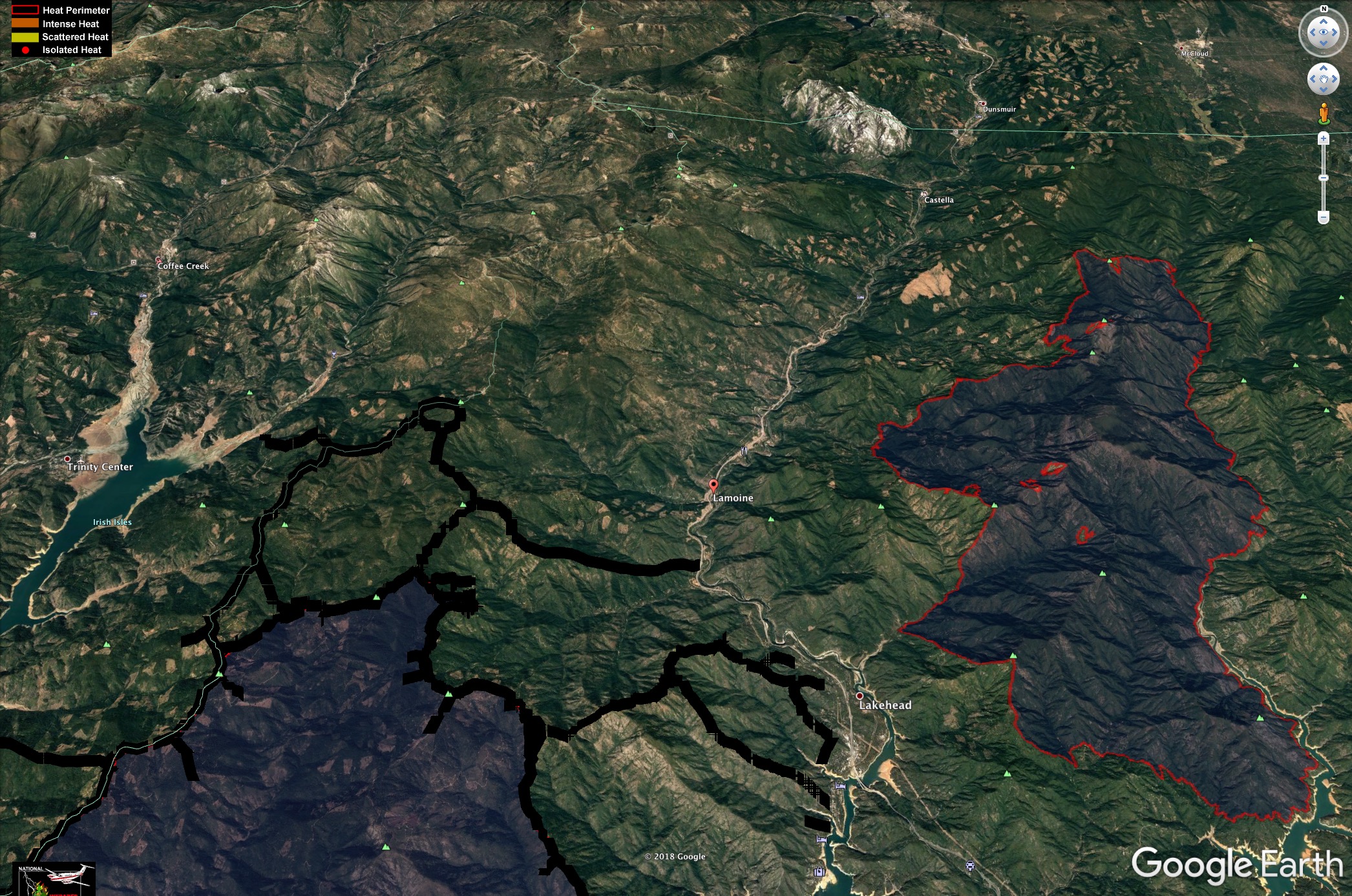
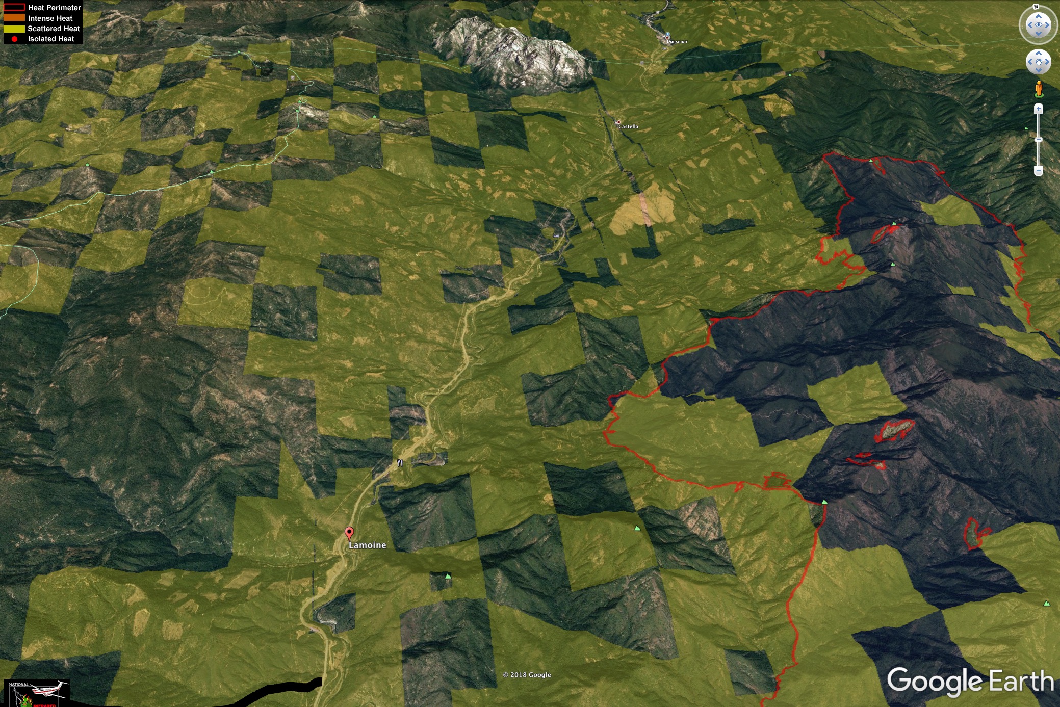
Location: I5 at Vollmers/Delta exit, north of Lakehead
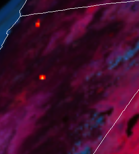
Reported acres: 3 fires (2 on east side of I5 at couple acres each, 1 on west side of I5)
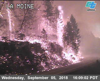
Webcam link: http://www.dot.ca.gov/dist2/cctv/sm_lakehead.shtml Sugarloaf Mtn cam
other caltrans cams in area might pick more up.
Delta Air Attack just placed large aircraft order above the IA response…
http://norcalscan.live for a live scanner that covers SHF and should have the aircraft also, depending on terrain, it gets scratchy up there…(also Broadcastify SHU live scanner)
EDIT: Also the Yreka office for CHP CAD. The CHP office boundary is right around here. Lot of entrapped vehicles and drivers running up I5 abandoning vehicles.
Now 500 Acres…0% Containment, CHP closed I-5 North at Fawndale, north of Redding, and I-5 South at Mott Road near Dunsmuir.
SHASCOM sending Redding Fire to assist.
Per CIIMT 1; North Ops Center reports fire is now @ 700+ acres, 0% contained, Rapid Rate of Spread, Long range spotting, 3 separate fires have burned together,Structures threatened Evacuations in progress I-5 closed S of Lamoine at Delta Rd. both directions
SRA shown in Yellow (when you don’t have an SRA map, just look for clearcuts, and you’ll be pretty close), but as was pointed out recently on other threads, this entire is Fed Direct Protection Area.