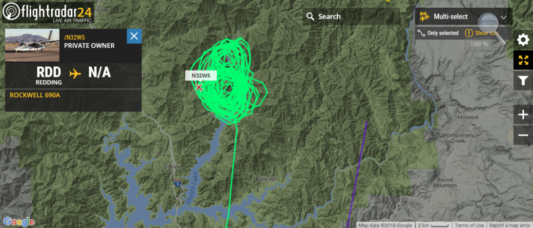
Showing 30 acre fire in the area of Lakehead. Will this be blended into the CARR incident or managed as a separate incident?
Separate incident most likely. Well outside the Carr incident, completely different objectives. However Carr aircraft are already enroute and I’m sure there will be plenty of ground resources ready to swarm out considering the red flag starting this afternoon for the area for S-SW winds gusting 20-35. They’ll want this thing cold fast. I’m hearing it managed over SHF-Forest Net.
Anyone have a more precise location on this one?
Edit: found it:
https://maps.nwcg.gov/sa/#/%3F/40.8896/-122.2455/12
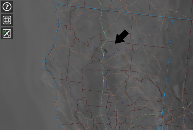
Per the map, looks like Gillman Road north of Moore Creek Campground
2 Likes
Google Map link via coordinates on the SHF WIldcad page, and MODIS/VIIRS hits are in the same spot.
As of 0955: 3 fires total, approx 100 acres in size between the 3 fires.
4 Likes
1200 update: Per AA to IC, air still too smoky for tankers, 1 Kmax working it, order in for another T1 and T2 copter. Fire behavior is moderate to slow, slight east to west wind on it. Still 100-150 acres. Bulk of it is hung up in a rocky ledge/outcropping. They’ll definitely look at tankers if air clears.
4 Likes
Per Hirz IC at about 1:00, 3 fires totaling about 100 acres. Smallest has hose lay. Two others will probably burn together. Working on line on east and west flanks.
1 Like
2:37 p.m. 350 acres. AA was asked to check out a potential new start west of Shasta Lake – turned out to be Carr burnout operation.
Team ordered.
IR from last night. https://ftp.nifc.gov/public/incident_specific_data/calif_n/!CALFIRE/2018_Incidents/CA-SHF-001223_Hirz/IR/20180811/20180811_HIRZ_11x17_portrait_TOPO.pdf
2 Likes
State or Fed
1 Like
7:15 a.m.
CA-SHF Hirz Fire: 1,423 acres, grass, brush, timber, 5% contained. Fire remained active during the overnight hours. The north and south fires are expected to merge during the next operational period. The National Weather Service in Sacramento has extended the Red Flag Warning until 11 PM Saturday. The fire will continue to crest over the Hirz Mountain ridge and back down into the north fork of Salt Creek, spreading West and North along Gillman Road. The fire threatens the residences along the Hirz Mountain Lookout Road, multiple residences along Gilman Road and the Salt Creek drainage.McCloud River Club and water rights are threatened. NorCal team 1 has been ordered for the incident. In-briefing will be today at 2:00 PM.
Fed, Looks Like NorCal 1.
Just toned out immediate need for structure protection. Stage at I-5 and Gillman.
Inciweb page:
https://inciweb.nwcg.gov/incident/6116/
Last night’s IR puts it at 4404 acres:
https://ftp.nifc.gov/public/incident_specific_data/calif_n/!2018_FEDERAL_Incidents/CA-SHF-001223_Hirz/IR/20180813/
Today’s Ops map:
2 Likes
17 posts were merged into an existing topic: CA-SHF-HIRZ
Thanks for the updates! Anything is great. Guess I gotta get used to fed fires again…
2 Likes
Anyone have more info on this one? Seems to have dropped off the list, yet still burning hot.
They are expecting some crazy winds tonight, hubby said. Due to the terrain quite a few IHC’s are workin day & night. The proposed lines are quite a lot bigger than the Fire was but seems to be growin into it? Only able to get boots on the ground intel every couple days due to location. Not much help but it’s what I was told.
4 Likes
Anyone have a copy of the IAP?