
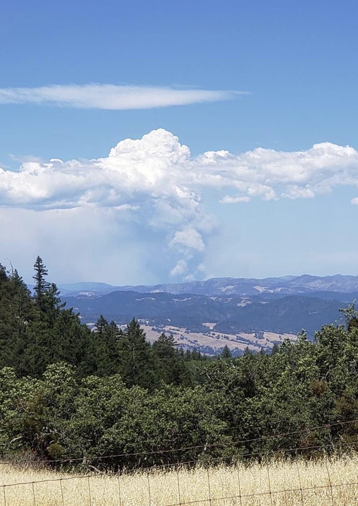
The fire is pushing toward Hwy 36. AA can’t get Tankers under the column. It looks pretty active with a decent column right now. Hwy 3 is closed at 36 and units are moving into wildwood canyon for structure defense.
3 Likes
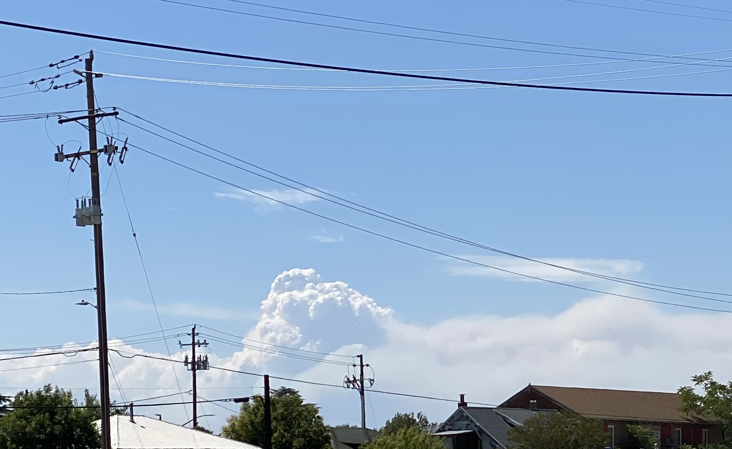
Wildwood evacuation just about complete. About to cut power to the area. Fire making crown runs and making crews hot foot it out of some areas.
9 Likes
10 Likes
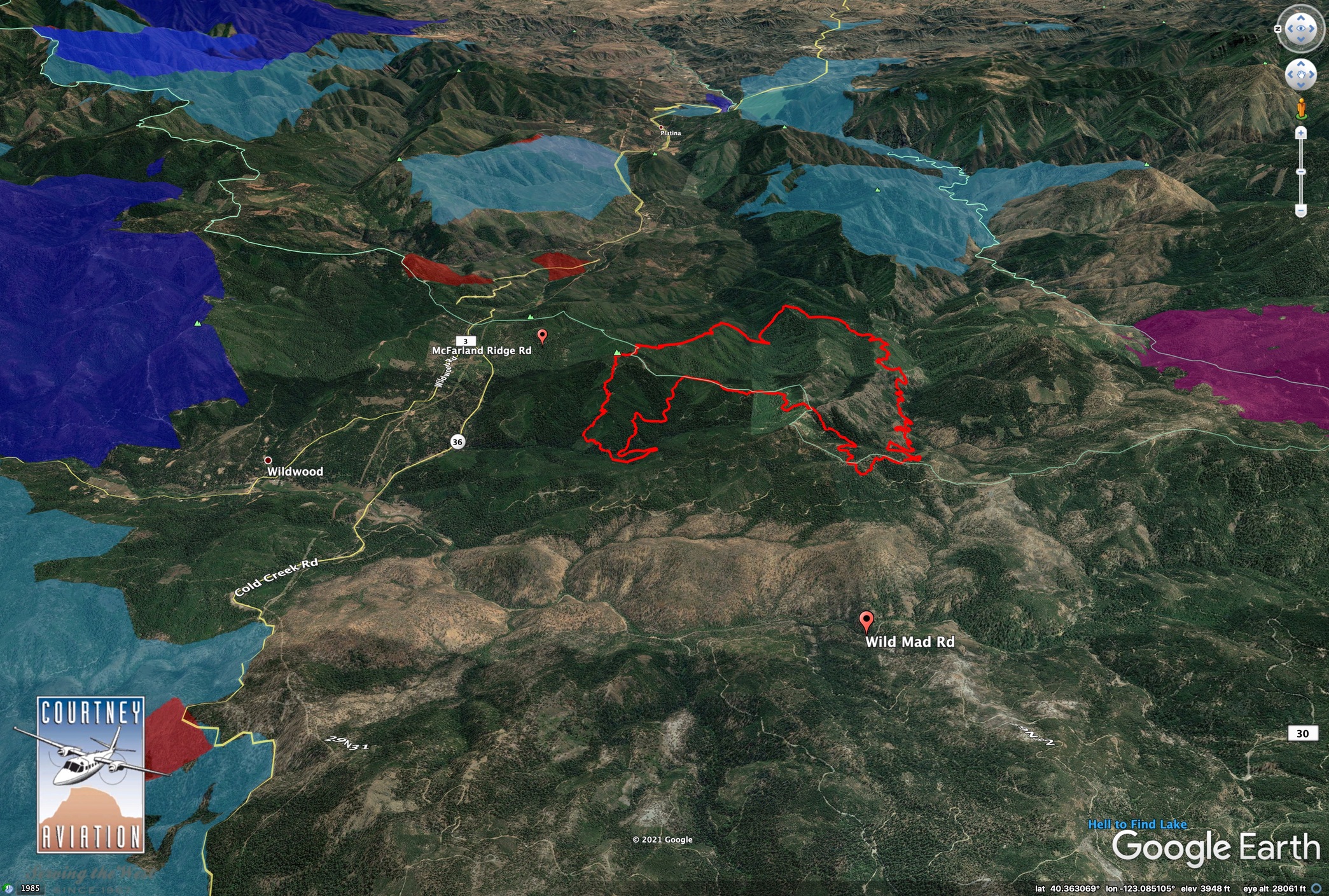
1800: Fire has pushed west and several spot fires have gotten established for a total of 130-200 acres on the west side of Wild Mad Road (the “30 road”)
Earlier today confirmed the south has gotten into the bottom of Sec 25, the very top of the North Fork Beegum Creek. That entire gorge west to east is a watch out for terrain aligned winds as the coastal influence breaths with the valley.
Also see @pyrogeography post in the lightning thread with the mapping. This thing has a lot of room to do what it wants on its terms.
5 Likes
Last night’s IR with the Wild Mad Road for reference.
2020 August Complex in purple, 2015 fires in dark blue, 2008 fires are light blue.
6 Likes
With the IR map for reference, i would say this new intel means the fire has probably doubled(ish) in size since last nights flight?
1 Like
Thanks Chris for the picture. Worked with him the last two years on various fires. JB Fire Support.
2 Likes
As of 1830 on 8/1/21:
3,200 acres, timber and brush, 5% contained. Active fire behavior with long-range spotting observed. Threat to structures with Evacuation Orders and Warnings issued. Threat to State Highway 36, private timberlands, power-lines, gas pipelines and communication infrastructure. Type 2 CA Team 11 (Fogle) assigned but has not yet transitioned to command.
4 Likes
2200 Sunday: the down canyons have started in upper Beegum Gorge, crews having to back off a bit on the east end of Div Z and might not hold the 10 road (28N10). Pattymocus Butte RAWS is on the east end of the drainage and slightly sheltered by elevation, but you can still see the daily breathing down canyon west at night, up canyon east winds at sunrise.
3 Likes
Definitely increased fire behavior the last 30 min (10:20pm)
http://www.alertwildfire.org/shastamodoc/index.html?camera=Axis-Hayfork2&v=fd40730
3 Likes
Caltopo has the heat signatures posted:
https://caltopo.com/map.html#ll=40.34947,-123.04136&z=13&b=t&o=f16a%2Cr&n=1,0.25&a=fire%2Cmodis_mp
zoom out and scroll around and the other lighting fires are showing up.
1 Like
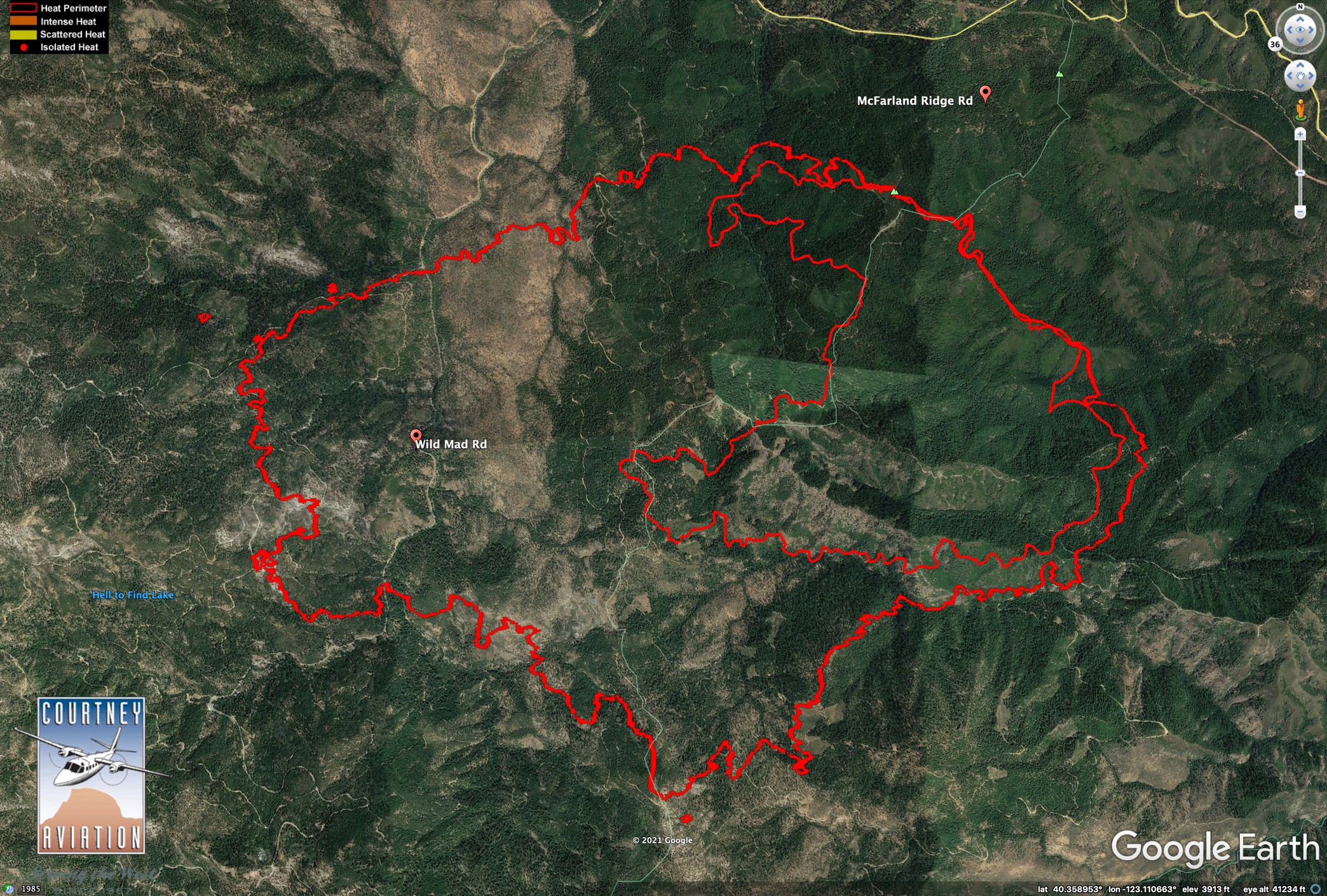
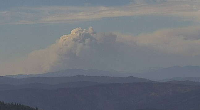
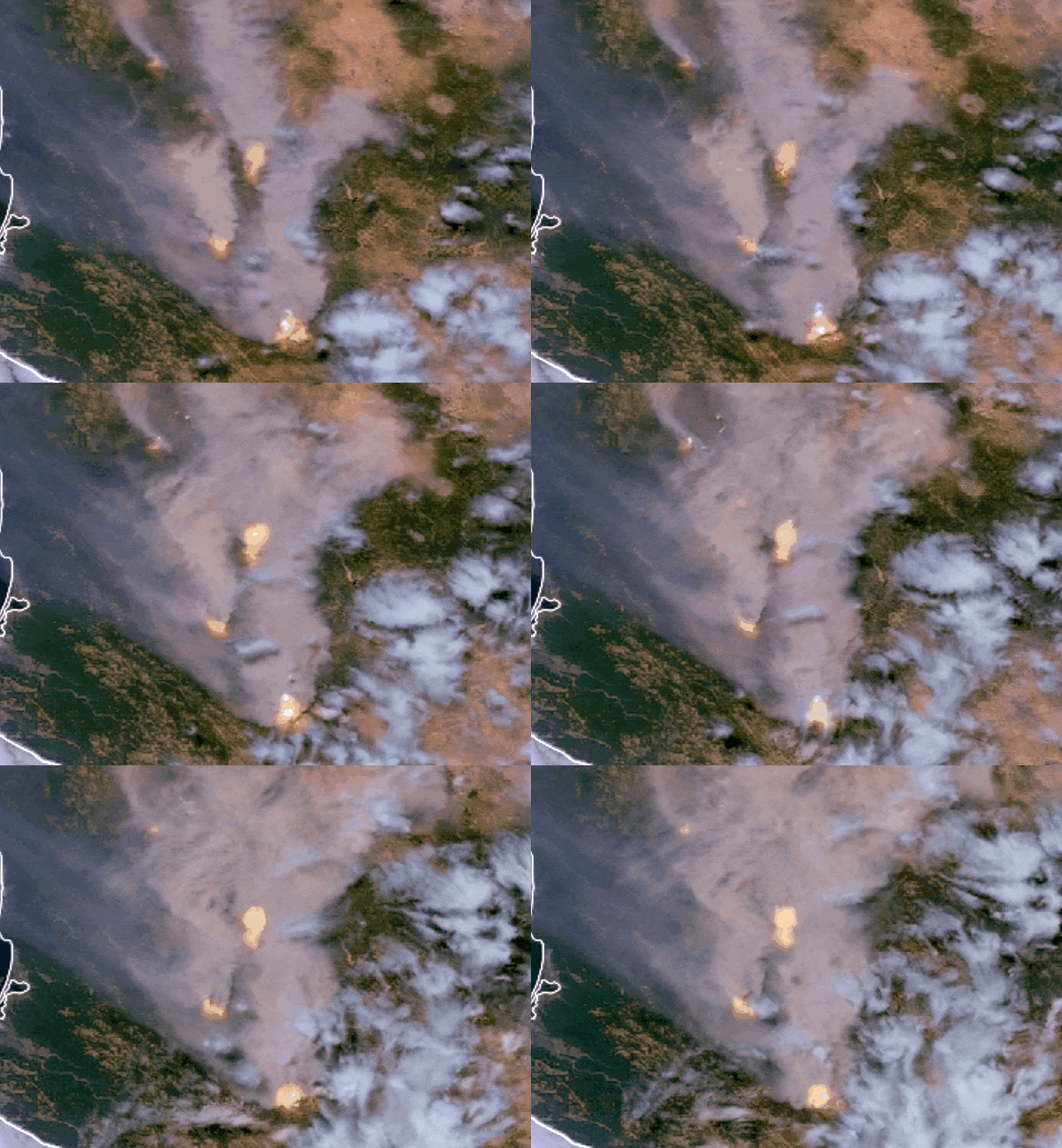
0640 ONCC Update:
CA-SHF McFarland Fire:
15,925 acres, timber and brush, 5% contained.
Active fire with long-range spotting observed overnight. Threat to structures with Evacuation Orders and Warnings issued. Road trail and area closures in effect. State Highway 36 is closed . Threat to private timberlands, power-lines, gas pipelines and communication infrastructure.
Type 2 CA Team 11 (Fogle) is in command.
3 Likes
In the context of this fire doubling in size every 24 hrs, I think this sounds pretty funny.
The fire is clearly in command, at the moment.
15 Likes