
2200 Sunday: the down canyons have started in upper Beegum Gorge, crews having to back off a bit on the east end of Div Z and might not hold the 10 road (28N10). Pattymocus Butte RAWS is on the east end of the drainage and slightly sheltered by elevation, but you can still see the daily breathing down canyon west at night, up canyon east winds at sunrise.
3 Likes
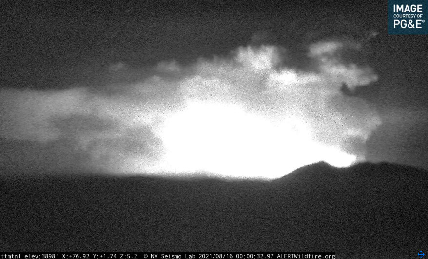
Definitely increased fire behavior the last 30 min (10:20pm)
http://www.alertwildfire.org/shastamodoc/index.html?camera=Axis-Hayfork2&v=fd40730
3 Likes
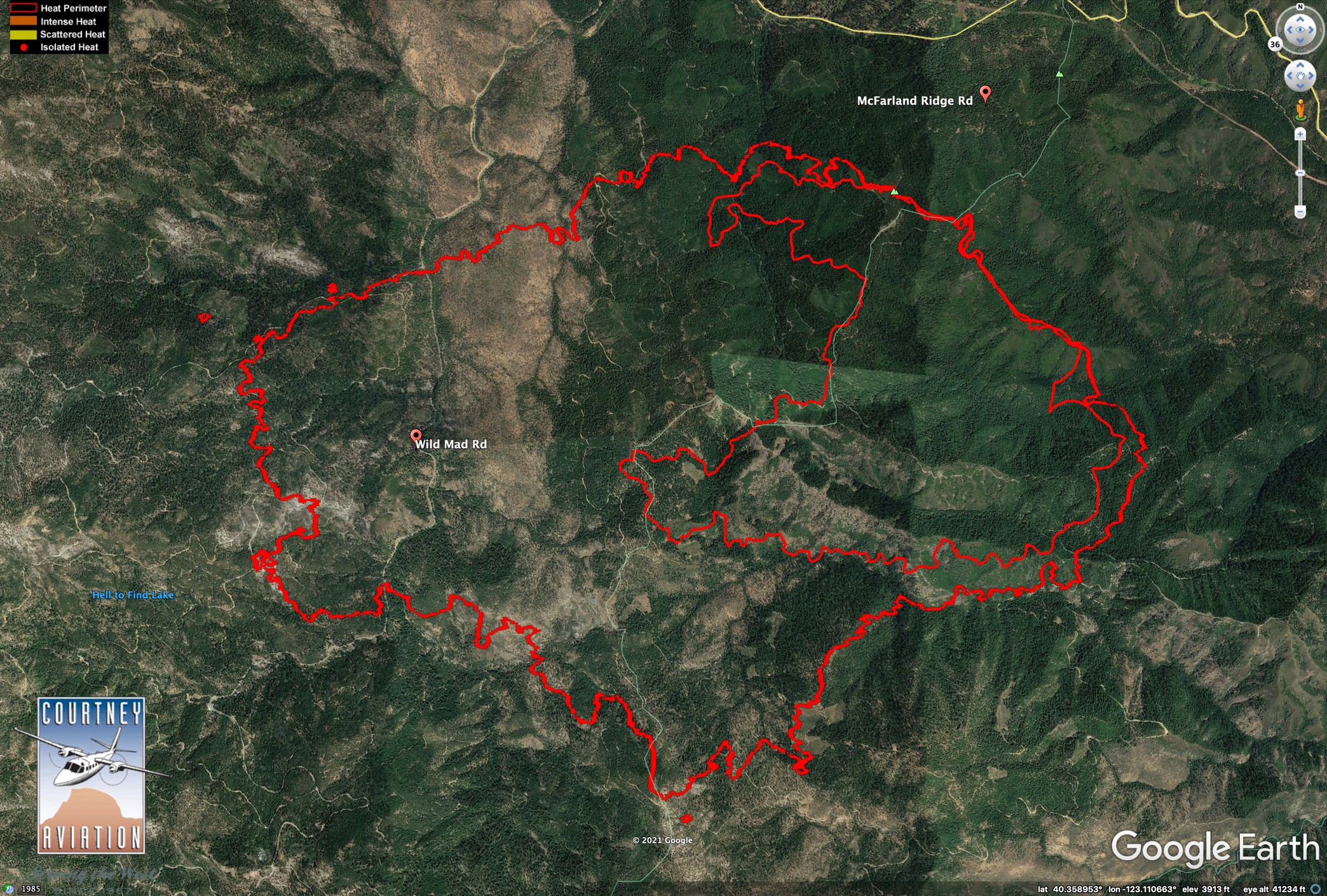
Caltopo has the heat signatures posted:
https://caltopo.com/map.html#ll=40.34947,-123.04136&z=13&b=t&o=f16a%2Cr&n=1,0.25&a=fire%2Cmodis_mp
zoom out and scroll around and the other lighting fires are showing up.
1 Like
0640 ONCC Update:
CA-SHF McFarland Fire:
15,925 acres, timber and brush, 5% contained.
Active fire with long-range spotting observed overnight. Threat to structures with Evacuation Orders and Warnings issued. Road trail and area closures in effect. State Highway 36 is closed . Threat to private timberlands, power-lines, gas pipelines and communication infrastructure.
Type 2 CA Team 11 (Fogle) is in command.
3 Likes
In the context of this fire doubling in size every 24 hrs, I think this sounds pretty funny.
The fire is clearly in command, at the moment.
15 Likes
Ha! Yes that was an interesting sentence considering the current conditions. This could be more accurate: “ Type 2 CA Team 11 (Fogle) is assigned, the Planning, Operations, and Logistics Sections are developing and implementing long range plans for containment….with no sleep in the forecast.”
(As a former IMT member I truly wish them luck and a safe roll to get a handle on this fire.)
7 Likes
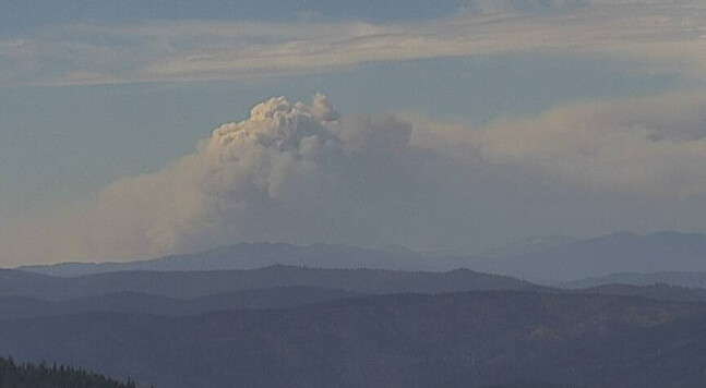
Aircraft have tried getting in all morning but zero vis anywhere around the fire. At 1015 the column finally busted through the inversion and going straight up before upper northerly flow.
5 Likes
3 LATs, 2 VLATs, 2 S3s, and a Lead requested by AA
3 Likes
data package is posted at maps.takserver.us for the mcfarland. Sorry for the interruption in services but I only make these for people when I know there are ATAK users on the incident.
7 Likes
Ducket looks like it has some brisk wind with how the trees are swaying.
http://www.alertwildfire.org/shastamodoc/index.html?camera=Axis-Ducket&v=fd40730
Beegum raws is get 30mph gusts.
1 Like
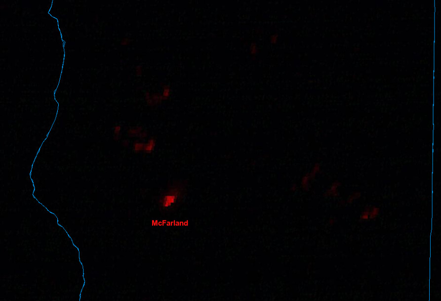
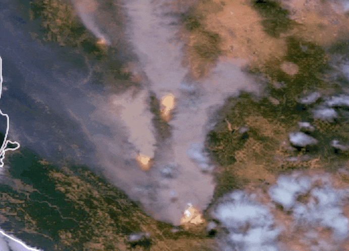
0300 MODIS is showing about 15,000 acres of growth to east on McFarland.
Not boding well for upcoming weather. 2020 fire scars will help, though (shown in red).

530 AM PDT MON AUG 16 2021
…FIRE WEATHER WATCH TUESDAY NIGHT AND WEDNESDAY…
HOT AND DRY WEATHER CONTINUES TODAY. LOCALLY BREEZY WEST TO
SOUTHWEST WINDS ARE EXPECTED AGAIN THIS AFTERNOON ALONG THE
WESTERN EDGE OF THE SACRAMENTO VALLEY. NOT AS HOT TUESDAY THROUGH
THE REMAINDER OF THE WEEK. GUSTY NORTH TO NORTHEAST WINDS WILL
DEVELOP TUESDAY NIGHT ACROSS MUCH OF THE SACRAMENTO VALLEY AND
SURROUNDING TERRAIN AND WILL CONTINUE WEDNESDAY. COMBINED WITH LOW
HUMIDITY AND EXTREMELY DRY FUELS, CRITICAL FIRE WEATHER CONDITIONS
WILL BE POSSIBLE.
5 Likes