
State ID:CA
3 letter designator:SHF
Fire name:SALMON
Location:west of Salmon mountain (41 10.056, -123 24.438)
Reported acres:20+
Rate of spread:
Report on Conditions:active torching
Structure threat:
Resources:AA, 1 LAT, 2 S2, TANKER 911 inbound.
Hazards:
Weather:
Radio channels:
Scanner link:
Webcam link:
Agency Website:
2 Likes
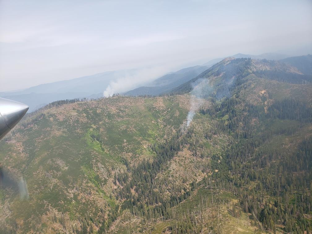
AA507 coming off the fire. Reporting 220 acres in brush and heavy snags working. Load of jumpers on the fire, and retardant lined.
Also, not sure how blurred the lines are between SHF Salmon and the SRF Red. They are right next to each other, and the fixed wing seemed to be all on the Red, just NW of the Salmon. The GOES17 IR heat all afternoon seemed to be on the SRF and KNF sides. Maybe when the two smokes were infant 1/4 acre smolders it was easy to say one was SRF and one was SHF, but now it’ll be interesting what comes out tomorrow morning.
Salmon is all on the western half of Section 20 here.
3 Likes
This was the Salmon this morning with the Red in behind it. The Salmon didn’t look so good this afternoon.
9 Likes
Just inside the megram and redspotfire scars.
1 Like
Looks like it was fairly active through the night.
It doesn’t appear that its visible on camera right now. Inciweb last evening had it at ~220ac and in the NW corner of the Trinity Alps Wilderness. The lightning activity over the last few nights has created a lot of work in that part of the world.
1 Like

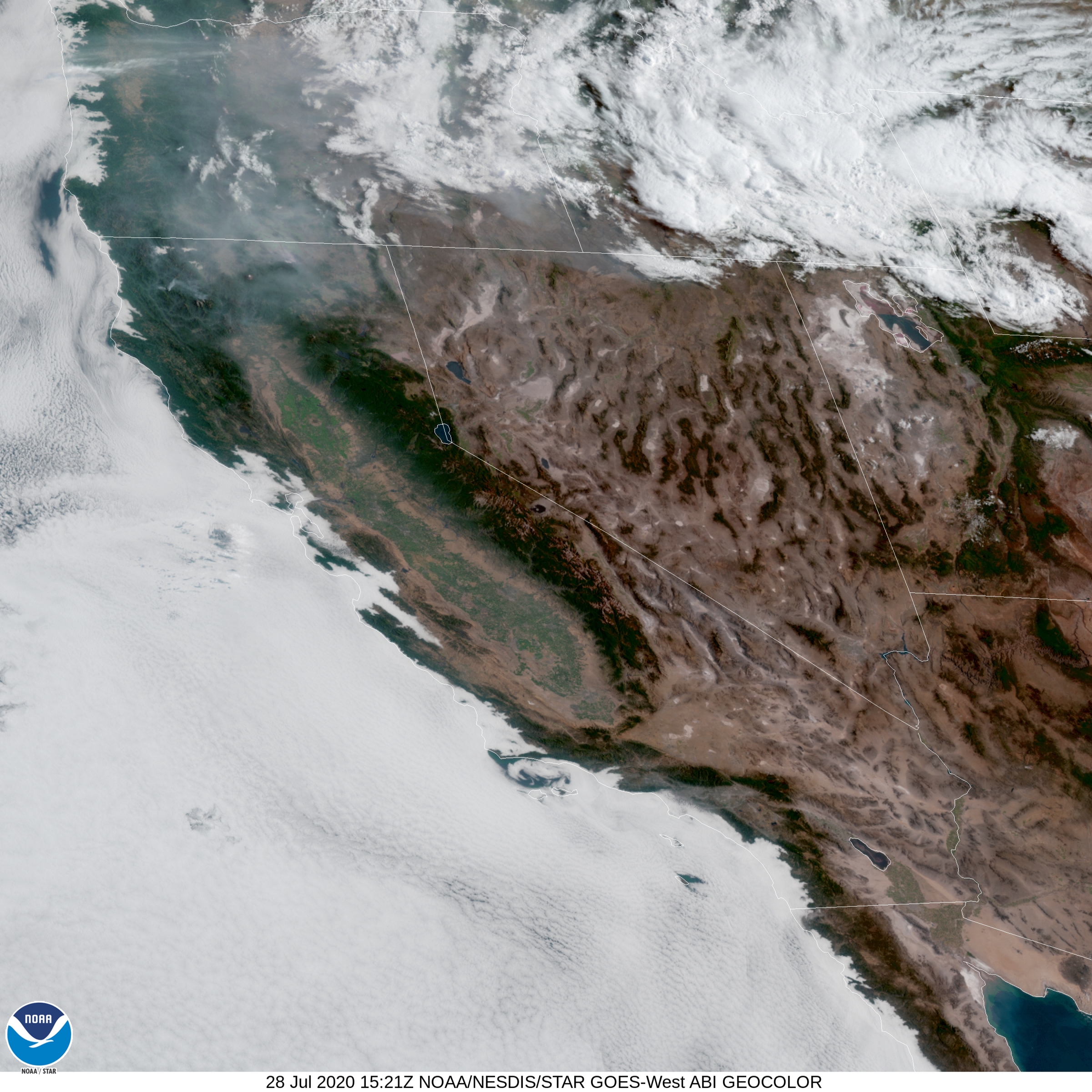
Local news is reporting 550ac and had several graphics. kymkemp.org
/Users/davidbrown/Pictures/Photos Library.photoslibrary/originals/C/C53C574F-27EC-4A6A-8AC0-7197BC085AA1.jpeg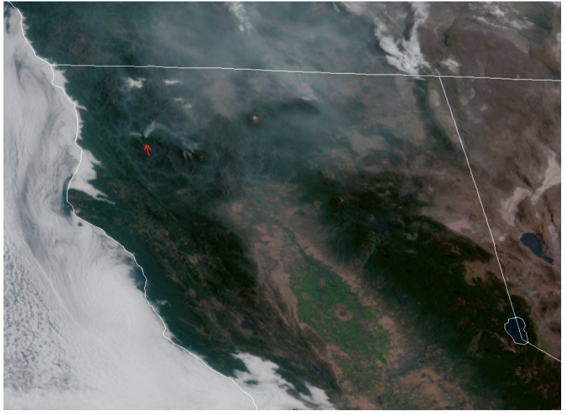
5 Likes
CA IIMT2 Team 14 is assigned inbrief tomorrow 1100.
6 Likes
Any news on location of ICP
Willow Creek, Ca.
Veterans Park
2 Likes
Any update on conditions?
Salmon fire along with Red fire are in the Red Salmon Complex
https://inciweb.nwcg.gov/incident/6891/
1 Like
Better than call it the red herring
7 Likes
Looks like both the Red and the Salmon are 500+ acres each. North Ops has them at 1060 combined yesterday, no IR flight last night (UTF), and the satellite detections show significant growth, especially on the Red. The Ops map definitely shows the “big box” in the works on this one, I’m afraid it will be Nor Cal’s smoke generator for the month of August. The country that this is in is about as remote, rugged, and inaccessible as you can get in California.
Ops Map link:
3 Likes
Fishcop (or anyone else)- are the IAPs no longer on that site for the Federal incidents?