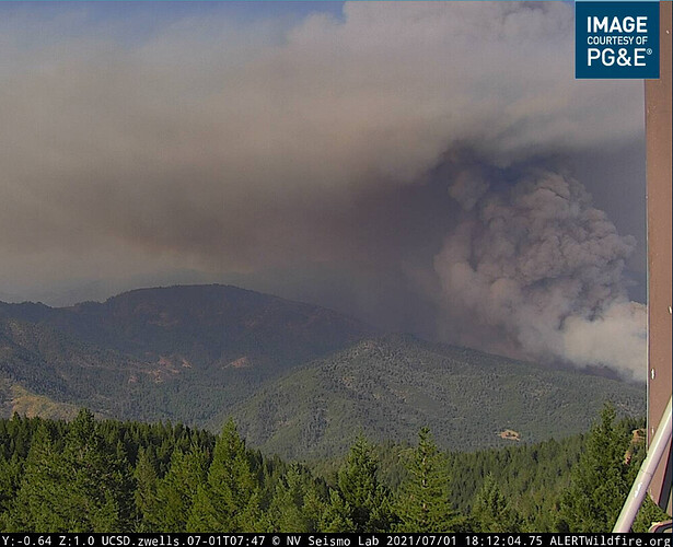
Sugarloaf cam is back.
Winds have kicked up considerably in the past hour out of the south, which has also cleared the Sugarloaf camera view.
WX stations also concur
WX PGE Cascade (Lakehead proper) 91F 28RH S9G14
WX PGE Sugarloaf (above Lakehead and higher than fire) went from casual east to heavier ESE.
WX PGE Whiskeytown (which is really Gray Rocks at the bottom of the Lake,) is a good indicator of the influence coming off the valley floor and into the McCloud and Sacramento Arms of the lake.
From Shasta Sheriff…The evacuation warning for Fenders Ferry Rd. between I-5 and Gilman Rd. is being upgraded to an evacuation ORDER. Evacuation center is still set up at Central Valley HS.
Also, Delta School Rd. and Delta Rd. are now under an evacuation WARNING.
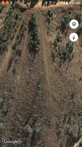
Good shots on your google. You get good perspective of slope alignment.
Whiskeytown HQ#2 RAWS: 1300 hours. 98 degree air temp. 24% rh with a 24 hour showing late day rh recoveries starting at 1800. Long hot days! Whiskeytown HQ#2 California
Whiskytown is way off from the salt fire.
Location: PG954 Lakehead
Current Temperature: 94°F
Relative Humidity: 25%
Current Wind Speed: 11 MPH
Wind Gust: 19 MPH
Observation Timestamp: 14:40 July 01, 2021 (Pacific Daylight Time
Sugarloaf, Whiskeytown & PG 954 Lakehead RAWS: All THREE show 90’s (within 4 degrees) of one another with Rh’s in low 20’s within a degree or two. Closest RAWS I could find. Coorilating data within miles of each other which shows general trend of high temps, low (critical) Rh’s and afternoon peak burning. Sugarloaf (SHF) California
as per Inciweb. 2 hrs ago: 4500 ac/ 0 % containent
This view from Anvilhead, from Sugarloaf1 cam, shows the fire racing up the north slope of the Middle Salt Creek drainage (where Gibson Creek comes into Middle Salt.) Depth-wise, it appears to be running right along the Delta line. Middle Salt Creek is the separation between Hirz (to south) and Delta (to north) here. Next drainage to the north is Campbell Creek. South side is untouched, midslope north side of Campbell Creek starts the Delta footprint. We’ll see if this has enough steam to make it up, over and back down tonight, or cheats and throws a spot.
edit: looks like it could be hooking a bit right, towards Crane Mtn. Still Delta scar anywhere north of Middle Salt Creek in this area.
edit2: Perspective in the picture - looking ENE, so north is “left” and south is “right”
Wile the Hirz scar will reduce the intensity, ROS will may be a problem if the wind keeps up. Doubt they have time and resources to open up the old brakes intime
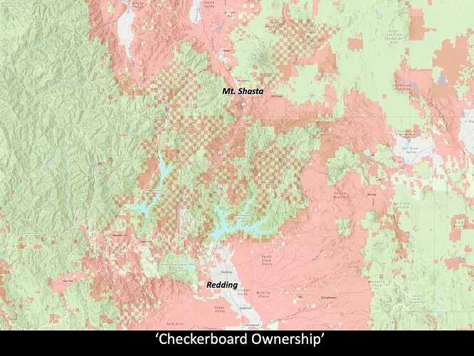
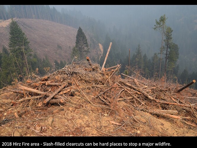
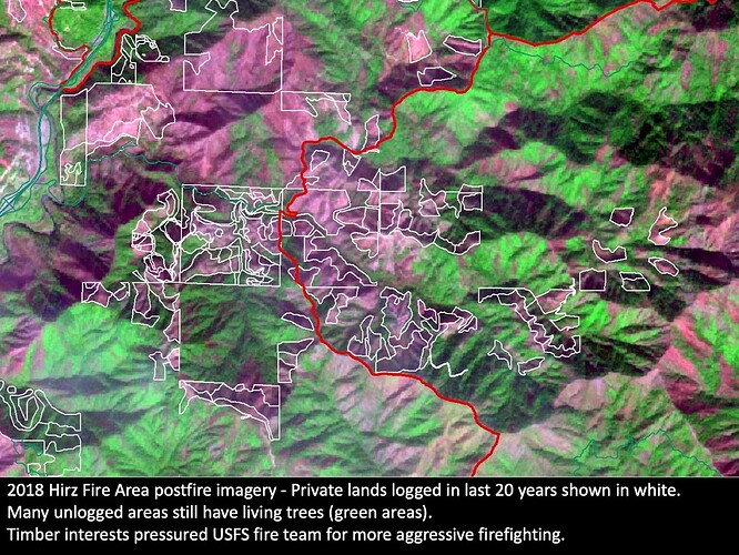
A lot of the Hirz Fire area is checkerboard ownership. A lot of the private land in Hirz Fire area was in younger clearcuts that had lots of slash and burned hot, while much of the USFS lands had less recent logging and had more surface fire in 2018. The fuel loading will mainly be young growth and dropped branches. I’d bet that most of the larger trees which survived Hirz would survive another burn. Last year’s Bear Fire really slowed down in Feather River Canyon when it hit the 2018 Camp Fire.
Pink areas burned hot, green areas underburned.
It looks like this fire blew thru some cable-yarded logging units with a ton of slash. https://maps.app.goo.gl/cdCBoRS1LDoPZWjy7
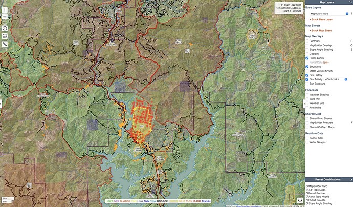
Salt has burned into Hirz Fire for most of its NE flank. Salt 29210702
Looks like northern progression reached the top of the spur ridge north side of Middle Salt Creek about midnight last night and then held there throughout the night. T36N 5W S36, 4W S31. Fire hit a jackpot of heat around 330am somewhere up the creek drainage that popped through the inversion for a bit, another around 630am.
Fire activity has increased in the Campbell drainage…
7,467 acres with 5% containment.
41 structures destroyed… including 27 residences and 14 outbuildings per inciweb
From Shasta SO…Due to increased fire activity threatening structures on Gilman Rd., an evacuation WARNING is being issued for Gilman Rd from Old Mill Rd to Top of the Hill Rd. Citizens are asked to prepare vehicles, prescriptions, and supplies in preparation of an evacuation order.
Excavator fire into the veg, working on contingency line in the green. 1 acre MROS, 2 tankers 1 helo plus ground response from shf and shu

