CA-SHU-Fawn???

Welcome @Tvc4gcross to these forums. It’s important to keep questions in the Q&A thread, which is marked with the ?? after the name. Here is a direct link. This thread is for fire intel only, fire behavior, direction, weather, observations.

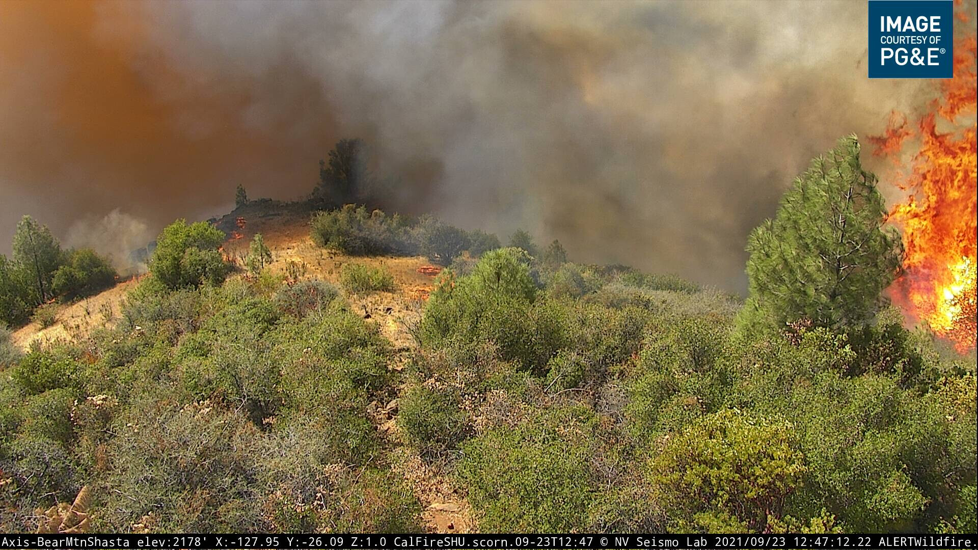
It’s also important to scroll up and read the narrative, as often the questions are already answered. In this case, the evacuation orders mentioned 2 hours ago give a clear picture of where the boundaries are that they think this fire is going towards. Quoted The Shasta County Sheriff’s Office is issuing an mandatory Evacuation ORDER. All roads off of Bear Mountain in both directions between Dry Creek and Old Oregon Trail must evacuate immediately

If you have questions on particular roads, hit up google maps and reference the evac boundaries above. This google link will get you right to the bulk of roads that are directly impacted currently.

11 Likes

Getting crowded up there

5 Likes

Yes it is. That doesn’t look like the rotowing are showing either.

1 Like

They are now
image

3 Likes

9 Likes

@pyrogeography, can you post a KML or link to the data for the map that you just posted to twitter? I’d like to open it on Google Earth so I can scroll around.

2 Likes

It’s about to get hot at Bear Mountain

3 Likes

Have to see if it survives!

1 Like

The Sky Crane is giving that area some attention making a few drops hopefully slow it down.

1 Like

Is this fire large enough to initiate an IMT? Or has one already been assigned?

1 Like

Don’t think one is rolling yet, but I’m guessing it will be soon.

1 Like

@MVUFirePhotographer posted two shots from the cam showing the fire let off a little steam :slight_smile:

4 Likes

ITS GONE BEAR CAMERA

5 Likes

Screenshot 2021-09-23 at 13-39-55 ALEXANDRA ANDREEVNA SOUVERNEVA - Recently Booked

She was booked on 09-12-2021 Douglas County, Oregon, criminal 2nd degree trespassing,
Lab tech turned Shaman…

2 Likes

The CalTrans CCT cam at 5 & 273 somewhat adds some perspective on how the westward movement towards I5 is occurring.

CalTrans I5 & 273

1 Like

Per AA: 3500 acres

3 Likes

Any good scanner links ?

2 Likes

Anybody know where ICP is going to be?