KML files filtered from 20210926 Fawn data package found here:
https://ftp.wildfire.gov/public/incident_specific_data/calif_n/!CALFIRE/!2021_Incidents/CA-SHU-010480_Fawn/GIS/IncidentData/20210926/
For import into CalTopo, Google Earth, etc. Can’t vouch for how accurate they keep the data vs what’s really on the ground.
Contained Line. There is 1 entry:
Completed Dozer Line. There are 51 entries:
Completed All Type Of Line. There are 69 entries:
Planned All Type Of Line. There are 0 entries.
Fire Perimeter:
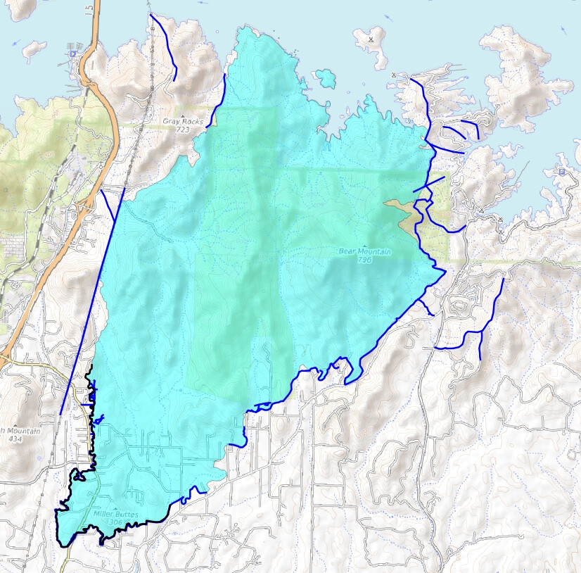
A map I threw together with some of this data:
Light Blue Area = “Fire perimeter”.
Dark Blue Line = “Completed All Type Of Line”.
Black Line = “Contained Line”.