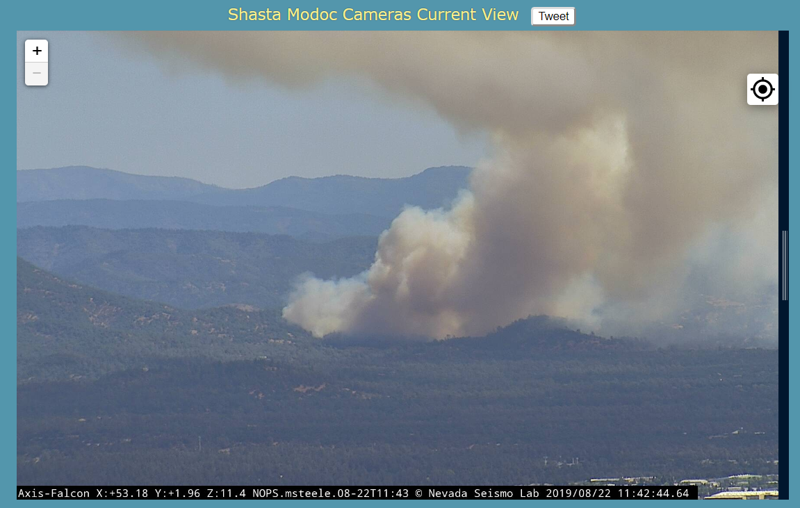
SHU - north side of Bear Mtn Road in Jones Valley area. Multiple spots south side of Bear Mtn Rd. Very fast start from thefire cams. Augmented dispatch just from smoke column for addl ground, rotor and fixed wing.
Not sure what the broadcastify scanner has, my scanner based out of Red Bluff has SHU Local and Command on priority, air tactics FM and air to ground (when the aircraft isn’t banking its antenna from me), as well as plenty of AM Victors, Natl FF etc.
It’s an mp3 stream so will need itunes or winamp etc on desktop, or VLC or other app on mobile. www.scancal.org/live.html for the launch page or norcalscan.live straight in the media player.
Just west of Jones fire footprint. I was at the Bella Vista station when it burned over and continued down Deschutes. Thankfully this is midday so everyone is up and at 'em, and not as strong of winds. Jones was basically from shore of Lake Shasta to Redding Airport in 6 hours or something like that?
Also, what a day for 10 new PGE fire cams to come online for the Shasta-Modoc network. Great timing, and an amazing resource for fire location and conditions.
I went to check the Southfork cam at SHU’s prealert for this fire and it was already zoomed in on the smoke. Hit the target feature to get an idea of a cross off Bear Mtn Rd and see 3-4 other camera targets all intersecting the area. What the heck?! Zoom out and see more blue triangles suddenly appear.
 so perfect!