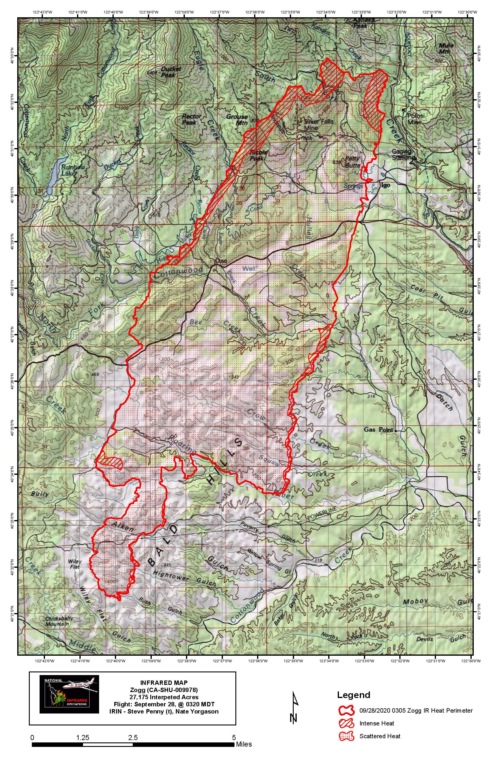
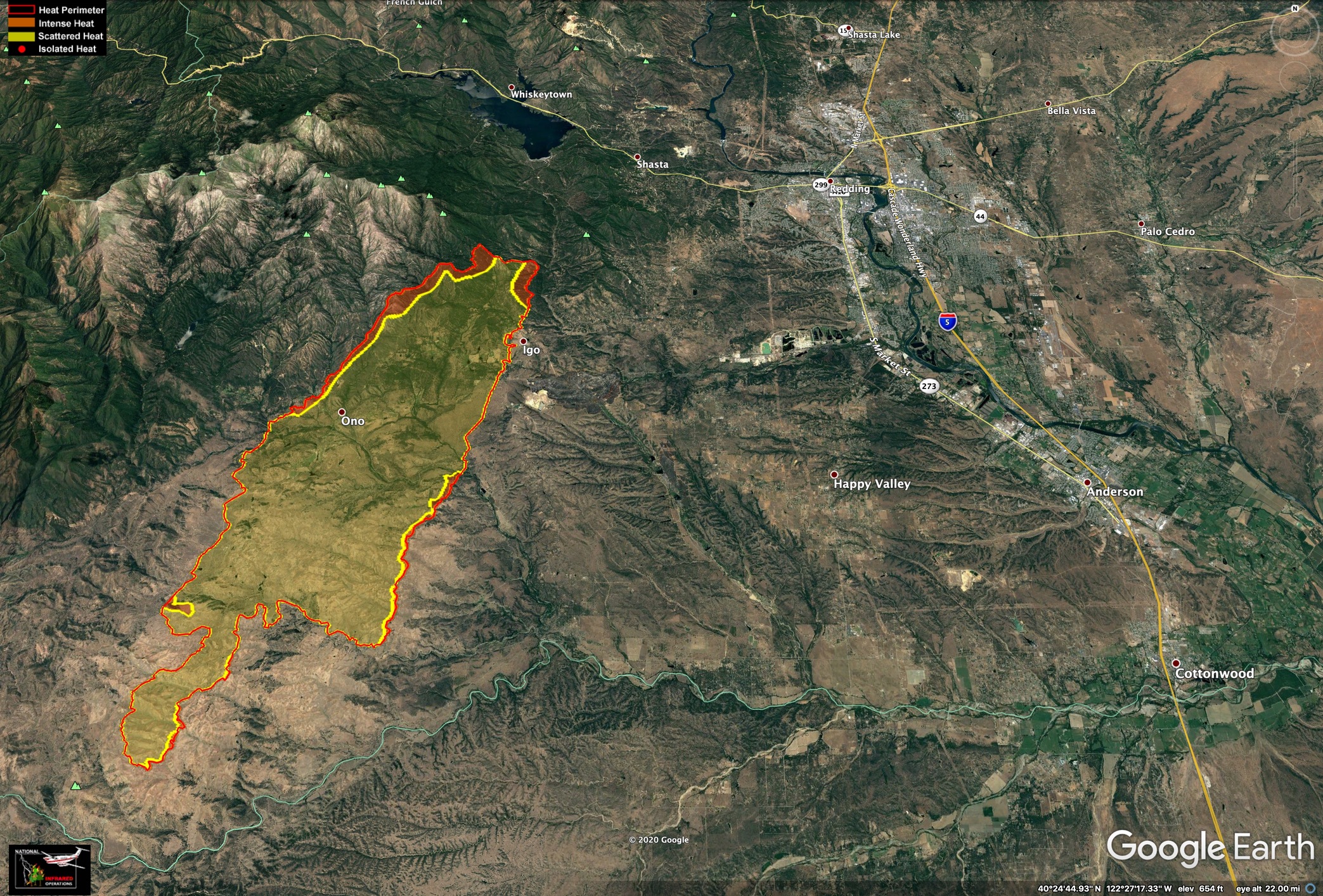
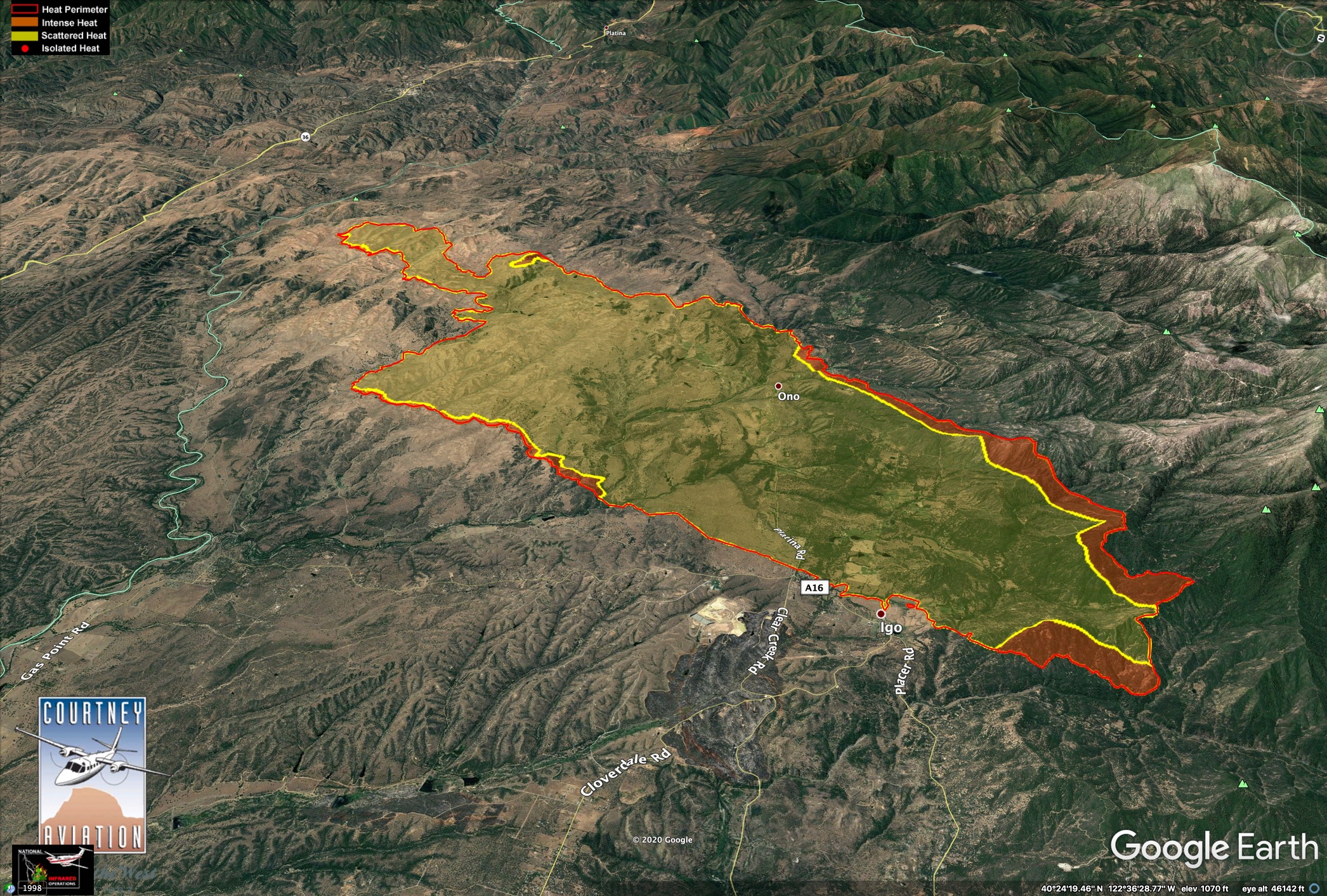
IR map from 0320 hours. 27,175 acres, wow.
7 Likes
Ground intel has verified GOES imagery fire is still well north of “the creek” (middle fork Cottonwood, Shasta/Tehama county line). It is excellent dozer country at the head of this thing at the bottom of Foster Road so they’re setting up to try and hook it around to the west.
0930 update:
They can only fill 4 or 5 S2’s (RDD, CIC, Grass Valley), and Tanker 01. No ASM available at the moment. Fixed wing launching now and C102 overhead.
7 Likes
Fire has spotted across Cottonwood Creek, well established about 1/2 mile ahead of itself, per the scanner.
Edit: From the cameras, looks like there’s significant activity at the heel moving toward Whiskeytown Lake. And now on the scanner, it has crossed their line, pulling resources out to Placer Road to regroup.
3 Likes
Fire is running clear creek, so far staying on the west side. If it jumps the creek additional evacuations will be ordered to Swasey and points south potentially.
3 Likes
Hold up - the incident is running two “the creeks”, Middle Fork Cottonwood and Clear Creek. This spot was over Clear Creek. I did the same immediate head crank to the radios when they said that.
Branch 1 DIV A “the creek” is Clear Creek, which has been their #1 priority on the fire to keep west of.
Branch 2 DIV F “the creek” is Middle Fork Cottonwood Creek, and has been held up right at Crow Flat it’s sounded like since this morning. Sec’s 28 and 29.
EDIT: I may have missed this as others did hear it cross Cottonwood Creek. Yikes.
3 Likes
OK, might have misheard, but I could swear I heard the Cottonwood Creek traffic a few minutes prior to the Clear Creek traffic. But I had the Glass Fire scanner running on the same computer, and a local scanner behind me, so could just be scanner overload  . Apologies if I got it wrong!
2 Likes
Hoping that is correct, I heard the same thing fishcop did, spot and established south of Cottonwood Creek and still holding west of Clear creek.
2 Likes
5 Likes
Yikes - I missed the Cottonwood Creek confirmation. I thought I heard the same thing, spot and established, but quickly got the idea they were mentioning Clear Creek. Then heard the clarification it is still west of Clear Creek, which then makes the radio traffic make more sense. Thanks.
1500: this thing is lining up to hit Hwy36 just east of Stewart Ranch Road and Vestal Road. About here on Google Maps
5 Likes
TGU now sending resources to fires on So. side of Cottonwood Creek. Div. spotted fire and requested equip from Baker station. 2 Eng’s , Dozers, and Copter.
3 Likes
I don’t know how much they have left in the toolbox?
3 Likes
Night Air Attack ordered up and will be over the fire at 2030. That’s a great tool out of the toolbox.  I think that’s a first over SHU, unless Carr had it one of the nights.
10 Likes
1900 update
31,237 acres 0%
146 structures destroyed
3 civilian fatalities
2 Likes
Any update on resource request?
L C E S
6 Likes
Hoping Night Air Attack ISR becomes the new norm. Fixed wing for initial attack ISR then move to Type 1 UAS for type 2 and above incidents. This is not having AA do two missions this would be strictly for ISR.
5 Likes
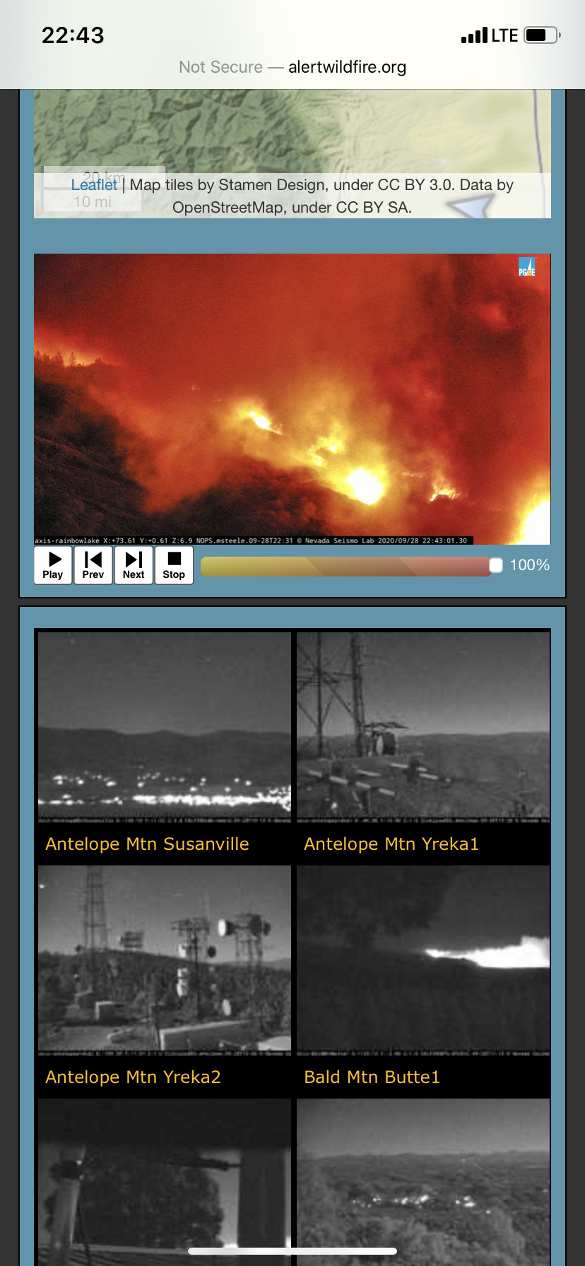
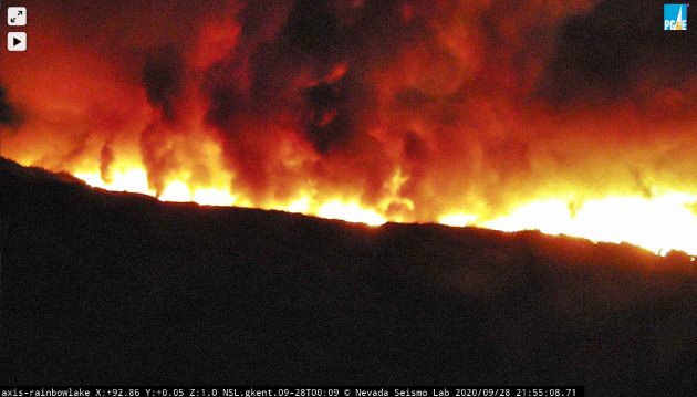
Just saw that…thinking that camera might be in trouble later
4 Likes
Crazy. It’s getting so bright the rainbow lake cam switched back to day color mode. Not good for the cam soon
3 Likes