Rainbow still online as of 0600 this morning. The 12 hour loop is impressive.
5 Likes
2 posts were merged into an existing topic: CA-SHU-Zogg??
Tehama update
Fire is still in check north of Hwy 36 and it’s promising to be a good stop, especially in this area where fuels are sparse and a creekbed runs along the entire north side of the highway. No resources on this piece of the fire at the moment. AA is setting up for two projects, to paint the south side of 36 to help reinforce the hwy corridor in this area, and then the finding a good spot on the left shoulder (east side) to anchor in and paint back north to the middle fork of Cottonwood Creek. There is a dozer line he was seeing that might be a good spot, but it might have to be a paint job with ground crews coming in well after the fact.
10 Likes
50,102 acres 0%
4 Likes
Any updated mapping
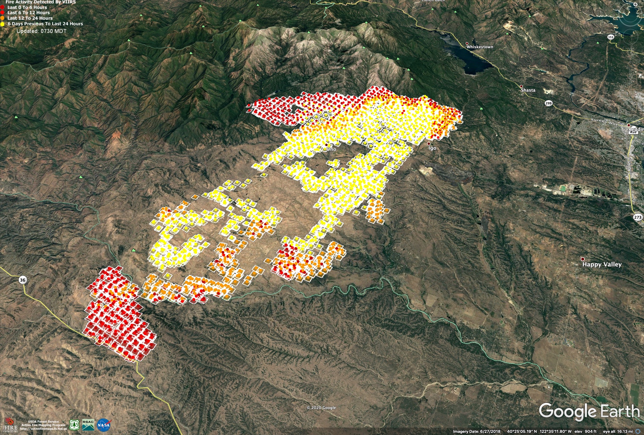
Not too much growth on Zogg in the last 24hrs. It worked a little bit NW and W around Rainbow Lake, and then a little to the east into Horse Gulch area, south of Cottonwood Creek. From the IR mission notes, the entire northern half was covered in scattered heat, while the southern half had some cool areas between heat patches.
Last night’s IR perimeter, looking NE, showing 24hr growth from Monday’s IR perimeter in blue.
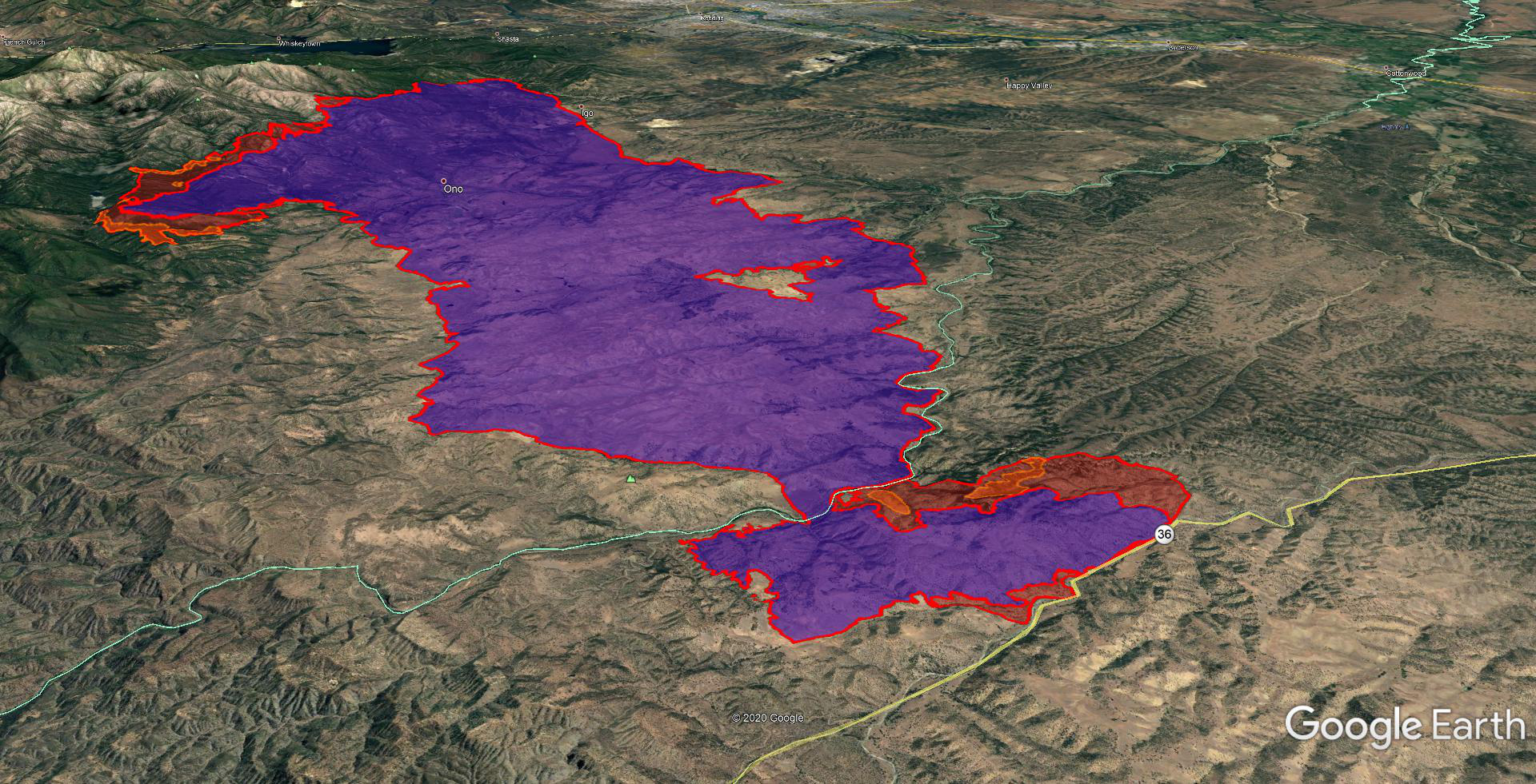
Last night’s IR perimeter focused south of Middle Fork Cottonwood Creek (the Tehama County side), looking slightly NW, showing 24hr growth from Monday’s IR perimeter in blue. Also MODIS/VIIRS hits for latest heat signatures.
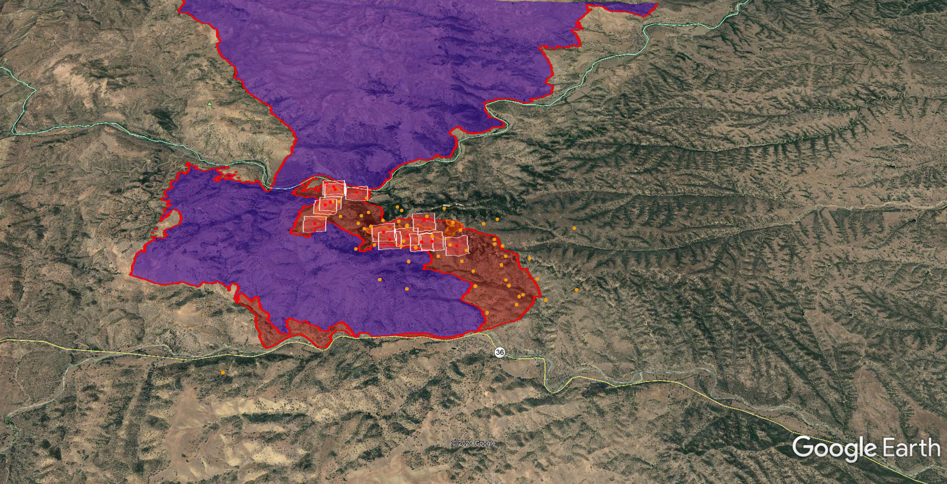
This southern piece is interesting, as air resources yesterday were directed to paint an indirect line 3 miles east of the fire, starting at the E in Earth on the map, and working their way north to Cottonwood Creek. A very large box. Multiple air resources were questioning why they were way out there as the fire intensity was very low and perfect for direct attack. By midday the lead plane was able to negotiate with DIVS on going direct, and for a good 2 hour window they successfully completed that direct line with 3 VLATs, 4 LAT’s and a couple S2s. However DIVS changed their mind and wanted aircraft back over the indirect line 3 miles east. Ground was insistent they wanted to burn that box off. The phrase “undue risk to aviators” was used multiple times over the radio before finally agreeing to go back to indirect. In the end of that mission, they put in 6.1 miles of indirect line, 3 miles to the east of the fire’s flank. Lead stopped the mission once visibility degraded later in the afternoon. Current GOES, early morning MODIS/VIIRS, and the IR perimeter all show fire’s edge currently stopped where they put the direct retardant line.
8 Likes
Started firing in DIV F (Tehama County Hwy 36) around 11am today. Just completed firing for the day it sounds like.
DIV F order up for tomorrow has 3 Charlies, 1 Golf, 1 Hotel, 4 Water tenders, 3 hose modules, 1 agency (TGU) and 2 private dozers, and 1 fireline medic/emt.
Little to no aircraft over the entire incident all day due to visibility.
3 Likes
Are those additional resources or in addition to resources already on the fire?
Only stated the resource order to give a picture of what conditions they’re expecting on that piece of fire in Tehama. It was a 215 order placed over the radio by DIV to Ops. As with any fire, they’ll fill the order out of staging or unassigned, and go from there…
4 Likes
Usually what the next shift will consist of. Probably will be filled with resources coming of their 12/24 off. Or very well could be new resources. Good way to tell is look a the iap (if available) and see whats currently staffed on that DIV
3 Likes
The division will push the request up the ladder once they have all the needs they will evaluate what they will have coming back from there day/time off. If it’s sufficient then they will just reassign equipment, if there needs exceed what they have then they will request more thru region.
3 Likes
Friday morning
Entire fire has been looking great the last 36 hours. There’s just a stubborn piece in the NW corner, right heel of the fire by Rainbow Lake and Ducket Peak. It is smoldering in some rough terrain and not having any clean fuel consumption so lots of potential for reburn if conditions deteriorate. Dozer line right on the Ducket Peak fire cam and you’ll often see 6+ dozers scooting along the camera to get back in there.
Minimal air ops since Tuesday afternoon due to visibility. They have snuck in a few rotor when safe enough in order to keep this NW corner in check, often just Helco and one heavy to avoid worrying about other aircraft in the smoke.
Likely my last update here. The scancal live scanner will remain focused on this fire for the next day or so but likely swing back to August North, with TGU/SHU IA coverage under that.
16 Likes
Good coverage and reporting. thank you
3 Likes
Looks Like PGE may hold the proverbial “Smoking Gun”
According to PG&E’s records, on September 27, 2020, a PG&E SmartMeter and a line recloser serving that area reported alarms and other activity between approximately 2:40 p.m. and 3:06 p.m., when the line recloser de-energized that portion of the circuit," the report read.
On Oct. 9, almost two weeks after the fire started, Cal Fire informed PG&E they had “taken possession” of the equipment as part of its ongoing investigation into the cause of the Zogg Fire.The corporation’s report says wildfire camera and satellite data show smoke, heat or signs of fire in that area for about three minutes just before 3 p.m. on Sept. 27, the day the fire began.
5 Likes
3 Likes