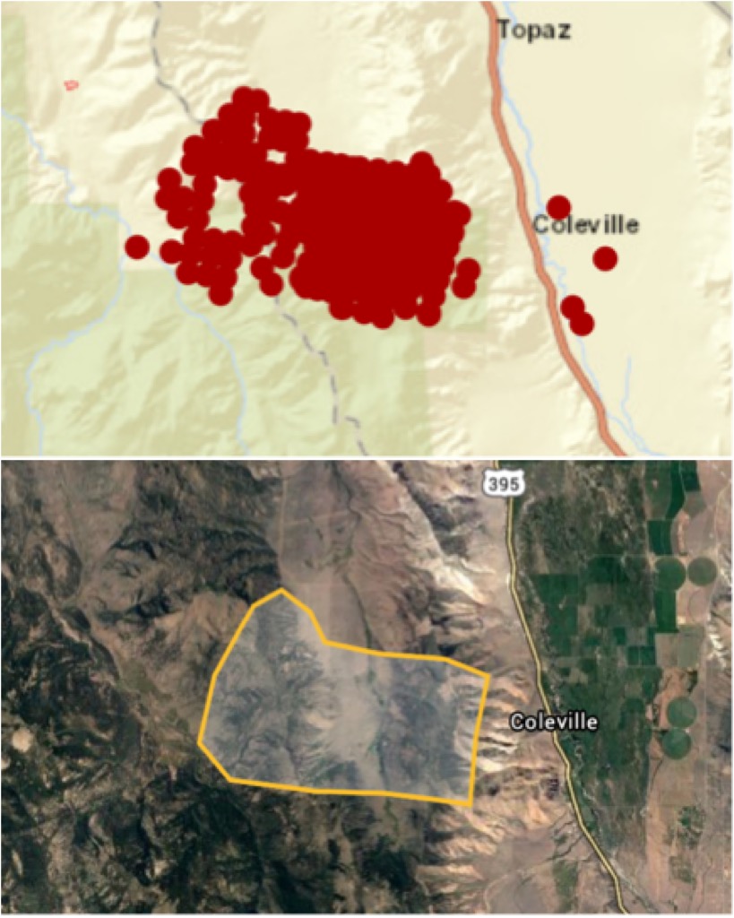
In Slinkard Valley, west of Topaz and Coleville CA.
Not sure if it’s CalFire, USFS or?
Reported around 6pm 8/29
Estimated 2,200 acres 8/30.
https://inciweb.nwcg.gov/incident/7105/?fbclid=IwAR3dpWnvOX0hYkczCqOwhoZirmeoKJYf5nm83-0ETKaCUtiJiHgz4LsbUUs
Google earth shape is 6,700.
“shrink” it a 1/4 mile on all sides and it’s still 5,500+
0% contained, super active overnight.
Bald Mtn, and Hawkins are pointed toward the fire, smoked out though. http://www.alertwildfire.org/inlandempire/index.html?camera=Axis-BaldNV&v=81e002f
1 Like
While it is in California, the Unit ID is NV-HTF, the Humboldt-Toiyabe National Forest. It is actually in the Great Basin GACC.
IA thread here:
From GBCC:
Incident ID:
2020-NVHTF-030684
Incident Name:
Slink
Fire Discovery Date/Time:
8/29/2020, 6:02:00 PM
Acreage:
2282 [total]
Strategy:
Full Suppression
Dispatch Center ID:
NVSFC
Fire Cause:
Unknown
Fuel Type:
Short Grass (1 foot)
Incident Commander:
Washam
Lat / Long:
38.64249 , -119.5275
Agency:
USFS
Predictive Services Area ID:
GB11
4 Likes