only heat showing up in all CA is on the Creek??
https://rammb-slider.cira.colostate.edu/?sat=goes-17&z=5&im=18&ts=1&st=0&et=0&speed=230&motion=loop&map=1&lat=0&opacity[0]=1&hidden[0]=0&pause=0&slider=-1&hide_controls=0&mouse_draw=0&follow_feature=0&follow_hide=0&s=rammb-slider&sec=full_disk&p[0]=cira_natural_fire_color&x=13556&y=3468
In a good spot too with no threat to anything in the middle fork of the san joaquin. There’s still some heat toward edison lake. Fire watch 51 is overhead.
333,880 acres and 55% contained.
down 1200 acres?
They changed it again 333,427 acres and 54% contained.
Edit:: 10/12 333,350
Putting up a good header right now in the middle fork of the San Joaquin, it’s long ways from anything.
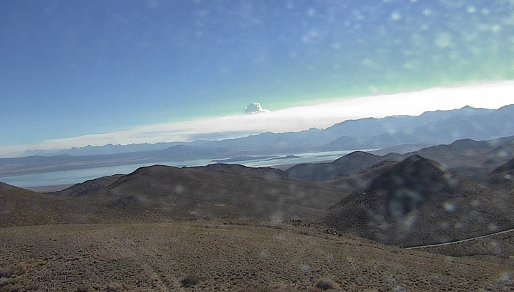
http://www.alertwildfire.org/sierra/index.html?camera=Axis-Buckhorn&v=81e004f
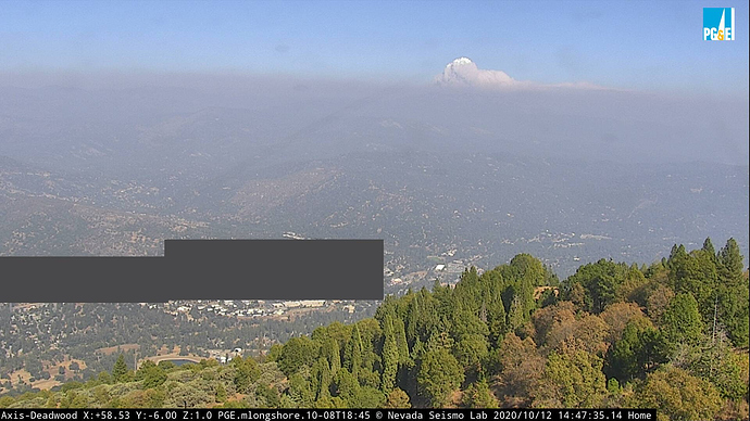
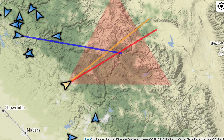
Found the same plume on Deadwood 1/2 triangulated the camera targets with Buckhorn. I think
you have the location spot on
Yesterday the fire crossed over east of the south fork into division M moving into heavier fuel and it has some wind behind it.
https://www.wrh.noaa.gov/mesowest/timeseries.php?sid=MMTC1&num=72&banner=gmap&raw=0&w=325
It’s showing on the meadow lakes camera too.
http://www.alertwildfire.org/sierra/index.html?camera=Axis-MeadowLakes&v=81e004f
Afternoon run underway.
http://www.alertwildfire.org/sierra/index.html?camera=Axis-Deadwood&v=81e004f
337,655 ac @ 55% containment per South Ops News and Notes AM update.
AA15 over the fire at 9AM and sent 3 copters out. 2 are working in Div. N, one for sling loads to hand crews and the other for water drops. 3rd one is in Div.M doing bucket work. Div.P is saying he sees a smoke outside the line but, AA15 is not finding that.
Mammoth Lakes helibase was setup 3 days ago. Some copters are stationed there. Winds out of the East allow clear air. Better then Mariposa.
10:30 update, DivN is getting a second type 1 for bucket work.
13:00 update, new slop over is now priority in Div.M and additional skycrane 1HT enroute to
assist. 4 copters will try to contain the new slop over and 1 copter will continue to work in Div.N.
Big firing firing op took place in division M using Arial ignition.
https://rammb-slider.cira.colostate.edu/?sat=goes-17&z=5&im=60&ts=1&st=0&et=0&speed=170&motion=loop&map=1&lat=0&opacity[0]=1&hidden[0]=0&pause=0&slider=-1&hide_controls=1&mouse_draw=0&follow_feature=0&follow_hide=0&s=rammb-slider&sec=full_disk&p[0]=cira_natural_fire_color&x=13798&y=3567.6640625
It’s crankin.
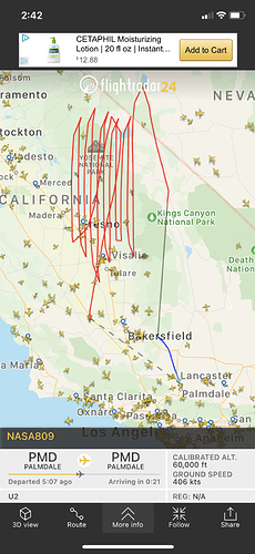
We’ve got nasa’s ER-2 U2 flying a pattern over the creek fire area at 60,000 feet.
341,722 acres and 55% contained. Division M burned actively through the night and is really starting to heat up.
Nice progression map posted 10/16 (am) showing current/latest growth.
And PIO map showing containment and open line areas (also 10/16 am)
AA507 flew the fire at 09:30 and stated the entire fire is covered in heavy smoke and can not see the ground. The Fish Creek and Junction Butte area is breaking through the inversion and looks like there’s a lot of heat there.


