440 was stating that many tankers were commenting on interference on the 170.7625 and was going to ask for a change tomorrow. Look for such a potential in AA frequency and post if you notice it.
NG helo on the ground at Mammoth Pool boat ramp, picked up multiple victims, some with burns, others with broken bones. Taking them to Fresno.
Those poor people! What a scary nightmare!
Read on FB it was at Huntington Lake…Im not familiar with the area at all
San Joaquin River drainage dividing Fresno and Madera Counties Exact center of California
Right near China Peak Ski Resort, off the 168
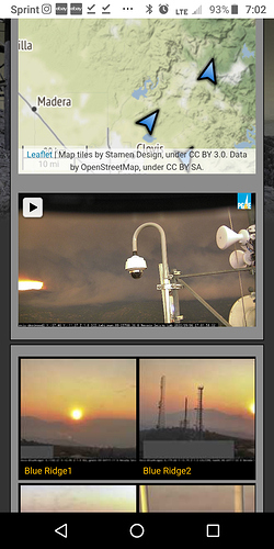
The video is taken from Big Creek Edison Hydroelectric Parking lot.
In Big Creek, north west of the power plant after bay.
On Spruce Ave @ Huntington lake road.
(37.2044549, -119.2423929)
If I heard right, 53 victims airlifted from Mammoth Pool area.
Quote from weather and climate expert Daniel Swain -
“That literally looks like a still from an implausibly dramatic disaster movie. Wow.”
I believe they updated the the number to 65, that’s the discussion I heard. The guard ship also said something about a minimum of 20 ambulances with 2 In litters… mods feel free to move if this is in the wrong place.
Seeing up to 63 possible victims with burn injuries and fractures being reported (though not all 63 are injured). Helos are landing in Fresno and victims are being transported by ground EMS and possibly city busses to area hospitals. Unknown triage counts (red/yellow/green).
39,458 acres per Ops map.
For Sunday operational period:
Air Tactics FM 171.1125
Air/Ground FM 166.6125 (newly added, could be replacement to 0625, or addl for A/G cmd)
Air/Ground FM 167.0625
Rotor Vic 119.075
Resident’s in Oakhurst, coarsegold, and north fork have been reporting thunder.
https://rammb-slider.cira.colostate.edu/?sat=goes-17&z=4&im=18&ts=1&st=0&et=0&speed=130&motion=loop&map=1&lat=0&opacity[0]=1&hidden[0]=0&pause=0&slider=-1&hide_controls=1&mouse_draw=0&follow_feature=0&follow_hide=0&s=rammb-slider&sec=conus&p[0]=cira_glm_l2_group_energy&x=7903&y=3904
Looks like we’ve got a column collapse underway!
http://www.alertwildfire.org/sierra/index.html?camera=Axis-Deadwood2&v=81e004f
A blob map of the fire perimeter is been created on google maps:
Most likely form fire watch 51 yesterday.
Click on the inset “larger map” then click on the creek fire link on left tab.
IR Topo Map:
SNF Creek 20200906_IR_Topo_11x17 SNF001391.pdf (1.2 MB)
Wild… Phenomenal time lapse starting at 06:00 showing the collapse and related outflow. Excellent example of the danger of sudden wind changes with thunder related weather.
Thanks TBS for noticing/sharing!
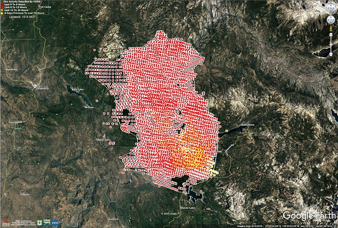
VIIRS & MODIS Satellite detections.
The lookout at shut-eye peak stayed as long as they could tracking fire movement and got out safely.
Creek AA unable to make it into the fire to much smoke. Returning to Fresno.

