I agree not much to worry about. There is no large fire growth history at these elevations in the Tulare County mountains this time of year. We’ve conducted several VMP’s (I know there’s a new term for that) in late September and October with no issues other than the small window in the afternoon that conditions were good for burning. Lots of dirty burns that didn’t accomplish a whole bunch.
Agreed. Not so much worried about temps as the fire has been creeping due to topography and North aspect fuel type.
We are definitely not out of the woods yet. My fear is the fire still getting established in the north side of the south fork. Topography and fuels will be aligned for great spread.
Fingers crossed it stays on the south side of the drainage
From a Three Rivers resident, thank you for this assessment.
Much of the Three Rivers area especially in upper South Fork is in Very High Fire Hazard Severity Zone

Evacuation just downgraded from mandatory to warning on South Fork Drive up to Cinnamon Canyon
I’m trying to figure out why mineral king needs damage assessment. Haven’t heard of fire on the valley and need to get cabin closed up.
Incase there’s damage due to fire related activities.
Maybe they’ll fix the road. Thx
A little bit of confusion today about next steps. Apparently some residents of upper south fork were told they could not spend the night at their home, this was after the mandatory evac was downgraded to voluntary this afternoon. Meanwhile at least one of the animal shelters will end housing animals of evacuees on Oct 2.
Update 9-30-2020:
It sounds like upper South Fork isn’t cleared for residents spending the night at their homes / full repopulation yet for a couple more days or so, but shelters are ending their help in animal housing in 2 days. Relocated residents, following the Cal Fire and TCSD public info releases are packing up and driving back to their homes only to be turned away by Sheriff’s department. Where is this miscommunication coming from?
Incident Update 9-30-2020 8:30 am
This is correct. Per resident on Mtn Rd 319, were told they can not stay at resident.
In division YY, Is this a spot fire out by Hockett Lakes? Or are they trying to tie it in to south fork?
Thanks.
There was a spot out there on the ops map posted 10 days ago.
Anyone know the containment plan on that north end in the park.
It would appear that “spot” by Hockett was a burn.
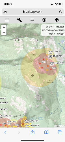
Looking like the fire spread closer to that Hockett “spot” and went north into the South Fork Kaweah River drainage (just under Homer’s Nose)
Is that all new backburn / fire ops from Cahoon mountain to Homer’s Nose? (North of South Fork Kaweah River and South Fork Drive, including West of Salt Creek Road / firebreak)
Mandatory evacs again in 3R (parts of South Fork area)
So, I’m a little confused (pardon my ignorance), but is this fire being managed, having terrain/access issues, or simply continual hiccups due to weather? It started in mid August & it’s now a week into October. Again, just trying to get an idea. Much appreciated to all the boots on the ground for all the hard work.
Its been a full suppression fire since day 1 but a combination of weather, terrain, and a lack of resources.
There is no more west zone all zones are under one team

