[prev Trout Fire]
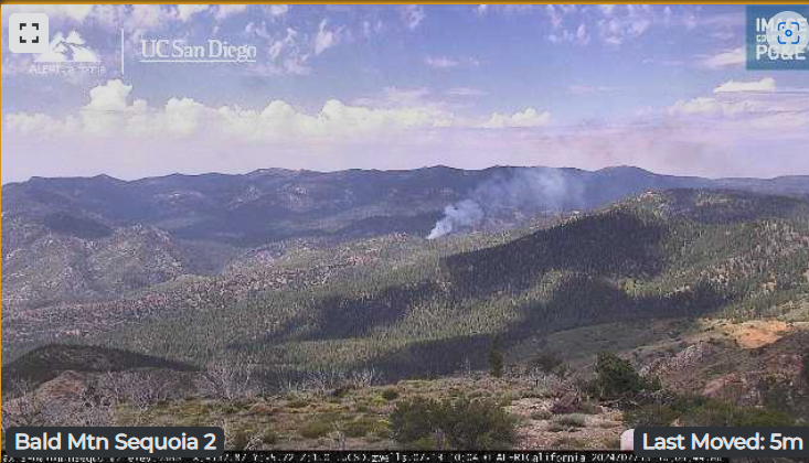
AlertWest (Bald Mountain): ALERTWest - Bald Mtn Sequoia 2
I saw a lot of down strikes in that area before sunrise this morning.
This will be the ‘Trout’ Fire. S of Sherman Pass Rd & N/E of Sirretta Peak ) per (Watch Duty) No further info yet.
Saw that. Locations didn’t seem to quite align between the maps.
Yeh me too, but familiar with are and it’s close in my thinking. It’s well east of Tobias and SE of Baker Peak in cam cross hairs anyway.
Yeah, the initial pins that WD drops tend to be more ‘general area’ than exact, then they refine it later.
I saw it on cams when it first popped. Small and only TWP/RNG provided by Bald Lookout.
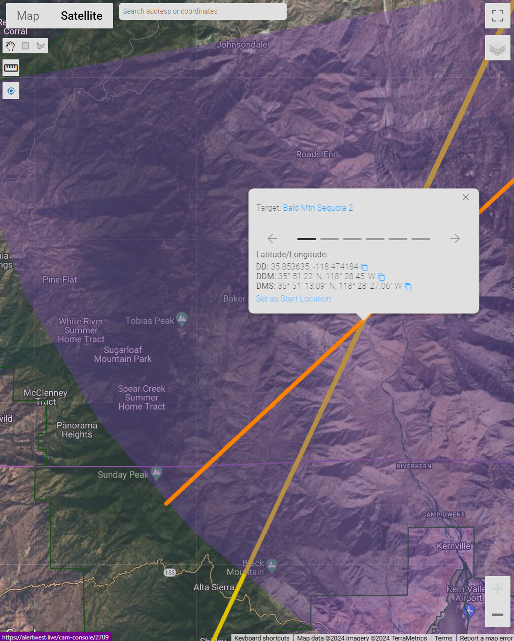
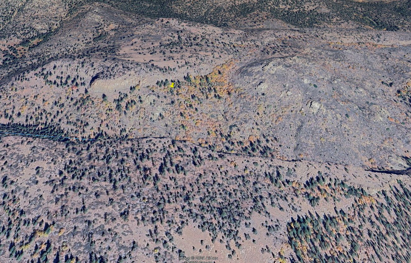
West of Domeland Wilderness. No easy road access. No resources assigned per CadWeb. Now it is has a Lat/Long: https://maps.app.goo.gl/N6J8dohJEHf7FgTr5
They are going to need to be really careful about where they are flying, today. Cloud to cloud lightning that doesnt touch the ground can still wreck an aircraft.
Red Flag Warning for the fire area:
https://forecast.weather.gov/showsigwx.php?warnzone=CAZ331&warncounty=CAC107&firewxzone=CAZ594&local_place1=26%20Miles%20N%20Kernville%20CA&product1=Red+Flag+Warning&lat=36.136&lon=-118.4607
Looks like a small spot on the mountain slope facing the camera…just below the main smoke column
I was talking to the NWS Hanford about 0400 this morning as there was a lot of activity both over the valley floor and the SQF. They were seeing everything I was and said to expect more.
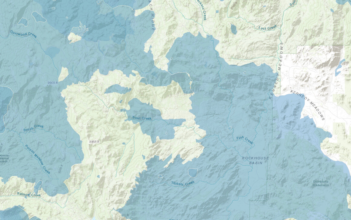
Last fire in Trout Creek was 1950. McNally 2002 and Manter 2000 burned around the current fire. Plenty of fuel regrowth. California Fire Perimeters
I was going to say. McNally 2.0.

McNally, the fire that never ended…
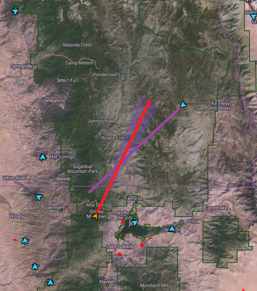
You can get some rough coordinates for locations of incidents from AlertWest by clicking on where the camera angles meet, presuming that they are looking at the same thing.
With it chugging now, likely gonna be a WFM show